|
South Hill, Cornwall
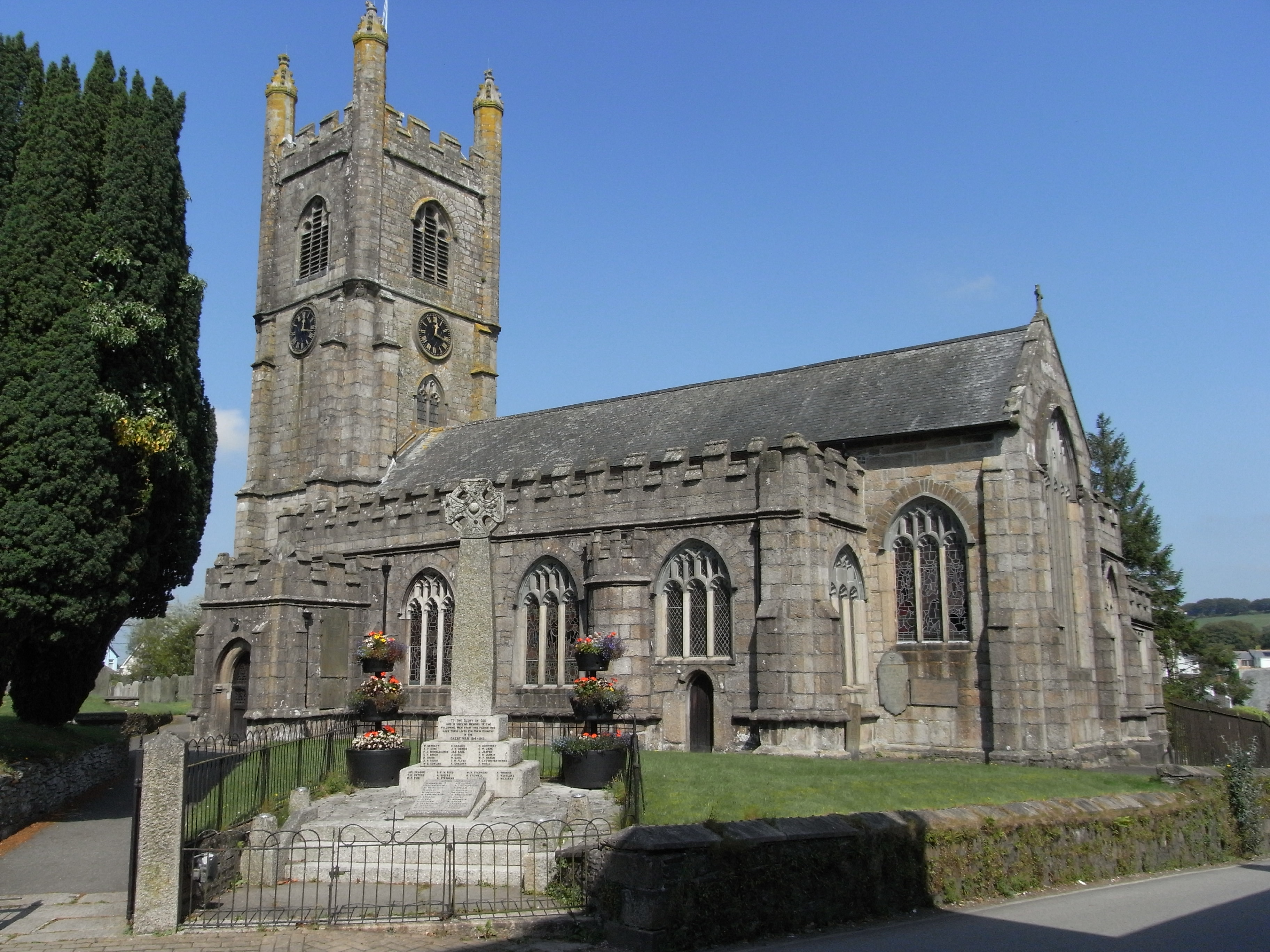
South Hill ( kw, Bre Dheghow) is a civil parish and hamlet in east Cornwall, England, United Kingdom. The parish population at the 2011 census was 489. The parish church was consecrated in 1333 and apart from the upper stage of the tower and the south aisle is entirely of this date (the additions are 15th century). The font is Norman and a fine example of the Bodmin type (carved with four faces, trees and curious creatures); in the churchyard is an inscribed stone of the 6th or 7th century. The tower is topped by figures of the Twelve Apostles. Callington was formerly in the parish of South Hill. St Sampson's well is supposed to have been either near the church in the grounds of the former rectory, or in a nearby valley in a stream leading to the river Lynher The River Lynher ( kw, Linar) (or St Germans River downstream from its confluence with the Tiddy) flows through east Cornwall, England, and enters the River Tamar at the Hamoaze, which in turn flows into Plymouth Sound ... [...More Info...] [...Related Items...] OR: [Wikipedia] [Google] [Baidu] |
Cornwall Council
Cornwall Council ( kw, Konsel Kernow) is the unitary authority for Cornwall in the United Kingdom, not including the Isles of Scilly, which has its own unitary council. The council, and its predecessor Cornwall County Council, has a tradition of large groups of independent councillors, having been controlled by independents in the 1970s and 1980s. Since the 2021 elections, it has been under the control of the Conservative Party. Cornwall Council provides a wide range of services to the approximately half a million people who live in Cornwall. In 2014 it had an annual budget of more than £1 billion and was the biggest employer in Cornwall with a staff of 12,429 salaried workers. It is responsible for services including: schools, social services, rubbish collection, roads, planning and more. History Establishment of the unitary authority On 5 December 2007, the Government confirmed that Cornwall was one of five councils that would move to unitary status. This was enacted b ... [...More Info...] [...Related Items...] OR: [Wikipedia] [Google] [Baidu] |
Cornwall
Cornwall (; kw, Kernow ) is a historic county and ceremonial county in South West England. It is recognised as one of the Celtic nations, and is the homeland of the Cornish people. Cornwall is bordered to the north and west by the Atlantic Ocean, to the south by the English Channel, and to the east by the county of Devon, with the River Tamar forming the border between them. Cornwall forms the westernmost part of the South West Peninsula of the island of Great Britain. The southwesternmost point is Land's End and the southernmost Lizard Point. Cornwall has a population of and an area of . The county has been administered since 2009 by the unitary authority, Cornwall Council. The ceremonial county of Cornwall also includes the Isles of Scilly, which are administered separately. The administrative centre of Cornwall is Truro, its only city. Cornwall was formerly a Brythonic kingdom and subsequently a royal duchy. It is the cultural and ethnic origin of the Cor ... [...More Info...] [...Related Items...] OR: [Wikipedia] [Google] [Baidu] |
South East Cornwall (UK Parliament Constituency)
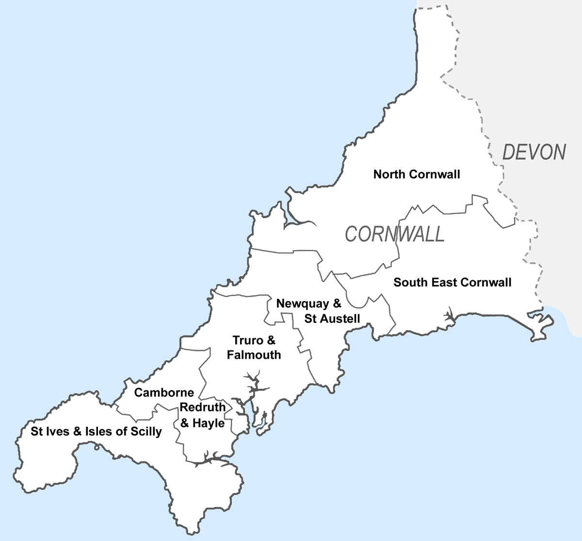
South East Cornwall is a constituency represented in the House of Commons of the UK Parliament since 2010 by Sheryll Murray, a Conservative. Boundaries 1983–2010: The District of Caradon, the Borough of Restormel wards of Fowey, Lostwithiel, St Blaise, and Tywardreath, and the District of North Cornwall ward of Stoke Climsland. 2010–present: The District of Caradon, and the Borough of Restormel ward of Lostwithiel. History The predecessor county division, Bodmin, serving the area from 1885 until 1983 had (during those 98 years) 15 members (two of whom had broken terms of office serving the area), seeing twelve shifts of preference between the Liberal, Liberal Unionist and Conservative parties, spread quite broadly throughout that period. Consistent with this, since 1983 the preference for an MP has alternated between Liberal Democrats and Conservatives. The current constituency territory contains the location of several former borough constituencies which were a ... [...More Info...] [...Related Items...] OR: [Wikipedia] [Google] [Baidu] |
Civil Parishes In England
In England, a civil parish is a type of Parish (administrative division), administrative parish used for Local government in England, local government. It is a territorial designation which is the lowest tier of local government below districts of England, districts and metropolitan and non-metropolitan counties of England, counties, or their combined form, the Unitary authorities of England, unitary authority. Civil parishes can trace their origin to the ancient system of Parish (Church of England), ecclesiastical parishes, which historically played a role in both secular and religious administration. Civil and religious parishes were formally differentiated in the 19th century and are now entirely separate. Civil parishes in their modern form came into being through the Local Government Act 1894, which established elected Parish councils in England, parish councils to take on the secular functions of the vestry, parish vestry. A civil parish can range in size from a sparsely ... [...More Info...] [...Related Items...] OR: [Wikipedia] [Google] [Baidu] |
Inscribed Stone In South Hill Churchyard - Geograph
{{unreferenced, date=August 2012 An inscribed triangle of a circle In geometry, an inscribed planar shape or solid is one that is enclosed by and "fits snugly" inside another geometric shape or solid. To say that "figure F is inscribed in figure G" means precisely the same thing as "figure G is circumscribed about figure F". A circle or ellipse inscribed in a convex polygon (or a sphere or ellipsoid inscribed in a convex polyhedron) is tangent to every side or face of the outer figure (but see Inscribed sphere for semantic variants). A polygon inscribed in a circle, ellipse, or polygon (or a polyhedron inscribed in a sphere, ellipsoid, or polyhedron) has each vertex on the outer figure; if the outer figure is a polygon or polyhedron, there must be a vertex of the inscribed polygon or polyhedron on each side of the outer figure. An inscribed figure is not necessarily unique in orientation; this can easily be seen, for example, when the given outer figure is a circle, in which cas ... [...More Info...] [...Related Items...] OR: [Wikipedia] [Google] [Baidu] |
Mee, Arthur
Arthur Henry Mee (21 July 187527 May 1943) was an English writer, journalist and educator. He is best known for ''The Harmsworth Self-Educator'', '' The Children's Encyclopædia'', '' The Children's Newspaper'', and '' The King's England''. The tone is looking back to the years immediately after the Great War, even during publication of volumes in the 1940s. Early life He was born on 21 July 1875 at Stapleford near Nottingham, England, the second of the ten children of Henry Mee (b. 1852), railway fireman, and his wife, Mary (née Fletcher). As a boy he earned money from reading the reports of Parliament to a local blind man. Career Mee left school at 14 to join a local newspaper, where he became an editor by age 20. He contributed many non-fiction articles to magazines and joined the staff of '' The Daily Mail'' in 1898. He was made literary editor five years later. In 1903 he began working for publisher Alfred Harmsworth's Amalgamated Press. He was appointed gene ... [...More Info...] [...Related Items...] OR: [Wikipedia] [Google] [Baidu] |
Callington, Cornwall
Callington ( kw, Kelliwik) is a civil parish and town in east Cornwall, England, United Kingdom about north of Saltash and south of Launceston. Callington parish had a population of 4,783 in 2001, according to the 2001 census. This had increased to 5,786 in the 2011 census. Geography The town is situated in east Cornwall between Dartmoor to the east and Bodmin Moor to the west. A former agricultural market town, it lies at the intersection of the south–north A388 Saltash to Launceston road and the east–west A390 Tavistock to Liskeard road. Kit Hill is a mile north-east of the town and rises to with views of Dartmoor, Bodmin Moor and the River Tamar. The hamlets of Bowling Green, Kelly Bray, Frogwell and Downgate are in the parish. Railway station Callington railway station was the terminus of a branch line from Bere Alston, the junction with the Southern Railway's Tavistock to Plymouth line. The railway line beyond Gunnislake to the Callington terminus was ... [...More Info...] [...Related Items...] OR: [Wikipedia] [Google] [Baidu] |
River Lynher
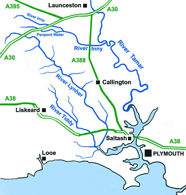
The River Lynher ( kw, Linar) (or St Germans River downstream from its confluence with the Tiddy) flows through east Cornwall, England, and enters the River Tamar at the Hamoaze, which in turn flows into Plymouth Sound. Navigation The normal tidal limit is a weir upstream of Notter Bridge. St Germans is a historic fishing village situated on the River Tiddy just upstream of its confluence with the Lynher. The Quay Sailing Club are based at St Germans Quay. The Queen's Harbour Master for Plymouth is responsible for managing navigation on the tidal Lynher and its tributaries (up to the normal tidal limits). Geography The river is about 21 miles (34 km long), rising at a height of about 920 feet (280m) on Bodmin Moor and flowing into the Tamar Estuary near Plymouth. It has four main tributaries, the largest of which is the River Tiddy. The smaller tributaries include Deans Brook, Withey Brook, Marke Valley and Darleyford streams and Kelly Brook. Ecology The Lynher an ... [...More Info...] [...Related Items...] OR: [Wikipedia] [Google] [Baidu] |
George Symons (VC)
Captain George Symons VC DCM (18 March 1826 – 18 November 1871) was a British Army officer and an English recipient of the Victoria Cross (VC), the highest and most prestigious award for gallantry in the face of the enemy that can be awarded to British and Commonwealth forces. Details Symons was 29 years old, and a sergeant in the Royal Regiment of Artillery, British Army during the Crimean War when the following deed On 6 June 1855 took place at Inkerman, Crimea for which he was awarded the VC. Later career Symons was later commissioned into the Military Train, transferred back to the Royal Artillery in 1862 and reached the rank of captain. On 15 January 1862 he was appointed Adjutant of the 1st Administrative Brigade of Yorkshire (East Riding) Artillery Volunteers.''Army List''. Further information His medals are held by the Royal Logistic Corps Officers Mess. Notes References *Monuments to Courage (David Harvey, 1999) *The Register of the Victoria Cross ''The R ... [...More Info...] [...Related Items...] OR: [Wikipedia] [Google] [Baidu] |
Hamlets In Cornwall
A hamlet is a human settlement that is smaller than a town or village. Its size relative to a parish can depend on the administration and region. A hamlet may be considered to be a smaller settlement or subdivision or satellite entity to a larger settlement. The word and concept of a hamlet has roots in the Anglo-Norman settlement of England, where the old French ' came to apply to small human settlements. Etymology The word comes from Anglo-Norman ', corresponding to Old French ', the diminutive of Old French ' meaning a little village. This, in turn, is a diminutive of Old French ', possibly borrowed from (West Germanic) Franconian languages. Compare with modern French ', Dutch ', Frisian ', German ', Old English ' and Modern English ''home''. By country Afghanistan In Afghanistan, the counterpart of the hamlet is the qala (Dari: قلعه, Pashto: کلي) meaning "fort" or "hamlet". The Afghan ''qala'' is a fortified group of houses, generally with its own co ... [...More Info...] [...Related Items...] OR: [Wikipedia] [Google] [Baidu] |


