|
Sinazongwe
Sinazongwe is a town in the Southern Province of Zambia, lying on the north shore of Lake Kariba. It was constructed in the 1950s as a local administrative centre, while its main industry now is kapenta fishing. It is also home to a lighthouse and an airstrip, while ferries sail to Chete Island. Sinazongwe also boasts The Houseboat Company. Sinazongwe is a fast developing area in Zambia. Sinazongwe is accessible nearly all year round. Access is by tar road from Batoka (which is between Pemba and Choma) and by of gravel road just outside Sinazeze Town. The nearest airstrip is approximately from Sinazongwe. The nearest large hospital is at Maamba which is about a 40-minute drive from Sinazongwe; however, there is a small hospital in Sinazongwe as well as a local clinic. Sinazongwe is only a three-and-a-half-hour drive from Livingstone and three-and-a-half-hour drive from Zambia's capital, Lusaka, therefore giving it good access to an international airport from either dir ... [...More Info...] [...Related Items...] OR: [Wikipedia] [Google] [Baidu] |
Sinazeze
Sinazeze (also known as Sinazezi) is a community located in Sinazongwe District in the Southern Province of Zambia. Sinazeze is about north of Sinazongwe and 35 kilometres north-east of Maamba Maamba is a town located in Sinazongwe District in the Southern Province, Zambia. It is about 35 kilometres south-west of Sinazeze and about 250 km south-west of the capital city of Zambia, Lusaka. Maamba is a coal mining town with about 1300 .... Its location at a road junction has led to its development. The Collum coal mine is located near the community. References Populated places in Southern Province, Zambia {{Zambia-geo-stub ... [...More Info...] [...Related Items...] OR: [Wikipedia] [Google] [Baidu] |
Sinazongwe District
Sinazongwe District is a district of Zambia Zambia (), officially the Republic of Zambia, is a landlocked country at the crossroads of Central Africa, Central, Southern Africa, Southern and East Africa, although it is typically referred to as being in Southern Africa at its most cent ..., located in Southern Province. The capital lies at Sinazongwe. As of the 2010 Zambian Census, the district had a population of 101,617 people. References Districts of Southern Province, Zambia {{Zambia-geo-stub ... [...More Info...] [...Related Items...] OR: [Wikipedia] [Google] [Baidu] |
Maamba
Maamba is a town located in Sinazongwe District in the Southern Province, Zambia. It is about 35 kilometres south-west of Sinazeze and about 250 km south-west of the capital city of Zambia, Lusaka. Maamba is a coal mining town with about 13000 residents. History Maamba gets its name from the Lozi Tribe, meaning talkative person. Maamba Coal Mine Maamba is the home to the largest Coal Plant in Zambia at 300MW, built for U$750million and operated by Maamba Collieries Limited (MCL) which as of 2010 is 100% owned by Nava Bharat Ventures Limited (NVBL) of India India, officially the Republic of India (Hindi: ), is a country in South Asia. It is the seventh-largest country by area, the second-most populous country, and the most populous democracy in the world. Bounded by the Indian Ocean on the so .... In 2021, Maamba Collieries Limited announced they were interested in increasing the capacity from 300 to 600MW. References Populated places in Southern Provin ... [...More Info...] [...Related Items...] OR: [Wikipedia] [Google] [Baidu] |
Southern Province, Zambia
Southern Province is one of Zambia's ten provinces, and home to Zambia's premier tourist attraction, Mosi-oa-Tunya (Victoria Falls), shared with Zimbabwe. The centre of the province, the Southern Plateau, has the largest area of commercial farmland of any Zambian province, and produces most of the maize crop. The Zambezi River is the province's southern border, and Lake Kariba, formed by the Kariba Dam, lies along the province's south-eastern edge. The eastern border is the Kariba Gorge and Zambezi, and the north-east border is the Kafue River, forming its border with Lusaka Province. The Kafue Flats lie mostly within the province's northern border with Central Province. In the north west lies part of the famous Kafue National Park, the largest in Zambia. The south-western border with Western Province runs through the teak forests around Mulobezi which once supported a commercial timber industry and for which the Mulobezi Railway was built. The provincial capital is Choma. Un ... [...More Info...] [...Related Items...] OR: [Wikipedia] [Google] [Baidu] |
Districts Of Zambia
The ten provinces of Zambia are divided into a total of 116 districts as of 2018. Article 109 in part VIII of the constitution of Zambia deals with local government. It states only that there should be some form of local government, and that this local government should be based on democratically elected councils on the basis of universal adult suffrage. Provincial Districts in Zambia Until 2011, Zambia was subdivided into 72 districts. However, since 2011, a number of new districts have been created, bringing the total to 116 as of 2018. ;Total Districts by Province # Central Province (11 districts) # Copperbelt Province (10 districts) # Eastern Province (15 districts) # Luapula Province (12 districts) # Lusaka Province (6 districts) # Muchinga Province (8 districts) # Northern Province (12 districts) # North-Western Province (11 districts) # Southern Province (15 districts) # Western Province (16 districts) Central Province Central Province is composed of 11 distric ... [...More Info...] [...Related Items...] OR: [Wikipedia] [Google] [Baidu] |
Lake Kariba
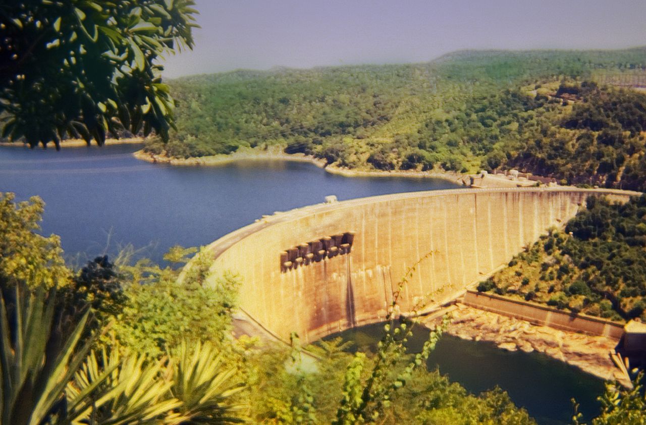
Lake Kariba is the world's largest artificial lake and reservoir (water), reservoir by List of lakes by volume, volume. It lies upstream from the Indian Ocean, along the border between Zambia and Zimbabwe. Lake Kariba was filled between 1958 and 1963 following the completion of the Kariba Dam at its northeastern end, flooding the Kariba Gorge on the Zambezi River. The Zimbabwean town of Kariba, Zimbabwe, Kariba was built for construction workers on the lake's dam, while some other settlements such as Binga village and Mlibizi in Zimbabwe and Siavonga and Sinazongwe in Zambia have grown up to house people displaced by the rising waters. Physical characteristics Lake Kariba is over long and up to in width. It covers an area of and its storage capacity is . The mean depth of the lake is ; the maximum depth is . It is the world's largest man-made reservoir by volume, four times as large as the Three Gorges Dam. The enormous mass of water (approximately 180,000,000,000,000 kilogra ... [...More Info...] [...Related Items...] OR: [Wikipedia] [Google] [Baidu] |
Zambia
Zambia (), officially the Republic of Zambia, is a landlocked country at the crossroads of Central Africa, Central, Southern Africa, Southern and East Africa, although it is typically referred to as being in Southern Africa at its most central point. Its neighbours are the Democratic Republic of the Congo to the north, Tanzania to the northeast, Malawi to the east, Mozambique to the southeast, Zimbabwe and Botswana to the south, Namibia to the southwest, and Angola to the west. The capital city of Zambia is Lusaka, located in the south-central part of Zambia. The nation's population of around 19.5 million is concentrated mainly around Lusaka in the south and the Copperbelt Province to the north, the core economic hubs of the country. Originally inhabited by Khoisan peoples, the region was affected by the Bantu expansion of the thirteenth century. Following the arrival of European exploration of Africa, European explorers in the eighteenth century, the British colonised the r ... [...More Info...] [...Related Items...] OR: [Wikipedia] [Google] [Baidu] |
International Airport
An international airport is an airport with customs and border control facilities enabling passengers to travel between countries around the world. International airports are usually larger than domestic airports and they must feature longer runways and have facilities to accommodate the heavier aircraft such as the Boeing 747 commonly used for international and intercontinental travel. International airports often also host domestic flights, which often help feed both passengers and cargo into international ones (and vice versa). Buildings, operations and management have become increasingly sophisticated since the mid-20th century, when international airports began to provide infrastructure for international civilian flights. Detailed technical standards have been developed to ensure safety and common coding systems implemented to provide global consistency. The physical structures that serve millions of individual passengers and flights are among the most complex and interc ... [...More Info...] [...Related Items...] OR: [Wikipedia] [Google] [Baidu] |
Lusaka
Lusaka (; ) is the Capital city, capital and largest city of Zambia. It is one of the fastest-developing cities in southern Africa. Lusaka is in the southern part of the central plateau at an elevation of about . , the city's population was about 3.3 million, while the urban population is estimated at 2.5 million in 2018. Lusaka is the centre of both commerce and government in Zambia and connects to the country's four main highways heading Great North Road, Zambia, north, Livingstone Road, south, Great East Road, east and Great West Road, Zambia, west. English is the official language of the city administration, while Bemba language, Bemba, Tonga language (Zambia and Zimbabwe), Tonga, Lenje, Soli language, Soli, Lozi language, Lozi and Nyanja are the commonly spoken street languages. The earliest evidence of settlement in the area dates to the 6th century AD, with the first known settlement in the 11th century. It was then home to the Lenje people, Lenje and Soli language, Soli ... [...More Info...] [...Related Items...] OR: [Wikipedia] [Google] [Baidu] |
Livingstone, Zambia
Livingstone is a city in Zambia. Until 1935, it served as the capital city of Zambia (then Northern Rhodesia). Lying 10 km (6.2 mi) to the north of the Zambezi River, it is a tourism attraction center for the Victoria Falls, Zambia, Victoria Falls and a border town with road and rail connections to Zimbabwe on the other side of the Victoria Falls. A historic British Empire, British colonial city, its present population was enumerated at 134,349 inhabitants at the 2010 census. It is named after David Livingstone, the Scotland, Scottish explorer and missionary who was the first European to Exploration, explore the area. Pre-colonial History Mukuni, to the south-east of present-day Livingstone, was the largest village in the area before Livingstone was founded. Its Leya language, Baleya inhabitants, originally from the Rozwi culture in Zimbabwe, were conquered by Chief Mukunda, Mukuni who came from the DR Congo, Congo in the 16th century. Another group of Baleya under Chief ... [...More Info...] [...Related Items...] OR: [Wikipedia] [Google] [Baidu] |
Choma, Zambia
Choma is a town that serves as the capital of the Southern Province of Zambia. It is also the capital of Choma District, one of the 15 administrative districts in the province. Location Choma lies on the Lusaka–Livingstone Road, approximately south-west of Lusaka, the national capital and largest city in Zambia. This is approximately , by road, northeast of Livingstone, the largest city in Zambia's Southern Province. The geographical coordinates of Choma are:16°46'16.0"S, 26°59'32.0"E (Latitude:-16.771111; Longitude:26.992222). Choma sits at an average elevation of above mean sea level. Population In 1990, the population of Choma was 30,143. In 2000, there were 40,405 people. The 2010 population census and household survey enumerated the population of the town at 51,842 inhabitants. The table below illustrates the same data. Overview Choma Town is home to a museum dedicated to the cultural heritage of the Tonga people of southern Zambia. The ''Nkanga River Conservati ... [...More Info...] [...Related Items...] OR: [Wikipedia] [Google] [Baidu] |


