|
Shoshone Mountains
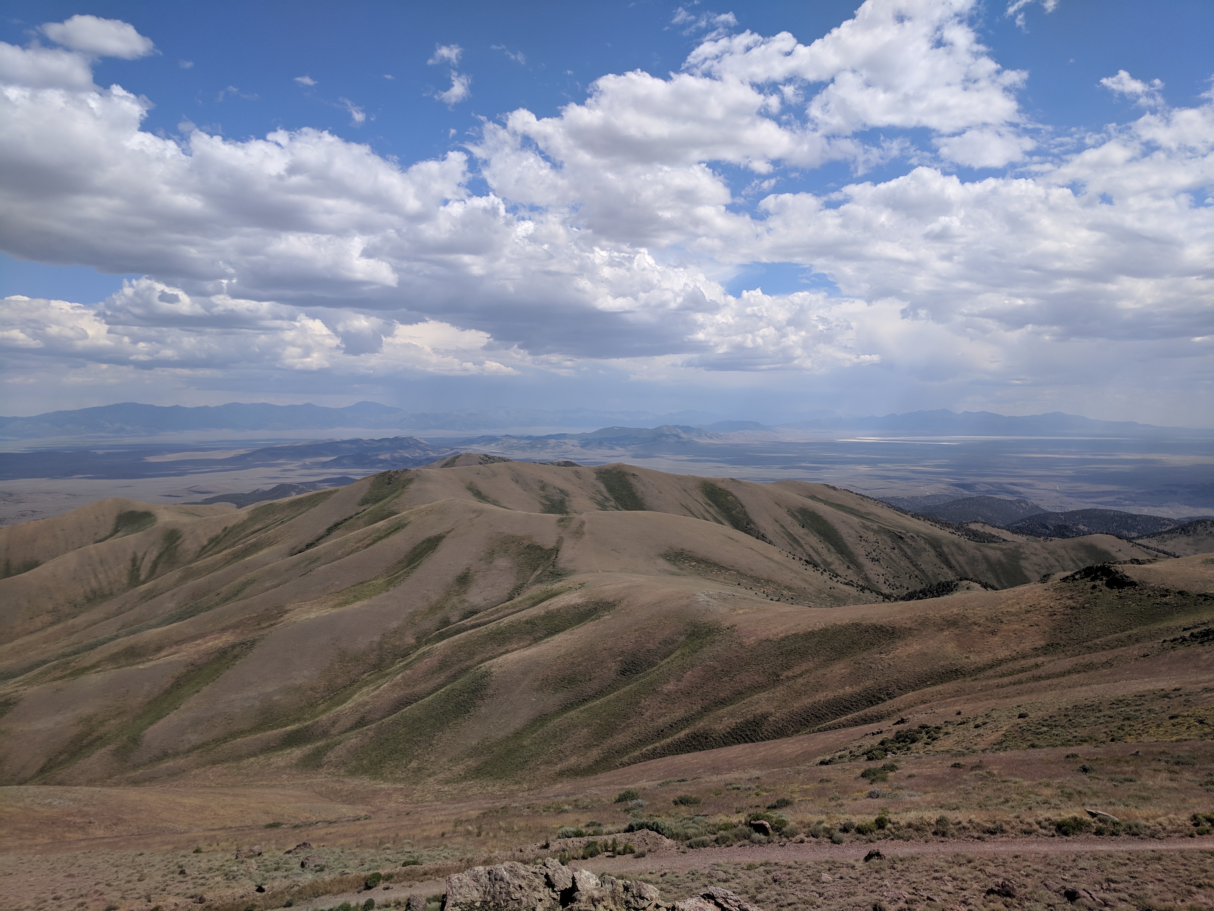
The Shoshone Mountains, in west central Nevada, make up one of the longest mountain ranges in the state. The range runs in a general north-south direction in Nye and Lander counties. The range has a length of about and a width of about with an area of approximately .''Ione Valley, Nevada,'' 30x60 Minute Quadrangle Topographic Map, USGS 1985 (38117-E1-TM-100)''Smith Creek Valley, Nevada,'' 30x60 Minute Quadrangle Topographic Map, USGS 1985 (39117-A1-TM-100)''Edwards Peak Valley, Nevada,'' 30x60 Minute Quadrangle Topographic Map, USGS 1983 (N3930-W11700/30X60) Named for the Shoshone Indians, the range receives 15 inches or less of precipitation in an average year. About 58% of the mountain range is managed by the Bureau of Land Management, with the Forest Service in charge of almost 42% of the area. A small part of the range is occupied by the Yomba Indian Reservation and private land. The small community of Ione lies to the west of the range, and the Berlin-Ichthyosau ... [...More Info...] [...Related Items...] OR: [Wikipedia] [Google] [Baidu] |
Mount Jefferson (Nevada)
Mount Jefferson is the highest mountain in both the Toquima Range and Nye County in Nevada, United States. It is the sixth highest mountain in the state. As the high point of a range which is well separated from other ranges by low basins, Mount Jefferson has a high topographic prominence of . This makes it the most prominent peak in Nye County and the third most prominent peak in Nevada (after Charleston Peak and Wheeler Peak). For similar reasons, it is also the highest mountain for over 90 miles in all directions. It is located about northeast of the county seat of Tonopah within the Alta Toquima Wilderness of the Humboldt-Toiyabe National Forest, near the smaller towns of Carvers and Round Mountain. Three distinct summits are located on a broad area of subalpine tundra: North Summit rises to , Middle Summit to , and South Summit to . During the Pleistocene, alpine glaciers eroded several cirque A (; from the Latin word ') is an amphitheatre-like valley formed by g ... [...More Info...] [...Related Items...] OR: [Wikipedia] [Google] [Baidu] |
Nevada State Route 844
State Route 844 (SR 844) is a state highway in central Nevada, United States. The route follows ''Ione Road'', covering part of the connection between State Route 361 and Berlin-Ichthyosaur State Park. SR 844 was formerly known as State Route 91, which extended further northeast to Ione. Route description State Route 844 begins at a junction with Gabbs Valley Road (SR 361) about north of Gabbs. The route heads east from there, passing through a small section of the Humboldt-Toiyabe National Forest. The state maintained highway ends in Ione Valley east of the national forest boundary. The road continues past the SR 844 terminus to connect to Berlin-Ichthyosaur State Park near the town site of Berlin and also provides connections to the town of Ione. History 45px, SR 844 was formerly a part of the longer State Route 91. The routing of SR 844 first appears on state maps in 1960 as State Route 91. This route was a graded road from State Route 23 (now SR 361) north of Ga ... [...More Info...] [...Related Items...] OR: [Wikipedia] [Google] [Baidu] |
Artemisia Tridentata
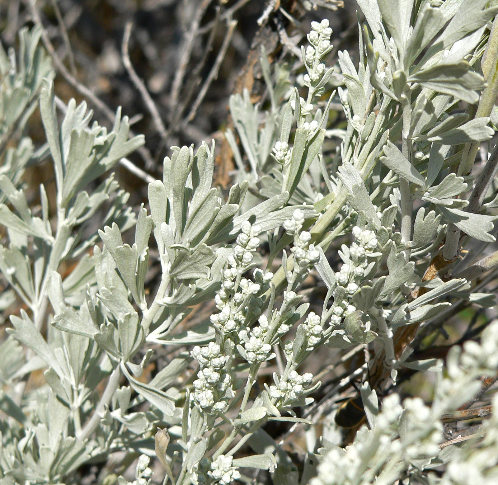
''Artemisia tridentata'', commonly called big sagebrush,MacKay, Pam (2013), ''Mojave Desert Wildflowers'', 2nd ed., , p. 264. Great Basin sagebrush or (locally) simply sagebrush, is an aromatic shrub from the family Asteraceae, which grows in arid and semi-arid conditions, throughout a range of cold desert, steppe, and mountain habitats in the Intermountain West of North America. The vernacular name "sagebrush" is also used for several related members of the genus '' Artemisia'', such as California sagebrush (''Artemisia californica''). Big sagebrush and other ''Artemisia'' shrubs are the dominant plant species across large portions of the Great Basin. The range extends northward through British Columbia's southern interior, south into Baja California, and east into the western Great Plains of New Mexico, Colorado, Nebraska, and the Dakotas. Several major threats exist to sagebrush ecosystems, including human settlements, conversion to agricultural land, livestock grazin ... [...More Info...] [...Related Items...] OR: [Wikipedia] [Google] [Baidu] |
Mineral County, Nevada
Mineral County is a county located in the U.S. state of Nevada. As of the 2020 census, the population was 4,554, making it the fourth-least populous county in Nevada. Its county seat is Hawthorne. History Mineral County was carved out of Esmeralda County in 1911 shortly after the county seat of Esmeralda was moved to Goldfield in 1907. Its name came from the surrounding area, which is heavily mineralized. Hawthorne has always been its county seat. The county is listed as Nevada Historical Marker 16. The marker is located on U.S. Highway 95 at Walker Lake. Geography According to the U.S. Census Bureau, the county has a total area of , of which is land and (1.6%) is water. The highest point in Mineral County is Mount Grant at 11,285 ft (3,440 m). Major highways * Interstate 11 (Future) * U.S. Route 6 * U.S. Route 95 * U.S. Route 95 Alternate * U.S. Route 95 Truck (Hawthorne) * State Route 359 * State Route 360 * State Route 361 Adjacent counties ... [...More Info...] [...Related Items...] OR: [Wikipedia] [Google] [Baidu] |
Cedar Mountains (Nevada)
The Cedar Mountains, also known as the Hardscrabble Mountains, are located in western Nevada in the United States. The mountain range lay north of the Monte Cristo Range about north of Tonopah in Mineral County and its highest point is Little Pilot Peak. This mountain range is situated in the Walker Lane region, which is part of the boundary between the Pacific Plate and the North American Plate, similar to the San Andreas Fault in to the west in California. Cedar Mountains was named for the cedar timber in the area. It was the site of a magnitude 7.2 earthquake on December 20, 1932 that was felt throughout much of the west. 1932 earthquake The earthquake originated in an uninhabited desert region. Mines and ore-treating plants were damaged and two cabins, one of stone and one of adobe, were destroyed. Shocks were felt in the Nevada towns of Tonopah, Mina, Luning and Fallon, as well as others. Reports included cracks in the ground (Luning) and downed chimneys (Mineral Coun ... [...More Info...] [...Related Items...] OR: [Wikipedia] [Google] [Baidu] |
Paradise Range
The Paradise Range is a mountain range in Nye County, Nevada Nevada ( ; ) is a U.S. state, state in the Western United States, Western region of the United States. It is bordered by Oregon to the northwest, Idaho to the northeast, California to the west, Arizona to the southeast, and Utah to the east. N .... References Mountain ranges of Nevada Mountain ranges of Nye County, Nevada Mountain ranges of the Great Basin {{NyeCountyNV-geo-stub ... [...More Info...] [...Related Items...] OR: [Wikipedia] [Google] [Baidu] |
Desatoya Mountains
The Desatoya Mountains are located in central Nevada in the western United States, approximately 117 miles east of Reno by road. The range runs in a southwest-northeasterly direction along the border of Churchill and Lander counties, reaching a maximum elevation of (3041 m) at Desatoya Peak near Rock Creek Canyon. Geography The range is separated from the Paradise Range in the south by Burnt Cabin Summit at the Nye County line, near the sites of Chalk Wells and Phonolite, and from the New Pass Range in the north by New Pass along U.S. Route 50.''Nevada Atlas & Gazetteer'', 2001, pgs. 44 & 45 It is traversed by three routes: Trans mountain navigation * The Old Overland Road between Smith Creek Valley and Edwards Creek Valley crosses the northern end of the range by way of Basque Summit at an elevation of 7,625 feet following the Pony Express route. * Nevada State Highway 722 crosses the range to the south by way of Carroll Summit at an elevation of 7,425 feet. * The th ... [...More Info...] [...Related Items...] OR: [Wikipedia] [Google] [Baidu] |
New Pass Range
The New Pass Range is a mountain range in Lander and Churchill counties of Nevada. The range is a north-south trending range which straddles the Lander-Churchill county boundary for about . The highest peak, New Pass Peak, has an elevation of . US Route 50 crosses New Pass Summit on the south end of the range between Austin to the east and Fallon on to the west.''Nevada Atlas and Gazetteer,'' DeLorme, 8th ed. 2012, pp. 37 and 45 The range was named from an early settler's belief that his route through the mountains was a "new pass" through the area. The Desatoya Mountains lie to the southwest and the Clan Alpine Mountains to the west. To the north is the Augusta Mountains with Antelope Valley to the northeast. To the east is Ravenswood Mountain at the south end of the Shoshone Range and Nevada State Route 305. To the southeast across the Reese River Valley is Austin at the north end of the Toiyabe Range The Toiyabe Range is a mountain range in Lander and Nye counties, Nevad ... [...More Info...] [...Related Items...] OR: [Wikipedia] [Google] [Baidu] |
Ravenswood Range
Ravenswood may refer to: Film and literature * Ravenswood, the name of a Swedish forest in ''Beowulf'', the setting of a battle between Geats and Swedes * ''Ravenswood'' (film), a 2006 Australian thriller, starring Stephen Moyer, Travis Fimmel and Teresa Palmer * ''Ravenswood'' (TV series), a spin-off of ''Pretty Little Liars'' * '' Ravenswood: The Steelworkers' Victory and the Revival of American Labor'', a book by Kate Bronfenbrenner and Tom Juravich *Ravenswood Castle, a fictional setting in the Scottish Lowlands, featured in Sir Walter Scott's 1819 classic, '' The Bride of Lammermoor'' Places Australia * Ravenswood, Queensland, a town **Ravenswood Mining Landscape and Chinese Settlement Area, a heritage-listed area within the town *Ravenswood, Tasmania, suburb of Launceston, Tasmania * Ravenswood, Victoria, a locality near Bendigo *Ravenswood, Western Australia, a town United Kingdom * Ravenswood, Cumbernauld, the largest town in North Lanarkshire, Scotland *Ravenswood, Ipswic ... [...More Info...] [...Related Items...] OR: [Wikipedia] [Google] [Baidu] |
Toiyabe Range
The Toiyabe Range is a mountain range in Lander and Nye counties, Nevada, United States. Most of the range is included within the Humboldt-Toiyabe National Forest. The highest point in the range, near its southern end, is Arc Dome (11,788 feet, 3592 m), an area protected as the Arc Dome Wilderness. The highest point in Lander County, Bunker Hill, is also located within the Toiyabe Range. The range starts in northwestern Nye County north of Tonopah, Nevada and runs approximately 120 miles (190 km) north-northeast into southern Lander County, making it the second longest range in the state. Geography Although the Toiyabe Range is in the rain shadow of the higher Sierra Nevada (U.S.) range to the west and is too arid to support forests except for scattered pines, the climate was cold and snowy enough during the Pleistocene to develop alpine glaciers in several places, with cirques, moraines, and other glacial features still apparent. There are numerous hiking ... [...More Info...] [...Related Items...] OR: [Wikipedia] [Google] [Baidu] |
Big Smokey Valley
Big or BIG may refer to: * Big, of great size or degree Film and television * ''Big'' (film), a 1988 fantasy-comedy film starring Tom Hanks * ''Big!'', a Discovery Channel television show * ''Richard Hammond's Big'', a television show presented by Richard Hammond * ''Big'' (TV series), a 2012 South Korean TV series * ''Banana Island Ghost'', a 2017 fantasy action comedy film Music * '' Big: the musical'', a 1996 musical based on the film * Big Records, a record label * ''Big'' (album), a 2007 album by Macy Gray * "Big" (Dead Letter Circus song) * "Big" (Sneaky Sound System song) * "Big" (Rita Ora and Imanbek song) * "Big", a 1990 song by New Fast Automatic Daffodils * "Big", a 2021 song by Jade Eagleson from ''Honkytonk Revival'' *The Notorious B.I.G., an American rapper Places * Allen Army Airfield (IATA code), Alaska, US * BIG, a VOR navigational beacon at London Biggin Hill Airport * Big River (other), various rivers (and other things) * Big Island (disambig ... [...More Info...] [...Related Items...] OR: [Wikipedia] [Google] [Baidu] |
Reese River
The Reese River is a tributary of the Humboldt River, located in central Nevada in the western United States. The Reese rises in the southern section of the Toiyabe Range, on the flanks of Arc Dome. In its upper reaches, the Reese River is a fast-flowing mountain stream surrounded by relatively lush growth, including Aspen groves and cottonwood trees. It then flows north between the Toiyabe Range and the Shoshone Mountains for approximately half its length. The river then passes through a low point in the Shoshone Mountains and continues north between that range and the Fish Creek Mountains. Once it exits the Toiyabe Range, it becomes a slow, muddy stream, and its waters are used for irrigation by scattered farms and ranches along its lower reaches. Although considered a tributary of the Humboldt, in most years, the Reese dwindles into a chain of shallow pools long before it reaches the main stem. Only during infrequent floods does the Reese contribute water to the Humbold ... [...More Info...] [...Related Items...] OR: [Wikipedia] [Google] [Baidu] |
.jpg)


