|
Shillford
Shillford or Shilford is a hamlet to the south-west of Barrhead on the Lochlibo Road in East Renfrewshire near Uplawmoor, Scotland in the parish of Neilston. It is located around south-west of Glasgow and north of Kilmarnock, and around south of Paisley. Meaning of place-name The name may derive from the word ''ford'' and the Scots word ''shill'', meaning cold or chilly; the word is also said to mean shallow. The old ford ceased to exist after the building of the railway that runs beside Loch Libo as the nearby cutting resulted in the Thorter Burn being diverted to run into the loch. History In 1910 the hamlet had a population of 46. The shallow ford at the hamlet was formed by the Thorter Burn that ran into a hollow on the old road.Pride, Page 83 Shillford Mill was a substantial grain and sawmill, still operating in the 1960s. It was located close to the present day Shillford Garage. (datum 2012) The site is now used as a lorry park. The old smithy is now a roofless ruin ... [...More Info...] [...Related Items...] OR: [Wikipedia] [Google] [Baidu] |
Loch Libo
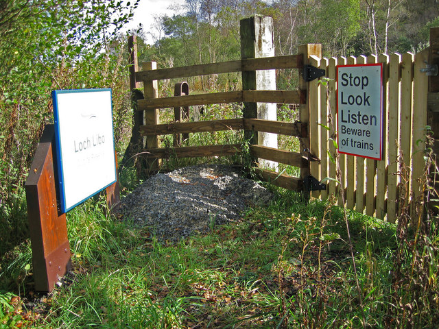
Loch Libo is a freshwater loch in East Renfrewshire, Parish of Neilston, Scotland. The Lugton Water has its source from the southern end of loch, running 14 miles before reaching its confluence with the River Garnock near Kilwinning. The village of Uplawmoor and the hamlet of Shillford lie nearby. away to the northeast is the town of Neilston. History The name is of great antiquity and 'Libo' may be pre-Gaelic in origin. The loch lies in a glen, with Caldwell Law to the north and Uplawmoor Wood to the south. In the 14th century was referred to as 'Loch le Bog Syde' in a charter, meaning the 'Bogside Loch'.Scottish Carper Retrieved : 2012-12-23 The loch is now owned by the |
Uplawmoor
Uplawmoor is a village in East Renfrewshire, Scotland. Its population was 700 as of 2016. Historic Uplawmoor, associated for centuries with the Barony of Caldwell and the Mure family, is still a vibrant community today, although bereft of the shops once to be found there. It has a primary school, hotel (Uplawmoor Hotel), village hall (Mure Hall), sports ground for tennis and football (including a playpark) and a golf club (Caldwell Golf Club). Nearby is the extensive Caldwell Estate with the roofless 18th century Caldwell House, which was designed by Robert Adam. The separate Caldwell Tower, of probable 16th century origin, is visible from the village. Several farms surround the village, as agriculture has always been of importance locally. Historically the village was served by two railway lines - Lanarkshire and Ayrshire and Glasgow, Barrhead and Kilmarnock Joint Railway Uplawmoor has a rural setting, with farmland on one side and mainly beech woodland (Pollick Glen and Shi ... [...More Info...] [...Related Items...] OR: [Wikipedia] [Google] [Baidu] |
Caldwell, East Renfrewshire
Caldwell is a mansion and old estate with the remains of a castle nearby. These lands lie close to the Lugton Water and the villages of Uplawmoor in East Renfrewshire and Lugton in East Ayrshire. History Caldwell Castle and tower The present day Caldwell Tower (NS 4223 5512), stands on a mound, and is a small, free-standing tower of probable 16th-century date although it may represent part of a larger castle now lost through robbing of stone for other uses. Square on plan, of good coursed rubble, it contains three stories beneath the parapet. This is carried on two courses of individual corbels. The crenellations seem to have been renewed. The door at ground floor level is in the west wall and admits to a vaulted basement, which does not communicate with the upper stories. The first floor, also vaulted, is reached via a modern forestair. The flooring above has been altered. The windows are small, and there are signs of built-up gun-loops in the walling. The fabric thro ... [...More Info...] [...Related Items...] OR: [Wikipedia] [Google] [Baidu] |
East Renfrewshire
East Renfrewshire ( sco, Aest Renfrewshire; gd, Siorrachd Rinn Friù an Ear) is one of 32 council areas of Scotland. Until 1975, it formed part of the county of Renfrewshire for local government purposes along with the modern council areas of Renfrewshire and Inverclyde. Although no longer a local authority area, Renfrewshire still remains the registration county and lieutenancy area of East Renfrewshire. The East Renfrewshire local authority was formed in 1996, as a successor to the Eastwood district, with the Levern Valley (which came from Renfrew district) being annexed. East Renfrewshire has borders with East Ayrshire, Glasgow, Renfrewshire, South Lanarkshire, and North Ayrshire. East Renfrewshire Council The composition of East Renfrewshire Council following the 5 May 2022 local elections: Council leader: Cllr Owen O'Donnell (Labour) Civic Leader: Provost Mary Montague (Labour). Political composition: Wards Six multi-member wards (20 seats) were created for the ... [...More Info...] [...Related Items...] OR: [Wikipedia] [Google] [Baidu] |
Barrhead
Barrhead ( sco, Baurheid, gd, Ceann a' Bharra) is a town in East Renfrewshire, Scotland, southwest of Glasgow city centre on the edge of the Gleniffer Braes. At the 2011 census its population was 17,268. History Barrhead was formed when a series of small textile-producing villages (Barrhead, Arthurlie, Grahamston and Gateside) gradually grew into one another to form one continuous town. According to local historian James McWhirter, the name "Barrhead" first appeared in 1750. Glanderston House, to the south, at one time belonged to the Stewart kings of Scotland. In 1851 there was an explosion at the Victoria Pit colliery in nearby Nitshill, killing 63 men and boys who worked in the mine, many of whom lived in Barrhead. The victims were buried in a mass grave in the yard at St John's Church on Darnley Road, and although some bodies were later exhumed and reburied in other cemeteries, some may still reside at St John's in an unmarked grave. In 1890, with a rapidly expa ... [...More Info...] [...Related Items...] OR: [Wikipedia] [Google] [Baidu] |
Scotland
Scotland (, ) is a country that is part of the United Kingdom. Covering the northern third of the island of Great Britain, mainland Scotland has a border with England to the southeast and is otherwise surrounded by the Atlantic Ocean to the north and west, the North Sea to the northeast and east, and the Irish Sea to the south. It also contains more than 790 islands, principally in the archipelagos of the Hebrides and the Northern Isles. Most of the population, including the capital Edinburgh, is concentrated in the Central Belt—the plain between the Scottish Highlands and the Southern Uplands—in the Scottish Lowlands. Scotland is divided into 32 administrative subdivisions or local authorities, known as council areas. Glasgow City is the largest council area in terms of population, with Highland being the largest in terms of area. Limited self-governing power, covering matters such as education, social services and roads and transportation, is devolved from the ... [...More Info...] [...Related Items...] OR: [Wikipedia] [Google] [Baidu] |
Neilston
Neilston ( sco, Neilstoun, gd, Baile Nèill, ) is a village and parish in East Renfrewshire in the west central Lowlands of Scotland. It is in the Levern Valley, southwest of Barrhead, south of Paisley, and south-southwest of Renfrew, at the southwestern fringe of the Greater Glasgow conurbation. Neilston is a dormitory village with a resident population of just over 5,000 people. Neilston is mentioned in documents from the 12th century, when the feudal lord Robert de Croc, endowed a chapel to Paisley Abbey to the North. Neilston Parish Church—a Category B listed building—is said to be on the site of this original chapel and has been at the centre of the community since 1163. Little remains of the original structure. Before industrialisation, Neilston was a scattered farming settlement composed of a series of single-storey houses, many of them thatched. Some domestic weaving was carried out using local flax. Water power from nearby streams ground corn and provided a ... [...More Info...] [...Related Items...] OR: [Wikipedia] [Google] [Baidu] |
Glasgow
Glasgow ( ; sco, Glesca or ; gd, Glaschu ) is the most populous city in Scotland and the fourth-most populous city in the United Kingdom, as well as being the 27th largest city by population in Europe. In 2020, it had an estimated population of 635,640. Straddling the border between historic Lanarkshire and Renfrewshire, the city now forms the Glasgow City Council area, one of the 32 council areas of Scotland, and is governed by Glasgow City Council. It is situated on the River Clyde in the country's West Central Lowlands. Glasgow has the largest economy in Scotland and the third-highest GDP per capita of any city in the UK. Glasgow's major cultural institutions – the Burrell Collection, Kelvingrove Art Gallery and Museum, the Royal Conservatoire of Scotland, the Royal Scottish National Orchestra, Scottish Ballet and Scottish Opera – enjoy international reputations. The city was the European Capital of Culture in 1990 and is notable for its architectur ... [...More Info...] [...Related Items...] OR: [Wikipedia] [Google] [Baidu] |
Kilmarnock
Kilmarnock (, sco, Kilmaurnock; gd, Cill Mheàrnaig (IPA: ʰʲɪʎˈveaːɾnəkʲ, " Marnock's church") is a large town and former burgh in East Ayrshire, Scotland and is the administrative centre of East Ayrshire Council. With a population of 46,770, Kilmarnock is the 14th most populated settlement in Scotland and the largest town in Ayrshire. The town is continuous to nearby neighbouring villages Crookedholm and Hurlford to the east, and Kilmaurs to the west of the town. It includes former villages subsumed by the expansion of the town such as Bonnyton and new purpose built suburbs such as New Farm Loch. The town and the surrounding Greater Kilmarnock area is home to 32 listed buildings and structures designated by Historic Environment Scotland. The River Irvine runs through the eastern section of Kilmarnock, and the Kilmarnock Water passes through it, giving rise to the name 'Bank Street'. The first collection of work by Scottish poet Robert Burns, '' Poem ... [...More Info...] [...Related Items...] OR: [Wikipedia] [Google] [Baidu] |
Paisley, Renfrewshire
Paisley ( ; sco, Paisley, gd, Pàislig ) is a large town situated in the west central Lowlands of Scotland. Located north of the Gleniffer Braes, the town borders the city of Glasgow to the east, and straddles the banks of the White Cart Water, a tributary of the River Clyde. Paisley serves as the administrative centre for the Renfrewshire council area, and is the largest town in the historic county of the same name. It is often cited as "Scotland's largest town" and is the fifth largest settlement in the country, although it does not have city status. The town became prominent in the 12th century, with the establishment of Paisley Abbey, an important religious hub which formerly had control over other local churches. By the 19th century, Paisley was a centre of the weaving industry, giving its name to the Paisley shawl and the Paisley pattern. The town's associations with political radicalism were highlighted by its involvement in the Radical War of 1820, with s ... [...More Info...] [...Related Items...] OR: [Wikipedia] [Google] [Baidu] |


