|
Scenic Highway (Queensland)
The Scenic Highway is a coastal highway from Yeppoon to Emu Park, both on the Capricorn Coast in the Shire of Livingstone, Queensland, Australia. Route The highway commences at a roundabout near the southern boundary of Yeppoon, which connects to the (northern) main road from Rockhampton ( Yeppoon Road) and the coastal road to the northern part of Yeppoon (Appleton Drive) It passes from Yeppoon through Cooee Bay, Lammermoor, Rosslyn, Mulambin, Causeway Lake and Kinka Beach to Emu Park. After proceeding south-east for about 350 metres it crosses Ross Creek and passes between Cooee Bay (to the east) and Taranganba (to the west) It then proceeds through Lammermoor, running beside the beach for about 1 km before reaching Rosslyn. Where it enters Rosslyn the road is cut into an ocean-front cliff-face near Statue Bay. This section of road was closed from 20 February 2015 until 26 July 2018 due to a landslip caused by Cyclone Marcia. A temporary detour through suburban stre ... [...More Info...] [...Related Items...] OR: [Wikipedia] [Google] [Baidu] |
Yeppoon, Queensland
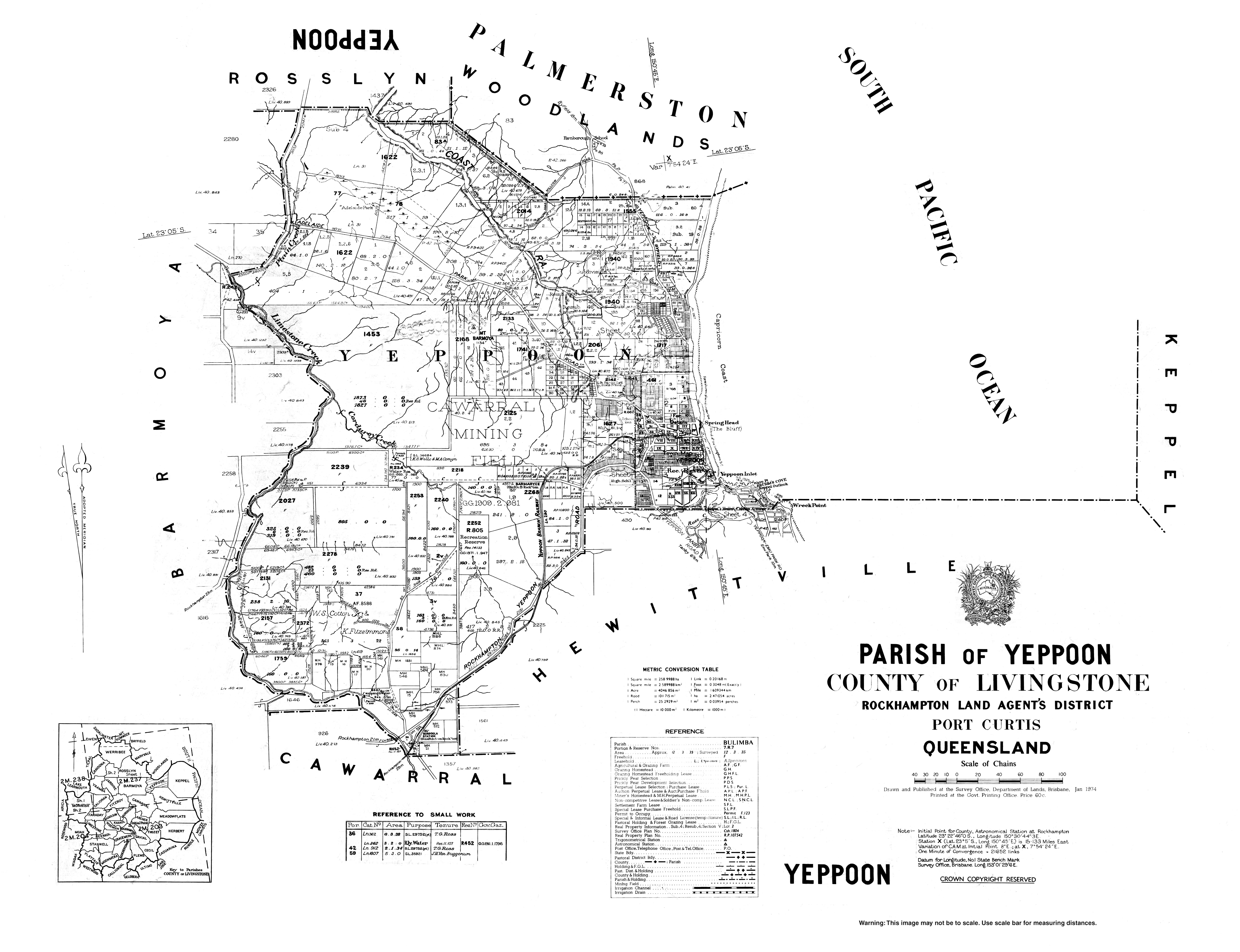
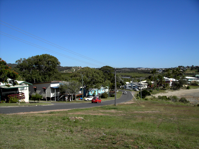
Yeppoon is a coastal town and locality in the Shire of Livingstone, Queensland, Australia. Yeppoon is renowned for its beaches, tropical climate, and the islands out on the bay. Located from the city of Rockhampton, Yeppoon is the seat of the Shire of Livingstone and the principal town on the Capricorn Coast, a string of seaside communities stretching more than from north to south. The beaches and shallow coves provide a destination both for tourists and retirees settling down in Central Queensland. Offshore, there are 27 islands including Great Keppel Island which is from Yeppoon. In the , the locality of Yeppoon had a population of 7,037 people; this does not include any neighbouring suburbs. Geography Yeppoon is located on Keppel Bay which opens to the Coral Sea, around north of the state capital, Brisbane, and from Rockhampton City. It is located within the local government area of Shire of Livingstone in Central Queensland. Between 2008 and 2013, it was within the R ... [...More Info...] [...Related Items...] OR: [Wikipedia] [Google] [Baidu] |
Vince Jones (Queensland Politician)
Vincent Edward Jones (15 June 1910 – 30 October 1971) was a member of the Queensland Legislative Assembly in Australia. Biography Jones was born in Barcaldine, Queensland, the son of Frank Harold Jones and his wife Kathleen Clarke (née Ivers). He was educated at Kalapa State School at Kalapa, Queensland and on leaving school became a dairy farmer, pig raiser and breeder. On 16 June 1936 Jones married Doris Elsie McNamara and together had a son and a daughter. He died in October 1971 at his home in Yeppoon and was buried in the North Rockhampton Cemetery.Deceased search — . Retrieved 14 May 2016. ...
|
Cyclone Marcia
Severe Tropical Cyclone Marcia was a powerful tropical cyclone that made landfall at its peak strength over central Queensland, near Shoalwater Bay on 20 February 2015. The cyclone went on to affect various areas including Yeppoon and Rockhampton. It passed just to the west of Yeppoon as a Category 4 system, then traversed over the regional city of Rockhampton as a Category 2 system on the same day. Eventually, the cyclone weakened, moved southeast out to sea, before dissipating. Marcia caused at least A$750 million (US$587 million) worth of damage. Meteorological history The Australian Bureau of Meteorology (BoM) started to monitor a tropical low which developed within the monsoon trough to the southeast of Papua New Guinea on 15 February. The system drifted generally eastwards and developed slowly under moderate vertical wind shear, until the Joint Typhoon Warning Center (JTWC) issued a Tropical Cyclone Formation Alert early on 17 February when deep convection wrappi ... [...More Info...] [...Related Items...] OR: [Wikipedia] [Google] [Baidu] |
Ross Creek (Central Queensland)
Ross Creek is the main ocean tributary of Yeppoon, Queensland, on the Capricorn Coast. Beak Bridge crosses Ross Creek, connecting Yeppoon with Cooee Bay and other southern towns along Scenic Highway 10. Community While Ross Creek has no permanent population, it is a major community centre with a park, boat ramp, and public barbecues. Markets at Ross Creek are held every month. Ross Creek is best known for its fishing. On the low tide, muddy sandbars on the southern side of the bridge are revealed, and are a popular place for pumping for yabbies. On the incoming tide, the creek fills to near capacity. Man-made stone walls on either side of the creek, plus a sandy beach at the mouth provide plentiful fishing spots. Whiting, flathead, and silver bream are common catches. Flora and fauna Sandy at its mouth, Ross Creek becomes muddier on the other side of the bridge and is popular for mud crabs. Hectares of low lying land either side of Ross Creek fills at high ti ... [...More Info...] [...Related Items...] OR: [Wikipedia] [Google] [Baidu] |
Causeway2022i
A causeway is a track, road or railway on the upper point of an embankment across "a low, or wet place, or piece of water". It can be constructed of earth, masonry, wood, or concrete. One of the earliest known wooden causeways is the Sweet Track in the Somerset Levels, England, which dates from the Neolithic age. Timber causeways may also be described as both boardwalks and bridges. Etymology When first used, the word ''causeway'' appeared in a form such as "causey way" making clear its derivation from the earlier form "causey". This word seems to have come from the same source by two different routes. It derives ultimately, from the Latin for heel, ''calx'', and most likely comes from the trampling technique to consolidate earthworks. Originally, the construction of a causeway utilised earth that had been trodden upon to compact and harden it as much as possible, one layer at a time, often by enslaved bodies or flocks of sheep. Today, this work is done by machines. The s ... [...More Info...] [...Related Items...] OR: [Wikipedia] [Google] [Baidu] |
Causeway Lake, Queensland
Causeway Lake is a coastal locality on the Capricorn Coast in the Livingstone Shire, Queensland, Australia. In the , Causeway Lake had a population of 121 people. Geography The locality takes its name from the lake of the same name which lies within the locality, both of which take their name from the causeway (and smallbridge) which allows the Scenic Highway to cross the lake's narrow entrance to the Coral Sea. There is very little development within the locality except for a small residential area on the north-eastern shore of the lake where there is also public parkland access to the lake for recreation. Apart from that, most of the locality is undeveloped being taken up with the lakes and the associated palustrine wetland surrounding the numerous creeks which flow into the lake. The northern mouth of the lake is part of the Capricorn Coast National Park. The southern part of the locality is within the Causeway Lake Conservation Park. History The Scenic Highway crossing ... [...More Info...] [...Related Items...] OR: [Wikipedia] [Google] [Baidu] |
Mulambin, Queensland
Mulambin is a coastal town and locality in the Livingstone Shire, Queensland, Australia. In the the locality of Mulambin had a population of 921 people. Geography The eastern boundary of Mulambin is the beach fronting onto the Coral Sea. The Scenic Highway A scenic route, tourist road, tourist route, tourist drive, holiday route, theme route, or scenic byway is a specially designated road or waterway that travels through an area of natural or cultural beauty. It often passes by scenic viewpoint ... runs from the north to the south as an esplanade between the beach and the residential area. The western boundary is Mulambin Creek which flows from the north to the south into Causeway Lake. The western part of the locality is largely undeveloped freehold land. History In the the locality of Mulambin had a population of 921 people. References External links * {{authority control Towns in Queensland Shire of Livingstone Capricorn Coast Localities in Queens ... [...More Info...] [...Related Items...] OR: [Wikipedia] [Google] [Baidu] |
Cooee Bay
Cooee Bay is a coastal locality in the Livingstone Shire, Queensland, Australia. In the Cooee Bay had a population of 913 people. Geography Cooee Bay is bounded to the east by the Coral Sea. It is centrally located on the Capricorn Coast, two kilometres south of Yeppoon, and north of Emu Park. Like its neighbouring suburb Taranganba, Cooee Bay is separated from Yeppoon by Ross Creek, a popular fishing location. Cooee Bay has the following headlands (from north to south): * Wave Point () * Keppel Outlook () * Wreck Point () These headlands create a number of small bays (from north to south): * Yeppoon Inlet at the mouth of Ross Creek () * Fishermans Bay () south of the mount of Ross Creek * Brumms Cove () between Wave Point and Keppel Outlook * Cooee Bay () south of Keppel Outlook Matthew Flinders Drive is an alternative tourist deviation from the Scenic Highway, which travels up to Wreck Point. From the lookout, the visitor can enjoy views to Byfield, Great Keppel Is ... [...More Info...] [...Related Items...] OR: [Wikipedia] [Google] [Baidu] |
Rockhampton, Queensland
Rockhampton is a city in the Rockhampton Region of Central Queensland, Australia. The population of Rockhampton in June 2021 was 79,967, Estimated resident population, 30 June 2018. making it the fourth-largest city in the state outside of the cities of South East Queensland, and the List of cities in Australia by population, 22nd-largest city in Australia. Today, Rockhampton is an industrial and agricultural centre of the north, and is the regional centre of Central Queensland. Rockhampton is one of the oldest cities in Queensland and in Northern Australia. In 1853, Charles and William Archer came across the Toonooba river, which is now also known as the Fitzroy River, Queensland, Fitzroy River, which they claimed in honour of Sir Charles Augustus FitzRoy, Charles FitzRoy. The Archer brothers took up a run near Gracemere in 1855, and more settlers arrived soon after, enticed by the fertile valleys. The town of Rockhampton was proclaimed in 1858, and surveyed by William Henry S ... [...More Info...] [...Related Items...] OR: [Wikipedia] [Google] [Baidu] |
Queensland
) , nickname = Sunshine State , image_map = Queensland in Australia.svg , map_caption = Location of Queensland in Australia , subdivision_type = Country , subdivision_name = Australia , established_title = Before federation , established_date = Colony of Queensland , established_title2 = Separation from New South Wales , established_date2 = 6 June 1859 , established_title3 = Federation , established_date3 = 1 January 1901 , named_for = Queen Victoria , demonym = , capital = Brisbane , largest_city = capital , coordinates = , admin_center_type = Administration , admin_center = 77 local government areas , leader_title1 = Monarch , leader_name1 = Charles III , leader_title2 = Governor , leader_name2 = Jeannette Young , leader_title3 = Premier , leader_name3 = Annastacia Palaszczuk ( ALP) , legislature = Parliament of Queensland , judiciary = Supreme Court of Queensland , national_representation = Parliament of Australia , national_representation_type ... [...More Info...] [...Related Items...] OR: [Wikipedia] [Google] [Baidu] |


