|
Sayh Mudayrah
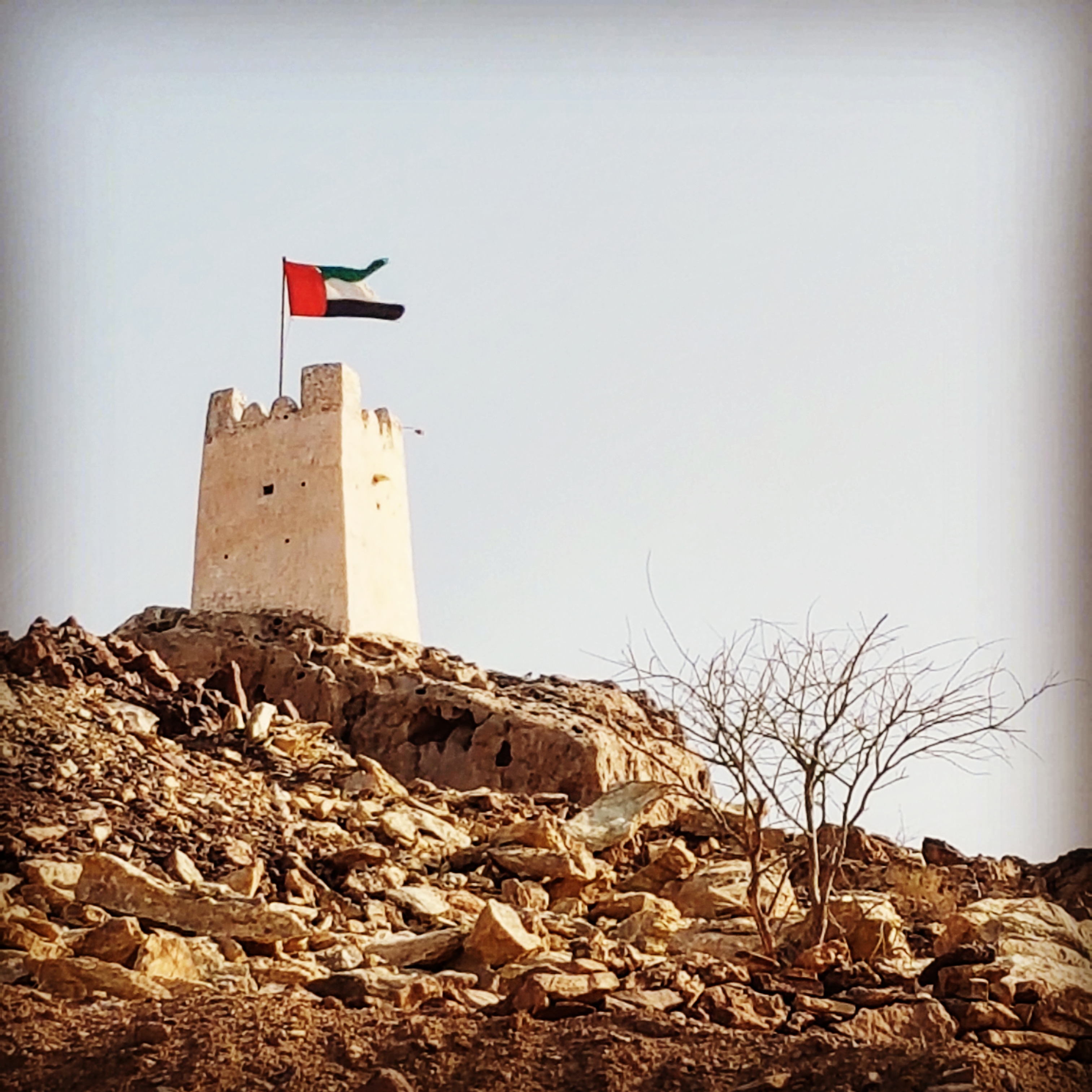
Sayh Mudayrah, pronounced locally ''Sayḥ Muzayraʿ'' ( ar, سَيْح مُزَيْرَع), is a township in Masfout, an exclave of the Emirate of Ajman, the United Arab Emirates (UAE). It is located on the Madam/ Hatta Highway ( E44) near the Oman–United Arab Emirates border. Description A large village which has developed parallel to the E44, Sayh Mudayrah gives its name to a geological fault line linked to the Hatta fault zone. The village, located on an alluvial fan, is rich in soil, mineral and water resources and its fertile land has long encouraged settlement. It sits on a watershed between the east and west coasts of the UAE, which gives rise to the unusual wadi formation at Sinadil, which sees water flowing from the same spot both West towards the Persian Gulf and East towards the Indian Ocean The Indian Ocean is the third-largest of the world's five oceanic divisions, covering or ~19.8% of the water on Earth's surface. It is bounded by Asia to the north, A ... [...More Info...] [...Related Items...] OR: [Wikipedia] [Google] [Baidu] |
Masfout
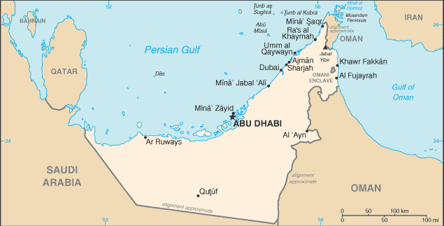
Masfout is a village that forms part of the eponymous exclave of Masfout in Ajman, one of the seven emirates forming the United Arab Emirates. It is surrounded by Ras Al Khaimah, the Dubai exclave of Hatta and Oman ( Mahdha Wilayat of Al Buraimi Governorate). It is only accessible from Ajman itself by crossing territories of Sharjah, Ras Al Khaimah, and Oman. At the census of 2017 the city had a population 8988 on an area of 86.59 km², which corresponds to a population density of 103.8 per km². The village has a number of government facilities and municipal centres, including a dedicated courthouse built in 2017. The 13,500 square metre Waraqa Park surrounds the former house of the founder of Ajman, Sheikh Rashid bin Humaid Al Nuaimi. In 2017 the Masfout Heights Resort Project was announced, intended as a mixed use hotel and tourism project. Digging water wells in the exclave was banned by the Ajman government as water depletion became an issue with over 80 unregulated w ... [...More Info...] [...Related Items...] OR: [Wikipedia] [Google] [Baidu] |
Al Madam
Al Madam ( ar, ٱلْمَدَام) is an inland town of the Emirate of Sharjah, the UAE. Located at the intersection of the Dubai-Hatta ( E44) and Mleiha- Shwaib (E55) roads, its development has mainly centred around these road links and the road traffic through Hatta to Oman. The volume of traffic to Oman through Madam and Hatta has lessened since the closure of the 'soft' Omani border at Mahda in 2016, although traffic volumes remain at some 5,000 travellers daily. The road from Madam to Hatta is now only open to UAE or Omani nationals and permit holders. Description The strip development of Madam along the E44 towards the 'dune bashing' tourist centre of Badayer (with its celebrated 'Big Red' sand dune) has resulted in the town becoming elongated, and includes the 'first shopping mall' to open there. This is in addition to municipal facilities, a medical centre, wedding hall and a large number of shops located along the main street of the town. Al Madam is home to an annu ... [...More Info...] [...Related Items...] OR: [Wikipedia] [Google] [Baidu] |
Populated Places In The Emirate Of Ajman
Population typically refers to the number of people in a single area, whether it be a city or town, region, country, continent, or the world. Governments typically quantify the size of the resident population within their jurisdiction using a census, a process of collecting, analysing, compiling, and publishing data regarding a population. Perspectives of various disciplines Social sciences In sociology and population geography, population refers to a group of human beings with some predefined criterion in common, such as location, race, ethnicity, nationality, or religion. Demography is a social science which entails the statistical study of populations. Ecology In ecology, a population is a group of organisms of the same species who inhabit the same particular geographical area and are capable of interbreeding. The area of a sexual population is the area where inter-breeding is possible between any pair within the area and more probable than cr ... [...More Info...] [...Related Items...] OR: [Wikipedia] [Google] [Baidu] |
Indian Ocean
The Indian Ocean is the third-largest of the world's five oceanic divisions, covering or ~19.8% of the water on Earth's surface. It is bounded by Asia to the north, Africa to the west and Australia to the east. To the south it is bounded by the Southern Ocean or Antarctica, depending on the definition in use. Along its core, the Indian Ocean has some large marginal or regional seas such as the Arabian Sea, Laccadive Sea, Bay of Bengal, and Andaman Sea. Etymology The Indian Ocean has been known by its present name since at least 1515 when the Latin form ''Oceanus Orientalis Indicus'' ("Indian Eastern Ocean") is attested, named after India, which projects into it. It was earlier known as the ''Eastern Ocean'', a term that was still in use during the mid-18th century (see map), as opposed to the ''Western Ocean'' ( Atlantic) before the Pacific was surmised. Conversely, Chinese explorers in the Indian Ocean during the 15th century called it the Western Oceans. In Anci ... [...More Info...] [...Related Items...] OR: [Wikipedia] [Google] [Baidu] |
Persian Gulf
The Persian Gulf ( fa, خلیج فارس, translit=xalij-e fârs, lit=Gulf of Fars, ), sometimes called the ( ar, اَلْخَلِيْجُ ٱلْعَرَبِيُّ, Al-Khalīj al-ˁArabī), is a mediterranean sea in Western Asia. The body of water is an extension of the Indian Ocean located between Iran and the Arabian Peninsula.United Nations Group of Experts on Geographical NameWorking Paper No. 61, 23rd Session, Vienna, 28 March – 4 April 2006. accessed October 9, 2010 It is connected to the Gulf of Oman in the east by the Strait of Hormuz. The Shatt al-Arab river delta forms the northwest shoreline. The Persian Gulf has many fishing grounds, extensive reefs (mostly rocky, but also coral), and abundant pearl oysters, however its ecology has been damaged by industrialization and oil spills. The Persian Gulf is in the Persian Gulf Basin, which is of Cenozoic origin and related to the subduction of the Arabian Plate under the Zagros Mountains. The current floo ... [...More Info...] [...Related Items...] OR: [Wikipedia] [Google] [Baidu] |
Sinadil
Sinadil is a settlement in Oman, located on the northern edge of the Hajjar mountain range just south of the village of Sayh Mudayrah in Ajman, United Arab Emirates. It is 8 km to the west of Hatta in the direction of Hadf. Although Sinadil was originally part of Ajman, it was transferred to Oman in the 1980s. Geography Sinadil is an old name referring to the triangular piece of land lying between Wadi Hadf and one of its distributaries. The gap through which the wadi exits the Hajjar mountains is 200 metres wide and known as the ''Sinadil gap''. The area is good for agriculture and the wadis are used for irrigation. Agriculture ends about 1 km downstream. A deep gorge at Sinadil has running water most of the year and stretches some 300 meters and is 15 to 20 metres deep. The Wadi Hadf at Sinadil is unique in that it flows both East to the Wadi Hatta and West to the Madam plain and Wadi Fayah, thereby creating a wadi that flows to the Persian Gulf and Gulf of Oman from a s ... [...More Info...] [...Related Items...] OR: [Wikipedia] [Google] [Baidu] |
Oman–United Arab Emirates Border
The Oman–United Arab Emirates border consists of three non-contiguous sections totalling 609 km (378 mi) in length. Description Northern (Musandam) section The northern section of border divides the Omani exclave of Musandam from the UAE Emirates of Fujairah and Ras Al Khaimah. This peninsula commands the strategic Strait of Hormuz, with the Oman-UAE border consisting of a series of irregular, though roughly horizontal, lines running through mountainous terrain, from the western Persian Gulf coast to the eastern Gulf of Oman coast. Middle (enclaved) section The middle section of the border consists of the Omani enclave of Madha, within which is the UAE counter-enclave of Nahwa, belonging to the Emirate of Sharjah. This territory is the only territory between UAE and Oman which is not lined with any barrier and there is no border crossing between Madha, Nahwa, or the rest of the UAE. Southern section The southern, and by far the longest section, of the frontier starts ... [...More Info...] [...Related Items...] OR: [Wikipedia] [Google] [Baidu] |
E 44 Road (United Arab Emirates)
E 44 ( ar, إ ٤٤) is one of the main roads of the United Arab Emirates (UAE). The road connects the city of Dubai to the town of Hatta. In Dubai, the city is also referred to as ''Al Khail Road'', '' Ras al Khor Road'' and, ''Al Aweer Road'', ''Dubai-Hatta Highway''. E 44 also connects the UAE with Oman. E 44 originates (as Al Khail Road) in Al Barsha, Dubai and runs roughly parallel to E 11 (Sheikh Zayed Road) and E 311 (Emirates Road). It is referred to as ''Ras Al Khor Road'' after the E 44-Oud Mehta Road junction near Dubai Creek Dubai Creek ( ar, خور دبي, Khūr Dubay) has been described as a natural Seawater, saltwater creek (tidal), creek, tidal inlet, and watercourse or waterway in Dubai, United Arab Emirates (UAE). It extends about inwards and forms a natural p .... The section between Sheikh Mohammed Bin Zayed Road and Emirates Road is known as ''Al Awir Road''. E 44 terminates in the town of Hatta. See also * Dubai Safari Park References ... [...More Info...] [...Related Items...] OR: [Wikipedia] [Google] [Baidu] |
Hatta, United Arab Emirates
Hatta ( ar, حتا) is an inland exclave of the emirate of Dubai in the United Arab Emirates. Formerly an Omani territory, its ownership was transferred to Dubai in or around 1850. Geography It lies to the south-east of Dubai's main territory and is about east of Dubai. It is located relatively high in the Hajar Mountains. It borders Oman to the east and the south, the Ajman exclave of Masfout to the west, and Ras al-Khaimah to the north. History Previously known as Hajarain, Hatta became a dependency of Dubai during the reign of Hasher Bin Maktoum after the Omani Sultan Turki bin Said transferred the territory, finding himself unable to defend it against the Na'im of Buraimi, who had settled neighbouring Masfout (today a part of the emirate of Ajman). The village was still called Hajarain as recently as 1906. The old village of Hatta includes two prominent military towers from the 1880s, a fort from 1896 and the Juma mosque, which was built in 1780 and is the oldest ... [...More Info...] [...Related Items...] OR: [Wikipedia] [Google] [Baidu] |
Emirate Of Ajman
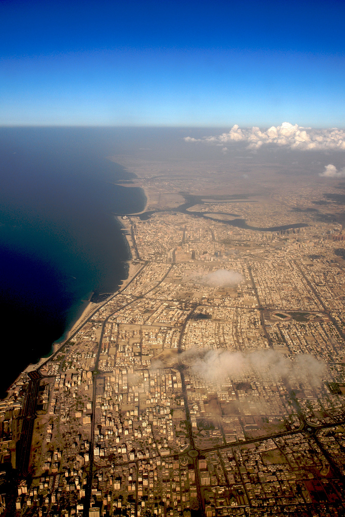
The Emirate of Ajman ( ar, إمارة عجمان; ) (Gulf Arabic: إمارة عيمان emāratʿymān) is one of the seven emirates of the United Arab Emirates. It joined the United Arab Emirates federation on December 2, 1971. It has an area of 259 square kilometers (100 sq mi), which makes it the smallest of the emirates in terms of area, while its population of approximately 504,846 in 2017 according to the Federal Competitiveness and Statistics Center makes it the fourth most populous emirate in the country. It is named after the city of Ajman, which is its seat of government. The main landmass of the emirate is bordered on the north, east, and south by the Emirate of Sharjah. Located on the coast of the Arabian Gulf, Ajman also controls two small inland exclaves: Manama and Masfout, both of which are primarily agricultural.https://www.sea-seek.com/ebook/Persian_-_Arabian_Gulf.pdf Approximately 95% of the population of the emirate resides in the city of Ajman, w ... [...More Info...] [...Related Items...] OR: [Wikipedia] [Google] [Baidu] |
Western Hajar Mountains
The Hajar Mountains ( ar, جِبَال ٱلْحَجَر, Jibāl al-Ḥajar, ''The Rocky Mountains'' or ''The Stone Mountains'') in northeastern Oman and also the eastern United Arab Emirates are the highest mountain range in the eastern Arabian peninsula. Also known as "Oman Mountains", they separate the low coastal plain of Oman from the high desert plateau, and lie inland from the Gulf of Oman. ''Al'' () means "the", and ''Ḥajar'' () means "stone" or "rock". So ''al-Ḥajar'' () is named as "the stone" or "the rock". Geology Orography and tectonic setting The Hajar Mountains extend for through the UAE and Oman. They are located on the north-east corner of the Arabian Plate, reaching from the Musandam Peninsula through to the east coast of Oman. The range is about wide, with Jabal Shams being the highest peak at 3,009 m (9,872 ft) in the central region of the mountains. Currently, the Arabian Plate is moving north relative to the Eurasian Plate at per ... [...More Info...] [...Related Items...] OR: [Wikipedia] [Google] [Baidu] |
Enclave And Exclave
An enclave is a territory (or a small territory apart of a larger one) that is entirely surrounded by the territory of one other state or entity. Enclaves may also exist within territorial waters. ''Enclave'' is sometimes used improperly to denote a territory that is only partly surrounded by another state. The Vatican City and San Marino, both enclaved by Italy, and Lesotho, enclaved by South Africa, are completely enclaved sovereign states. An exclave is a portion of a state or district geographically separated from the main part by surrounding alien territory (of one or more states or districts etc). Many exclaves are also enclaves, but not all: an exclave can be surrounded by the territory of more than one state. The Azerbaijani exclave of Nakhchivan is an example of an exclave that is not an enclave, as it borders Armenia, Turkey and Iran. Semi-enclaves and semi-exclaves are areas that, except for possessing an unsurrounded sea border (a coastline contiguous with internati ... [...More Info...] [...Related Items...] OR: [Wikipedia] [Google] [Baidu] |


