|
Sauðárkrókur
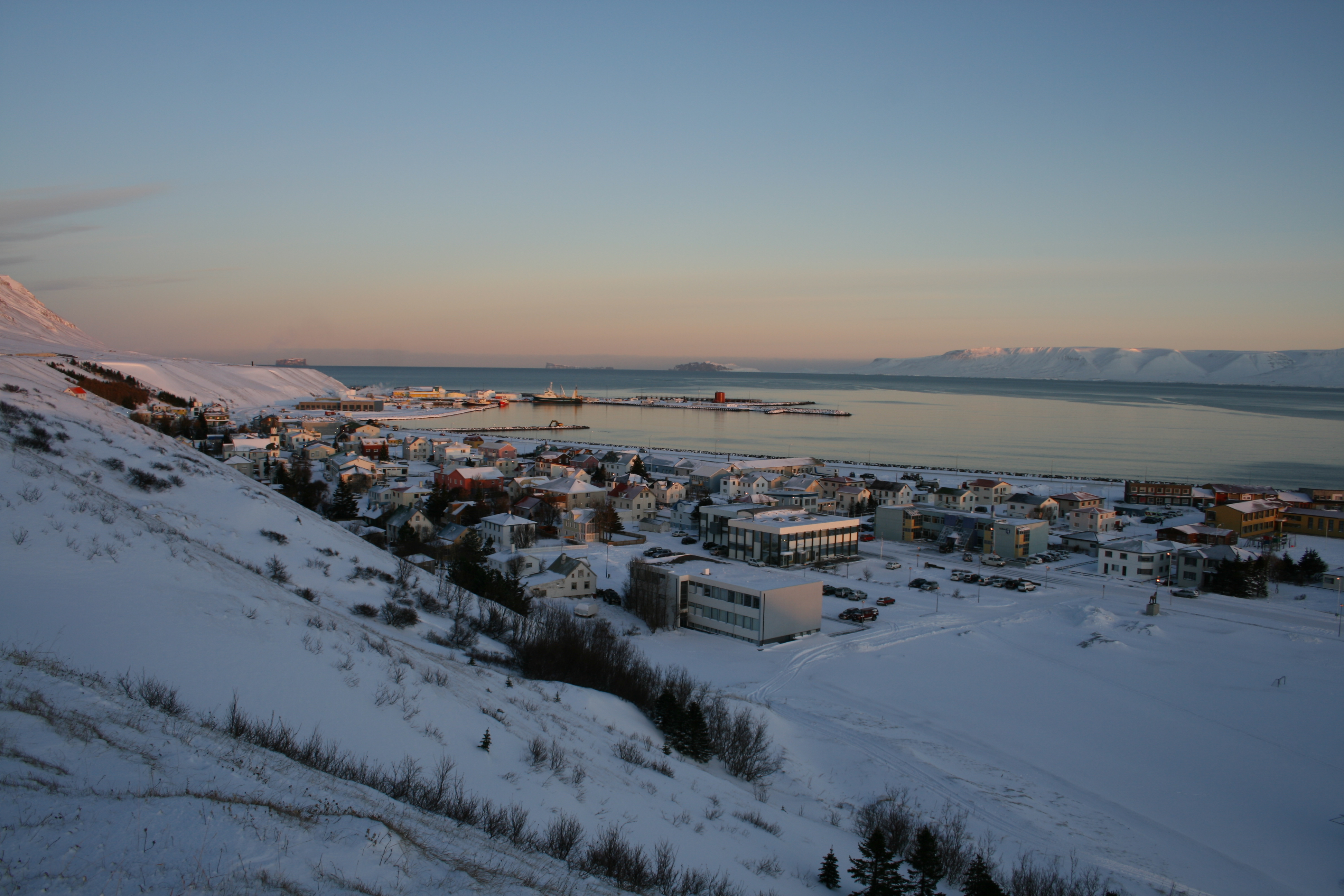
Sauðárkrókur () is a town on the Skagafjörður in northern Iceland. It is the seat of both the Sveitarfélagið Skagafjörður ('Municipality of Skagafjörður') and the Northwestern Region. Sauðárkrókur is the largest town in Northwest Iceland and the second-largest town on the north coast of Iceland, with a population of 2,612. It is the centre for commerce and services in the district, and an important link in Iceland's food production. The population of Sauðárkrókur has grown steadily in recent years, and its economy is relatively diverse. Economic mainstays are fisheries, dairy production, light industry and broad-based services such as computer and engineering operations, financials, consulting, design and printing. The natural hot pool located north of Sauðárkrókur is mentioned in the ''Grettis saga''. Etymology Sauðárkrókur got its name from the creek that runs through the land. The creek is named Sauðá, and the name Sauðárkrókur indicates t ... [...More Info...] [...Related Items...] OR: [Wikipedia] [Google] [Baidu] |
Sauðárkrókur Airport
Sauðárkrókur Airport is an airport serving Sauðárkrókur, a village on the Skagafjörður bay in northern Iceland. The Hegranes non-directional beacon (Ident: HE) is 1.8 nautical miles northeast of the airport. Airlines and destinations With Eagle Air ceasing to operate flights to Reykjavík in May 2018, there are no more scheduled flights from Sauðárkrókur. Statistics Passengers and movements See also * Transport in Iceland * List of airports in Iceland This is a list of airports in Iceland. There are no railways in Iceland. Driving from Reykjavík to Akureyri takes 4-5 hours compared to 45 minutes flight time, driving from Reykjavík to Egilsstaðir takes 9 hours compared to 1 hour flight time ... Notes References External links * OurAirports - Sauðárkrókur AirportOpenStreetMap - SauðárkrókurSkyVector - Saudarkrokur Airport Airports in Iceland Sauðárkrókur {{Iceland-struct-stub ... [...More Info...] [...Related Items...] OR: [Wikipedia] [Google] [Baidu] |
Skagafjörður (municipality)
Skagafjörður () is a municipality that covers most of the land area of the region around the fjord with the same name (see Skagafjörður for details on the region) in northern Iceland. Overview The municipality was created in 1998 when 11 out of the 12 municipalities in Skagafjörður held votes on whether they should merge or not. The merge was approved in all the municipalities that held the vote. Akrahreppur was the only municipality in Skagafjörður that did not participate. In February 2022, residents of Akrahreppur and Skagafjörður voted to merge into a single municipality; the merger will be formalized in the spring of 2022. The merge joined the town of Sauðárkrókur, the villages of Hofsós and Varmahlíð and several rural districts. It also includes the historic cathedral site of Hólar which is the site of a growing university today. Localities * Ábær * Hofsós * Hólar * Keta * Miklibær * Reynistaður * Sauðárkrókur * Silfrastaðir * Varmahlíð ... [...More Info...] [...Related Items...] OR: [Wikipedia] [Google] [Baidu] |
Skagafjörður
Skagafjörður () is a deep fjord and its valley in northern Iceland. Location Skagafjörður, the fjord, is about 40 km long and 15 km wide, situated between Tröllaskagi to the east and the Skagi Peninsula to the west. There are two municipalities in the area, Skagafjörður Municipality (approx. 4140 inhabitants) and Akrahreppur Municipality (approx. 210 inhabitants). This is one of Iceland's most prosperous agricultural regions, with widespread dairy and sheep farming in addition to the horse breeding for which the district is famed. Skagafjörður is the only county in Iceland where horses outnumber people. It is a centre for agriculture, and some fisheries are also based in the settlements of Sauðárkrókur and Hofsós. The people living in Skagafjörður have a reputation for choir singing, horsemanship, and gatherings. There are three islands in the bay: Málmey, Drangey and Lundey (Puffin Island). The bay is located in a submerged glacial valley which ... [...More Info...] [...Related Items...] OR: [Wikipedia] [Google] [Baidu] |
Northwestern Region (Iceland)
Northwestern Region ( is, Norðurland vestra ) is one of the traditional eight regions of Iceland, located in the north of the island. The largest town in the region is Sauðárkrókur, with a population of 3000. One of the primary attractions of the area is the basalt rock Hvítserkur (, regionally also ) is a 15 m high basalt Stack (geology), stack along the eastern shore of the Vatnsnes peninsula, in Northwestern Region (Iceland), northwest Iceland. The rock has two holes at the base, which give it the appearance of a ..., 15 meters high and resembles a dragon that throws its head to take a sip of water. References External links * {{iceland-geo-stub ... [...More Info...] [...Related Items...] OR: [Wikipedia] [Google] [Baidu] |
Varmahlíð
Varmahlíð () is a small village in Skagafjörður, northern Iceland. Around 140 people live on the eastern slope of the hill for which the town is named (''varmur''=warm, ''hlíð''=slope). Varmahlíð is on the ring road Route 1, at the junction of Route 75 leading to Sauðárkrókur, about 24 km to the north. Varmahlíð is in the middle of a flourishing agricultural area, where the Icelandic horse has been treasured for centuries. One of the main industries is horse-rearing. The area has an abundance of geothermal hot water. Hence Varmahlíð has a number of greenhouses with tropical and sub-tropical fruits and vegetables. Varmahlíð stands high on the western side of a valley, at the crossroads at the foot of Vatnsskarð pass. Near Varmahlíð stands the turf roofed church at Víðimýri, built in 1834, which has a magnificent altarpiece dating from 1727. The monument to Icelandic poet Stephan Stephansson is located at Vatnsskarð pass. Miðgarður, a concert hal ... [...More Info...] [...Related Items...] OR: [Wikipedia] [Google] [Baidu] |
Hofsós
Hofsós () is one of the oldest trading ports in northern Iceland dating back to the 16th century. The tiny village Hofsós in the Northern Region in Iceland was a rather busy trading post in the 17th and 18th century, but despite the merchant activities this small village did not develop into a larger village or a town in the 20th century. Hofsós had all the historical prerequisites to become a large town. It was a trading post for the Danish Trade Monopoly, it was not far away from the fishing grounds, it was central in the region, and it had a relatively good landing spot for boats. The Drangey Exhibition is in Pakkhús, the Hofsós warehouse built in 1777, during the time of the trading monopoly. Massacre hill farm (''Mannskaðaholl'') at the south end of Lake Höfðavatn, is named for the massacre of English marauders, which took place there in 1431. Other services offered are accommodation in guesthouses, a restaurant, coffee-house, and a camping site. There are also plea ... [...More Info...] [...Related Items...] OR: [Wikipedia] [Google] [Baidu] |
Localities Of Iceland
Most municipalities in Iceland include more than one settlement. For example, four localities ( Selfoss, Stokkseyri, Eyrarbakki, and Tjarnabyggð) can all be found in the municipality of Árborg. A number of municipalities only contain a single locality, while there are also a few municipalities in which no localities exist. All localities in Iceland can only be located within a single municipality, i.e. they cannot straddle multiple municipality borders. Some municipalities, such as Hafnarfjörður and Akranes, also share the same name with a locality. However, these localities are not always situated in their namesake municipalities. In those cases, this does not necessarily mean that they there are no other localities included in that particular municipality. Even when they are the only locality there, they do not always encompass the span of that municipality's entire land area. List of localities The majority of the functions that are carried out by ''local governme ... [...More Info...] [...Related Items...] OR: [Wikipedia] [Google] [Baidu] |
Regions Of Iceland
The regions of Iceland are eight areas of Iceland that roughly follow the arrangement of parliamentary constituencies as they were between 1959 and 2003. These regions are not incorporated polities but rather recognized groupings of municipalities. Iceland only has two levels of administration, the national government and 69 municipalities. The municipalities have organized themselves into eight regional associations and those boundaries are also recognized by Statistics Iceland to report statistics. Since 2014, police and commissioner (''sýslumaður'') districts have followed the eight region model with the exception that Vestmannaeyjar form a special district and are not part of the South region. The divisions of Iceland for the purposes of health care and district courts diverge more from the commonly used eight region model. The postal code system also roughly corresponds with the regions with the first digit of the three digit codes usually being the same as on the map below ... [...More Info...] [...Related Items...] OR: [Wikipedia] [Google] [Baidu] |
Akureyri Airport
Akureyri Airport ( is, Akureyrarflugvöllur , regionally also ) is a single-runway international airport in Akureyri, Iceland, south of the town centre. Icelandair and Norlandair link the airport with several domestic locations. History Scheduled air travel to Akureyri started in 1928 when Flugfélag Íslands ("Airline of Iceland") began flying on seaplanes to Reykjavík, landing on the fjord of Eyjafjörður near downtown Akureyri. The airline was short-lived, as it ceased operations after only three years. Another airline, Flugfélag Akureyrar ("Airline of Akureyri"), was founded in 1937 and in 1940 it changed its name to Flugfélag Íslands, though it was in no way affiliated with its predecessor. In 1944, Loftleiðir started flying from Reykjavík on Grumman Goose seaplanes, which added competition to the popular route. It was not until the early 1950s that construction of the airport itself started on top of a landfill on the delta of Eyjafjörður river, a few kilometres fr ... [...More Info...] [...Related Items...] OR: [Wikipedia] [Google] [Baidu] |
Icelandic Meteorological Office
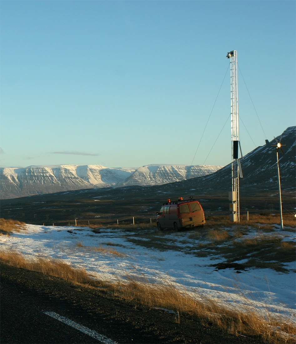
Icelandic Meteorological Office (IMO; is, Veðurstofa Íslands) is Iceland's national weather service and as such a government agency under the Ministry of Environment and Natural Resources. It is also active in volcano monitoring, esp. volcano seismology, and, together with other institutions, responsible for civil protection in IcelandMission. About the Icelandic Meteorological Office. (28.5.2010) Retrieved 18 August 2020. Aims and functions "The research focus of IMO is on and ,[...More Info...] [...Related Items...] OR: [Wikipedia] [Google] [Baidu] |
Köppen Climate Classification
The Köppen climate classification is one of the most widely used climate classification systems. It was first published by German-Russian climatologist Wladimir Köppen (1846–1940) in 1884, with several later modifications by Köppen, notably in 1918 and 1936. Later, the climatologist Rudolf Geiger (1894–1981) introduced some changes to the classification system, which is thus sometimes called the Köppen–Geiger climate classification system. The Köppen climate classification divides climates into five main climate groups, with each group being divided based on seasonal precipitation and temperature patterns. The five main groups are ''A'' (tropical), ''B'' (arid), ''C'' (temperate), ''D'' (continental), and ''E'' (polar). Each group and subgroup is represented by a letter. All climates are assigned a main group (the first letter). All climates except for those in the ''E'' group are assigned a seasonal precipitation subgroup (the second letter). For example, ''Af'' indi ... [...More Info...] [...Related Items...] OR: [Wikipedia] [Google] [Baidu] |
December Solstice
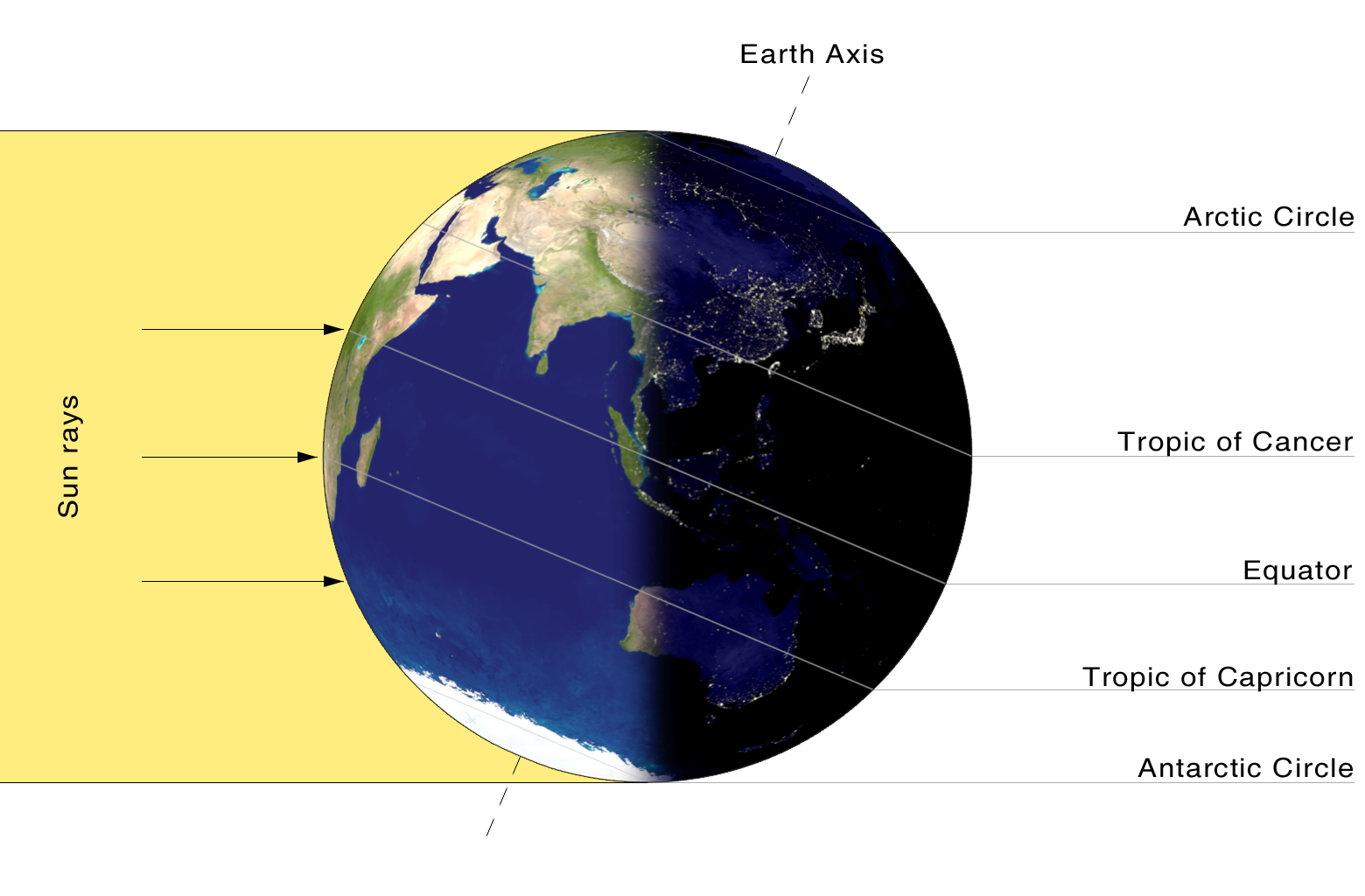
The December solstice, also known as the southern solstice, is the solstice that occurs each December – typically on 21 December, but may vary by one day in either direction according to the Gregorian calendar. In the Northern Hemisphere, the December solstice is the winter solstice (the day with the shortest period of daylight), whilst in the Southern Hemisphere it is the summer solstice (the day with the longest period of daylight). The solstice also marks the changing of seasons in many countries. 21 December is the first day of winter (in the Northern Hemisphere) and the first day of summer (in the Southern Hemisphere). __TOC__ Solar year The December-solstice solar year is the solar year based on the December solstice. It is thus the length of time between adjacent December solstices. The length of the December-solstice year has been relatively stable between 6000 BC and AD 2000, in the range of 49 minutes 30 seconds to 50 minutes in excess of 365 days 5 hours ... [...More Info...] [...Related Items...] OR: [Wikipedia] [Google] [Baidu] |


