|
Sarufutsu
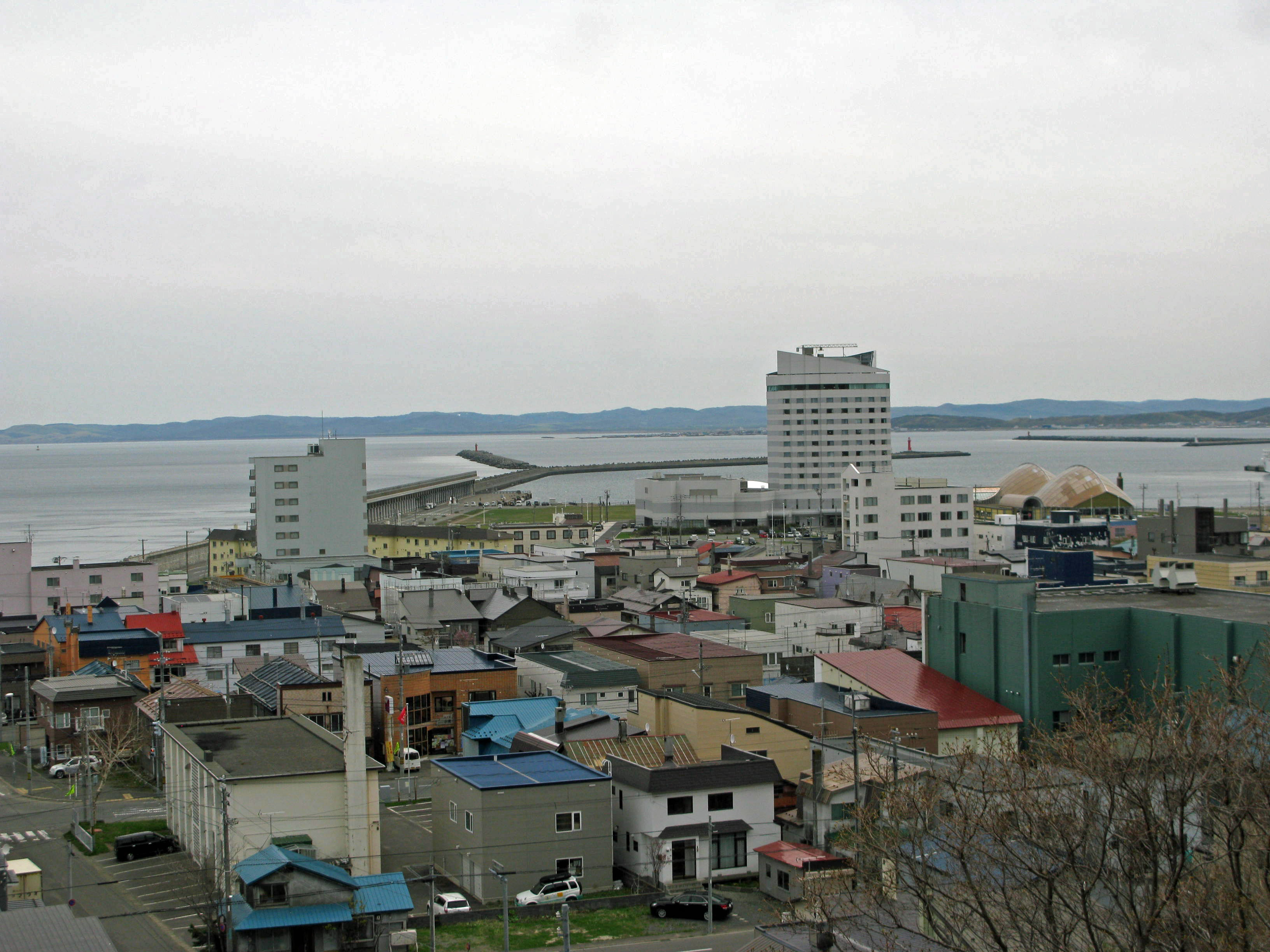
is a village located in Sōya Subprefecture, Hokkaido, Japan. As of September 2014, the village has an estimated population of 2,884 and a density of 4.91 persons per km². The total area is 590.00 km². Geography Sarufutsu is the northernmost village in Japan and is the largest village in Hokkaido in area. Located on the Tonbetsu Plain, it faces the Sea of Okhotsk to the east where, during the winter, there is drift ice. 80% of the village's total area is covered by forests. * Mountains: Mount Horoshiri * Rivers: Sarufutsu River * Lakes: Poro Swamp, Kamuito Swamp, Mokeuni Swamp Settlements/Localities in Sarufutsu *Ashino (芦野) *Asajino (浅茅野) *Chiraibetsu (知来別) *Hamaonishibetsu (浜鬼志別) *Hamasarufutsu (浜猿払) *Onishibetsu (鬼志別)(Town Hall is located here) *Koishi (小石) Neighbouring municipalities * Hokkaido ** Wakkanai ** Toyotomi ** Hamatonbestu ** Horonobe Climate Economy Sarufutsu is famous for its large and particularly excellent ... [...More Info...] [...Related Items...] OR: [Wikipedia] [Google] [Baidu] |
Sarufutsu Station
is a village located in Sōya Subprefecture, Hokkaido, Japan. As of September 2014, the village has an estimated population of 2,884 and a density of 4.91 persons per km². The total area is 590.00 km². Geography Sarufutsu is the northernmost village in Japan and is the largest village in Hokkaido in area. Located on the Tonbetsu Plain, it faces the Sea of Okhotsk to the east where, during the winter, there is drift ice. 80% of the village's total area is covered by forests. * Mountains: Mount Horoshiri * Rivers: Sarufutsu River * Lakes: Poro Swamp, Kamuito Swamp, Mokeuni Swamp Settlements/Localities in Sarufutsu *Ashino (芦野) *Asajino (浅茅野) *Chiraibetsu (知来別) *Hamaonishibetsu (浜鬼志別) *Hamasarufutsu (浜猿払) *Onishibetsu (鬼志別)(Town Hall is located here) *Koishi (小石) Neighbouring municipalities * Hokkaido ** Wakkanai ** Toyotomi ** Hamatonbestu ** Horonobe Climate Economy Sarufutsu is famous for its large and particularly excellent s ... [...More Info...] [...Related Items...] OR: [Wikipedia] [Google] [Baidu] |
Hokkaido
is Japan's second largest island and comprises the largest and northernmost prefecture, making up its own region. The Tsugaru Strait separates Hokkaidō from Honshu; the two islands are connected by the undersea railway Seikan Tunnel. The largest city on Hokkaidō is its capital, Sapporo, which is also its only ordinance-designated city. Sakhalin lies about 43 kilometers (26 mi) to the north of Hokkaidō, and to the east and northeast are the Kuril Islands, which are administered by Russia, though the four most southerly are claimed by Japan. Hokkaidō was formerly known as ''Ezo'', ''Yezo'', ''Yeso'', or ''Yesso''. Nussbaum, Louis-Frédéric. (2005). "Hokkaidō" in Although there were Japanese settlers who ruled the southern tip of the island since the 16th century, Hokkaido was considered foreign territory that was inhabited by the indigenous people of the island, known as the Ainu people. While geographers such as Mogami Tokunai and Mamiya Rinzō explored the isla ... [...More Info...] [...Related Items...] OR: [Wikipedia] [Google] [Baidu] |
Sōya Subprefecture
is a subprefecture of Hokkaido Prefecture, Japan. Its population is estimated to be 77,500 as of July 31, 2004 and its area is . It is the northernmost subprefecture of Japan. Wakkanai Airport is located in Wakkanai. Rishiri Airport is located in Rishirifuji, Rishiri District. Geography Municipalities Mergers History *1897: Sōya Subprefecture established; Sōya, Esashi, Rishiri, Rebun Districts placed under its jurisdiction *1948: Toyotomi village (now town), Teshio District transferred from Rumoi Subprefecture is a subprefecture of Hokkaido Prefecture, Japan. As of 2011, it had a population of 52,627 and an area of . The population density of the subprefecture, 13 people per km2, is very low compared to the rest of Japan. The population of Rumoi Subpr ... *2010: Horonobe town, Teshio District transferred from Rumoi Subprefecture External links Official website Subprefectures in Hokkaido {{Hokkaido-geo-stub ... [...More Info...] [...Related Items...] OR: [Wikipedia] [Google] [Baidu] |
Sōya District, Hokkaido
is a district located in Sōya Subprefecture, Hokkaido, Japan. As of 2004, the district has an estimated population of 2,925 and a density Density (volumetric mass density or specific mass) is the substance's mass per unit of volume. The symbol most often used for density is ''ρ'' (the lower case Greek letter rho), although the Latin letter ''D'' can also be used. Mathematical ... of 4.96 persons per km2. The total area is 590.00 km2. Towns and villages * Sarufutsu Districts in Hokkaido {{Hokkaido-geo-stub ... [...More Info...] [...Related Items...] OR: [Wikipedia] [Google] [Baidu] |
List Of Villages In Japan
A is a Local government, local administrative unit in Japan. It is a local public body along with , , and . Geographically, a village's extent is contained within a prefecture. It is larger than an actual settlement, being in actuality a subdivision of a rural , which are subdivided into towns and villages with no overlap and no uncovered area. As a result of merger and dissolution of municipalities of Japan, mergers and elevation to higher statuses, the number of villages in Japan is decreasing. Currently, 13 prefectures no longer have any villages: Tochigi Prefecture, Tochigi (since March 20, 2006), Fukui Prefecture, Fukui (since March 3, 2006), Ishikawa Prefecture, Ishikawa (since March 1, 2005), Shizuoka Prefecture, Shizuoka (since July 1, 2005), Hyōgo Prefecture, Hyōgo (since April 1, 1999), Mie Prefecture, Mie (since November 1, 2005), Shiga Prefecture, Shiga (since January 1, 2005), Hiroshima Prefecture, Hiroshima (since November 5, 2004), Yamaguchi Prefecture, Yamag ... [...More Info...] [...Related Items...] OR: [Wikipedia] [Google] [Baidu] |
Wakkanai, Hokkaido
' meaning "cold water river" is a city located in Sōya Subprefecture, Hokkaido, Japan. It is the capital of Sōya Subprefecture. It contains Japan's northernmost point, Cape Sōya, from which the Russian island of Sakhalin can be seen. As of 1 June 1975, the city has an estimated population of 55,465 and a population density of 72.8 persons per km2 (189 persons per mi2). The total area is . Wakkanai is also home to Japan's first nursing home built inside the central train station of its city, a novel approach to caring for Japan's growing elderly population that has since been imitated in several other cities. History Wakkanai was originally home to an Ainu population. The first Japanese settlement was established in 1685. *1879: The village of Wakkanai was founded. *1897: Sōya Subprefecture established. *1901: Wakkanai village became Wakkanai town. *1949: Wakkanai town became Wakkanai city. *1955: Soya village was merged into Wakkanai city. *1959: Wakkanai Airport opened. ... [...More Info...] [...Related Items...] OR: [Wikipedia] [Google] [Baidu] |
Scallop
Scallop () is a common name that encompasses various species of marine bivalve mollusks in the taxonomic family Pectinidae, the scallops. However, the common name "scallop" is also sometimes applied to species in other closely related families within the superfamily Pectinoidea, which also includes the thorny oysters. Scallops are a cosmopolitan family of bivalves found in all of the world's oceans, although never in fresh water. They are one of the very few groups of bivalves to be primarily "free-living", with many species capable of rapidly swimming short distances and even migrating some distance across the ocean floor. A small minority of scallop species live cemented to rocky substrates as adults, while others attach themselves to stationary or rooted objects such as seagrass at some point in their lives by means of a filament they secrete called a byssal thread. The majority of species, however, live recumbent on sandy substrates, and when they sense the presence of a p ... [...More Info...] [...Related Items...] OR: [Wikipedia] [Google] [Baidu] |
World War II
World War II or the Second World War, often abbreviated as WWII or WW2, was a world war that lasted from 1939 to 1945. It involved the vast majority of the world's countries—including all of the great powers—forming two opposing military alliances: the Allies and the Axis powers. World War II was a total war that directly involved more than 100 million personnel from more than 30 countries. The major participants in the war threw their entire economic, industrial, and scientific capabilities behind the war effort, blurring the distinction between civilian and military resources. Aircraft played a major role in the conflict, enabling the strategic bombing of population centres and deploying the only two nuclear weapons ever used in war. World War II was by far the deadliest conflict in human history; it resulted in 70 to 85 million fatalities, mostly among civilians. Tens of millions died due to genocides (including the Holocaust), starvation, ma ... [...More Info...] [...Related Items...] OR: [Wikipedia] [Google] [Baidu] |
River
A river is a natural flowing watercourse, usually freshwater, flowing towards an ocean, sea, lake or another river. In some cases, a river flows into the ground and becomes dry at the end of its course without reaching another body of water. Small rivers can be referred to using names such as Stream#Creek, creek, Stream#Brook, brook, rivulet, and rill. There are no official definitions for the generic term river as applied to Geographical feature, geographic features, although in some countries or communities a stream is defined by its size. Many names for small rivers are specific to geographic location; examples are "run" in some parts of the United States, "Burn (landform), burn" in Scotland and northeast England, and "beck" in northern England. Sometimes a river is defined as being larger than a creek, but not always: the language is vague. Rivers are part of the water cycle. Water generally collects in a river from Precipitation (meteorology), precipitation through a ... [...More Info...] [...Related Items...] OR: [Wikipedia] [Google] [Baidu] |


