|
ST Postcode Area
The ST postcode area, also known as the Stoke-on-Trent postcode area,Royal Mail, ''Address Management Guide'', (2004) is a group of 21 postcode districts in England, within six post towns. These cover much of north and central Staffordshire (including Stoke-on-Trent, Stafford, Leek, Newcastle-under-Lyme, Stone and Uttoxeter), plus very small parts of Cheshire and Derbyshire. __TOC__ Coverage The approximate coverage of the postcode districts: , - ! ST1 , STOKE-ON-TRENT , Hanley, Cobridge, Sneyd Green, Birches Head, Shelton , Stoke-on-Trent , - ! ST2 , STOKE-ON-TRENT , Bentilee, Abbey Hulton, Bucknall , Stoke-on-Trent, Staffordshire Moorlands , - ! ST3 , STOKE-ON-TRENT , Longton, Meir, Blurton, Weston Coyney , Stoke-on-Trent, Stafford, Staffordshire Moorlands , - ! ST4 , STOKE-ON-TRENT , Stoke, Fenton, Penkhull, Trentham , Stoke-on-Trent, Stafford , - ! ST5 , NEWCASTLE , Newcastle-under-Lyme, Keele, Chesterton , Newcastle-under-Lyme, Stafford , - ! ... [...More Info...] [...Related Items...] OR: [Wikipedia] [Google] [Baidu] |
England
England is a country that is part of the United Kingdom. It shares land borders with Wales to its west and Scotland to its north. The Irish Sea lies northwest and the Celtic Sea to the southwest. It is separated from continental Europe by the North Sea to the east and the English Channel to the south. The country covers five-eighths of the island of Great Britain, which lies in the North Atlantic, and includes over 100 smaller islands, such as the Isles of Scilly and the Isle of Wight. The area now called England was first inhabited by modern humans during the Upper Paleolithic period, but takes its name from the Angles, a Germanic tribe deriving its name from the Anglia peninsula, who settled during the 5th and 6th centuries. England became a unified state in the 10th century and has had a significant cultural and legal impact on the wider world since the Age of Discovery, which began during the 15th century. The English language, the Anglican Church, and Engli ... [...More Info...] [...Related Items...] OR: [Wikipedia] [Google] [Baidu] |
Abbey Hulton
Abbey Hulton is an area of Stoke-on-Trent, Staffordshire, England, named after the abbey that existed between the 13th and 16th centuries. History The name Abbey Hulton is derived from 'hilltown' (Anglo-Saxon ''hyll'' + ''tūn''; Middle English ''hil'', ''hull'' + ''toun''; 13th & 14th century ''Hulton'') with the addition of 'abbey' from the Cistercian abbey founded here in 1223. It is recorded in the ''Domesday Book'' of 1086-87 as ''Heltone'', in Pirehill Hundred, when it was held by Robert of Stafford. Henry de Aldithley (or Audley) endowed the Cistercian Abbey of St. Mary at Hulton, near the site of Heleigh Castle in 1223, donating a large amount of land, some of which was an inheritance from his mother and some of which was purchased. The endowment consisted of the villages of Julton and Rushton to the south of Burslem with "Manesmore", a wood at Sneyd, all Henry's land at Bucknall and Anormancot, a meadow called "bukkeley", and in the northeast of the county the villa ... [...More Info...] [...Related Items...] OR: [Wikipedia] [Google] [Baidu] |
Chesterton, Staffordshire
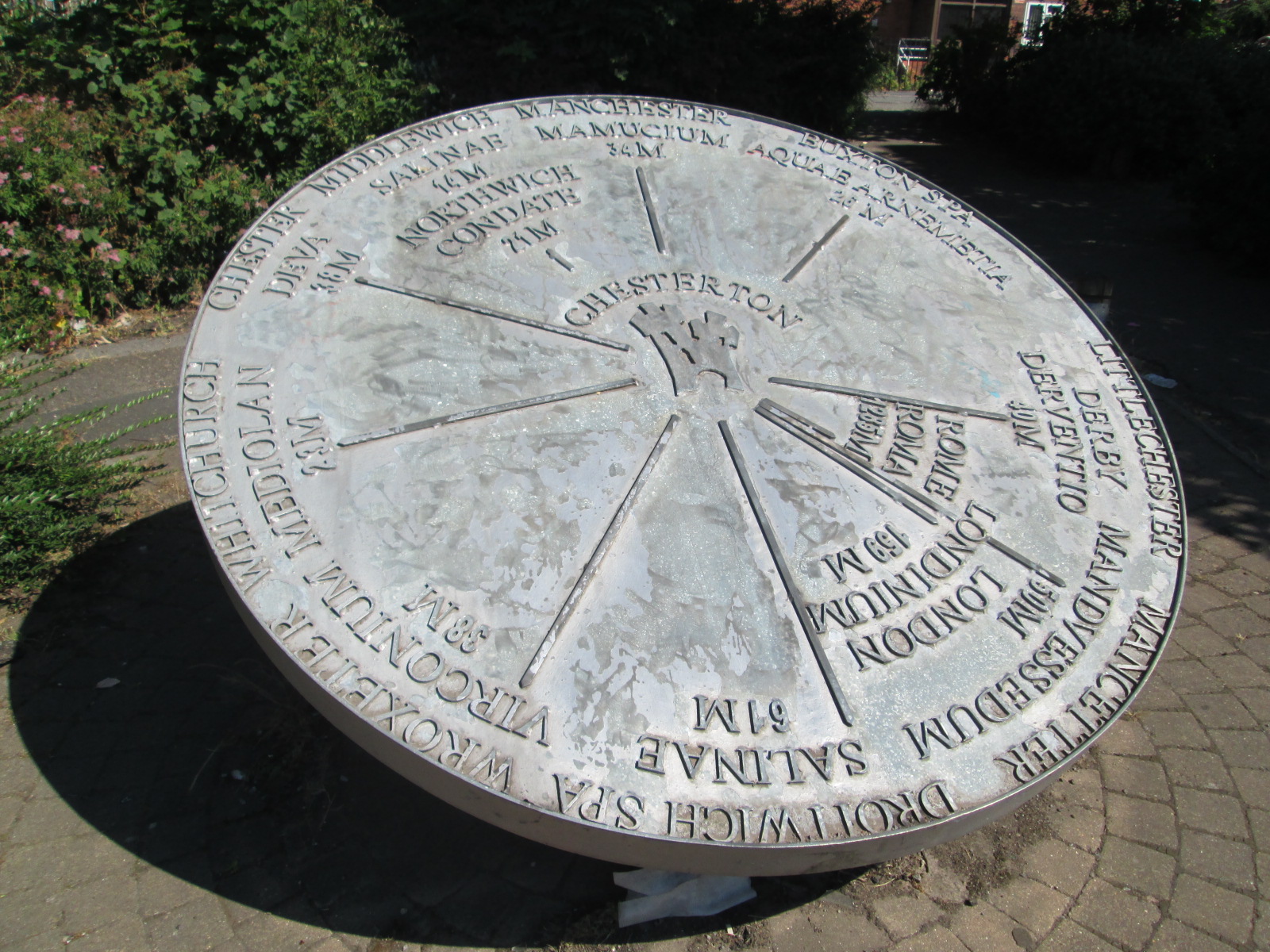
Chesterton is a former mining village in the Borough of Newcastle-under-Lyme in Staffordshire, England. Chesterton is the second largest individual ward in the Borough of Newcastle-under-Lyme. In the 2011 census, Chesterton's population stood at 7,421. History Roman Chesterton Chesterton was the site of a Roman fort, built on an area now occupied by Chesterton Community Sports College. There is little indication of how long the fort was in use but it is believed to have been constructed in the late 1st Century AD. A vicus was built at nearby Holditch, where it is believed that some inhabitants may have mined for coal. There have been various excavations at the site. Excavations in 1895 revealed the fort's vallum, fosse ( moat) and parts of the east and west defensive structures. Later excavations in 1969 uncovered further sections of the eastern ramparts. Later history Chesterton was a parish in the Wolstanton Rural District from 1894 to 1904. Following that, it became ... [...More Info...] [...Related Items...] OR: [Wikipedia] [Google] [Baidu] |
Keele
Keele is a village and civil parish in the Borough of Newcastle-under-Lyme in Staffordshire, England. It is approximately three miles (5 km) west of Newcastle-under-Lyme, and is close to the village of Silverdale. Keele lies on the A53 road from Newcastle-under-Lyme to Market Drayton and Shrewsbury. The village is the location of Keele University (at ) and Keele Services (), a motorway service area on the M6. Keele is located in the Keele ward of the borough of Newcastle-under-Lyme with its name drawing from the old Anglo-Saxon ''Cȳ-hyll'' = "Cow-hill". The 2001 census indicated the parish had a population of 3,664,(increasing to 4,129 at the 2011 census) most of whom students at Keele University as one of the halls of residence, Hawthorns, now sold for land redevelopment, was located in the heart of the village. The Knights Templars & Hospitallers The village is recognised for its association with the university and its position astride the M6. But during the Middle A ... [...More Info...] [...Related Items...] OR: [Wikipedia] [Google] [Baidu] |
Trentham, Staffordshire
Trentham () is a suburb of the city of Stoke-on-Trent in North Staffordshire, England, south-west of the city centre and south of the neighbouring town of Newcastle-under-Lyme. It is separated from the main urban area by open space and by the Trent and Mersey Canal and the River Trent, giving it the feel of a village. Boundaries The River Trent is the border between the City of Stoke-on-Trent and Stafford Borough for most of its southerly flow past Trentham. Some parts of Trentham are in Stafford Borough, notably the parish church and the remaining buildings of the Trentham Hall estate in the parish of Swynnerton which are classed as a conservation area. History Werburgh, an Anglo-Saxon princess, was born in Stone and died in Trentham in 699 AD. She became the patron saint of the city of Chester in Cheshire. Her feast day is 3 February. Trentham was the site of Trentham Priory, dissolved in 1540. The Lord of the Manor of Trentham existed from 1149-1541. Trentham village wa ... [...More Info...] [...Related Items...] OR: [Wikipedia] [Google] [Baidu] |
Penkhull
Penkhull is a district of the city of Stoke-on-Trent, Staffordshire, England, part of Penkhull and Stoke electoral ward, and Stoke Central parliamentary constituency. Penkhull is a conservation area, and includes Grade II listed buildings such as the church and Greyhound Inn public house. History ''The Victoria History of the County of Stafford: Volume 8'' (1965) suggests that name arises from the British ''pencet'' ('end or head of the wood') and the Old English ''hyll'' (hill). Ward (1843) also mentioned the possibility of the Celtic British ''Pen'' (head) and ''Kyl'' (kiln). The idea of a 'head' or 'end' is topographically apt, since the village is sited on the elevated end of a long strip of valley-side woodland which begins at the ancient Bradwell Wood five miles to the north. The early origins date from 2500 BC, and there have been three archaeological finds from this period. A study by the local city Council stated of Penkhull that... "it has held a settlement for over f ... [...More Info...] [...Related Items...] OR: [Wikipedia] [Google] [Baidu] |
Fenton, Staffordshire
Fenton is one of the six towns that amalgamated with Hanley, Tunstall, Burslem, Longton and Stoke-upon-Trent to form the county borough of Stoke-on-Trent in 1910, later raised to city status in 1925. Fenton is often referred to as "the Forgotten Town", because it was omitted by local author, Arnold Bennett, from many of his works based in the area, including one of his most famous novels, ''Anna of the Five Towns''. History Etymology The name Fenton means 'fen farm'. Administration Fenton started to become populated as a group of farms and private small-holdings were built there, alongside a lane running from the southern reaches of Hanley (by 1933 this lane was very busy and given the title of the A50). Around the 1750s, the land was commonly known as Fenton Vivian, after Vivian of Standon and his heirs, its lords in the thirteenth century. By the 1850s, the area around Duke Street and China Street had become populated during the rapid development of the Potteries. Po ... [...More Info...] [...Related Items...] OR: [Wikipedia] [Google] [Baidu] |
Stoke-upon-Trent
Stoke-upon-Trent, commonly called Stoke is one of the six towns that along with Hanley, Burslem, Fenton, Longton and Tunstall form the city of Stoke-on-Trent, in Staffordshire, England. The town was incorporated as a municipal borough in 1874. In 1910 it became one of the six towns that federated to become the County Borough of Stoke-on-Trent and later the City of Stoke-on-Trent. Since federation in 1910 it has the seat of the city's council, though Stoke-on-Trent's city centre is usually regarded as being the nearby town of Hanley which, since federation, has been the most commercially important of the six towns. Name On 1 April 1910, the town was federated into the county borough of Stoke-on-Trent. By 1925 the area was granted city status. Confusion can arise over the similarity of this town's name to that of the larger city. If the new borough had to be named after one of the original towns, the main reason for using "Stoke" is that this was where the new town's admini ... [...More Info...] [...Related Items...] OR: [Wikipedia] [Google] [Baidu] |
Borough Of Stafford
The Borough of Stafford is a local government district with borough status in Staffordshire, England. It is named after the town of Stafford. It also includes the towns of Stone and Eccleshall, as well as numerous villages such as Weston, Hixon, Barlaston, Baswich, Salt, Ingestre, Sandon and Gnosall. History The borough was formed on 1 April 1974, under the Local Government Act 1972, as a merger of the municipal borough of Stafford, Stone urban district, Stafford Rural District Stafford Rural District was a rural district in the county of Staffordshire. It was created in 1894 and abolished in 1974 by virtue of the Local Government Act 1972. On formation it contained the following civil parishes: *Baswich *Bradley, St ... and Stone Rural District. A new Civic Centre was constructed at Riverside in Stafford and completed in 1978. Most its parishes fell within the Hundred of Pirehill. Wards It has 26 wards: Barlaston and Oulton, Baswich, Chartley, Church Eaton, Common, ... [...More Info...] [...Related Items...] OR: [Wikipedia] [Google] [Baidu] |
Weston Coyney
Weston Coyney is a suburb of the City of Stoke-on-Trent in Staffordshire. It lies on the south eastern edge of the city and borders the neighbouring Staffordshire Moorlands district. Originally developed around a crossroads the area now also includes two major estates, ''Park Hall'' – developed in the 1970s, and ''Coalville'' – a 1950s estate built for the National Coal Board (NCB) to house many of its miners. Weston Coyney is almost entirely a residential area with little industry and most of the residents work elsewhere in the city. History Weston Coyney is identified in the Domesday Book as a manor called ''Westone'' or West Town in lands belonging to Robert de Stafford and held by Ernulf de Hesding. The land was recorded as being mostly woodland but with enough arable land to require three ploughs. At some time during the 13th century, during the reign of Henry III the manor of Westone had passed to the Coyney family who held the manor for several hundred years. I ... [...More Info...] [...Related Items...] OR: [Wikipedia] [Google] [Baidu] |
Blurton
Blurton is a district in the south of Stoke on Trent, in the English county of Staffordshire. Hollybush, Old Blurton, Blurton Farm and Newstead are the names of the areas in which make up the town known as Blurton. Education Sutherland Primary Academy, The Meadows Primary Academy & Newstead Primary Academy provide co-ed learning for pupils up to the age of 11. Blurton has one co-ed secondary school, which pupils can stay on at sixth form. Ormiston Sir Stanley Matthews Academy, a specialist in maths, business and enterprise. Transport First Potteries, part of the FirstGroup FirstGroup plc is a British multi-national transport group, based in Aberdeen, Scotland. [...More Info...] [...Related Items...] OR: [Wikipedia] [Google] [Baidu] |
Meir, Staffordshire
Meir is a suburb in Stoke-on-Trent, Staffordshire situated between Lightwood, Stoke-on-Trent, Lightwood and Longton, Staffordshire, Longton. Meir Park estate extends from Meir uphill to the Meir Heath and Rough Close village hall, located in Meir Heath. Meir Aerodrome Meir Aerodrome closed in the early 1970s and the site has now become the Meir Park housing estate. The earlier parts have mainly aviation-associated street names. The last official flight was on 16 August 1973 when Fred Holdcroft flew a Piper Tri-Pacer carrying a ''The Sentinel (Staffordshire), Sentinel'' journalist to Manchester. The last unofficial flight "a year or two" later by Eric Clutton was in a home-made folding machine called Clutton-Tabenor FRED, FRED (Flying Runabout Experimental Design) which the pilot towed home behind his car. The light planes used to be parked on the grass alongside the A50 road, opposite the Airport Garage, which remains. Staffordshire Potteries had a factory (now demolished) besid ... [...More Info...] [...Related Items...] OR: [Wikipedia] [Google] [Baidu] |


