|
River Mite
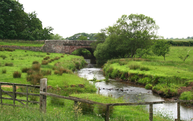
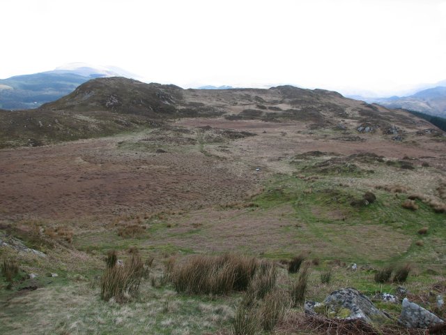
The River Mite is a river in the county of Cumbria in northern England. The valley through which the river Mite runs is called Miterdale. The name Mite is thought to be of British origin and related to a root such as 'meigh': to urinate or dribble, possibly a wry reflection of the relatively minor nature of the Mite. The Mite rises on Tongue Moor, immediately below the peak of Illgill Head to the north west, at an altitude of around After coalescing into a stream, the upper Mite runs over the waterfalls of Miterdale Head and descends into the narrow but steep-sided upper Miterdale valley. It then flows to the south west, past the Bakerstead outdoor pursuit centre, the village Eskdale Green, to the north of Muncaster Fell, and Muncaster Mill. Finally, the River Mite meets the River Esk and River Irt at the estuarine confluence of the three, near the ancient village of Ravenglass on the Cumbrian coast. The river runs parallel to the Ravenglass and Eskdale steam railway, and ... [...More Info...] [...Related Items...] OR: [Wikipedia] [Google] [Baidu] |
Muncaster Mill Bridge Over The River Mite - Geograph
Muncaster is a civil parish in Cumbria, North West England. The parish is south west of the city of Carlisle, in the Borough of Copeland, Copeland district, in the county of Cumbria, England. The parish includes the village of Ravenglass. In 2011 the parish had a population of 290. The parish touches Bootle, Cumbria, Bootle, Drigg and Carleton, Eskdale, Cumbria, Eskdale, Irton with Santon, Ulpha and Waberthwaite. Features There are 14 listed buildings in Muncaster. History The name "Muncaster" means 'Mula's/Muli's Roman site', which perhaps refers to the Roman fort Glannoventa at Ravenglass. The surname Muncaster (surname), Muncaster. derives from the place. It was anciently called "Meolceastre". In 1847 the parish contained the Township (England), townships of Muncaster and Birkby, Cumbria, Birkby. On 25 March 1886 part of Millom was transferred to the parish. References External links Cumbria County History Trust: Muncaster(nb: provisional research only – see Tal ... [...More Info...] [...Related Items...] OR: [Wikipedia] [Google] [Baidu] |
Cumbria
Cumbria ( ) is a ceremonial and non-metropolitan county in North West England, bordering Scotland. The county and Cumbria County Council, its local government, came into existence in 1974 after the passage of the Local Government Act 1972. Cumbria's county town is Carlisle, in the north of the county. Other major settlements include Barrow-in-Furness, Kendal, Whitehaven and Workington. The administrative county of Cumbria consists of six districts ( Allerdale, Barrow-in-Furness, Carlisle, Copeland, Eden and South Lakeland) and, in 2019, had a population of 500,012. Cumbria is one of the most sparsely populated counties in England, with 73.4 people per km2 (190/sq mi). On 1 April 2023, the administrative county of Cumbria will be abolished and replaced with two new unitary authorities: Westmorland and Furness (Barrow-in-Furness, Eden, South Lakeland) and Cumberland ( Allerdale, Carlisle, Copeland). Cumbria is the third largest ceremonial county in England by area. It i ... [...More Info...] [...Related Items...] OR: [Wikipedia] [Google] [Baidu] |
England
England is a country that is part of the United Kingdom. It shares land borders with Wales to its west and Scotland to its north. The Irish Sea lies northwest and the Celtic Sea to the southwest. It is separated from continental Europe by the North Sea to the east and the English Channel to the south. The country covers five-eighths of the island of Great Britain, which lies in the North Atlantic, and includes over 100 smaller islands, such as the Isles of Scilly and the Isle of Wight. The area now called England was first inhabited by modern humans during the Upper Paleolithic period, but takes its name from the Angles, a Germanic tribe deriving its name from the Anglia peninsula, who settled during the 5th and 6th centuries. England became a unified state in the 10th century and has had a significant cultural and legal impact on the wider world since the Age of Discovery, which began during the 15th century. The English language, the Anglican Church, and Engli ... [...More Info...] [...Related Items...] OR: [Wikipedia] [Google] [Baidu] |
Illgill Head
Illgill Head is a fell in the English Lake District. It is known more commonly as the northern portion of the Wastwater Screes. The fell is 609 metres high and stands along the south-east shore of Wastwater, the deepest lake in England. Topography The panorama of the Wastwater Screes across Wastwater is one of the most famous and awe-inspiring views in England. Poet Norman Nicholson described the Screes as ‘like the inverted arches of a Gothic Cathedral’. The title Wastwater Screes applies to the scree-covered north-western fellside which plunges dramatically down into Wastwater. This also includes Illgill Head's neighbour Whin Rigg, the continuation of the ridge to the south-west. The scree slope continues beneath the lake to a depth of 79 metres (259 ft). The screes were formed as a result of ice and weathering erosion on the rocks. Geologically, Illgill Head and Whin Rigg are part of the Borrowdale Volcanic Group, typical for the southern-western area of the Lak ... [...More Info...] [...Related Items...] OR: [Wikipedia] [Google] [Baidu] |
Eskdale Green
Eskdale Green is a village in Cumbria, England, 10 miles west of Coniston. Historically in Cumberland, it lies off the A595 road and is one of the few settlements in Eskdale. Main sights The village is centred on the small St. Bega's Church and hall. Since 1950 the Outward Bound Trust has owned Gate House mansion near the centre of the village, which they operate as an outdoor adventure and education centre for young people. In late summer the grounds of Gate House are the venue for the annual Eskdale Fête. The Gate House grounds used to encompass the Giggle Alley Forest, to the northwest of the village, which is now open to the public and contains of woodland, including a secluded Japanese garden designed by Thomas Mawson. Transport The Ravenglass and Eskdale Railway has two stations in the village. Eskdale Green station (or The Green) is a short distance to the south of the village centre, while Irton Road station is at the western edge of the village, on the road to ... [...More Info...] [...Related Items...] OR: [Wikipedia] [Google] [Baidu] |
Muncaster Fell
Muncaster Fell is a fell at the far western edge of the Lake District National Park, in Cumbria, England. Muncaster Fell is a long, narrow ridge of land, approximately 1.2 km wide and 6 km long, lying between the River Mite to the north, and River Esk to the south. The fell rises from the coast near Ravenglass village to its highest point at Hooker Crag (231 m). The ridge then continues to the north-east, dropping gently to its furthest prominence at ''Silver Knott'' (174 m). The fell then falls away rapidly to the village of Eskdale Green at its north-eastern tip. Landscape The fell forms a long, low, yet steep-sided ridge that separates the southern portions of the valleys of Miterdale and Eskdale. The north-western slopes of the fell are characterised by steep crags and scree slopes, which drop abruptly to the fluvial floor of the Mite valley. The narrow-gauge Ravenglass and Eskdale Railway tracks cling to the lower sides of this rocky face. The south-e ... [...More Info...] [...Related Items...] OR: [Wikipedia] [Google] [Baidu] |
Muncaster Mill
Muncaster is a civil parish in Cumbria, North West England. The parish is south west of the city of Carlisle, in the Copeland district, in the county of Cumbria, England. The parish includes the village of Ravenglass. In 2011 the parish had a population of 290. The parish touches Bootle, Drigg and Carleton, Eskdale, Irton with Santon, Ulpha and Waberthwaite. Features There are 14 listed buildings in Muncaster. History The name "Muncaster" means 'Mula's/Muli's Roman site', which perhaps refers to the Roman fort Glannoventa at Ravenglass. The surname Muncaster. derives from the place. It was anciently called "Meolceastre". In 1847 the parish contained the townships of Muncaster and Birkby. On 25 March 1886 part of Millom Millom is a town and civil parish on the north shore of the estuary of the River Duddon in southwest Cumbria, historically part of Cumberland, England. It is situated just outside the Lake District National Park, about north of Barrow-in-Furne ... wa ... [...More Info...] [...Related Items...] OR: [Wikipedia] [Google] [Baidu] |
River Esk, Cumbria
The River Esk, sometimes called the Cumbrian Esk, is a river in Cumbria, England. It flows for approximately 25 km (15.5 miles) from its source in the Scafells range of mountains to its estuary at Ravenglass. It is one of two Rivers Esk in Cumbria, and not to be confused with the Border Esk which flows into Cumbria from Scotland. Course The Esk rises in the Sca Fell range of mountains at a height of 800 metres, just below Esk Hause, the mountain pass between the fells of Great End and Esk Pike. The infant river then flows southerly through wild and picturesque countryside receiving many streams flowing off the Scafell range, the most significant of which are Calfcove Gill and Little Narrowcove Beck. The river makes several leaps over waterfalls including the Esk Falls before being joined by its first major tributary Lingcove Beck at Lingcove Bridge. Within a few miles the Esk passes Brotherilkeld Farm, which formerly belonged to the monks of Furness Abbey, at this po ... [...More Info...] [...Related Items...] OR: [Wikipedia] [Google] [Baidu] |
River Irt
The River Irt is a river in the county of Cumbria in northern England. It flows for from the south-western end of Wast Water, the deepest lake in England, leaving the lake at the foot of Whin Rigg, the southern peak of the famous Wastwater Screes. The name of the river is believed to derive either from the Old English ''gyr'' which means "mud", or from the Brittonic words ''*ar'', "flowing", or ''*īr'', "fresh, clean, pure", suffixed with ''-ed'', a nominal suffix meaning "having the quality of...". The river forms at the confluence of Lingmell Beck and Mosedale Beck on Wasdale Head, which is on the north-western side of Scafell Pike. On its short journey to the coast, the Irt is crossed by the Cumbria Coastal Way long-distance footpath, at Drigg Holme packhorse bridge. The Irt flows through the Drigg Dunes and Irt Estuary Nature Reserve before joining the River Esk and River Mite at Ravenglass. The river is tidal up until the railway bridge that carries the Cumbrian Coast L ... [...More Info...] [...Related Items...] OR: [Wikipedia] [Google] [Baidu] |
Ravenglass
Ravenglass is a coastal village in the Copeland District in Cumbria, England. It is between Barrow-in-Furness and Whitehaven. Historically in Cumberland, it is the only coastal village in the Lake District National Park. It is located at the estuary of three rivers: the Esk, Mite and Irt. History The village dates back to at least the 2nd century, when it was an important naval base for the Romans. The Latin name of the settlement was long thought to be ''Glannoventa''. The discovery of a lead seal in excavations at the Roman fort during the 1970s named the ''Cohors Prima Aelia Classica'' (First Cohort of Hadrian's Marines). This unit is listed in the ''Notitia Dignitatum'' as being garrisoned at ''Itunocelum'' during the fourth century. Due to this it was suggested that Ravenglass was not ''Glannoventa'' but actually the ''Itunocelum.'' Since the lead seal was discovered two other objects, a Roman military diploma from the beach by the fort at Ravenglass and a fragment of a ... [...More Info...] [...Related Items...] OR: [Wikipedia] [Google] [Baidu] |
Ravenglass And Eskdale Railway
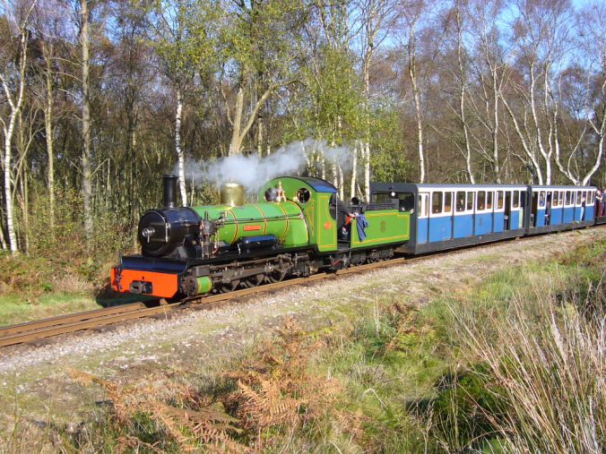
The Ravenglass and Eskdale Railway is a minimum gauge heritage railway in Cumbria, England. The line runs from Ravenglass to Dalegarth Station near Boot in the valley of Eskdale, in the Lake District. At Ravenglass the line ends at Ravenglass railway station on the Cumbrian Coast Line. Intermediate stations and halts are at Muncaster Mill, Miteside, Murthwaite, Irton Road, The Green, Fisherground and Beckfoot. The railway is owned by a private company and supported by a preservation society. The oldest locomotive is ''River Irt'', parts of which date from 1894, while the newest is the diesel-hydraulic '' Douglas Ferreira'', built in 2005. The line is known locally as ''La'al Ratty'' and its gauge predecessor as ''Owd Ratty''. Nearby attractions include: the Roman Bath House at Ravenglass; the Hardknott Roman Fort, known to the Romans as ''Mediobogdum'', at the foot of Hardknott Pass; the watermills at Boot and Muncaster; and Muncaster Castle, the home of the Pen ... [...More Info...] [...Related Items...] OR: [Wikipedia] [Google] [Baidu] |
Arthur Ransome
Arthur Michell Ransome (18 January 1884 – 3 June 1967) was an English author and journalist. He is best known for writing and illustrating the ''Swallows and Amazons'' series of children's books about the school-holiday adventures of children, mostly in the Lake District and the Norfolk Broads. The entire series remains in print, and ''Swallows and Amazons'' is the basis for a tourist industry around Windermere and Coniston Water, the two lakes Ransome adapted as his fictional North Country lake. He also wrote about the literary life of London, and about Russia before, during, and after the revolutions of 1917. His connection with the leaders of the Revolution led to him providing information to the Secret Intelligence Service, while he was also suspected by MI5 of being a Soviet spy. Early life Ransome was the son of Cyril Ransome (1851–1897) and his wife Edith Ransome (née Baker Boulton) (1862–1944). Arthur was the eldest of four children: he had two sisters Cecily ... [...More Info...] [...Related Items...] OR: [Wikipedia] [Google] [Baidu] |


