|
River Esk, Cumbria
The River Esk, sometimes called the Cumbrian Esk, is a river in Cumbria, England. It flows for approximately 25 km (15.5 miles) from its source in the Scafells range of mountains to its estuary at Ravenglass. It is one of two Rivers Esk in Cumbria, and not to be confused with the Border Esk which flows into Cumbria from Scotland. Course The Esk rises in the Sca Fell range of mountains at a height of 800 metres, just below Esk Hause, the mountain pass between the fells of Great End and Esk Pike. The infant river then flows southerly through wild and picturesque countryside receiving many streams flowing off the Scafell range, the most significant of which are Calfcove Gill and Little Narrowcove Beck. The river makes several leaps over waterfalls including the Esk Falls before being joined by its first major tributary Lingcove Beck at Lingcove Bridge. Within a few miles the Esk passes Brotherilkeld Farm, which formerly belonged to the monks of Furness Abbey, at this po ... [...More Info...] [...Related Items...] OR: [Wikipedia] [Google] [Baidu] |
United Kingdom
The United Kingdom of Great Britain and Northern Ireland, commonly known as the United Kingdom (UK) or Britain, is a country in Europe, off the north-western coast of the continental mainland. It comprises England, Scotland, Wales and Northern Ireland. The United Kingdom includes the island of Great Britain, the north-eastern part of the island of Ireland, and many smaller islands within the British Isles. Northern Ireland shares a land border with the Republic of Ireland; otherwise, the United Kingdom is surrounded by the Atlantic Ocean, the North Sea, the English Channel, the Celtic Sea and the Irish Sea. The total area of the United Kingdom is , with an estimated 2020 population of more than 67 million people. The United Kingdom has evolved from a series of annexations, unions and separations of constituent countries over several hundred years. The Treaty of Union between the Kingdom of England (which included Wales, annexed in 1542) and the Kingdom of Scotland in 170 ... [...More Info...] [...Related Items...] OR: [Wikipedia] [Google] [Baidu] |
River Irt
The River Irt is a river in the county of Cumbria in northern England. It flows for from the south-western end of Wast Water, the deepest lake in England, leaving the lake at the foot of Whin Rigg, the southern peak of the famous Wastwater Screes. The name of the river is believed to derive either from the Old English ''gyr'' which means "mud", or from the Brittonic words ''*ar'', "flowing", or ''*īr'', "fresh, clean, pure", suffixed with ''-ed'', a nominal suffix meaning "having the quality of...". The river forms at the confluence of Lingmell Beck and Mosedale Beck on Wasdale Head, which is on the north-western side of Scafell Pike. On its short journey to the coast, the Irt is crossed by the Cumbria Coastal Way long-distance footpath, at Drigg Holme packhorse bridge. The Irt flows through the Drigg Dunes and Irt Estuary Nature Reserve before joining the River Esk and River Mite at Ravenglass. The river is tidal up until the railway bridge that carries the Cumbrian Coast L ... [...More Info...] [...Related Items...] OR: [Wikipedia] [Google] [Baidu] |
River Usk
The River Usk (; cy, Afon Wysg) rises on the northern slopes of the Black Mountain (''y Mynydd Du''), Wales, in the westernmost part of the Brecon Beacons National Park. Initially forming the boundary between Carmarthenshire and Powys, it flows north into Usk Reservoir, then east by Sennybridge to Brecon before turning southeast to flow by Talybont-on-Usk, Crickhowell and Abergavenny after which it takes a more southerly course. Beyond the eponymous town of Usk it passes the Roman legionary fortress of Caerleon to flow through the heart of the city of Newport and into the Severn Estuary at Uskmouth beyond Newport near the Newport Wetlands. The river is about long. The Monmouthshire and Brecon Canal follows the Usk for most of the length of the canal. Etymology The name of the river derives from a Common Brittonic word meaning "abounding in fish" (or possibly "water"), this root also appears in other British river names such as Exe, Axe, Esk and other variants. The nam ... [...More Info...] [...Related Items...] OR: [Wikipedia] [Google] [Baidu] |
River Exe
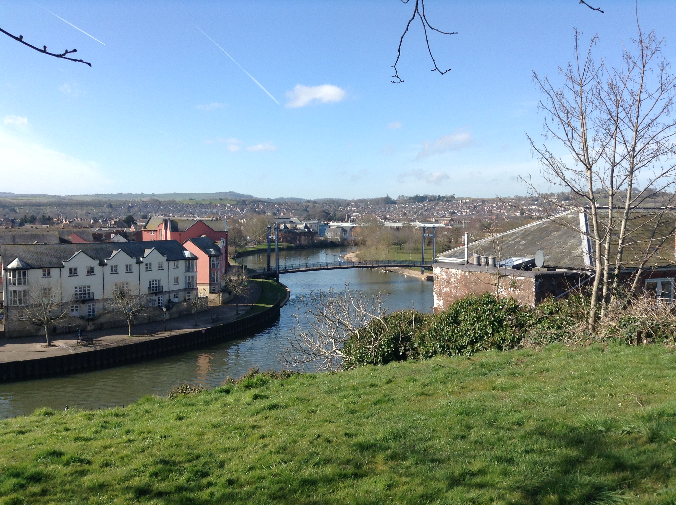
The River Exe ( ) in England rises at Exe Head, near the village of Simonsbath, on Exmoor in Somerset, from the Bristol Channel coast, but flows more or less directly due south, so that most of its length lies in Devon. It flows for 60 miles (96 km) and reaches the sea at a substantial ria, the Exe Estuary, on the south (English Channel) coast of Devon. Historically, its lowest bridging point was the Old Exe Bridge in Exeter, the largest settlement on the river, but there is now a viaduct for the M5 motorway about south of the city centre. Topography The river's name derives from *Uɨsk, a Common Brittonic root meaning "abounding in fish", and a cognate of both the Irish ''iasc'', meaning "fish", and ''pysg'', the plural word for "fish" in Welsh. The same root separately developed into the English Axe and Esk, the Welsh Usk, though not, as some have claimed, the word ''whisky'', this latter being from the Classical Irish/Gaelic "water" (the fuller phrase being ; ... [...More Info...] [...Related Items...] OR: [Wikipedia] [Google] [Baidu] |
River Axe (other) , an English river flowing west from the Mendip Hills to the Bristol Channel near Weston-super-Mare
{{disambig ...
River Axe may refer to: *River Axe (Lyme Bay), an English river flowing south through Axminster to the English Channel in Lyme Bay near Seaton *River Axe (Bristol Channel) The River Axe is a river in South West England. The river is formed by water entering swallets in the limestone and rises from the ground at Wookey Hole Caves in the Mendip Hills in Somerset, and runs through a V-shaped valley. The geolog ... [...More Info...] [...Related Items...] OR: [Wikipedia] [Google] [Baidu] |
Cognate
In historical linguistics, cognates or lexical cognates are sets of words in different languages that have been inherited in direct descent from an etymology, etymological ancestor in a proto-language, common parent language. Because language change can have radical effects on both the sound and the meaning of a word, cognates may not be obvious, and often it takes rigorous study of historical sources and the application of the comparative method to establish whether lexemes are cognate or not. Cognates are distinguished from Loanword, loanwords, where a word has been borrowed from another language. The term ''cognate'' derives from the Latin noun '':wikt:cognatus, cognatus blood relative'. Characteristics Cognates need not have the same meaning, which semantic drift, may have changed as the languages developed independently. For example English language, English ''wikt:starve#English, starve'' and Dutch language, Dutch ''wikt:sterven#Dutch, sterven'' 'to die' or German languag ... [...More Info...] [...Related Items...] OR: [Wikipedia] [Google] [Baidu] |
Common Brittonic
Common Brittonic ( cy, Brythoneg; kw, Brythonek; br, Predeneg), also known as British, Common Brythonic, or Proto-Brittonic, was a Celtic language spoken in Britain and Brittany. It is a form of Insular Celtic, descended from Proto-Celtic, a theorized parent tongue that, by the first half of the first millennium BC, was diverging into separate dialects or languages. Pictish is linked, likely as a sister language or a descendant branch. Evidence from early and modern Welsh shows that Common Brittonic took a significant amount of influence from Latin during the Roman period, especially in terms related to the church and Christianity. By the sixth century AD, the tongues of the Celtic Britons were more rapidly splitting into Neo-Brittonic: Welsh, Cumbric, Cornish, Breton, and possibly the Pictish language. Over the next three centuries it was replaced in most of Scotland by Scottish Gaelic and by Old English (from which descend Modern English and Scots) throughout most o ... [...More Info...] [...Related Items...] OR: [Wikipedia] [Google] [Baidu] |
Cumbrian Coast Line
The Cumbrian Coast line is a rail route in North West England, running from Carlisle to Barrow-in-Furness via Workington and Whitehaven. The line forms part of Network Rail route NW 4033, which continues (as the Furness line) via Ulverston and Grange-over-Sands to Carnforth, where it connects with the West Coast Main Line. History George Stephenson favoured, and carried out preliminary surveys for, a scheme to link England and Scotland by a railway running along the coast between Lancaster and Carlisle, but this 'Grand Caledonian Junction Railway' was never built, the direct route over Shap being preferred. Consequently, the line along the Cumbrian coast is the result of piecemeal railway building (largely to serve local needs) by a number of different companies: Maryport and Carlisle Railway Carlisle to Maryport Promoted to link with Newcastle and Carlisle Railway to give "one complete and continuous line of communication from the German Ocean to the Irish Sea" and to op ... [...More Info...] [...Related Items...] OR: [Wikipedia] [Google] [Baidu] |
Ministry Of Defence (United Kingdom)
The Ministry of Defence (MOD or MoD) is the department responsible for implementing the defence policy set by His Majesty's Government, and is the headquarters of the British Armed Forces. The MOD states that its principal objectives are to defend the United Kingdom of Great Britain and Northern Ireland and its interests and to strengthen international peace and stability. The MOD also manages day-to-day running of the armed forces, contingency planning and defence procurement. The expenditure, administration and policy of the MOD are scrutinised by the Defence Select Committee, except for Defence Intelligence which instead falls under the Intelligence and Security Committee of Parliament. History During the 1920s and 1930s, British civil servants and politicians, looking back at the performance of the state during the First World War, concluded that there was a need for greater co-ordination between the three services that made up the armed forces of the United Kingdom: t ... [...More Info...] [...Related Items...] OR: [Wikipedia] [Google] [Baidu] |
Shooting Range
A shooting range, firing range, gun range or shooting ground is a specialized facility, sports venue, venue or playing field, field designed specifically for firearm usage qualifications, training, practice or shooting sport, competitions. Some shooting ranges are operated by military or law enforcement agencies, though the majority of ranges are privately owned by civilians and sporting clubs and cater mostly to recreational shooters. Each facility is typically overseen by one or more supervisory personnel, variously called a ''range master'' or "Range Safety Officer" (RSO) in the United States, or a ''range conducting officer'' (RCO) in the United Kingdom. Supervisory personnel are responsible for ensuring that all weapon safety rules and relevant gun law, government regulations are followed at all times. Shooting ranges can be indoor or outdoor, and may be restricted to certain types of firearm that can be used such as handguns or long guns, or they can specialize in cert ... [...More Info...] [...Related Items...] OR: [Wikipedia] [Google] [Baidu] |
Salt Marsh
A salt marsh or saltmarsh, also known as a coastal salt marsh or a tidal marsh, is a coastal ecosystem in the upper coastal intertidal zone between land and open saltwater or brackish water that is regularly flooded by the tides. It is dominated by dense stands of salt-tolerant plants such as herbs, grasses, or low shrubs. These plants are terrestrial in origin and are essential to the stability of the salt marsh in trapping and binding sediments. Salt marshes play a large role in the aquatic food web and the delivery of nutrients to coastal waters. They also support terrestrial animals and provide coastal protection. Salt marshes have historically been endangered by poorly implemented coastal management practices, with land reclaimed for human uses or polluted by upstream agriculture or other industrial coastal uses. Additionally, sea level rise caused by climate change is endangering other marshes, through erosion and submersion of otherwise tidal marshes. However, recent ackn ... [...More Info...] [...Related Items...] OR: [Wikipedia] [Google] [Baidu] |


_(Tony_Radakin_cropped).jpg)

