|
River Chelt
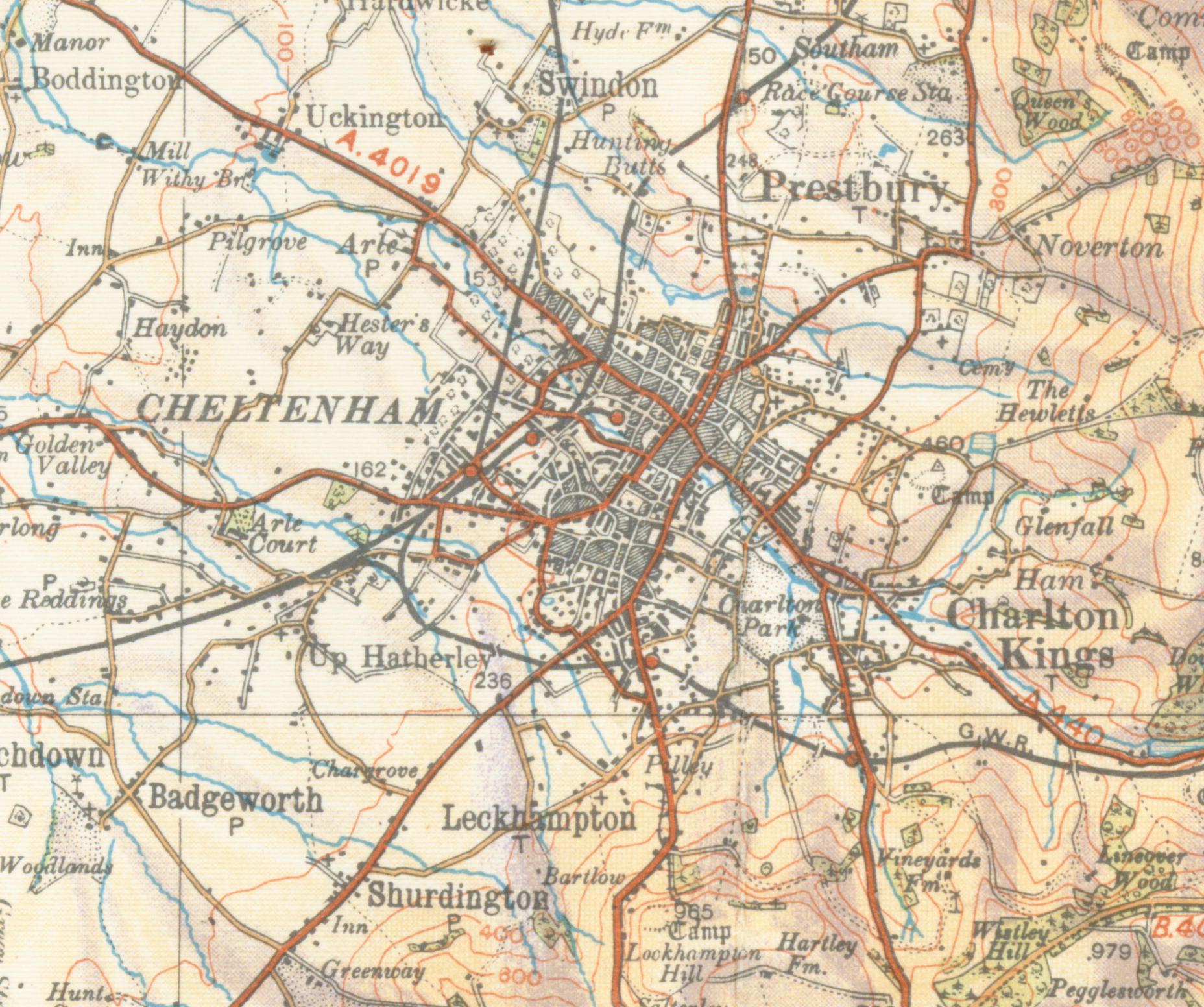
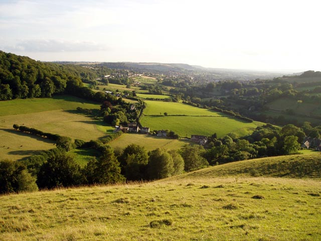
The River Chelt is a tributary of England's largest river, the Severn. The Chelt flows through the western edge of the Cotswolds and the town of Cheltenham, from which it derives its name, before its confluence with the River Severn at Wainlodes Hill. There were a number of mills along the length of the river, the highest being in Charlton Kings and the lowest at Norton where the river passes under the present A38. The river caused significant flooding in 1979 and 2007. See also *List of rivers of England This is a list of rivers of England, organised geographically and taken anti-clockwise around the English coast where the various rivers discharge into the surrounding seas, from the Solway Firth on the Scottish border to the Welsh Dee on the Wel ... References External links Cheltenham Rivers of Gloucestershire Tributaries of the River Severn 1Chelt {{Gloucestershire-geo-stub ... [...More Info...] [...Related Items...] OR: [Wikipedia] [Google] [Baidu] |
England
England is a country that is part of the United Kingdom. It shares land borders with Wales to its west and Scotland to its north. The Irish Sea lies northwest and the Celtic Sea to the southwest. It is separated from continental Europe by the North Sea to the east and the English Channel to the south. The country covers five-eighths of the island of Great Britain, which lies in the North Atlantic, and includes over 100 smaller islands, such as the Isles of Scilly and the Isle of Wight. The area now called England was first inhabited by modern humans during the Upper Paleolithic period, but takes its name from the Angles, a Germanic tribe deriving its name from the Anglia peninsula, who settled during the 5th and 6th centuries. England became a unified state in the 10th century and has had a significant cultural and legal impact on the wider world since the Age of Discovery, which began during the 15th century. The English language, the Anglican Church, and Engli ... [...More Info...] [...Related Items...] OR: [Wikipedia] [Google] [Baidu] |
Gloucestershire
Gloucestershire ( abbreviated Glos) is a county in South West England. The county comprises part of the Cotswold Hills, part of the flat fertile valley of the River Severn and the entire Forest of Dean. The county town is the city of Gloucester and other principal towns and villages include Cheltenham, Cirencester, Kingswood, Bradley Stoke, Stroud, Thornbury, Yate, Tewkesbury, Bishop's Cleeve, Churchdown, Brockworth, Winchcombe, Dursley, Cam, Berkeley, Wotton-under-Edge, Tetbury, Moreton-in-Marsh, Fairford, Lechlade, Northleach, Stow-on-the-Wold, Chipping Campden, Bourton-on-the-Water, Stonehouse, Nailsworth, Minchinhampton, Painswick, Winterbourne, Frampton Cotterell, Coleford, Cinderford, Lydney and Rodborough and Cainscross that are within Stroud's urban area. Gloucestershire borders Herefordshire to the north-west, Worcestershire to the north, Warwickshire to the north-east, Oxfordshire to the east, Wiltshire to the south, Bristol and Somerset ... [...More Info...] [...Related Items...] OR: [Wikipedia] [Google] [Baidu] |
River Severn
, name_etymology = , image = SevernFromCastleCB.JPG , image_size = 288 , image_caption = The river seen from Shrewsbury Castle , map = RiverSevernMap.jpg , map_size = 288 , map_caption = Tributaries (light blue) and major settlements on and near the Severn (bold blue) , pushpin_map = , pushpin_map_size = 288 , pushpin_map_caption= , subdivision_type1 = Country , subdivision_name1 = England and Wales , subdivision_type2 = , subdivision_name2 = , subdivision_type3 = Region , subdivision_name3 = Mid Wales, West Midlands, South West , subdivision_type4 = Counties , subdivision_name4 = Powys, Shropshire, Worcestershire, Gloucestershire , subdivision_type5 = Cities , subdivision_name5 = Shrewsbury, Worcester, Gloucester, Bristol , length = , width_min = , width_avg = , width_max = , depth_min = , depth_avg = ... [...More Info...] [...Related Items...] OR: [Wikipedia] [Google] [Baidu] |
Tributary
A tributary, or affluent, is a stream or river that flows into a larger stream or main stem (or parent) river or a lake. A tributary does not flow directly into a sea or ocean. Tributaries and the main stem river drain the surrounding drainage basin of its surface water and groundwater, leading the water out into an ocean. The Irtysh is a chief tributary of the Ob river and is also the longest tributary river in the world with a length of . The Madeira River is the largest tributary river by volume in the world with an average discharge of . A confluence, where two or more bodies of water meet, usually refers to the joining of tributaries. The opposite to a tributary is a distributary, a river or stream that branches off from and flows away from the main stream. PhysicalGeography.net, Michael Pidwirny & S ... [...More Info...] [...Related Items...] OR: [Wikipedia] [Google] [Baidu] |
Cotswolds
The Cotswolds (, ) is a region in central-southwest England, along a range of rolling hills that rise from the meadows of the upper Thames to an escarpment above the Severn Valley and Evesham Vale. The area is defined by the bedrock of Jurassic limestone that creates a type of grassland habitat rare in the UK and that is quarried for the golden-coloured Cotswold stone. The predominantly rural landscape contains stone-built villages, towns, and stately homes and gardens featuring the local stone. Designated as an Area of Outstanding Natural Beauty (AONB) in 1966, the Cotswolds covers making it the largest AONB. It is the third largest protected landscape in England after the Lake District and Yorkshire Dales national parks. Its boundaries are roughly across and long, stretching southwest from just south of Stratford-upon-Avon to just south of Bath near Radstock. It lies across the boundaries of several English counties; mainly Gloucestershire and Oxfordshire, and parts ... [...More Info...] [...Related Items...] OR: [Wikipedia] [Google] [Baidu] |
Cheltenham
Cheltenham (), also known as Cheltenham Spa, is a spa town and borough on the edge of the Cotswolds in the county of Gloucestershire, England. Cheltenham became known as a health and holiday spa town resort, following the discovery of mineral springs in 1716, and claims to be the most complete Regency town in Britain. The town hosts several festivals of culture, often featuring nationally and internationally famous contributors and attendees; they include the Cheltenham Literature Festival, the Cheltenham Jazz Festival, the Cheltenham Science Festival, the Cheltenham Music Festival, the Cheltenham Cricket Festival and the Cheltenham Food & Drink Festival. In steeplechase horse racing, the Gold Cup is the main event of the Cheltenham Festival, held every March. History Cheltenham stands on the small River Chelt, which rises nearby at Dowdeswell and runs through the town on its way to the Severn. It was first recorded in 803, as ''Celtan hom''; the meaning has not been resol ... [...More Info...] [...Related Items...] OR: [Wikipedia] [Google] [Baidu] |
Charlton Kings
Charlton Kings is a contiguous village adjoining Cheltenham in Gloucestershire, England. The area constitutes a civil parish In England, a civil parish is a type of administrative parish used for local government. It is a territorial designation which is the lowest tier of local government below districts and counties, or their combined form, the unitary authority ... of 10,396 residents (2011). Landscape Charlton Kings is situated in the west foothills of the north-south Cotswolds, which is an Area of Outstanding Natural Beauty. Its surroundings are protected by nature conservation legislation and designations. Lineover Wood SSSI is located on the Cotswold District side of the eastern boundary. Charlton Kings Common and Leckhampton Hill are also designated as SSSIs by Natural England. The River Chelt enters the area from the east. The Cotswold Way, Cotswold Way National Trail is on Charlton Kings's eastern boundary and runs alongside Dowdeswell Reservoir and Wood ... [...More Info...] [...Related Items...] OR: [Wikipedia] [Google] [Baidu] |
Norton, Gloucestershire
Norton is a settlement and civil parish in the English county of Gloucestershire. Overview The main settlements in the parish are the three hamlets of Norton (sometimes called Cold Elm Norton), Bishop's Norton and Prior's Norton. The parish is bisected by the main A38 road that connects Gloucester and Tewkesbury, Bishop's Norton lying to its west and Prior's Norton to its east. Norton formerly lay on the road but is now bypassed. For the purposes of local government the parish forms part of the Tewkesbury borough The village has a small school (Norton Church of England Primary School), a village hall, a sports pitch, two pubs (The Red Lion at Wainlode Hill and the New Dawn Inn) and a church. The parish of Norton had a population of 439 according to the 2011 census. On the Bishop's Norton side, just down from the trigpoint at the top of Sandhurst Hill, is a commemoration stone in the middle of a small group of trees with the following inscription: "This stone marks the site of ... [...More Info...] [...Related Items...] OR: [Wikipedia] [Google] [Baidu] |
Gloucestershire Wildlife Trust
The Gloucestershire Wildlife Trust is the Gloucestershire local partner in a conservation network of 46 Wildlife Trusts. The Wildlife Trusts are local charities with the specific aim of protecting the United Kingdom's natural heritage. The Gloucestershire Wildlife Trust is managed by a Board of Trustees elected from its membership who provide overall direction for the development of the trust and there are advisory committees. The work of the trust is carried out through staff and volunteers. History The trust was founded in 1961 and was then named the Gloucestershire Trust for Nature Conservation. Founder members included Sir Peter Scott, Christopher Cadbury and a group of other local people with the shared interest of nature conservation. The name was changed to the Gloucestershire Wildlife Trust in 1991. In 1990 Lady Scott became the trust's patron succeeding her late husband, Sir Peter Scott. Originally the trust headquarters was at Church House, Standish, which was opene ... [...More Info...] [...Related Items...] OR: [Wikipedia] [Google] [Baidu] |
List Of Rivers Of England
This is a list of rivers of England, organised geographically and taken anti-clockwise around the English coast where the various rivers discharge into the surrounding seas, from the Solway Firth on the Scottish border to the Welsh Dee on the Welsh border, and again from the Wye on the Welsh border anti-clockwise to the Tweed on the Scottish border. Tributaries are listed down the page in an upstream direction, i.e. the first tributary listed is closest to the sea, and tributaries of tributaries are treated similarly. Thus, in the first catchment below, the River Sark is the lowermost tributary of the Border Esk and the Hether Burn is the lowermost tributary of the River Lyne. The main stem (or principal) river of a catchment is labelled as (MS), left-bank tributaries are indicated by (L), right-bank tributaries by (R). Note that in general usage, the 'left (or right) bank of a river' refers to the left (or right) hand bank, as seen when looking downstream. Where a named river ... [...More Info...] [...Related Items...] OR: [Wikipedia] [Google] [Baidu] |
Rivers Of Gloucestershire
A river is a natural flowing watercourse, usually freshwater, flowing towards an ocean, sea, lake or another river. In some cases, a river flows into the ground and becomes dry at the end of its course without reaching another body of water. Small rivers can be referred to using names such as creek, brook, rivulet, and rill. There are no official definitions for the generic term river as applied to geographic features, although in some countries or communities a stream is defined by its size. Many names for small rivers are specific to geographic location; examples are "run" in some parts of the United States, "burn" in Scotland and northeast England, and "beck" in northern England. Sometimes a river is defined as being larger than a creek, but not always: the language is vague. Rivers are part of the water cycle. Water generally collects in a river from precipitation through a drainage basin from surface runoff and other sources such as groundwater recharge, springs, a ... [...More Info...] [...Related Items...] OR: [Wikipedia] [Google] [Baidu] |
Tributaries Of The River Severn
A tributary, or affluent, is a stream or river that flows into a larger stream or main stem (or parent) river or a lake. A tributary does not flow directly into a sea or ocean. Tributaries and the main stem river drain the surrounding drainage basin of its surface water and groundwater, leading the water out into an ocean. The Irtysh is a chief tributary of the Ob river and is also the longest tributary river in the world with a length of . The Madeira River is the largest tributary river by volume in the world with an average discharge of . A confluence, where two or more bodies of water meet, usually refers to the joining of tributaries. The opposite to a tributary is a distributary, a river or stream that branches off from and flows away from the main stream. PhysicalGeography.net, Michael Pidwirny & Scott ... [...More Info...] [...Related Items...] OR: [Wikipedia] [Google] [Baidu] |


