|
Rideauview Terrace
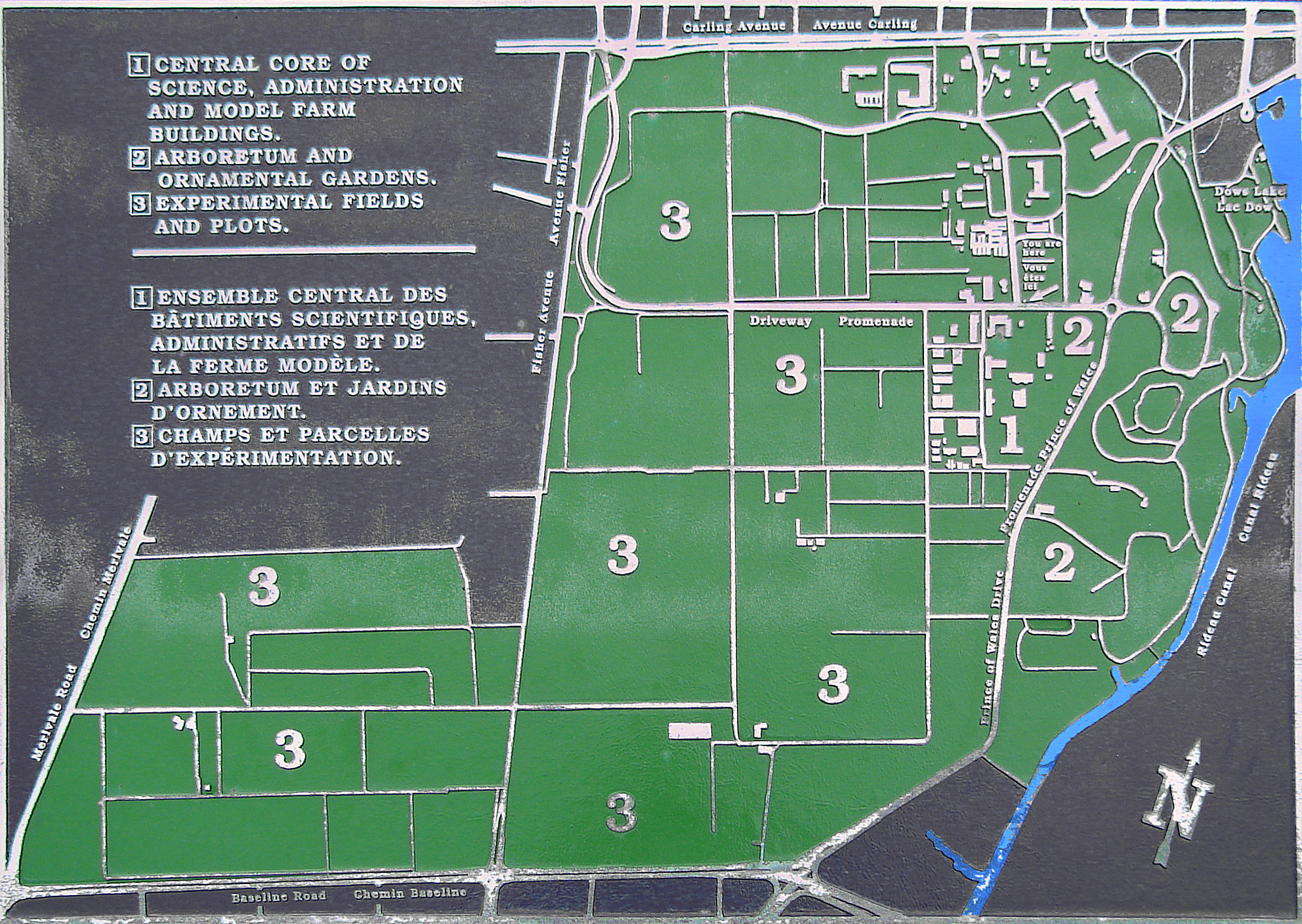
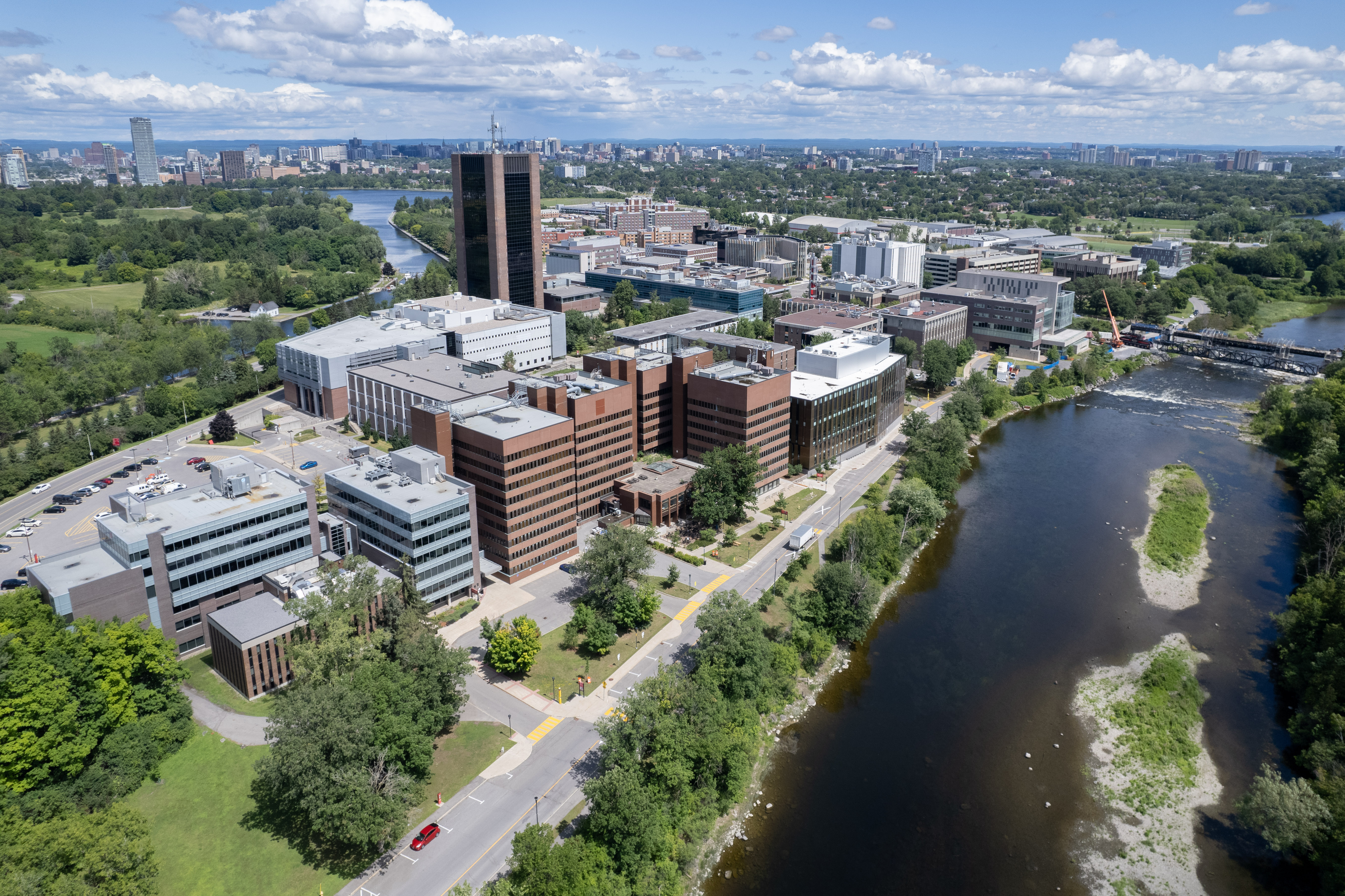
Rideauview Terrace is a sub-neighbourhood of Carleton Heights in River Ward in the west-end of Ottawa, Ontario, Canada. It is located just west of the Rideau Canal. It is bordered by Prince of Wales Drive to the west, Heron Drive to the south, Rideau Canal to the east and the Central Experimental Farm to the north. It is across the Rideau Canal from Carleton University. According to the Canada 2011 Census, there were 45 dwellings in the neighbourhood and it had a population of 98.Census Block 3506106740 The neighbourhood consists of three streets: Green Valley Terrace, Fairchild Private and Rideauview Terrace plus a few houses on Prince of Wales. All the homes (except for five on Green Valley Drive) are detached houses and are relatively large and high in price. Fairchild Private and Rideauview Terrace were developed in the 1980s, Green Valley Crescent is older. There are several office buildings at the corner of Prince of Wales and Heron/Baseline Road. Green Valley Crescent is h ... [...More Info...] [...Related Items...] OR: [Wikipedia] [Google] [Baidu] |
Carleton Heights
Carleton Heights (French: ''Hauteurs Carleton'') is a neighbourhood in River Ward in Ottawa, Ontario, Canada. According to the Carleton Heights and Area Community Association, the neighbourhood is bounded on the north by the Central Experimental Farm, on the east by the Rideau River, on the south by the junction of Prince of Wales Drive and Fisher Avenue and on the west by Fisher Avenue. The neighbourhood is sometimes referred to as Hog's Back after the nearby falls. The total population of the neighbourhood is 7,586 according to the Canada 2016 Census. Homes were developed after World War II in the main Carleton Heights neighbourhood (then part of Nepean Township), located south of Meadowlands Drive. Most of these homes were not built until c. 1950. The neighbourhood was originally built for War Veterans, thanks to the Veterans' Land Act. The houses were small, but were built on large lots (many of which were subdivided in the future). The Courtland Park section of the neigh ... [...More Info...] [...Related Items...] OR: [Wikipedia] [Google] [Baidu] |
River Ward
River Ward or Ward 16 (French: ''Quartier Rivière'') is a municipal ward located in Ottawa, Ontario. It is located in the south central portion of the city, and includes the communities of Carlington, Central Park, Carleton Heights, Mooney's Bay, Riverside Park, and Hunt Club/ Uplands. The ward spans both sides of the Rideau River between Carling Avenue and Hunt Club Road. Prior to amalgamation, this area was part of Mooney's Bay Ward, which existed from 1994 to 2000. Before this, the ward was called Riverside Ward which was created in 1980 from parts of Elmdale-Victoria Ward and Gloucester Ward. City councillors #Jim Durrell (1981-1985) #George Brown (1986-1994) #Karin Howard (1995-1999) # Jim Bickford (1999-2000) # Wendy Stewart (2001-2003) # Maria McRae (2003-2014) #Riley Brockington (2014–present) Election results 1980 1982 1985 1988 1991 1994 1997 1999 by-election A by-election was held on April 6, 1999 to replace Karin Howard who resigned her sea ... [...More Info...] [...Related Items...] OR: [Wikipedia] [Google] [Baidu] |
Ottawa
Ottawa (, ; Canadian French: ) is the capital city of Canada. It is located at the confluence of the Ottawa River and the Rideau River in the southern portion of the province of Ontario. Ottawa borders Gatineau, Quebec, and forms the core of the Ottawa–Gatineau census metropolitan area (CMA) and the National Capital Region (NCR). Ottawa had a city population of 1,017,449 and a metropolitan population of 1,488,307, making it the fourth-largest city and fourth-largest metropolitan area in Canada. Ottawa is the political centre of Canada and headquarters to the federal government. The city houses numerous foreign embassies, key buildings, organizations, and institutions of Canada's government, including the Parliament of Canada, the Supreme Court, the residence of Canada's viceroy, and Office of the Prime Minister. Founded in 1826 as Bytown, and incorporated as Ottawa in 1855, its original boundaries were expanded through numerous annexations and were ultimately ... [...More Info...] [...Related Items...] OR: [Wikipedia] [Google] [Baidu] |
Ontario
Ontario ( ; ) is one of the thirteen provinces and territories of Canada.Ontario is located in the geographic eastern half of Canada, but it has historically and politically been considered to be part of Central Canada. Located in Central Canada, it is Canada's most populous province, with 38.3 percent of the country's population, and is the second-largest province by total area (after Quebec). Ontario is Canada's fourth-largest jurisdiction in total area when the territories of the Northwest Territories and Nunavut are included. It is home to the nation's capital city, Ottawa, and the nation's most populous city, Toronto, which is Ontario's provincial capital. Ontario is bordered by the province of Manitoba to the west, Hudson Bay and James Bay to the north, and Quebec to the east and northeast, and to the south by the U.S. states of (from west to east) Minnesota, Michigan, Ohio, Pennsylvania, and New York. Almost all of Ontario's border with the United States f ... [...More Info...] [...Related Items...] OR: [Wikipedia] [Google] [Baidu] |
Canada
Canada is a country in North America. Its ten provinces and three territories extend from the Atlantic Ocean to the Pacific Ocean and northward into the Arctic Ocean, covering over , making it the world's second-largest country by total area. Its southern and western border with the United States, stretching , is the world's longest binational land border. Canada's capital is Ottawa, and its three largest metropolitan areas are Toronto, Montreal, and Vancouver. Indigenous peoples have continuously inhabited what is now Canada for thousands of years. Beginning in the 16th century, British and French expeditions explored and later settled along the Atlantic coast. As a consequence of various armed conflicts, France ceded nearly all of its colonies in North America in 1763. In 1867, with the union of three British North American colonies through Confederation, Canada was formed as a federal dominion of four provinces. This began an accretion of provinces an ... [...More Info...] [...Related Items...] OR: [Wikipedia] [Google] [Baidu] |
Rideau Canal
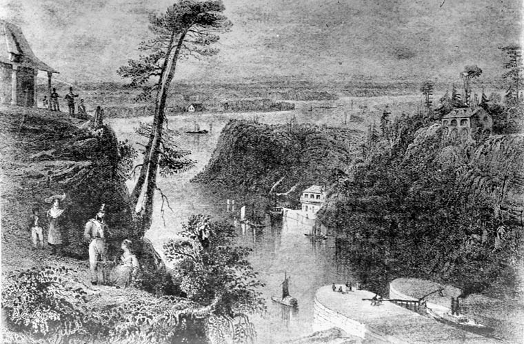
The Rideau Canal, also known unofficially as the Rideau Waterway, connects Canada's capital city of Ottawa, Ontario, to Lake Ontario and the Saint Lawrence River at Kingston. It is 202 kilometres long. The name ''Rideau'', French for "curtain", is derived from the curtain-like appearance of the Rideau River's twin waterfalls where they join the Ottawa River. The canal system uses sections of two rivers, the Rideau and the Cataraqui, as well as several lakes. Parks Canada operates the Rideau Canal. The canal was opened in 1832 as a precaution in case of war with the United States. It remains in use today primarily for pleasure boating, with most of its original structures intact. The locks on the system open for navigation in mid-May and close in mid-October. It is the oldest continuously operated canal system in North America. In 2007 it was registered as a UNESCO World Heritage Site. History Plan After the War of 1812, information was received about the United States' ... [...More Info...] [...Related Items...] OR: [Wikipedia] [Google] [Baidu] |
Prince Of Wales Drive
Prince of Wales Drive ( Ottawa Road #73) is a road serving Ottawa, Ontario, named after the eponymous road in Battersea, London, U.K. The northern section is a low-speed street running along the west bank of the Rideau River, while southern portions of the road were formerly Highway 16 (downgraded after the construction of Highway 416). Prince of Wales Drive is the continuation of Queen Elizabeth Driveway beyond Preston Street. It runs around Dow's Lake and through the Central Experimental Farm before reaching a roundabout. The speed limit is down to Fisher Avenue, at which point it increases to . There is a major intersection with Hunt Club Road, where several commuters from south Nepean use the bridge to cross the Rideau River. Prince of Wales Drive follows the Rideau River past Barrhaven and Manotick. South of the intersection with Jockvale Road, the road diverts from the river and heads in a southwesterly direction toward North Gower, where it terminates at Fourth Line ... [...More Info...] [...Related Items...] OR: [Wikipedia] [Google] [Baidu] |
Central Experimental Farm
The Central Experimental Farm (CEF), commonly known as the Experimental Farm, is an agricultural facility, working farm, and research centre of the Science and Technology Branch, formerly the Research Branch, of Agriculture and Agri-Food Canada. As the name indicates, this farm is centrally located in and now surrounded by the City of Ottawa, Ontario, Canada. The farm is a National Historic Site of Canada and most buildings are protected and preserved as heritage buildings. The CEF original intent was to perform scientific research for improvement in agricultural methods and crops. While such research is still being conducted, the park-like atmosphere of the CEF has become an important place of recreation and education for the residents of Ottawa. Furthermore, over the years several other departments and agencies have encroached onto the CEF property, such as Natural Resources Canada, National Defence ( HMCS Carleton on Dow's Lake), and the Ottawa Civic Hospital (helicopter pad). ... [...More Info...] [...Related Items...] OR: [Wikipedia] [Google] [Baidu] |
Carleton University
Carleton University is an English-language public research university in Ottawa, Ontario, Canada. Founded in 1942 as Carleton College, the institution originally operated as a private, non-denominational evening college to serve returning World War II veterans. Carleton was chartered as a university by the provincial government in 1952 through ''The Carleton University Act,'' which was then amended in 1957, giving the institution its current name. The university is named for the now-dissolved Carleton County, which included the city of Ottawa at the time the university was founded. Carleton County, in turn, was named in honour of Guy Carleton, 1st Baron Dorchester, who was Governor General of The Canadas from 1786 to 1796. The university moved to its current campus in 1959, growing rapidly in size during the 1960s as the Ontario government increased support for post-secondary institutions and expanded access to higher education. Carleton offers a diverse range of academic program ... [...More Info...] [...Related Items...] OR: [Wikipedia] [Google] [Baidu] |
Baseline Road (Ottawa)
Baseline Road ( Ottawa Road #16) is a road in Ottawa, Ontario, Canada. Baseline runs from Richmond Road (almost directly over Highway 416) east in a straight line until it ends at the Heron Road Bridge over the Rideau River and Rideau Canal when it becomes Heron Road. Before the 2001 City of Ottawa amalgamation, Baseline formed the border of the city of Ottawa and Nepean. The street is named for its location as the baseline for Nepean Township. When Nepean Township was surveyed, Baseline formed the northern boundary of Nepean's six north–south concessions. Currently, Baseline is a major east–west street, and in the late 1990s it became so busy that Hunt Club Road had to be extended west of the Rideau River to alleviate pressure. Points of interest on Baseline include the Queensway Carleton Hospital, the Boy Scouts Museum, Algonquin College and the Central Experimental Farm. Baseline Road is a four-lane principal arterial road for its entire length, except between Centr ... [...More Info...] [...Related Items...] OR: [Wikipedia] [Google] [Baidu] |
Ukrainian Greek Catholic Church
, native_name_lang = uk , caption_background = , image = StGeorgeCathedral Lviv.JPG , imagewidth = , type = Particular church (sui iuris) , alt = , caption = St. George's Cathedral in Lviv, mother church of Ukrainian Greek Catholic Church , abbreviation = UGCC , main_classification = Eastern Catholic , orientation = Eastern Christianity , theology = Catholic Theology , governance=Synod of the Ukrainian Catholic Church , polity = Episcopal , leader_title = Pope , leader_name = Francis , leader_title2 = Major Archbishop , leader_name2 = Sviatoslav Shevchuk , division_type = Parishes , division = 3993 , director = , fellowships = , associations = , area = Mainly: Ukraine Minority: Canada, the United States, Australia, France, the United Kingdom, Germany, Brazil, Poland, Lithuania and ... [...More Info...] [...Related Items...] OR: [Wikipedia] [Google] [Baidu] |


