|
Rivière Aux Outardes (North Shore)
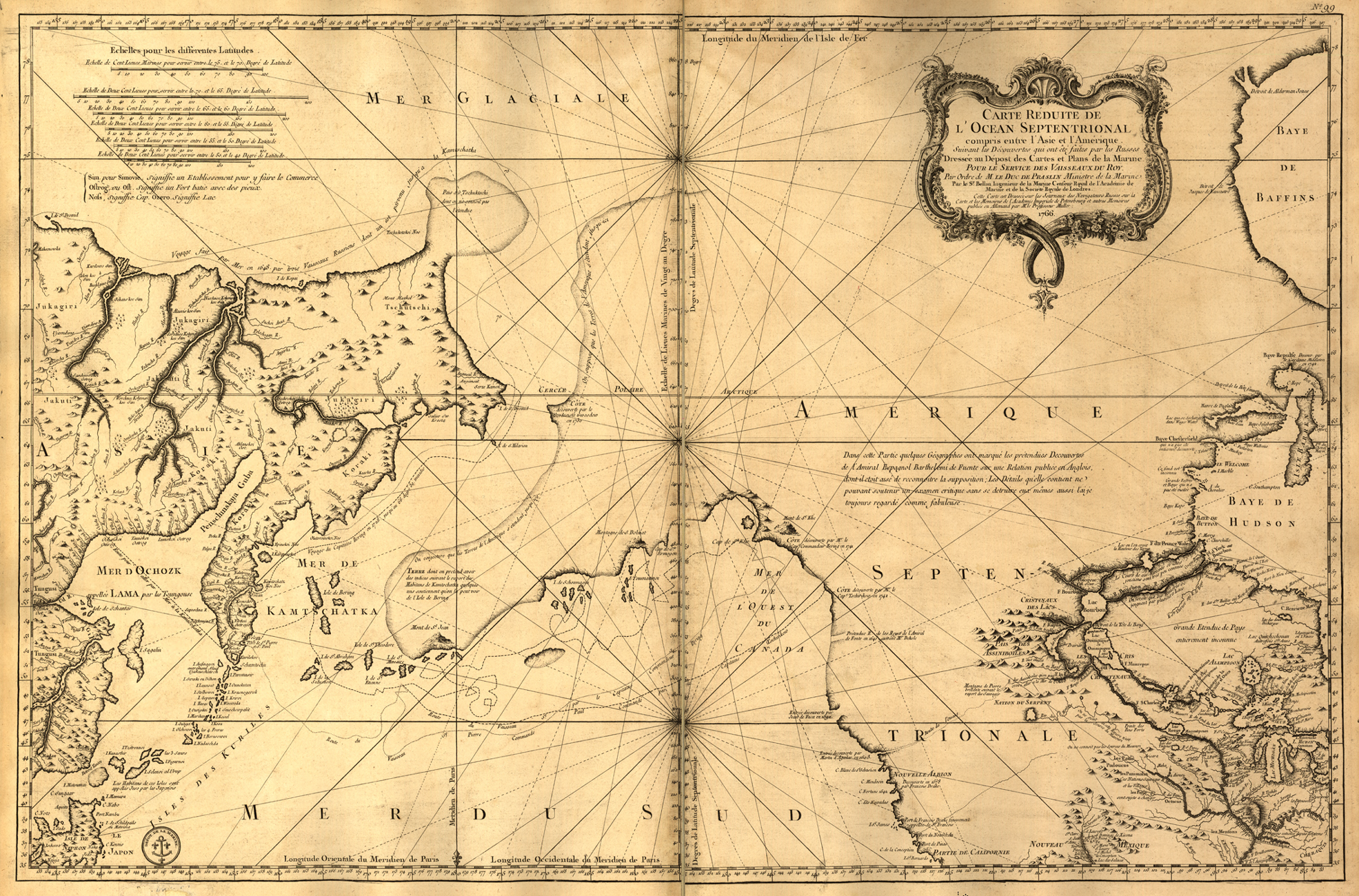
The Rivière aux Outardes or Outardes River is a river in Quebec, Canada. The river originates in the Otish Mountains, and flows in a southerly direction for its entire course. It passes through Lake Plétipi and Burnt Islands Lake (''Îles Brûlées''), and widens about midway to form the large Outardes 4 Reservoir. It drains into Outardes Bay of the Saint Lawrence River, about southwest of Baie-Comeau. At its mouth, the Outardes River widens and flows over a sandbar, making it extremely shallow. There are several islands in Outardes Bay of which the most notable are White Island (''île Blanche''), a rock of white granite high, and Mine Island (''île de la Mine''), a bare red rock reaching high. The river was first called Cane or Caen River by Jean Alfonse in 1544. The name ''riviere aux Outardes'' came in use following its appearance on maps by Jacques-Nicolas Bellin in 1744 and 1764. English maps from the end of the 18th century and early 19th century would show "Bustard ... [...More Info...] [...Related Items...] OR: [Wikipedia] [Google] [Baidu] |
Canada
Canada is a country in North America. Its ten provinces and three territories extend from the Atlantic Ocean to the Pacific Ocean and northward into the Arctic Ocean, covering over , making it the world's second-largest country by total area. Its southern and western border with the United States, stretching , is the world's longest binational land border. Canada's capital is Ottawa, and its three largest metropolitan areas are Toronto, Montreal, and Vancouver. Indigenous peoples have continuously inhabited what is now Canada for thousands of years. Beginning in the 16th century, British and French expeditions explored and later settled along the Atlantic coast. As a consequence of various armed conflicts, France ceded nearly all of its colonies in North America in 1763. In 1867, with the union of three British North American colonies through Confederation, Canada was formed as a federal dominion of four provinces. This began an accretion of provinces an ... [...More Info...] [...Related Items...] OR: [Wikipedia] [Google] [Baidu] |
Canadian French
Canadian French (french: français canadien) is the French language as it is spoken in Canada. It includes Varieties of French#Canada, multiple varieties, the most prominent of which is Quebec French, Québécois (Quebec French). Formerly ''Canadian French'' referred solely to Quebec French and the closely related varieties of Ontario (Franco-Ontarian) and Western Canada—in contrast with Acadian French, which is spoken by Acadians in New Brunswick (including the Chiac dialect) and some areas of Nova Scotia (including the dialect St. Marys Bay French), Prince Edward Island and Newfoundland and Labrador, Newfoundland & Labrador (where Newfoundland French is also spoken). In 2011, the total number of native French speakers in Canada was around 7.3 million (22% of the entire population), while another 2 million spoke it as a second language. At the federal level, it has official status alongside Canadian English. At the provincial level, French is the sole official language of Que ... [...More Info...] [...Related Items...] OR: [Wikipedia] [Google] [Baidu] |
Outardes-4
Outardes-4 is a hydroelectric power station and dam on the Outardes River northwest of Baie-Comeau, Quebec, Canada. The power station was commissioned in 1969 and is supplied by the Outardes-4 Reservoir which is created by seven additional dams. Construction Outardes-4 was built in conjunction with the Manicouagan-Outardes project and is the northernmost power station on the Outardes River. Construction on the diversion tunnel for the Outardes River began in September 1964 and was finished in April 1965. A cofferdam was constructed upstream to direct the river into the diversion tunnel; none was built downstream because the river's grade was sufficient. Once the river was diverted, work commenced on Dam No. 1's foundation. Workers and engineers cleared alluvial material from the riverbed but ran into uplift faults and pot-holes. Around six pot-holes with to diameters and up to deep had to be excavated, partly by hand. Eventually, those under the dam's foundation were filled in ... [...More Info...] [...Related Items...] OR: [Wikipedia] [Google] [Baidu] |
Outardes-3
Outardes-3 is a hydroelectric power station and dam on the Outardes River northwest of Baie-Comeau, Quebec, Canada. The power station was commissioned in 1969 and is run-of-the-river. Outardes-3 was built in conjunction with the Manicouagan-Outardes project and is located downstream of Outardes-4. Only a high concrete dam was needed to exploit of hydraulic head as the dam raised up water into the existing Lake Tirebouchon. Raising the water in the lake allowed it to rise east near the actual power station downstream. Near the eastern portion of the lake, two depressions were filled in with small dikes to withhold the higher lake level, one of which supports a concrete spillway. From the intake on the northern portion of the concrete dam, water is fed via four penstocks towards the underground power station. Water being discharged from the power station enters a long and high tunnel before being returned to the river. See also * List of largest power stations in Canada * ... [...More Info...] [...Related Items...] OR: [Wikipedia] [Google] [Baidu] |
Chute-aux-Outardes, Quebec
Chute-aux-Outardes is a village municipality in Quebec, Canada, at the mouth of the Outardes River. It is about south-west of Baie-Comeau along Route 138. Demographics In the 2021 Census of Population conducted by Statistics Canada, Chute-aux-Outardes had a population of living in of its total private dwellings, a change of from its 2016 population of . With a land area of , it had a population density of in 2021. Population trend: * Population in 2021: 1391 (2006 to 2011 population change: -11%) * Population in 2016: 1563 * Population in 2011: 1644 * Population in 2006: 1853 * Population in 2001: 1968 * Population in 1996: 2155 * Population in 1991: 2161 Mother tongue: * English as first language: 0.4% * French as first language: 99.6% * English and French as first language: 0% * Other as first language: 0% Education Centre de services scolaire de l'Estuaire operates francophone public schools, including: * École Richard The Eastern Shores School Board operates a ... [...More Info...] [...Related Items...] OR: [Wikipedia] [Google] [Baidu] |
Outardes-2
Outardes-2 is a hydroelectric power station and dam on the Outardes River southwest of Baie-Comeau, Quebec, Canada. The power station was commissioned in 1978 and is run-of-the-river. Outardes-2 was built in conjunction with the Manicouagan-Outardes project and is located at the mouth of the Outardes River by Noye Bay. Just west of the power station was another that had been owned and operated by the Quebec North Shore Paper Company since 1937. Instead of raising the reservoir as initially envisioned, Outardes-2 was constructed to better exploit the river flow. See also * Outardes-3 * Outardes-4 * McCormick Dam * Jean-Lesage generating station * René-Lévesque generating station * Daniel-Johnson Dam * History of Hydro-Québec * List of hydroelectric stations in Quebec The following page lists electrical generating stations in Quebec, Canada. Quebec produces close to 96% of its electricity through hydropower. The James Bay Project is Quebec's largest generation complex ... [...More Info...] [...Related Items...] OR: [Wikipedia] [Google] [Baidu] |
Innu
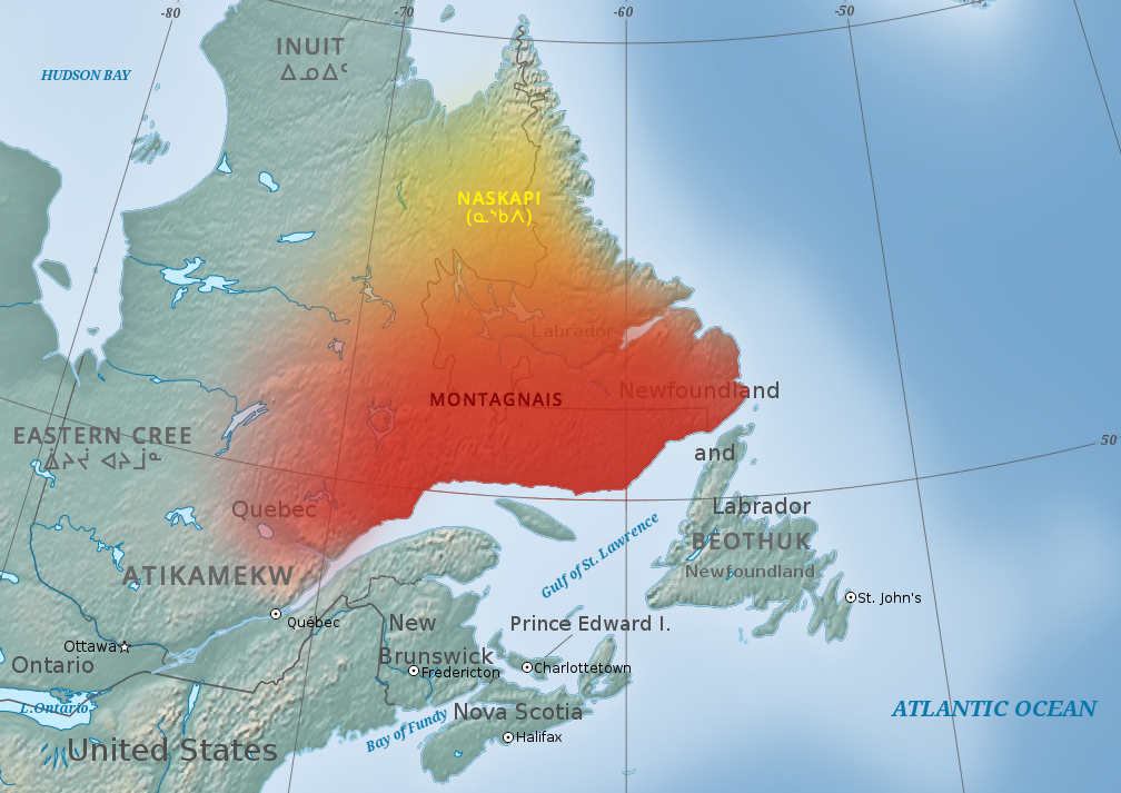
The Innu / Ilnu ("man", "person") or Innut / Innuat / Ilnuatsh ("people"), formerly called Montagnais from the French colonial period ( French for "mountain people", English pronunciation: ), are the Indigenous inhabitants of territory in the northeastern portion of the present-day province of Labrador and some portions of Quebec. They refer to their traditional homeland as ''Nitassinan'' ("Our Land", ᓂᑕᔅᓯᓇᓐ) or ''Innu-assi'' ("Innu Land"). The Innu are divided into several bands, with the Montagnais being the southernmost group and the Naskapi being the northernmost. Their ancestors were known to have lived on these lands as hunter-gatherers for several thousand years. To support their seasonal hunting migrations, they created portable tents made of animal skins. Their subsistence activities were historically centred on hunting and trapping caribou, moose, deer, and small game. Their language, Ilnu-Aimun or Innu-Aimun (popularly known since the French colonia ... [...More Info...] [...Related Items...] OR: [Wikipedia] [Google] [Baidu] |
Canada Goose
The Canada goose (''Branta canadensis''), or Canadian goose, is a large wild goose with a black head and neck, white cheeks, white under its chin, and a brown body. It is native to the arctic and temperate regions of North America, and it is occasionally found during migration across the Atlantic in northern Europe. It has been introduced to the United Kingdom, Ireland, Finland, Sweden, Denmark, New Zealand, Japan, Chile, Argentina, and the Falkland Islands. Like most geese, the Canada goose is primarily herbivorous and normally migratory; often found on or close to fresh water, the Canada goose is also common in brackish marshes, estuaries, and lagoons. Extremely adept at living in human-altered areas, Canada geese have established breeding colonies in urban and cultivated habitats, which provide food and few natural predators. The success of this common park species has led to its often being considered a pest species because of its excrement, its depredation of crops, its n ... [...More Info...] [...Related Items...] OR: [Wikipedia] [Google] [Baidu] |
Jacques-Nicolas Bellin
Jacques Nicolas Bellin (1703 – 21 March 1772) was a French hydrographer, geographer, and member of the French intellectual group called the philosophes. Bellin was born in Paris. He was hydrographer of France's hydrographic office, member of the ''Académie de Marine'' and of the Royal Society of London. Over a 50-year career, he produced many maps of particular interest to the ''Ministère de la Marine''. His maps of Canada and of French territories in North America (New France, Acadia, Louisiana) are particularly valuable. He died at Versailles. First ''Ingenieur de la Marine'' In 1721, at age 18, he was appointed hydrographer (chief cartographer) to the French Navy. In August 1741, he became the first ''Ingénieur de la Marine of the Dépot des cartes et plans de la Marine'' (the French Hydrographical Office) and was named Official Hydrographer of the French King. Prodigious work, high standard of excellence During his reign the Depot published a prodigious number of cha ... [...More Info...] [...Related Items...] OR: [Wikipedia] [Google] [Baidu] |
Quebec
Quebec ( ; )According to the Canadian government, ''Québec'' (with the acute accent) is the official name in Canadian French and ''Quebec'' (without the accent) is the province's official name in Canadian English is one of the thirteen provinces and territories of Canada. It is the largest province by area and the second-largest by population. Much of the population lives in urban areas along the St. Lawrence River, between the most populous city, Montreal, and the provincial capital, Quebec City. Quebec is the home of the Québécois nation. Located in Central Canada, the province shares land borders with Ontario to the west, Newfoundland and Labrador to the northeast, New Brunswick to the southeast, and a coastal border with Nunavut; in the south it borders Maine, New Hampshire, Vermont, and New York in the United States. Between 1534 and 1763, Quebec was called ''Canada'' and was the most developed colony in New France. Following the Seven Years' War, Quebec b ... [...More Info...] [...Related Items...] OR: [Wikipedia] [Google] [Baidu] |

.jpg)

