|
River Lin
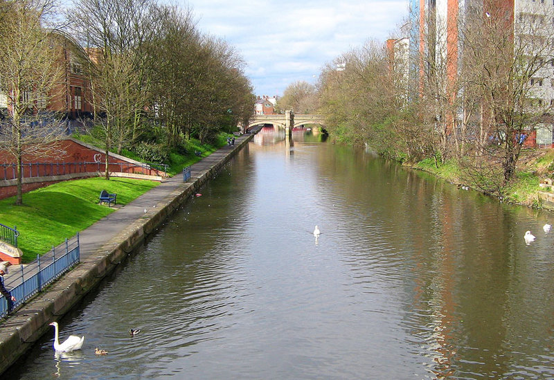
The River Lin is a river which runs through North Leicestershire. The source of the river is in Ulverscroft, near Charnwood Forest. The river runs through Bradgate Park before the river runs into the River Soar in Quorn. The river also feeds Cropston Reservoir and Swithland Reservoir. The river runs for around 17 kilometres between its source and confluence with the River Soar. The river is described as one of Leicestershire's shortest rivers. Course The source of the river is at the head of the Ulverscroft Valley, where a number of small streams converge. At this point, the river is named locally as the Ulverscroft Brook. The source of the river is 163m above sea level. Freshwater from the brook was diverted to feed Lord Stamford's Pond. The Stamford family were major landowners in the area, owning the land which later became Bradgate Park. The river passed close by Ulverscroft Mill. Water from the river would also serve Ulverscroft Priory. Water from the river feeds into Cro ... [...More Info...] [...Related Items...] OR: [Wikipedia] [Google] [Baidu] |
England
England is a country that is part of the United Kingdom. It shares land borders with Wales to its west and Scotland to its north. The Irish Sea lies northwest and the Celtic Sea to the southwest. It is separated from continental Europe by the North Sea to the east and the English Channel to the south. The country covers five-eighths of the island of Great Britain, which lies in the North Atlantic, and includes over 100 smaller islands, such as the Isles of Scilly and the Isle of Wight. The area now called England was first inhabited by modern humans during the Upper Paleolithic period, but takes its name from the Angles, a Germanic tribe deriving its name from the Anglia peninsula, who settled during the 5th and 6th centuries. England became a unified state in the 10th century and has had a significant cultural and legal impact on the wider world since the Age of Discovery, which began during the 15th century. The English language, the Anglican Church, and Engli ... [...More Info...] [...Related Items...] OR: [Wikipedia] [Google] [Baidu] |
Leicestershire
Leicestershire ( ; postal abbreviation Leics.) is a ceremonial and non-metropolitan county in the East Midlands, England. The county borders Nottinghamshire to the north, Lincolnshire to the north-east, Rutland to the east, Northamptonshire to the south-east, Warwickshire to the south-west, Staffordshire to the west, and Derbyshire to the north-west. The border with most of Warwickshire is Watling Street, the modern A5 road (Great Britain), A5 road. Leicestershire takes its name from the city of Leicester located at its centre and unitary authority, administered separately from the rest of the county. The ceremonial county – the non-metropolitan county plus the city of Leicester – has a total population of just over 1 million (2016 estimate), more than half of which lives in the Leicester Urban Area. History Leicestershire was recorded in the Domesday Book in four wapentakes: Guthlaxton, Framland, Goscote, and Gartree (hundred), Gartree. These later became hundred ... [...More Info...] [...Related Items...] OR: [Wikipedia] [Google] [Baidu] |
Ulverscroft
Ulverscroft is a civil parish in the Charnwood district of Leicestershire. It has a population of about 100. The population in 2011 is included in the civil parish of Newtown Linford. There is no village by the name, but there was previously an Ulverscroft Priory. There are some good examples of early Arts and Crafts movement architecture in and around Ulverscroft including Stoneywell by Ernest Gimson Ernest William Gimson (; 21 December 1864 – 12 August 1919) was an English furniture designer and architect. Gimson was described by the art critic Nikolaus Pevsner as "the greatest of the English architect-designers". Today his reputatio .... Stoneywell, now a National Trust property, opened to the public in 2015. Notes External links Ulverscroft Home Page Civil parishes in Leicestershire Borough of Charnwood Villages in Leicestershire {{Leicestershire-geo-stub ... [...More Info...] [...Related Items...] OR: [Wikipedia] [Google] [Baidu] |
River Soar
The River Soar () is a major tributary of the River Trent in the English East Midlands and is the principal river of Leicestershire. The source of the river is midway between Hinckley and Lutterworth. The river then flows north through Leicester, where it is joined by the Grand Union Canal. Continuing on through the Leicestershire Soar Valley, it passes Loughborough and Kegworth until it reaches the Trent at the county boundary. In the 18th century, the Soar was made navigable, initially between Loughborough and the Trent, and then through to Leicester. It was not until the early 19th century that it was linked by the Grand Union Canal to the wider network to the south and to London. Name The name of the ''Soar'' is included in a family of old river-names derived from a root ''*ser-'' "to flow", alongside (among others) ''Saravus'' (''Soar'', a tributary of the Moselle in Belgium), ''Sera'' (''la Serre'', ''la Cère'' and ''le Séran'', three rivers in France), ''Serantia'' ( ... [...More Info...] [...Related Items...] OR: [Wikipedia] [Google] [Baidu] |
Quorn, Leicestershire
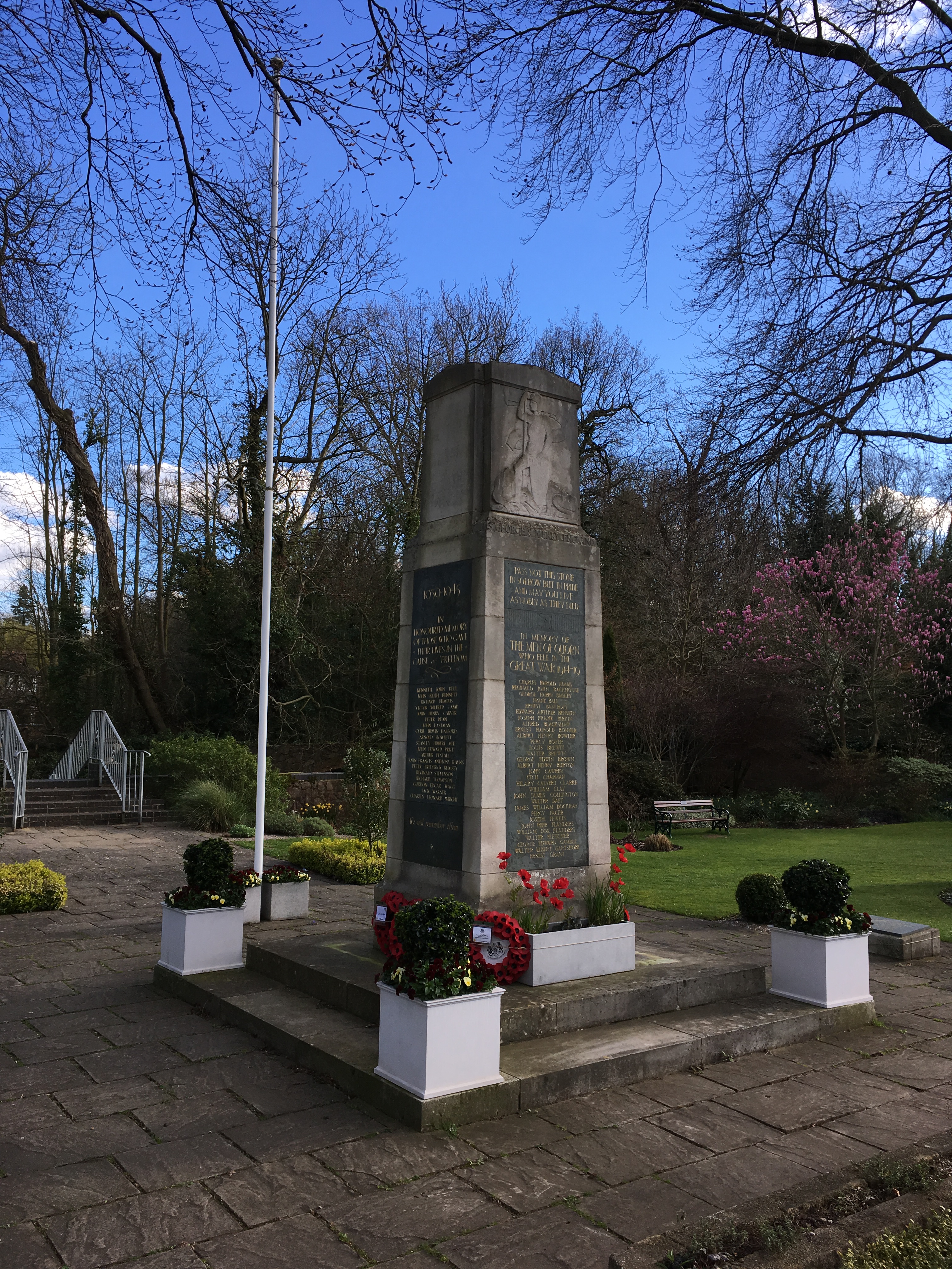
Quorn () is a village and civil parish in Leicestershire, England, near the university town of Loughborough. Its name was shortened from Quorndon in 1889, to avoid postal difficulties owing to its similarity to the name of another village, Quarndon, in neighbouring Derbyshire. History The first known evidence of the village is in the Lincoln Episcopal Registers for 1209–1235, as Quernendon. Other variations of the village name over the centuries include Querne, Quendon, Querendon, Quarendon, Qaryndon, Querinden, Querondon, and Quernedon. The quarrying of stone in Quorn began at a very early age at Buddon Wood, on the edge of the parish. Granite millstones were quarried in the early Iron Age, and under the Romans stone was quarried for building in Leicester. Some of the larger millstones can still be seen in the area, however these days they are either used as garden ornaments, or worked into seats or slabs. The village's name is thought to be derived from the Old English ''c ... [...More Info...] [...Related Items...] OR: [Wikipedia] [Google] [Baidu] |
Charnwood Forest
Charnwood Forest is a hilly tract in north-western Leicestershire, England, bounded by Leicester, Loughborough and Coalville. The area is undulating, rocky and picturesque, with barren areas. It also has some extensive tracts of woodland; its elevation is generally and upwards, the area exceeding this height being about . The highest point, Bardon Hill, is . On its western flank lies an abandoned coalfield, with Coalville and other former mining villages, now being regenerated and replanted as part of the National Forest. The M1 motorway, between junctions 22 and 23, cuts through Charnwood Forest. The hard stone of Charnwood Forest has been quarried for centuries, and was a source of whetstones and quern-stones. The granite quarries at Bardon Hill, Buddon Hill and Whitwick supply crushed aggregate to a wide area of southern Britain. The forest is an important recreational area with woodland walks, noted for their displays of bluebells in the early spring, rock climbing ... [...More Info...] [...Related Items...] OR: [Wikipedia] [Google] [Baidu] |
Bradgate Park
Bradgate Park () is a public park in Charnwood Forest, in Leicestershire, England, northwest of Leicester. It covers . The park lies between the villages of Newtown Linford, Anstey, Cropston, Woodhouse Eaves and Swithland. The River Lin runs through the park, flowing into Cropston Reservoir which was constructed on part of the park. To the north-east lies Swithland Wood. The park's two well known landmarks, Old John and the war memorial, both lie just above the contour. The park is part of the 399.3 hectare Bradgate Park and Cropston Reservoir Site of Special Scientific Interest, which has been designated under both biological and geological criteria. Following a fire in April 2017, the owners Bradgate Trust advised that all visitors are expected to be alert to the risk of causing fire, though another fire in June destroyed one of the ancient oaks. History The area now enclosed as Bradgate Park was one of a number of parks surrounding Charnwood Forest. Since medieval ti ... [...More Info...] [...Related Items...] OR: [Wikipedia] [Google] [Baidu] |
Swithland Reservoir
Swithland Reservoir is a reservoir in the English county of Leicestershire. It is north-east of the village of Swithland from which it takes its name, north-west of Rothley and approximately south-west of Mountsorrel Quarry. It is part of the Buddon Wood and Swithland Reservoir Site of Special Scientific Interest (SSSI). History Leicester's rapidly growing population in the latter half of the 19th century required the construction of a series of reservoirs. In 1854 Thornton Reservoir was opened, serving a population of 61,000. By 1861 the population had increased, with the Waterworks Company now directly supplying 24,000 people, and five years later the company was supplying between 60 and 70,000 people and work began on Bradgate Reservoir (now known as Cropston Reservoir). By 1878 the "water population" had increased to 110,000 and by 1893 to 203,000, requiring further reservoirs to be constructed. In 1890 Leicester City Council sought Parliamentary authority to acquire the ... [...More Info...] [...Related Items...] OR: [Wikipedia] [Google] [Baidu] |
Ulverscroft Mill
Ulverscroft is a civil parish in the Charnwood district of Leicestershire. It has a population of about 100. The population in 2011 is included in the civil parish of Newtown Linford Newtown Linford is a linear village in Leicestershire, England. The population of the civil parish was 1,000 at the 2001 census, including Ulverscroft, increasing to 1,103 at the 2011 census. The village lies in a valley in the Charnwood Forest .... There is no village by the name, but there was previously an Ulverscroft Priory. There are some good examples of early Arts and Crafts movement architecture in and around Ulverscroft including Stoneywell by Ernest Gimson. Stoneywell, now a National Trust property, opened to the public in 2015. Notes External links Ulverscroft Home Page Civil parishes in Leicestershire Borough of Charnwood Villages in Leicestershire {{Leicestershire-geo-stub ... [...More Info...] [...Related Items...] OR: [Wikipedia] [Google] [Baidu] |
Ulverscroft Priory
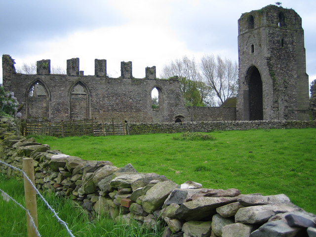
Ulverscroft Priory is a former hermitage and priory in Ulverscroft, Leicestershire. History The priory was founded by Robert de Beaumont, 2nd Earl of Leicester, in 1139, as a hermitage for eremites of the Order of St Augustine. Before 1174, following a papal order, it became an Augustinian priory.Ulverscroft Priory ''English Heritage: PastScape'' The priory gained the of the church at Stanford on Soar in Nottinghamshire before 1174, however the priory lost it by 1280, following a dispute. In 1323 William de Ferrers donated "70 acres of waste land at " and the advowson of Syston Church, both in Leices ... [...More Info...] [...Related Items...] OR: [Wikipedia] [Google] [Baidu] |
Newtown Linford
Newtown Linford is a linear village in Leicestershire, England. The population of the civil parish was 1,000 at the 2001 census, including Ulverscroft, increasing to 1,103 at the 2011 census. The village lies in a valley in the Charnwood Forest area, and has four access roads. The first is from Anstey, then there are roads which lead to the A50 at Groby and at Markfield (the former passing Groby Pool). Another road that leads north towards Ulverscroft, or Loughborough, Woodhouse, Woodhouse Eaves, Swithland etc. History The village's name originates from the relocation of people when the Ferrers family of Groby turned Bradgate into a deer park. The people who lived within the estate were moved to the "New Town" - or hamlet as it would have been then, at the ford of the river Lin (once located at the junction of Markfield Lane and Main Street). The village was first documented in 1293 and was previously known as "Lyndynford". The villagers were all tenants of the Ferrers family ... [...More Info...] [...Related Items...] OR: [Wikipedia] [Google] [Baidu] |


