|
Ribeirão Chiqueiro - Tarrafal) passes near the village.
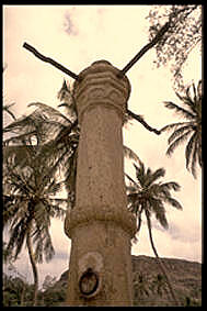
Ribeirão Chiqueiro is a village in the southcentral part of the island of Santiago, Cape Verde. It is part of the municipality of São Domingos. It is 5 km southeast of the municipal seat São Domingos. In 2010 its population was 775. Its elevation is around 270 m. The national road EN1-ST01 (Praia - Assomada Assomada is a cityCabo Verde, Statistical Yearbook 2015 References {{Subdivisions of Santiago, Cape Verde Villages and settlements in Santiago, ...[...More Info...] [...Related Items...] OR: [Wikipedia] [Google] [Baidu] |
Santiago, Cape Verde
Santiago (Portuguese for “ Saint James”) is the largest island of Cape Verde, its most important agricultural centre and home to half the nation's population. Part of the Sotavento Islands, it lies between the islands of Maio ( to the east) and Fogo ( to the west). It was the first of the islands to be settled: the town of Ribeira Grande (now Cidade Velha and a UNESCO World Heritage Site) was founded in 1462. Santiago is home to the nation's capital city of Praia. History The eastern side of the nearby island of Fogo collapsed into the ocean 73,000 years ago, creating a tsunami 170 meters high which struck Santiago. In 1460, António de Noli became the first to visit the island. Da Noli settled at ''Ribeira Grande'' (now Cidade Velha) with his family members and Portuguese from Algarve and Alentejo in 1462.Valor simbóli ... [...More Info...] [...Related Items...] OR: [Wikipedia] [Google] [Baidu] |
Cape Verde
, national_anthem = () , official_languages = Portuguese , national_languages = Cape Verdean Creole , capital = Praia , coordinates = , largest_city = capital , demonym = Cape Verdean or Cabo Verdean , ethnic_groups_year = 2017 , government_type = Unitary semi-presidential republic , leader_title1 = President , leader_name1 = José Maria Neves , leader_title2 = Prime Minister , leader_name2 = Ulisses Correia e Silva , legislature = National Assembly , area_rank = 166th , area_km2 = 4033 , area_sq_mi = 1,557 , percent_water = negligible , population_census = 561,901 , population_census_rank = 172nd , population_census_year = 2021 , population_density_km2 = 123.7 , population_density_sq_mi = 325.0 , population_density_rank = 89th , GDP_PPP ... [...More Info...] [...Related Items...] OR: [Wikipedia] [Google] [Baidu] |
São Domingos, Cape Verde (municipality)
São Domingos is a ''concelho'' (municipality) of Cape Verde. It is situated in the southeastern part of the island of Santiago. Its seat is the city São Domingos (''Várzea da Igreja''). Its population was 13,699 at the 2010 census, and its area is 147.5 km2. The two major settlements in the concelho are São Domingos and Praia Baixo, São Domingos (population about 3,000) being the largest settlement in the area. Smaller settlements in the area include Água do Gato, Achada Banana and Rui Vaz, which is situated on the edge of a 1 km high cliff overlooking Ribeirão Galinha. While Rui Vaz and Praia Baixo are the main tourist draws in the area, tourism does not constitute a major factor in the region’s overwhelmingly agrarian economy. Farmlands cover the eastern and the central parts, where runoff from the center of the island allows a higher water table and loamier soils than the dense clays found on most of the island. Mountains dominate the western border, wh ... [...More Info...] [...Related Items...] OR: [Wikipedia] [Google] [Baidu] |
São Domingos, Cape Verde
São Domingos (also: ''Várzea da Igreja'') is a cityCabo Verde, Statistical Yearbook 2015 Instituto Nacional de Estatística, p. 32-33 in the central part of the island of , . In 2010 its population was 2,818. It is the seat of the [...More Info...] [...Related Items...] OR: [Wikipedia] [Google] [Baidu] |
EN1-ST01
EN1-ST01 is a first class national road on the island of Santiago, Cape Verde. It runs from the capital Praia in the south to Tarrafal in the north, through the mountainous interior of the island. Instituto de Estradas It is 61 km long. The main intersections are: *north of Praia: '' da Praia'' (EN1-ST06) *north of : to (EN1-ST02) *east of |
Praia
Praia (, Portuguese language, Portuguese for "beach") is the capital and largest city of Cape Verde.Cape Verde, Statistical Yearbook 2015 Instituto Nacional de Estatística (Cape Verde), Instituto Nacional de Estatística Located on the southern coast of Santiago, Cape Verde, Santiago island, within the Sotavento Islands group, the city is the seat of the Praia, Cape Verde (municipality), Praia Municipality. Praia is the economic, political, and cultural center of Cape Verde. History  The island of Santiago was discovered by António da Noli in 1460.
 [...More Info...] [...Related Items...] OR: [Wikipedia] [Google] [Baidu] |
Tarrafal, Cape Verde
Tarrafal (also: ''Mangui'' or ''Mangue'') is a cityCabo Verde, Statistical Yearbook 2015 Instituto Nacional de Estatística, p. 32-33 in the northern part of the island of , . In 2010 its population was 6,656. It is a fishing port situated on the northwestern coast. It constitutes the seat of the |
Villages And Settlements In Santiago, Cape Verde
A village is a clustered human settlement or community, larger than a hamlet but smaller than a town (although the word is often used to describe both hamlets and smaller towns), with a population typically ranging from a few hundred to a few thousand. Though villages are often located in rural areas, the term urban village is also applied to certain urban neighborhoods. Villages are normally permanent, with fixed dwellings; however, transient villages can occur. Further, the dwellings of a village are fairly close to one another, not scattered broadly over the landscape, as a dispersed settlement. In the past, villages were a usual form of community for societies that practice subsistence agriculture, and also for some non-agricultural societies. In Great Britain, a hamlet earned the right to be called a village when it built a church. [...More Info...] [...Related Items...] OR: [Wikipedia] [Google] [Baidu] |

.jpg)
.jpg)


