|
Rampside Leading Light
Rampside Leading Light'', is a leading light (navigation beacon) located in the Rampside area of Barrow-in-Furness, Cumbria, England. Built in 1875, it is the only surviving example of 13 such beacons built around Barrow during the late 19th century to aid vessels into the town's port. It stands tall and is constructed from red and yellow bricks. Rampside leading light was designated a Grade II listed building by English Heritage in 1991. See also * Listed buildings in Barrow-in-Furness * List of lighthouses in England This is a list of lighthouses in England. It includes lighthouses which are no longer in use as a light but are still standing. It also includes some of the harbour and pier-head lights around the country. Details of several lighthouses and li ... References External links Port Barrow Lighthouses completed in 1875 Buildings and structures in Barrow-in-Furness Grade II listed lighthouses Lighthouses in Cumbria {{Europe-lighthouse-stub ... [...More Info...] [...Related Items...] OR: [Wikipedia] [Google] [Baidu] |
Piel Island
Piel Island lies in Morecambe Bay, around off the southern tip of the Furness peninsula in the administrative county of Cumbria, England. It is one of the Islands of Furness, three of which sit near to Piel at the mouth of Walney Channel. The island is the location of Piel Castle, built by the monks of Furness Abbey in the fourteenth century. Historically within Lancashire, the island today is owned by the town of Barrow-in-Furness, having been given to the people by the Duke of Buccleuch in 1922. The council's administrative duties also include the selection of the "King" of Piel, who is the landlord of the island's public house, the Ship Inn. Piel is about in size. The landlord and their family and three others who live in the old Ship's pilots' cottages are the island's only permanent residents. History In the Middle Ages Piel was known as Fowdray (or Fouldrey or Fowdrey) island. This name would seem to be derived from the Old Norse words ', meaning "fodder", and ' o ... [...More Info...] [...Related Items...] OR: [Wikipedia] [Google] [Baidu] |
Rampside
Rampside is a village in Cumbria, England. Historically in Lancashire, it is located a few miles south-east of the town of Barrow-in-Furness, in the north-western corner of Morecambe Bay on the Furness peninsula. History There is evidence that the village was inhabited as early as 1292, in the records of the monks of Furness Abbey, though Viking and Roman artefacts have been found in the village's church. As well as agriculture, the village acted as a small port, with shipping trade coming to Furness Abbey through Roa Island, which itself was defended by the fortified Piel Island, both around one mile south of Rampside.''Barrow and District'' by Fred Barnes, Barrow-in-Furness Corporation, Barrow-in-Furness (Lancs) 1968 Thomas Lawson, a herbalist and botanist, was born at Rampside in 1630 and became minister at the village church. He invited George Fox to preach from the pulpit after one Sunday service, and subsequently became a Quaker himself in 1653. He published various ... [...More Info...] [...Related Items...] OR: [Wikipedia] [Google] [Baidu] |
Cumbria
Cumbria ( ) is a ceremonial county in North West England. It borders the Scottish council areas of Dumfries and Galloway and Scottish Borders to the north, Northumberland and County Durham to the east, North Yorkshire to the south-east, Lancashire to the south, and the Irish Sea to the west. Its largest settlement is the city of Carlisle. Cumbria is predominantly rural, with an area of and a population of 500,012; this makes it the third-largest ceremonial county in England by area but the eighth-smallest by population. Carlisle is located in the north; the towns of Workington and Whitehaven lie on the west coast, Barrow-in-Furness on the south coast, and Penrith, Cumbria, Penrith and Kendal in the east of the county. For local government purposes the county comprises two Unitary authorities of England, unitary authority areas, Westmorland and Furness and Cumberland (unitary authority), Cumberland. Cumbria was created in 1974 from the historic counties of Cumberland and Westmor ... [...More Info...] [...Related Items...] OR: [Wikipedia] [Google] [Baidu] |
England
England is a Countries of the United Kingdom, country that is part of the United Kingdom. It is located on the island of Great Britain, of which it covers about 62%, and List of islands of England, more than 100 smaller adjacent islands. It shares Anglo-Scottish border, a land border with Scotland to the north and England–Wales border, another land border with Wales to the west, and is otherwise surrounded by the North Sea to the east, the English Channel to the south, the Celtic Sea to the south-west, and the Irish Sea to the west. Continental Europe lies to the south-east, and Ireland to the west. At the 2021 United Kingdom census, 2021 census, the population was 56,490,048. London is both List of urban areas in the United Kingdom, the largest city and the Capital city, capital. The area now called England was first inhabited by modern humans during the Upper Paleolithic. It takes its name from the Angles (tribe), Angles, a Germanic peoples, Germanic tribe who settled du ... [...More Info...] [...Related Items...] OR: [Wikipedia] [Google] [Baidu] |
Obelisk
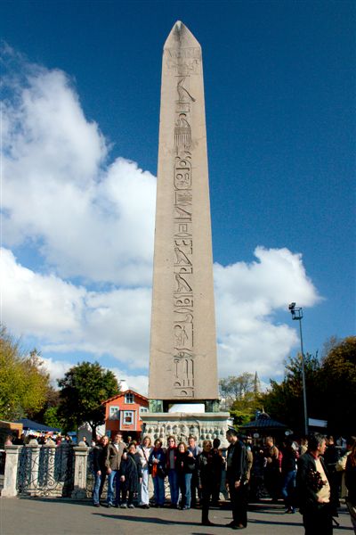
An obelisk (; , diminutive of (') ' spit, nail, pointed pillar') is a tall, slender, tapered monument with four sides and a pyramidal or pyramidion top. Originally constructed by Ancient Egyptians and called ''tekhenu'', the Greeks used the Greek term to describe them, and this word passed into Latin and ultimately English. Though William Thomas used the term correctly in his ''Historie of Italie'' of 1549, by the late sixteenth century (after reduced contact with Italy following the excommunication of Queen Elizabeth), Shakespeare failed to distinguish between pyramids and obelisks in his plays and sonnets. Ancient obelisks are monolithic and consist of a single stone; most modern obelisks are made of several stones. Ancient obelisks Egyptian Obelisks were prominent in the architecture of the ancient Egyptians, and played a vital role in their religion placing them in pairs at the entrance of the temples. The word "obelisk" as used in English today is of Greek rathe ... [...More Info...] [...Related Items...] OR: [Wikipedia] [Google] [Baidu] |
Barrow-in-Furness
Barrow-in-Furness is a port town and civil parish (as just "Barrow") in the Westmorland and Furness district of Cumbria, England. Historic counties of England, Historically in the county of Lancashire, it was incorporated as a municipal borough in 1867 and merged with Dalton-in-Furness Urban District in 1974 to form the Borough of Barrow-in-Furness. The borough subsequently merged with adjoining boroughs in 2023 to form the Westmorland and Furness unitary authority. At the tip of the Furness, Furness peninsula, close to the Lake District, it is bordered by Morecambe Bay, the Duddon Estuary and the Irish Sea. In 2021, Barrow's population was 55,489, making it the second largest urban area in Cumbria after Carlisle, Cumbria, Carlisle, and the largest in the Westmorland and Furness unitary authority. Natives of Barrow, as well as the local dialect, are known as Barrovian. In the Middle Ages, Barrow was a small hamlet (place), hamlet within the parish of Dalton-in-Furness with Fu ... [...More Info...] [...Related Items...] OR: [Wikipedia] [Google] [Baidu] |
Port Of Barrow
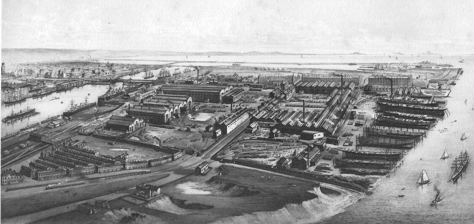
The Royal Port of Barrow refers to the enclosed dock system within the town of Barrow-in-Furness, England. Morecambe Bay is to the east of the port and the Irish Sea surrounds it to the south and west. The port is currently owned and operated by Associated British Ports Holdings, but some land is shared with BAE Systems Submarine Solutions. Currently consisting of four large docks, the Royal Port of Barrow is one of North West England's most important ports. The docks are as follows: Buccleuch Dock, Cavendish Dock, Devonshire Dock and Ramsden Dock. The port of Barrow is the only deep water port between the Mersey and the Clyde. Barrow shipyard is one of the largest in the United Kingdom (it has built well over 800 vessels in its history), rivalled only by those in Belfast, Birkenhead and Govan. It is also home to the country's only submarine production facility. The port is heavily involved with the transportation of natural gases and other forms of energy from local sit ... [...More Info...] [...Related Items...] OR: [Wikipedia] [Google] [Baidu] |
Geograph Britain And Ireland
Geograph Britain and Ireland is a web-based project, begun in March 2005, to create a freely accessible archive of geographically located photographs of Great Britain and Ireland. Photographs in the Geograph collection are chosen to illustrate significant or typical features of each 1 km × 1 km (100 ha) grid square in the Ordnance Survey National Grid and the Irish national grid reference system.Hawgood D. Geograph or supplemental (June 2007) (accessed 13 March 2008) There are 332,216 such grid squares containing at least some land or permanent structure (at low tide), of which 281,131 have Geographs. [...More Info...] [...Related Items...] OR: [Wikipedia] [Google] [Baidu] |
Listed Building
In the United Kingdom, a listed building is a structure of particular architectural or historic interest deserving of special protection. Such buildings are placed on one of the four statutory lists maintained by Historic England in England, Historic Environment Scotland in Scotland, in Wales, and the Historic Environment Division of the Department for Communities in Northern Ireland. The classification schemes differ between England and Wales, Scotland, and Northern Ireland (see sections below). The term has also been used in the Republic of Ireland, where buildings are protected under the Planning and Development Act 2000, although the statutory term in Ireland is "Record of Protected Structures, protected structure". A listed building may not be demolished, extended, or altered without permission from the local planning authority, which typically consults the relevant central government agency. In England and Wales, a national amenity society must be notified of any work to ... [...More Info...] [...Related Items...] OR: [Wikipedia] [Google] [Baidu] |
English Heritage
English Heritage (officially the English Heritage Trust) is a charity that manages over 400 historic monuments, buildings and places. These include prehistoric sites, a battlefield, medieval castles, Roman forts, historic industrial sites, Listed building, listed ruins, and architecturally notable English country houses. The charity states that it uses these properties to "bring the story of England to life for over 10 million people each year". Within its portfolio are Stonehenge, Dover Castle, Tintagel Castle, and the "best-preserved" parts of Hadrian's Wall. English Heritage also manages the London blue plaque scheme, which links influential historical figures to particular buildings. When originally formed in 1983, English Heritage was the operating name of an executive non-departmental public body of the Her Majesty's Government, British Government, officially titled the Historic Buildings and Monuments Commission for England, that ran the national system of heritage prot ... [...More Info...] [...Related Items...] OR: [Wikipedia] [Google] [Baidu] |
Listed Buildings In Barrow-in-Furness
There are 274 listed buildings in the former Borough of Barrow-in-Furness (now part of Westmorland and Furness) , with about 70% in Barrow-in-Furness itself. The 2015 Heritage Index formed by the Royal Society of Arts and the Heritage Lottery Fund placed the Borough as seventh highest of 325 English districts with an especially high score relating to industrial heritage assets. The Barrow Island, Barrow-in-Furness, Barrow Island conservation area contains dozens of historic shipyard buildings and tenements, while numerous listed buildings can be found lining Abbey Road, Barrow-in-Furness, Abbey Road and Duke Street, Barrow-in-Furness, Duke Street, which were designed as the principal north to south and east to west thoroughfares of the Victorian era, Victorian planned town. Despite many buildings and structures dating from this era, an abundance of listed buildings exist throughout the Borough that pre-date Barrow, in villages that were consumed by the rapidly expanding town. One ... [...More Info...] [...Related Items...] OR: [Wikipedia] [Google] [Baidu] |
List Of Lighthouses In England
This is a list of lighthouses in England. It includes lighthouses which are no longer in use as a light but are still standing. It also includes some of the harbour and pier-head lights around the country. Details of several lighthouses and lightvessels in current use in England, together with Wales, the Channel Islands and Lighthouses in Gibraltar, Gibraltar can be found on the website of Trinity House. Locations of major lighthouses are shown on the adjacent map. __TOC__ Active lighthouses Inactive lighthouses See also *Lists of lighthouses *List of lighthouses in Wales *List of lighthouses in Scotland *List of lighthouses in the Isle of Man *List of lighthouses in Ireland *List of lighthouses in the Channel Islands Notes References External links * see Lighthouses of the British IsleslighthousesRus.org (England Page) * {{Architecture of England Lists of lighthouses in the United Kingdom, England Lighthouses in England, Lists of buildings and structu ... [...More Info...] [...Related Items...] OR: [Wikipedia] [Google] [Baidu] |


