|
Rainbow Warrior II
''Rainbow Warrior'' (sometimes informally called ''Rainbow Warrior II'') was a three-masted schooner most notable for service with the environmental protection organization Greenpeace. She was built to replace the original ''Rainbow Warrior'' that the French intelligence service (DGSE) bombed in 1985 in the Port of Auckland, New Zealand, which sank the ship and killed photographer Fernando Pereira. The ''Rainbow Warrior II'' was built from the hull of the deep sea fishing ship ''Ross Kashmir'' (later ''Grampian Fame''), which had been built by Cochrane & Sons of Selby, North Yorkshire and launched in 1957. ''Rainbow Warrior'' was originally long and powered by steam, but was extended to in 1966. Greenpeace gave the vessel new masts, a gaff rig, a new engine and a number of environmentally low-impact systems to handle waste, heating and hot water. She was officially re-launched in Hamburg on 10 July 1989, the fourth anniversary of the bombing of her predecessor, the orig ... [...More Info...] [...Related Items...] OR: [Wikipedia] [Google] [Baidu] |
Bastia
Bastia (, , , ; co, Bastìa ) is a commune in the department of Haute-Corse, Corsica, France. It is located in the northeast of the island of Corsica at the base of Cap Corse. It also has the second-highest population of any commune on the island after Ajaccio and is the capital of the Bagnaja region and of the department. Bastia is the principal port of the island and its principal commercial town and is known for its wines. The inhabitants of the commune are known as ''Bastiais'' or ''Bastiaises''. Approximately 10% of the population are immigrants. The commune has been awarded three flowers by the ''National Council of Towns and Villages in Bloom'' in the ''Competition of cities and villages in Bloom''. Geography Located in the North-East of Corsica at the base of the Cap Corse, between the sea and the mountain, Bastia is the principal port of the island. The city is located away from the northern tip of the Cap Corse, west from Elba, an Italian island, and away from ... [...More Info...] [...Related Items...] OR: [Wikipedia] [Google] [Baidu] |
Steam Engine
A steam engine is a heat engine that performs mechanical work using steam as its working fluid. The steam engine uses the force produced by steam pressure to push a piston back and forth inside a cylinder. This pushing force can be transformed, by a connecting rod and crank, into rotational force for work. The term "steam engine" is generally applied only to reciprocating engines as just described, not to the steam turbine. Steam engines are external combustion engines, where the working fluid is separated from the combustion products. The ideal thermodynamic cycle used to analyze this process is called the Rankine cycle. In general usage, the term ''steam engine'' can refer to either complete steam plants (including boilers etc.), such as railway steam locomotives and portable engines, or may refer to the piston or turbine machinery alone, as in the beam engine and stationary steam engine. Although steam-driven devices were known as early as the aeolipile in the f ... [...More Info...] [...Related Items...] OR: [Wikipedia] [Google] [Baidu] |
Tubbataha Reef
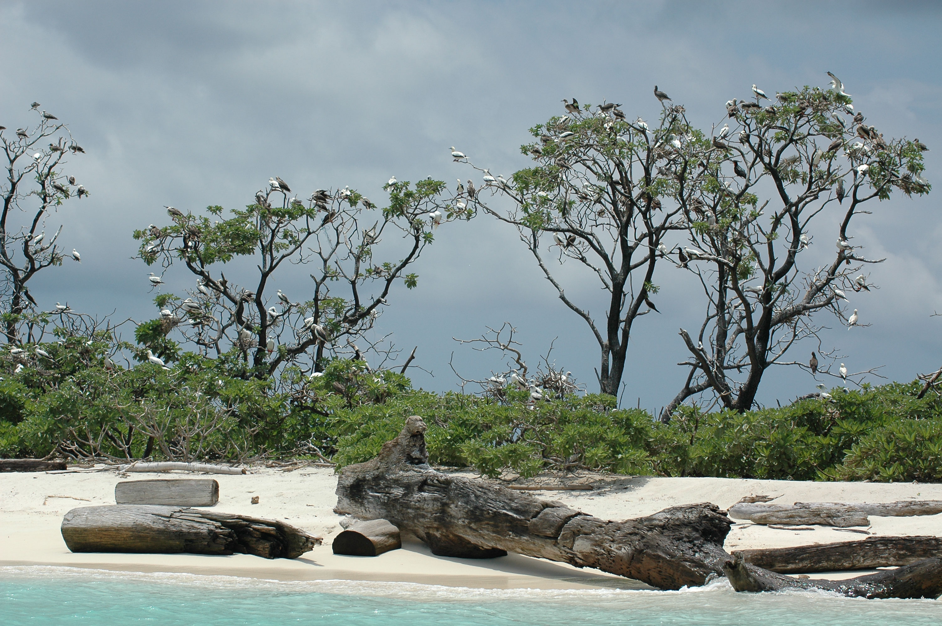
The Tubbataha Natural Park, also known as the Tubbataha Reefs Natural Park ( fil, Bahurang Tubbataha), is a protected area of the Philippines located in the middle of the Sulu Sea. The marine and bird sanctuary consists of two huge atolls (named the North Atoll and South Atoll) and the smaller Jessie Beazley Reef covering a total area of . It is located southeast of Puerto Princesa, the capital of Palawan. The uninhabited islands and reefs are part of the island municipality of Cagayancillo, located roughly to the northeast of the reef. In December 1993, the UNESCO declared the Tubbataha Reefs National Park as a World Heritage Site as a unique example of an atoll reef with a very high density of marine species; the North Islet serving as a nesting site for birds and marine turtles. The site is an excellent example of a pristine coral reef with a spectacular 100-m perpendicular wall, extensive lagoons and two coral islands. In 1999, Ramsar listed Tubbataha as one of the wetlands ... [...More Info...] [...Related Items...] OR: [Wikipedia] [Google] [Baidu] |
Solar Energy
Solar energy is radiant light and heat from the Sun that is harnessed using a range of technologies such as solar power to generate electricity, solar thermal energy (including solar water heating), and solar architecture. It is an essential source of renewable energy, and its technologies are broadly characterized as either passive solar or active solar depending on how they capture and distribute solar energy or convert it into solar power. Active solar techniques include the use of photovoltaic systems, concentrated solar power, and solar water heating to harness the energy. Passive solar techniques include orienting a building to the Sun, selecting materials with favorable thermal mass or light-dispersing properties, and designing spaces that naturally circulate air. The large magnitude of solar energy available makes it a highly appealing source of electricity. In 2020 solar energy has been the cheapest source of Electricity. In Saudi Arabia a power purchase agreemen ... [...More Info...] [...Related Items...] OR: [Wikipedia] [Google] [Baidu] |
Geothermal Energy
Geothermal energy is the thermal energy in the Earth's crust which originates from the formation of the planet and from radioactive decay of materials in currently uncertain but possibly roughly equal proportions. The high temperature and pressure in Earth's interior cause some rock to melt and solid mantle to behave plastically. This results in parts of the mantle convecting upward since it is lighter than the surrounding rock. Temperatures at the core–mantle boundary can reach over 4000 °C (7200 °F). Geothermal heating, using water from hot springs, for example, has been used for bathing since Paleolithic times and for space heating since ancient Roman times. More recently geothermal power, the term used for generation of electricity from geothermal energy, has gained in importance. It is estimated that the earth's geothermal resources are theoretically more than adequate to supply humanity's energy needs, although only a very small fraction is currently being ... [...More Info...] [...Related Items...] OR: [Wikipedia] [Google] [Baidu] |
Alternative Energy
Renewable energy is energy that is collected from renewable resources that are naturally replenished on a Orders of magnitude (time), human timescale. It includes sources such as Solar power, sunlight, wind power, wind, the movement of Hydropower, water, and geothermal energy, geothermal heat. Although most renewable energy sources are sustainable energy, sustainable, some are not. For example, some biomass sources are considered unsustainable at current rates of exploitation of natural resources, exploitation. Renewable energy often provides energy for electricity generation to a grid, space heating, air and water heating/air conditioning, cooling, and stand-alone power systems. Renewable energy technology projects are typically large-scale, but they are also suited to rural and remote areas and Renewable energy in developing countries, developing countries, where energy is often crucial in Human development (humanity), human development. Renewable energy is often deployed toge ... [...More Info...] [...Related Items...] OR: [Wikipedia] [Google] [Baidu] |
Climate Change
In common usage, climate change describes global warming—the ongoing increase in global average temperature—and its effects on Earth's climate system. Climate change in a broader sense also includes previous long-term changes to Earth's climate. The current rise in global average temperature is more rapid than previous changes, and is primarily caused by humans burning fossil fuels. Fossil fuel use, deforestation, and some agricultural and industrial practices increase greenhouse gases, notably carbon dioxide and methane. Greenhouse gases absorb some of the heat that the Earth radiates after it warms from sunlight. Larger amounts of these gases trap more heat in Earth's lower atmosphere, causing global warming. Due to climate change, deserts are expanding, while heat waves and wildfires are becoming more common. Increased warming in the Arctic has contributed to melting permafrost, glacial retreat and sea ice loss. Higher temperatures are also causing m ... [...More Info...] [...Related Items...] OR: [Wikipedia] [Google] [Baidu] |
Philippines
The Philippines (; fil, Pilipinas, links=no), officially the Republic of the Philippines ( fil, Republika ng Pilipinas, links=no), * bik, Republika kan Filipinas * ceb, Republika sa Pilipinas * cbk, República de Filipinas * hil, Republika sang Filipinas * ibg, Republika nat Filipinas * ilo, Republika ti Filipinas * ivv, Republika nu Filipinas * pam, Republika ning Filipinas * krj, Republika kang Pilipinas * mdh, Republika nu Pilipinas * mrw, Republika a Pilipinas * pag, Republika na Filipinas * xsb, Republika nin Pilipinas * sgd, Republika nan Pilipinas * tgl, Republika ng Pilipinas * tsg, Republika sin Pilipinas * war, Republika han Pilipinas * yka, Republika si Pilipinas In the recognized optional languages of the Philippines: * es, República de las Filipinas * ar, جمهورية الفلبين, Jumhūriyyat al-Filibbīn is an archipelagic country in Southeast Asia. It is situated in the western Pacific Ocean and consists of around 7,641 islands t ... [...More Info...] [...Related Items...] OR: [Wikipedia] [Google] [Baidu] |
Legazpi, Albay
Legazpi, officially the City of Legazpi ( bcl, Siyudad nin Legazpi; fil, Lungsod ng Legazpi), is a 1st class component city and capital of the province of Albay, Philippines. According to the 2020 census, it has a population of 209,533. Legazpi is the regional center and largest city of the Bicol Region, in terms of population."DILG Regional Office No. 5 Directory" . Bicol Region Official website. It is the region's center of tourism, education, health services, commerce and transportation in the Bicol Region. The city is composed of two districts, Legazpi Port and the Old Albay District. , one of the Philippines' most popular ic ... [...More Info...] [...Related Items...] OR: [Wikipedia] [Google] [Baidu] |
2004 Indian Ocean Tsunami
An earthquake and a tsunami, known as the Boxing Day Tsunami and, by the scientific community, the Sumatra–Andaman earthquake, occurred at 07:58:53 local time (UTC+7) on 26 December 2004, with an epicentre off the west coast of northern Sumatra, Indonesia. It was an undersea megathrust earthquake that registered a magnitude of 9.1–9.3 , reaching a Mercalli intensity up to IX in certain areas. The earthquake was caused by a rupture along the fault between the Burma Plate and the Indian Plate. A series of massive tsunami waves grew up to high once heading inland, after being created by the underwater seismic activity offshore. Communities along the surrounding coasts of the Indian Ocean were devastated, and the tsunamis killed an estimated 227,898 people in 14 countries, making it one of the deadliest natural disasters in recorded history. The direct results caused major disruptions to living conditions and commerce in coastal provinces of surrounded countries, including Ac ... [...More Info...] [...Related Items...] OR: [Wikipedia] [Google] [Baidu] |
Rongelap
Rongelap Atoll ( Marshallese: , ) is a coral atoll of 61 islands (or motus) in the Pacific Ocean, and forms a legislative district of the Ralik Chain of the Marshall Islands. Its total land area is . It encloses a lagoon with an area of . It is historically notable for its close proximity to US hydrogen bomb tests in 1954, and was particularly devastated by fallout from the Castle Bravo test. The population was forcibly removed from Rongelap following the test due to high radiation levels, and later studied due to their exposure to radiation. However, according to the most recent census in 2011 it has begun to recover with about eighty people living on the atoll. History The first sighting recorded by Europeans was by Spanish navigator Álvaro de Saavedra on 1 January 1528. Together with Utirik, Ailinginae and Toke atolls, they were charted as ''Islas de los Reyes'' (Islands of the Three Wise Kings in Spanish) due to the proximity of Epiphany. Fourteen years later it ... [...More Info...] [...Related Items...] OR: [Wikipedia] [Google] [Baidu] |


