|
Queen Louise Island
Queen Louise Island ( da, Dronning Louise Ø) or Kissarsiitilik is an uninhabited island in the Kujalleq municipality in southern Greenland. The island was named ''Dronning Louise Ø'' after Queen Louise of Sweden (1851–1926), wife of King Frederick VIII of Denmark. Geography Queen Louise Island is a coastal island located off King Frederick VI Coast in southeastern Greenland between two narrow fjords on the southern side of the mouth of Lindenow Fjord. Its length is and its maximum width . Queen Louise Island is mountainous, Nuussuaq the tallest of its three main peaks reaching in height. The island's coast is deeply indented and off its easternmost point lies the smaller island of Kanajoorartuut. Nanuuseq Island lies 7.7 km to the north, on the other side of the mouth of Lindenow Fjord. See also *List of islands of Greenland The following is an alphabetical list of the islands of Greenland. Many of these islands have both a Kalaallisut language name and a European ... [...More Info...] [...Related Items...] OR: [Wikipedia] [Google] [Baidu] |
North Atlantic Ocean
The Atlantic Ocean is the second-largest of the world's five oceans, with an area of about . It covers approximately 20% of Earth's surface and about 29% of its water surface area. It is known to separate the "Old World" of Africa, Europe and Asia from the "New World" of the Americas in the European perception of the World. The Atlantic Ocean occupies an elongated, S-shaped basin extending longitudinally between Europe and Africa to the east, and North and South America to the west. As one component of the interconnected World Ocean, it is connected in the north to the Arctic Ocean, to the Pacific Ocean in the southwest, the Indian Ocean in the southeast, and the Southern Ocean in the south (other definitions describe the Atlantic as extending southward to Antarctica). The Atlantic Ocean is divided in two parts, by the Equatorial Counter Current, with the North(ern) Atlantic Ocean and the South(ern) Atlantic Ocean split at about 8°N. Scientific explorations of the Atlant ... [...More Info...] [...Related Items...] OR: [Wikipedia] [Google] [Baidu] |
Greenland
Greenland ( kl, Kalaallit Nunaat, ; da, Grønland, ) is an island country in North America that is part of the Kingdom of Denmark. It is located between the Arctic and Atlantic oceans, east of the Canadian Arctic Archipelago. Greenland is the world's largest island. It is one of three constituent countries that form the Kingdom of Denmark, along with Denmark and the Faroe Islands; the citizens of these countries are all citizens of Denmark and the European Union. Greenland's capital is Nuuk. Though a part of the continent of North America, Greenland has been politically and culturally associated with Europe (specifically Norway and Denmark, the colonial powers) for more than a millennium, beginning in 986.The Fate of Greenland's Vikings , by Dale Mackenzie Brown, ''Archaeological Institute of America'', ... [...More Info...] [...Related Items...] OR: [Wikipedia] [Google] [Baidu] |
Kujalleq
Kujalleq ( Greenlandic: , da, Den Syden, lit=The South) is a municipality on the southern tip of Greenland, operational from 1 January 2009. The administrative center of the municipality is in Qaqortoq (formerly called Julianehåb). Creation The municipality consists of the former municipalities of southern Greenland, each named after the biggest settlement: * Nanortalik Municipality * Narsaq Municipality * Qaqortoq Municipality In addition to the area of these municipalities, uninhabited parts of the former municipalities of Paamiut and Ammassalik were added to the new administrative entity. In the case of Paamiut Municipality, it was exclusively a part of the ice sheet including a few nunataks, while in the case of Ammassalik Municipality, it included the coast from the fjord Kangerlussuatsiaq (in Danish ''Lindenow Fjord'') on the old border with Nanortalik Municipality in the south to north of Timmiarmiut. Coat of arms The coat of arms of the municipality depicts a ram's h ... [...More Info...] [...Related Items...] OR: [Wikipedia] [Google] [Baidu] |
Louise Of Sweden
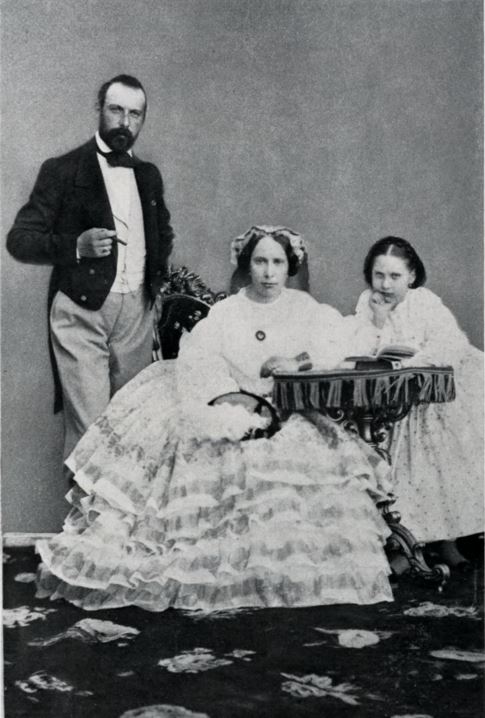
Louise Josephine Eugenie of Sweden ( sv, Lovisa Josefina Eugenia; 31 October 1851 – 20 March 1926) was Queen of Denmark from 1906 until 1912 as the spouse of King Frederick VIII. Born into the House of Bernadotte, Louise was the only surviving child of King Charles XV of Sweden and Norway and his consort, Louise of the Netherlands. Although her father made several attempts to have her recognized as his heir, she was barred from the succession as at the time only males could ascend the throne of Sweden. In 1869, she married the future King Frederick VIII of Denmark, with whom she had eight children. Louise became queen of Denmark in 1906. As queen, she was mainly known for her many charity projects, an interest that she shared with her spouse. She did not care for ceremonial duties and public events, and lived a discreet life dedicated to her children and her interests in art, literature and charity. After a short tenure as queen, she was widowed in 1912. Louise was the mot ... [...More Info...] [...Related Items...] OR: [Wikipedia] [Google] [Baidu] |
Frederick VIII Of Denmark
Frederick VIII ( da, Christian Frederik Vilhelm Carl; 3 June 1843 – 14 May 1912) was King of Denmark from 29 January 1906 until his death in 1912. The eldest son of King Christian IX, nicknamed the ''Father-in-law of Europe'', Frederick was related to royalty throughout Europe. He was heir apparent to the Danish throne and served as crown prince for more than 42 years. During the long reign of his father, he was largely excluded from influence and political power. Upon his father's death in 1906, he acceded to the throne at the advanced age of 62. In many ways, Frederick VIII was a liberal monarch who was much more favorable to the new parliamentary system introduced in 1901 than his father had been, being reform-minded and democratically inclined. Due to his late accession to the throne, however, Frederick's reign would last only six years, throughout which he was plagued by ill health. Early life Prince Frederick was born on 3 June 1843 in the Yellow Palace, an 18 ... [...More Info...] [...Related Items...] OR: [Wikipedia] [Google] [Baidu] |
King Frederick VI Coast
King Frederick VI Coast ( da, Kong Frederik VI Kyst) is a major geographic division of Greenland. It comprises the coastal area of Southeastern Greenland in Sermersooq and Kujalleq municipalities fronting the Irminger Sea of the North Atlantic Ocean. It is bordered by King Christian IX Land on the north and the Greenland Ice Sheet to the west. Named after King Frederick VI of Denmark-Norway, the coast stretches for about south of the Arctic Circle. It is characterized by a succession of short fjords, steep mountains and small coastal islands. There is a narrow belt of ice-free land between the shore and the Inland ice cap, interrupted by active glaciers reaching the shore with the ice limit varying seasonally from year to year. Owing to the movement of pack ice carried by the East Greenland Current and frequent gale-force winds that sweep down from the Greenland ice cap, it is mostly very difficult to approach or navigate along the coast by ship. History This area was inhabite ... [...More Info...] [...Related Items...] OR: [Wikipedia] [Google] [Baidu] |
Lindenow Fjord
Lindenow Fjord or Kangerlussuatsiaq, is a fjord in the King Frederick VI Coast, Kujalleq municipality, southern Greenland. History Igdlukulik, an archaeological site with the ruins of a former Inuit settlement lies by the shore where the Nørrearm branches north. The fjord is named after Godske Lindenov (d. 1612), admiral of the Danish Navy noted for his role in King Christian IV's expeditions to Greenland. In 1931 Norway sent two expeditions to establish hunting and radio station in Southeast Greenland. Led by Ole Mortensen, one of the expeditions went to Kangerlussuaq Fjord on ship ''Signalhorn'' from Ålesund and built a hut there. Since hunting there was poor, Mortensen moved with his men to Lindenow Fjord, where a Norwegian radio and meteorological station named Moreton was built from the mouth of the fjord in 1932. Following sovereignty claims by Norway under the official name Fridtjof Nansen Land on the southeast coast of Greenland between 60°30'N and 63°40'N in t ... [...More Info...] [...Related Items...] OR: [Wikipedia] [Google] [Baidu] |
GoogleEarth
Google Earth is a computer program that renders a 3D representation of Earth based primarily on satellite imagery. The program maps the Earth by superimposing satellite images, aerial photography, and GIS data onto a 3D globe, allowing users to see cities and landscapes from various angles. Users can explore the globe by entering addresses and coordinates, or by using a keyboard or mouse. The program can also be downloaded on a smartphone or tablet, using a touch screen or stylus to navigate. Users may use the program to add their own data using Keyhole Markup Language and upload them through various sources, such as forums or blogs. Google Earth is able to show various kinds of images overlaid on the surface of the earth and is also a Web Map Service client. In 2019, Google has revealed that Google Earth now covers more than 97 percent of the world, and has captured 10 million miles of Street View imagery. In addition to Earth navigation, Google Earth provides a series of ... [...More Info...] [...Related Items...] OR: [Wikipedia] [Google] [Baidu] |
Nanuuseq
Nanuuseq, also known as ''Nanûseq'' or ''Nanusek'' is an uninhabited island in the Kujalleq municipality in southern Greenland. Geography Nanuuseq is a coastal island, although it is also considered a peninsula owing to it almost being attached to the mainland shore of King Frederick VI Coast.''Prostar Sailing Directions 2005 Greenland and Iceland Enroute'', p. 99 located off the southeastern coast of Greenland between the mouth of Lindenow Fjord on its southern side and the mouth of Nanuuseq Fjord —formerly known as Oyfjord— to the north. Its length is and its maximum width .GoogleEarth Google Earth is a computer program that renders a 3D representation of Earth based primarily on satellite imagery. The program maps the Earth by superimposing satellite images, aerial photography, and GIS data onto a 3D globe, allowing users ... Although Nanuuseq is relatively small, its highest point reaches in height. The island's coast is deeply indented and the Sound (geography) ... [...More Info...] [...Related Items...] OR: [Wikipedia] [Google] [Baidu] |
List Of Islands Of Greenland
The following is an alphabetical list of the islands of Greenland. Many of these islands have both a Kalaallisut language name and a European language name. Islands and archipelagoes * Aaluik * Aasiaat Archipelago * Achton Friis Islands * Aggas *Akilia *Alluttoq Island *Aluk Island * Ammassalik Island * Anoraliuirsoq *Appat Island *Apusiaajik Island *ATOW1996 *Beaumont Island (Greenland) * Bjorne Island *Bjorne Islands * Bjornesk Island * Bonsall Islands *Bontekoe Island *Borup Island * Brainard Island * Bushnan Island *Cape Farewell Archipelago ** Annikitsoq ** Avallersuaq **Egger Island ** Ikeq Island ** Nunarsuaq (Nunarssuak) ** Pamialluk ** Qernertoq **Qunnerit **Sammisoq ** Saningassoq **Walkendorff Island *Carey Islands * Castle Island, Greenland *Clavering Island * Crown Prince Islands *Crozier Island *Danmark Island *Danske Islands * Deception Island (Greenland) * Diego's Island * Djævleøen * Dog's Island * Edward Island * Elison Island *Ella Island * Ensomheden *Fi ... [...More Info...] [...Related Items...] OR: [Wikipedia] [Google] [Baidu] |


