|
Pakhli
Pakhli Sultanate was an ancient sarkar (district) of the Mughal Subah of Punjab, now part of Hazara, Pakistan. It roughly corresponds to the ancient Urasa, the Aρσa or Οΰaρσa which Ptolemy placed between the Bidaspes (Jhelum) and the Indus. It was part of the Gandhara or Gandharva country of antiquity). It later became part of Chandragupta Maurya's Empire. The archaeological remains found here suggest that this was a place of great Buddhist learning. In the Rajatarangini this place now appeared as a separate kingdom and then again as tributary to the Kashmir valley. The Ain-i-Akbari refers to this entire region as Sarkar Pakhli, which formed a part of the larger Kashmir province, which in turn was part of Subah Kabul. The area of Pakhli today forms a part of the Mansehra of Khyber Pakhtunkhwa, Khyber-Pakhtunkhwa province of Pakistan. History The king of Pakhli at the time of Alexander the Great was Arsakes, during the time of the Chinese pilgrim Xuanzang visited the area it ... [...More Info...] [...Related Items...] OR: [Wikipedia] [Google] [Baidu] |
Hari Singh Nalwa
Hari Singh Nalwa (1791–1837) was Commander-in-chief of the Sikh Khalsa Fauj, the army of the Sikh Empire. He is known for his role in the conquests of Kasur, Sialkot, Attock, Multan, Kashmir, Peshawar and Jamrud. Hari Singh Nalwa was responsible for expanding the frontier of Sikh Empire to beyond the Indus River right up to the mouth of the Khyber Pass. At the time of his death, the western boundary of the empire was Jamrud. He served as governor of Kashmir, Peshawar and Hazara. He established a mint on behalf of the Sikh Empire to facilitate revenue collection in Kashmir and Peshawar. Early life Hari Singh Nalwa was born in Gujranwala, in the Majha region of Punjab to Dharam Kaur and Gurdial Singh Uppal. According to historian Autar Singh Sandhu, Hari Singh Nalwa's family are of Uppal Khatri origin. As per Vanit Nalwa who claims to be Hari's descadant says that their family were Uppal Khatris who originally belonged to Majitha town near Amritsar. After his father died ... [...More Info...] [...Related Items...] OR: [Wikipedia] [Google] [Baidu] |
Behali
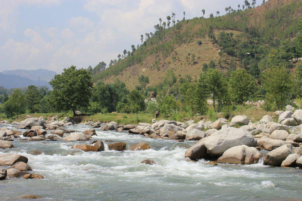
Bahali is a village and union councils of Pakistan, union council (an administrative subdivision) of the Mansehra District in Khyber Pakhtunkhwa, Khyber-Pakhtunkhwa province of Pakistan. Bahali is part of Mansehra Tehsil and is located at the boundary area of the Mansehra district and the Abbottabad district, west from the Karakurram highway at Qalanderabad. It is a valley surrounded by mountains. It is inhabited by Turki, Tanolies, Awan, Gujjar, Syeds And Galye. Etymology Behali is actually a distortion of the word Bahali, which means "restoration." Tradition holds that the reason the village was named Bahali was due to its successive destruction by various tribes and Sikhs and its ...[...More Info...] [...Related Items...] OR: [Wikipedia] [Google] [Baidu] |
Swati (Pashtun Tribe)
Swatis (Urdu: سواتی, Pashto: سواتي) are a Pashtun tribe, mostly inhabiting the Hazara Division of the Khyber Pakhtunkhwa province in Pakistan. They are mostly agricultural and are the biggest land owning tribe in the districts of Mansehra and Batagram (Feudal Tanawal excluded). Swatis are divided into four major tribal clans: Gabri (گبری), Mitravi (متراوی), Mumyaali (ممیالی) and Toar (ٹوڑ). Some of them speak Hindko in towns like Mansehra, Balakot, Naran, Kaghan and Garhi Habibullah while majority of them speak Pashto as a mother tongue. Their code of conduct and customs are similar to Pashtunwali, and are called Swatiwali. Swatis are sometimes referred to as Suwadis and Servatis. Most of them are orthodox Muslims, and have been Muslim since Ghaznavid times. They are staunch followers of the Hanafi school of Islamic jurisprudence. According to the 1911 Census Report, the tribe was counted as having 33,000 individuals in Hazara District alone, ex ... [...More Info...] [...Related Items...] OR: [Wikipedia] [Google] [Baidu] |
Khyber Pakhtunkhwa
Khyber Pakhtunkhwa (; ps, خېبر پښتونخوا; Urdu, Hindko: خیبر پختونخوا) commonly abbreviated as KP or KPK, is one of the Administrative units of Pakistan, four provinces of Pakistan. Located in the Geography of Pakistan, northwestern region of the country, Khyber Pakhtunkhwa is the smallest province of Pakistan by land area and the Demographics of Pakistan, third-largest province by population after Punjab, Pakistan, Punjab and Sindh. It shares land borders with the Pakistani provinces of Balochistan, Pakistan, Balochistan to the south, Punjab, Pakistan, Punjab to the south-east and province of Gilgit-Baltistan to the north and north-east, as well as Islamabad Capital Territory to the east, Azad Jammu and Kashmir, Autonomous Territory of Azad Jammu and Kashmir to the north-east. It shares an Durand Line, international border with Afghanistan to the west. Khyber Pakhtunkhwa is known as a tourist hot spot for adventurers and explorers and has a varied landsca ... [...More Info...] [...Related Items...] OR: [Wikipedia] [Google] [Baidu] |
Sherwan
Sherwan is a Tehsil from the Abbottabad District in the Khyber-Pakhtunkhwa province of Pakistan, located 35 km west of Abbottabad. Sherwan consists of two adjacent villages. The northern part is referred to as Sherwan Kalan, and the southern as Sherwan Khurd. Sherwan is on a ridge 5,000 feet high in the centre of Lower Tanawal. Sherwan is located in a valley which is surrounded by large, forested mountains on three sides. These forests host various wild animals, such as jackals, wolves, pigs, porcupines, foxes, and occasionally leopards. Sherwan is divided into two parts: Sherwan Khurd (small) and Sherwan Kalan (wide). Sherwan Kalan covers a much larger area than Sherwan Khurd. A village called Patheel is on the northeast of Sherwan Union Council. To the west of Sherwan Union Council is another village called Bacha Kalan. A stream called Mangal lies south of the valley; it is home to several fish such as trout, eels, soles, and others. Location and demographics Sherwan is ... [...More Info...] [...Related Items...] OR: [Wikipedia] [Google] [Baidu] |
Sarkar (country Subdivision)
Sarkar ( hi, , ur, , pa, ਸਰਕਾਰ, bn, সরকার also spelt Circar) is a historical administrative division, used mostly in the Mughal Empire. It was a division of a Subah or province. A sarkar was further divided into Mahallas or Parganas. The Sarkar system was replaced in the early 18th century by the Chakla system. See also * Northern Circars, the five individual districts making up a former division of British India's Madras Presidency * Rajamundry Sarkar, one among the Northern Circars * Pakhli, an ancient sarkar now part of Hazara, Pakistan * Pakhal Sarkar Pakhal is an area of the Mansehra district in Khyber Pakhtunkhwa, Pakistan. It was ruled by the Sarkar Sultanate between 1190 and 1519. Also known as the Sarkar Kingdom, it was known for agricultural products such as rice and tobacco. The territory ..., an area of Mansehra district in Khyber Pakhtunkhwa, Pakistan References Subdivisions of the Mughal Empire Former subdivisions of Bangladesh ... [...More Info...] [...Related Items...] OR: [Wikipedia] [Google] [Baidu] |
Buddhist
Buddhism ( , ), also known as Buddha Dharma and Dharmavinaya (), is an Indian religion or philosophical tradition based on teachings attributed to the Buddha. It originated in northern India as a -movement in the 5th century BCE, and gradually spread throughout much of Asia via the Silk Road. It is the world's fourth-largest religion, with over 520 million followers (Buddhists) who comprise seven percent of the global population. The Buddha taught the Middle Way, a path of spiritual development that avoids both extreme asceticism and hedonism. It aims at liberation from clinging and craving to things which are impermanent (), incapable of satisfying ('), and without a lasting essence (), ending the cycle of death and rebirth (). A summary of this path is expressed in the Noble Eightfold Path, a training of the mind with observance of Buddhist ethics and meditation. Other widely observed practices include: monasticism; " taking refuge" in the Buddha, the , and th ... [...More Info...] [...Related Items...] OR: [Wikipedia] [Google] [Baidu] |
Sum Elai-Mang
Sum Elai-Mang ( Hindko:هندکو) or Sum is a village/state in Sirran Valley, Mansehra District, Khyber-Pakhtunkhwa. It is also a union council (an administrative subdivision) of Mansehra District in Khyber-Pakhtunkhwa province of Pakistan Pakistan ( ur, ), officially the Islamic Republic of Pakistan ( ur, , label=none), is a country in South Asia. It is the world's fifth-most populous country, with a population of almost 243 million people, and has the world's second-lar .... S Floods A disaster took place in Sum during the floods of September 1992 and July 2001. The entire village was under flood and the schools and the houses of the local population floated away. References {{coord missing, Khyber Pakhtunkhwa Populated places in Mansehra District ... [...More Info...] [...Related Items...] OR: [Wikipedia] [Google] [Baidu] |
Damtaur
Dahamtore ( ps, دھمتوڑ, ur, ) is situated at about 6 km towards east of Abbottabad, Hazara, Pakistan, Hazara, Khyber Pakhtunkhwa, Pakistan and is the largest village and union council of Abbottabad. Their language is Hindko which is the traditional mother tongue of the Hazara Division but in some villages specially :ur:نگکی, Nagakki village, Gujari language, Gojri is also mother tongue . Dhamtour village is the gate way to places like Murree, Nathiagali, Dunga Gali, Bara Gali, Ayubia National Park, Miranjani, Mukeshpuri and most famous picnic spot of Abbottabad, Harnoi. The Union council is located in Abbottabad District in the Khyber-Pakhtunkhwa province of Pakistan. Subdivisions The Union Council of Dhamtour is divided into the areas of Banda Bazdar, Bandi Shoalian, Dhamtour, Guldhok, Jaswal, :ur:نگکی, Nagakki, Banda Said khan and Ukhreela. [...More Info...] [...Related Items...] OR: [Wikipedia] [Google] [Baidu] |
Ranjit Singh
Ranjit Singh (13 November 1780 – 27 June 1839), popularly known as Sher-e-Punjab or "Lion of Punjab", was the first Maharaja of the Sikh Empire, which ruled the northwest Indian subcontinent in the early half of the 19th century. He survived smallpox in infancy but lost sight in his left eye. He fought his first battle alongside his father at age 10. After his father died, he fought several wars to expel the Afghans in his teenage years and was proclaimed as the "Maharaja of Punjab" at age 21. His empire grew in the Punjab region under his leadership through 1839. Prior to his rise, the Punjab region had numerous warring misls, misls (confederacies), twelve of which were under Sikh rulers and one Muslim. Ranjit Singh successfully absorbed and united the Sikh misls and took over other local kingdoms to create the Sikh Empire. He repeatedly defeated Afghan-Sikh Wars, invasions by outside armies, particularly those arriving from Afghanistan, and established friendly relat ... [...More Info...] [...Related Items...] OR: [Wikipedia] [Google] [Baidu] |
Sikhs
Sikhs ( or ; pa, ਸਿੱਖ, ' ) are people who adhere to Sikhism (Sikhi), a monotheistic religion that originated in the late 15th century in the Punjab region of the Indian subcontinent, based on the revelation of Guru Nanak. The term ''Sikh'' has its origin in the word ' (), meaning 'disciple' or 'student'. Male Sikhs generally have ''Singh'' ('lion'/'tiger') as their last name, though not all Singhs are necessarily Sikhs; likewise, female Sikhs have ''Kaur'' ('princess') as their last name. These unique last names were given by the Gurus to allow Sikhs to stand out and also as an act of defiance to India's caste system, which the Gurus were always against. Sikhs strongly believe in the idea of "Sarbat Da Bhala" - "Welfare of all" and are often seen on the frontline to provide humanitarian aid across the world. Sikhs who have undergone the ''Amrit Sanchar'' ('baptism by Khanda'), an initiation ceremony, are from the day of their initiation known as Khalsa, and they m ... [...More Info...] [...Related Items...] OR: [Wikipedia] [Google] [Baidu] |
Indus
The Indus ( ) is a transboundary river of Asia and a trans-Himalayan river of South and Central Asia. The river rises in mountain springs northeast of Mount Kailash in Western Tibet, flows northwest through the disputed region of Kashmir, Quote: "Kashmir, region of the northwestern Indian subcontinent. It is bounded by the Uygur Autonomous Region of Xinjiang to the northeast and the Tibet Autonomous Region to the east (both parts of China), by the Indian states of Himachal Pradesh and Punjab to the south, by Pakistan to the west, and by Afghanistan to the northwest. The northern and western portions are administered by Pakistan and comprise three areas: Azad Kashmir, Gilgit, and Baltistan, ... The southern and southeastern portions constitute the Indian state of Jammu and Kashmir. The Indian- and Pakistani-administered portions are divided by a "line of control" agreed to in 1972, although neither country recognizes it as an international boundary. In addition, China became ... [...More Info...] [...Related Items...] OR: [Wikipedia] [Google] [Baidu] |


