|
Pueblo De Los Muertos
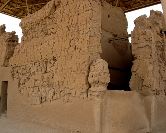
Pueblo de Los Muertos ("City of the Dead") is a historical ruin in the U.S. state of Arizona. It is located approximately west of Chandler. The large Hohokam settlement was situated within the southern Salado valley. Geography Los Muertos is situated west of Chandler and near Tempe, in the Salt River valley of southern Arizona. It covers an area greater than along the borders of a canal or artificial river, measuring almost . The Los Muertos and Pueblo de las Acequias ("City of the Canals") ruins are approximately apart. History In 1887, Frank Hamilton Cushing, leader of the Hemenway Southwestern Archaeological Expedition, explored the ruins of an early people, a place he called "El Pueblo de los Muertos"—"The City of the Dead"—in the center of which he uncovered many large communal houses, and beyond them found the remains of more sparsely-settled suburbs extending for . The largest of these houses was bigger than Casa Grande. It was surrounded by smaller edifices, ... [...More Info...] [...Related Items...] OR: [Wikipedia] [Google] [Baidu] |
Arizona
Arizona ( ; nv, Hoozdo Hahoodzo ; ood, Alĭ ṣonak ) is a state in the Southwestern United States. It is the 6th largest and the 14th most populous of the 50 states. Its capital and largest city is Phoenix. Arizona is part of the Four Corners region with Utah to the north, Colorado to the northeast, and New Mexico to the east; its other neighboring states are Nevada to the northwest, California to the west and the Mexican states of Sonora and Baja California to the south and southwest. Arizona is the 48th state and last of the contiguous states to be admitted to the Union, achieving statehood on February 14, 1912. Historically part of the territory of in New Spain, it became part of independent Mexico in 1821. After being defeated in the Mexican–American War, Mexico ceded much of this territory to the United States in 1848. The southernmost portion of the state was acquired in 1853 through the Gadsden Purchase. Southern Arizona is known for its desert cl ... [...More Info...] [...Related Items...] OR: [Wikipedia] [Google] [Baidu] |
Chandler, Arizona
Chandler is a city in Maricopa County, Arizona, United States, and a suburb in the Phoenix-Mesa-Chandler Metropolitan Statistical Area (MSA). It is bordered to the north and west by Tempe, to the north by Mesa, to the west by Phoenix, to the south by the Gila River Indian Community, and to the east by Gilbert. As of the 2020 census, the population of Chandler was 275,987, up from 236,123 at the 2010 census. History In 1891, Dr. Alexander John Chandler, the first veterinary surgeon in Arizona Territory, settled on a ranch south of Mesa, studying irrigation engineering. By 1900, he had acquired of land, and began drawing up plans for a townsite on what was then known as the Chandler Ranch. The townsite office opened on May 16, 1912. (Soon after celebrating Chandler's Centennial on May 17, 2012, Chandler Museum staff discovered that the city had been celebrating the wrong date. In May 1912, the ''Chandler Arizonan'' newspaper had erroneously published the founding day as Ma ... [...More Info...] [...Related Items...] OR: [Wikipedia] [Google] [Baidu] |
Hohokam
Hohokam () was a culture in the North American Southwest in what is now part of Arizona, United States, and Sonora, Mexico. It existed between 300 and 1500 AD, with cultural precursors possibly as early as 300 BC. Archaeologists disagree about whether communities that practiced the culture were related or politically united. According to local oral tradition, Hohokam societies may be the ancestors of the historic Pima and Tohono O'odham peoples in Southern Arizona. The origin of the culture is debated. Most archaeologists either argue it emerged locally or in Mesoamerica, but it was also influenced by the Northern Pueblo culture. Hohokam settlements were located on trade routes that extended past the Hohokam area, as far east as the Great Plains and west to the Pacific coast. Hohokam societies received a remarkable amount of immigration. Some communities established significant markets, such as that in Snaketown. The harshness of the Sonoran Desert may have been the most influ ... [...More Info...] [...Related Items...] OR: [Wikipedia] [Google] [Baidu] |
Salt River (Arizona)
The Salt River (Spanish: , O'odham ima , Yavapai: or , Maricopa language: Va Shly’ay) is a river in Gila and Maricopa counties in Arizona, United States, that is the largest tributary of the Gila River. The river is about 200 miles (320 km) long.Calculated with Google Maps and Google Earth Its drainage basin is about 13,700 square miles (35,000 km2) large. The longest of the Salt River's many tributaries is the 195-mile (314 km) Verde River. The Salt's headwaters tributaries, the Black River and East Fork, increase the river's total length to about 300 miles (480 km). The name Salt River comes from the fact that the river flows over large salt deposits shortly after the merging of the White and Black Rivers. Variant names According to the Geographic Names Information System, the Salt River has also been known as: * Assumption * Black River * Blau Fluss * Blue River * Rio Asuncion * Rio Azulrio de Lasrio * Rio de la Asuncion ... [...More Info...] [...Related Items...] OR: [Wikipedia] [Google] [Baidu] |
Tempe, Arizona
, settlement_type = City , named_for = Vale of Tempe , image_skyline = Tempeskyline3.jpg , imagesize = 260px , image_caption = Tempe skyline as seen from Papago Park , image_flag = Tempe, Arizona official flag.png , seal_size = , image_map = File:Maricopa County Arizona Incorporated and Unincorporated areas Tempe Highlighted 0473000.svg , mapsize = 250px , map_caption = Location of Tempe in Maricopa County, Arizona , image_map1 = , mapsize1 = , map_caption1 = , pushpin_map = Arizona#USA , pushpin_map_caption = Location in Arizona##Location in the United States , pushpin_relief = 1 , coordinates = , subdivision_type = L ... [...More Info...] [...Related Items...] OR: [Wikipedia] [Google] [Baidu] |
Southern Arizona
Southern Arizona is a region of the United States comprising the southernmost portion of the State of Arizona. It sometimes goes by the name Gadsden or Baja Arizona, which means "Lower Arizona" in Spanish. Geography Although Southern Arizona's boundaries are not well-defined, it is generally considered to include all areas south of the Gila River but sometimes only Cochise County, Pima County and Santa Cruz County, anchored by the city of Tucson. Other cities and large towns in Southern Arizona include Ajo, Casa Grande, Gila Bend, Oro Valley, Sierra Vista, Yuma, and the border cities of Nogales and Douglas. Furthermore, the populated areas of Southern Arizona include the major U.S. Army post of Fort Huachuca and Davis–Monthan Air Force Base of the U.S. Air Force. The most major scientific site of Southern Arizona is the set of several astronomical observatories of the Kitt Peak National Observatory, a reasonable distance west-southwest of Tucson. Southern Arizona is t ... [...More Info...] [...Related Items...] OR: [Wikipedia] [Google] [Baidu] |
Frank Hamilton Cushing
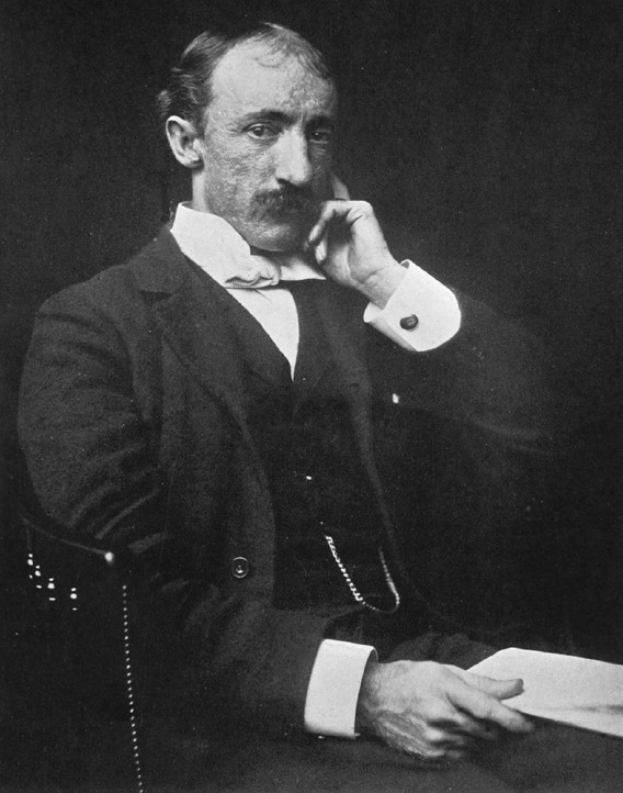
Frank Hamilton Cushing (July 22, 1857 in North East Township, Erie County, Pennsylvania – April 10, 1900 in Washington, D.C.) was an American anthropologist and ethnologist. He made pioneering studies of the Zuni Indians of New Mexico by entering into their culture; his work helped establish participant observation as a common anthropological research strategy. In recent years, however, questions have emerged about Cushing's activities among the Zuni. Consequently, Frank Cushing's work provides an important case study for considering the ethics of both ethnographic research and the generation of museum collections. Early life Cushing was born in the borough of North East, Pennsylvania. He later moved with his family to Western New York. As a boy he took an interest in the Native American artifacts in the surrounding countryside and taught himself how to knap flint (make arrowheads and such from flint). He published his first scientific paper when he was 17. After a brief pe ... [...More Info...] [...Related Items...] OR: [Wikipedia] [Google] [Baidu] |
Hemenway Southwestern Archaeological Expedition
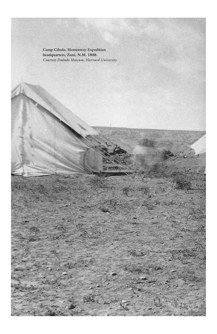
The Hemenway Southwestern Archaeological Expedition occurred between 1886 and 1894 in the American Southwest. Sponsored by Mary Tileston Hemenway, a wealthy widow and philanthropist, the expedition was initially led by Frank Hamilton Cushing, who was replaced in 1889 by Jesse Walter Fewkes. It was considered to be a major scientific archaeological expedition, notable for the discovery of the prehistoric Hohokam culture. The expeditionary records held by Cushing were in storage until 1930. Emil Haury, a Harvard University student, was the first to study these, and he published a monograph on Pueblo de Los Muertos in 1945. The site had been investigated in detail by the Hemenway Expedition and dated to the Hohokam culture. Background Mary Tileston Hemenway was a wealthy widow and philanthropist in New England who was impressed with Frank Hamilton Cushing's anthropological work studying the Zuni Indians in northwestern New Mexico and his enthusiasm for further investigations. Her amb ... [...More Info...] [...Related Items...] OR: [Wikipedia] [Google] [Baidu] |
Casa Grande Ruins National Monument
Casa Grande Ruins National Monument ( ood, Siwañ Waʼa Ki: or ''Sivan Vahki''), in Coolidge, Arizona, just north-east of the city of Casa Grande, preserves a group of Hohokam structures dating to the Classic Period (). History of the area The national monument consists of the ruins of multiple structures surrounded by a compound wall constructed by the ancient people of the Hohokam period, who farmed the Gila Valley in the early 13th century. "Archeologists have discovered evidence that the ancient Sonoran Desert people who built the Casa Grande also developed wide-scale irrigation farming and extensive trade connections which lasted over a thousand years until about . "Casa Grande" is Spanish for "big house" (''Siwañ Wa'a Ki:'' in O'odham); these names refer to the largest structure on the site, which is what remains of a four-story structure that may have been abandoned by 1450. The structure is made of caliche, and has managed to survive the extreme weather conditions fo ... [...More Info...] [...Related Items...] OR: [Wikipedia] [Google] [Baidu] |
Adobe
Adobe ( ; ) is a building material made from earth and organic materials. is Spanish for ''mudbrick''. In some English-speaking regions of Spanish heritage, such as the Southwestern United States, the term is used to refer to any kind of earthen construction, or various architectural styles like Pueblo Revival or Territorial Revival. Most adobe buildings are similar in appearance to cob and rammed earth buildings. Adobe is among the earliest building materials, and is used throughout the world. Adobe architecture has been dated to before 5,100 B.C. Description Adobe bricks are rectangular prisms small enough that they can quickly air dry individually without cracking. They can be subsequently assembled, with the application of adobe mud to bond the individual bricks into a structure. There is no standard size, with substantial variations over the years and in different regions. In some areas a popular size measured weighing about ; in other contexts the size is weighi ... [...More Info...] [...Related Items...] OR: [Wikipedia] [Google] [Baidu] |
Stone Age
The Stone Age was a broad prehistoric period during which stone was widely used to make tools with an edge, a point, or a percussion surface. The period lasted for roughly 3.4 million years, and ended between 4,000 BC and 2,000 BC, with the advent of metalworking. Though some simple metalworking of malleable metals, particularly the use of gold and copper for purposes of ornamentation, was known in the Stone Age, it is the melting and smelting of copper that marks the end of the Stone Age. In Western Asia, this occurred by about 3,000 BC, when bronze became widespread. The term Bronze Age is used to describe the period that followed the Stone Age, as well as to describe cultures that had developed techniques and technologies for working copper alloys (bronze: originally copper and arsenic, later copper and tin) into tools, supplanting stone in many uses. Stone Age artifacts that have been discovered include tools used by modern humans, by their predecessor species in the ... [...More Info...] [...Related Items...] OR: [Wikipedia] [Google] [Baidu] |
John Wesley Powell
John Wesley Powell (March 24, 1834 – September 23, 1902) was an American geologist, U.S. Army soldier, explorer of the American West, professor at Illinois Wesleyan University, and director of major scientific and cultural institutions. He is famous for his 1869 geographic expedition, a three-month river trip down the Green and Colorado rivers, including the first official U.S. government-sponsored passage through the Grand Canyon. Powell was appointed by US President James A. Garfield to serve as the second director of the U.S. Geological Survey (1881–1894) and proposed, for development of the arid West, policies that were prescient for his accurate evaluation of conditions. Two years prior to his service as director of the U.S. Geological Survey, Major Powell had become the first director of the Bureau of Ethnology at the Smithsonian Institution where he supported linguistic and sociological research and publications. Biography Early life Powell was born in Mount Mo ... [...More Info...] [...Related Items...] OR: [Wikipedia] [Google] [Baidu] |


_1.jpg)

