|
Protea Asymmetrica
''Protea asymmetrica'', also known as the Inyanga sugarbush, is a flowering plant, named for its asymmetric flowerheads, of the family Proteaceae and endemic to Zimbabwe and the Nyanga region, where it grows in grasslands, as well as Mount Nyangani Mount Nyangani (formerly Mount Inyangani) is the highest mountain in Zimbabwe at . The mountain is located within Nyanga National Park in Nyanga District, about northwest of Mutare. The summit lies atop a small outcrop of rock around above the s .... It reaches a height of up to 1.6m, and mainly flowers from June to August. The plant sprouts after a fire, and grows on grassland at a height of around 2000m. See also * References {{Taxonbar, from=Q18082514 asymmetrica ... [...More Info...] [...Related Items...] OR: [Wikipedia] [Google] [Baidu] |
Proteaceae
The Proteaceae form a family of flowering plants predominantly distributed in the Southern Hemisphere. The family comprises 83 genera with about 1,660 known species. Together with the Platanaceae and Nelumbonaceae, they make up the order Proteales. Well-known genera include ''Protea'', ''Banksia'', ''Embothrium'', ''Grevillea'', ''Hakea'' and ''Macadamia''. Species such as the New South Wales waratah (''Telopea speciosissima''), king protea (''Protea cynaroides''), and various species of ''Banksia'', ''soman'', and ''Leucadendron'' are popular cut flowers. The nuts of ''Macadamia integrifolia'' are widely grown commercially and consumed, as are those of Gevuina avellana on a smaller scale. Australia and South Africa have the greatest concentrations of diversity. Etymology The name Proteaceae was adapted by Robert Brown from the name Proteae coined in 1789 for the family by Antoine Laurent de Jussieu, based on the genus ''Protea'', which in 1767 Carl Linnaeus derived from t ... [...More Info...] [...Related Items...] OR: [Wikipedia] [Google] [Baidu] |
Zimbabwe
Zimbabwe (), officially the Republic of Zimbabwe, is a landlocked country located in Southeast Africa, between the Zambezi and Limpopo Rivers, bordered by South Africa to the south, Botswana to the south-west, Zambia to the north, and Mozambique to the east. The capital and largest city is Harare. The second largest city is Bulawayo. A country of roughly 15 million people, Zimbabwe has 16 official languages, with English, Shona language, Shona, and Northern Ndebele language, Ndebele the most common. Beginning in the 9th century, during its late Iron Age, the Bantu peoples, Bantu people (who would become the ethnic Shona people, Shona) built the city-state of Great Zimbabwe which became one of the major African trade centres by the 11th century, controlling the gold, ivory and copper trades with the Swahili coast, which were connected to Arab and Indian states. By the mid 15th century, the city-state had been abandoned. From there, the Kingdom of Zimbabwe was established, fol ... [...More Info...] [...Related Items...] OR: [Wikipedia] [Google] [Baidu] |
Nyanga District
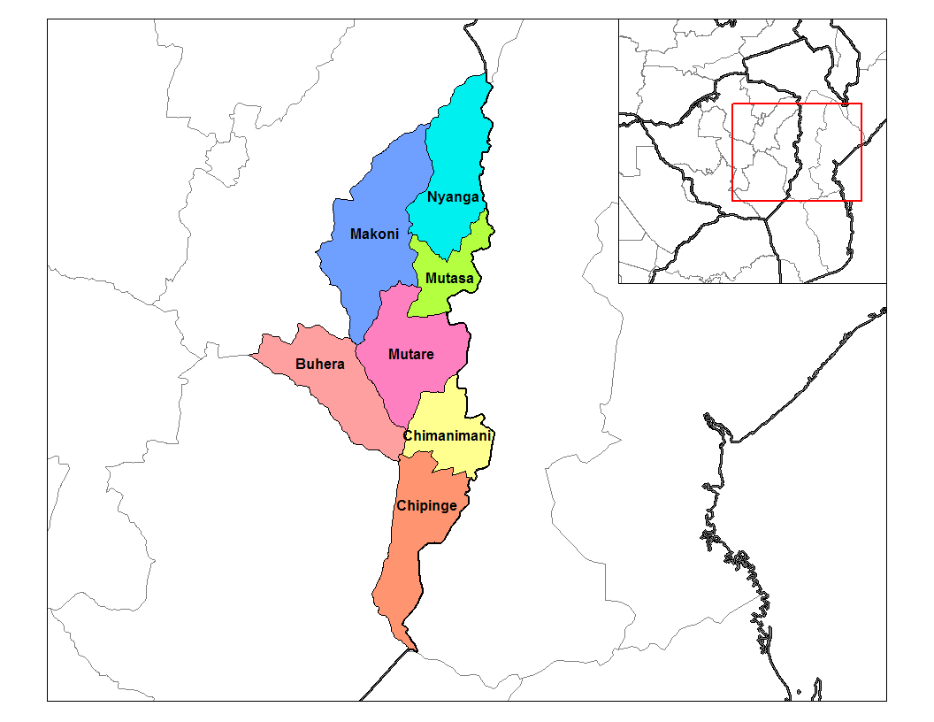
Nyanga District is located in Manicaland Province of Zimbabwe. The administrative center is Nyanga village. The 2012 National Zimbabwe census reported its population to be 126,599 and being 52.2% female and 47.8% male. Geography Nyanga District is bounded on the south by Mutasa District, on the west by Makoni District, on the northwest by Mashonaland East Province, and on the east by Mozambique. The Nyanga Mountains occupy the southern portion of the district, extending into Mutasa District. Nyanga National Park covers the central part of the range, including Mount Nyangani, Zimbabwe's highest peak. The Gairezi River forms the eastern boundary of the District with Mozambique. The Nyangombe River forms the district's western and northwestern boundary. Both rivers flow generally northwards, and meet at the district's northernmost point to form the Luenha River, a tributary of the Zambezi. The Nyangui highlands lie in the center of the district. Nyangui State Forest was establis ... [...More Info...] [...Related Items...] OR: [Wikipedia] [Google] [Baidu] |
Mount Nyangani
Mount Nyangani (formerly Mount Inyangani) is the highest mountain in Zimbabwe at . The mountain is located within Nyanga National Park in Nyanga District, about northwest of Mutare. The summit lies atop a small outcrop of rock around above the surrounding area. The remainder of the peak is a broad moor of mainly rolling hills and plateau with an area of about 8 km2. The edges of this plateau then fall steeply to the east and west sides. The mountain vegetation is largely composed of heath around the summit plateau with evergreen forest along the wetter eastern slopes and grassland to the western side. Annual rainfall totals are high (around ) but long spells of dry weather occur during the winter period of May to August. Due to its relatively low altitude and tropical location, snow falls very rarely, last recorded in August 1935. Geology The mountain is composed of an upper sill of dolerite and sandstone, with the harder dolerite forming cliffs and ridges. The dolerite si ... [...More Info...] [...Related Items...] OR: [Wikipedia] [Google] [Baidu] |


