|
Prieto River (Ponce, Puerto Rico)
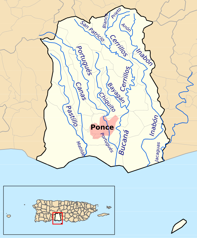
Prieto River is a river in the municipality of Ponce, Puerto Rico. It is located in the northeastern area of the municipality. Forming at an altitude of , Río Prieto originates at the second highest point of any river in the municipality after Río Inabon. It empties into Río Cerrillos. Together with Río Blanco, Río Prieto is one of the two rivers in Ponce with mouths at the highest elevation (both at ). This river is one of the 14 rivers in the municipality. Origin Río Prieto has its origin in barrio Anón in Ponce, in the area of Toro Negro State Forest,''Bosques de Puerto Rico: Bosque Estatal de Toro Negro.'' Hojas de Nuestro Ambiente. July 2008. [...More Info...] [...Related Items...] OR: [Wikipedia] [Google] [Baidu] |
Commonwealth (U
A commonwealth is a traditional English term for a political community founded for the common good. Historically, it has been synonymous with "republic". The noun "commonwealth", meaning "public welfare, general good or advantage", dates from the 15th century. Originally a phrase (the common-wealth or the common wealth – echoed in the modern synonym "public wealth"), it comes from the old meaning of "wealth", which is "well-being", and is itself a loose translation of the Latin res publica (republic). The term literally meant "common well-being". In the 17th century, the definition of "commonwealth" expanded from its original sense of "public welfare" or "wikt:commonweal, commonweal" to mean "a state in which the supreme power is vested in the people; a republic or democracy, democratic state". The term evolved to become a title to a number of political entities. Three countries – Australia, the Bahamas, and Dominica – have the official title "Commonwealth", as do four U.S. ... [...More Info...] [...Related Items...] OR: [Wikipedia] [Google] [Baidu] |
List Of Rivers Of Ponce
This list of rivers of Ponce consists of the 14 rivers in the municipality of Ponce, Puerto Rico. Rivers that either originate in the municipality or that run the bulk of their course through said municipality are listed. Except for two rivers, Río Portugués and Río Jacaguas, all other rivers originate and terminate within the boundaries of the municipality of Ponce. This list does not include ''quebradas'' (English: brooks). Only streams recognized as "rivers" by the United States Geological Survey and the Puerto Rico Department of Natural and Environmental Resources are included here. All the rivers in the municipality of Ponce run into one of four river basins that then empty into the Caribbean Sea. These four river basins are: Río Matilde, Río Bucaná, Río Inabón, and Río Jacaguas. Río Pastillo and Río Canas merge to form Río Matilde. Río Blanco, Río Prieto, Río San Patricio, Río Bayagán, Río Cerrillos, Río Chiquito, and Río Portugués all run in one ma ... [...More Info...] [...Related Items...] OR: [Wikipedia] [Google] [Baidu] |
List Of Rivers Of Puerto Rico
A ''list'' is any set of items in a row. List or lists may also refer to: People * List (surname) Organizations * List College, an undergraduate division of the Jewish Theological Seminary of America * SC Germania List, German rugby union club Other uses * Angle of list, the leaning to either port or starboard of a ship * List (information), an ordered collection of pieces of information ** List (abstract data type), a method to organize data in computer science * List on Sylt, previously called List, the northernmost village in Germany, on the island of Sylt * ''List'', an alternative term for ''roll'' in flight dynamics * To ''list'' a building, etc., in the UK it means to designate it a listed building that may not be altered without permission * Lists (jousting), the barriers used to designate the tournament area where medieval knights jousted * ''The Book of Lists'', an American series of books with unusual lists See also * The List (other) * Listing (di ... [...More Info...] [...Related Items...] OR: [Wikipedia] [Google] [Baidu] |
PR-139
Puerto Rico Highway 139 (PR-139) is a two-way secondary Manual de Especificaciones y Diseño; General Design Criteria. San Juan, Puerto Rico: Puerto Rico DTOP. Pages 1-2 and 1-3. Accessed 30 April 2019. highway in the municipality of . Route description The road runs north to south, and mostly alongside in barrio |
Río Bucana
Rio or Río is the Portuguese, Spanish, Italian, and Maltese word for "river". When spoken on its own, the word often means Rio de Janeiro, a major city in Brazil. Rio or Río may also refer to: Geography Brazil * Rio de Janeiro * Rio do Sul, a town in the state of Santa Catarina, Brazil Mexico * Río Bec, a Mayan archaeological site in Mexico * Río Bravo, Tamaulipas, a city in Mexico United States * Rio, a location in Deerpark, New York, US * Rio, Florida, a census-designated place in Martin County, US * Rio, Georgia, an unincorporated community in Spalding County, US * Rio, Illinois, a village in Knox County, US * Rio, Virginia, a community in Albemarle County, US * Rio, West Virginia, a village in Hampshire County, US * Rio, Wisconsin, a village in Columbia County, US * El Río, Las Piedras, Puerto Rico, a barrio * Río Arriba, Añasco, Puerto Rico, a barrio * Río Arriba, Arecibo, Puerto Rico, a barrio * Río Arriba, Fajardo, Puerto Rico, a barrio * Río Arriba, Vega Baja, Pu ... [...More Info...] [...Related Items...] OR: [Wikipedia] [Google] [Baidu] |
Cerro De Punta
Cerro de Punta or just Cerro Punta is the highest peak in Puerto Rico, rising to above sea level.As of February, 1981, the US Geological Survey reports the height as 1,328 meters. (See''Geographic Names Information System: Feature Query Results.''United States Geological Survey. 13-FEB-1981. Retrieved 22 August 2013.) However, Gousha (1995) and Metrodata (1998) report the height as 1,338 meters. (See Universidad Interamericana de Puerto Rico en Bayamon. Departamento de Ciencias Naturales y Matematicas. Retrieved 22 August 2013.) The mountain is part of the Cordillera Central and is located in the municipality of Ponce. Location The mountain is part of the Cordillera Central and is located on the border between the municipalities of Jayuya and Ponce. The access road to the point closest to the highest elevation is from the municipality of Jayuya. It is part of the Toro Negro Forest Reserve, and it has been described as "an alpine runt." It is located on the western end of the ... [...More Info...] [...Related Items...] OR: [Wikipedia] [Google] [Baidu] |
Cerro Jayuya
Monte Jayuya is the second highest peak of Puerto Rico measuring above sea level. The mountain is located in the Cordillera Central, on the border between the municipalities of Jayuya ( Barrio Saliente) and Ponce (Barrio Anón). The peak is located in the municipality of Ponce USGS. Retrieved 6 August 2014. and it is within the Toro Negro State Forest
Toro Negro State Forest (Spanish: ''Bosque Estatal de Toro Negro'') is one of the 21 forests that make up the public forests system in Puerto Rico. It is also Puerto Rico's highest cloud forest. It is in the Cordillera Central region of the is ...
[...More Info...] [...Related Items...] OR: [Wikipedia] [Google] [Baidu] |
Toro Negro State Forest
Toro Negro State Forest (Spanish: ''Bosque Estatal de Toro Negro'') is one of the 21 forests that make up the public forests system in Puerto Rico. It is also Puerto Rico's highest cloud forest. It is in the Cordillera Central region of the island and covers , of mountains. Toro Negro's mountains have heights reaching up to and include Cerro de Punta,EyeTour - an independent guide to Puerto Rico sponsored by the Government of Puerto Rico Tourism Company. Retrieved 27 April 2010. and |
Anón
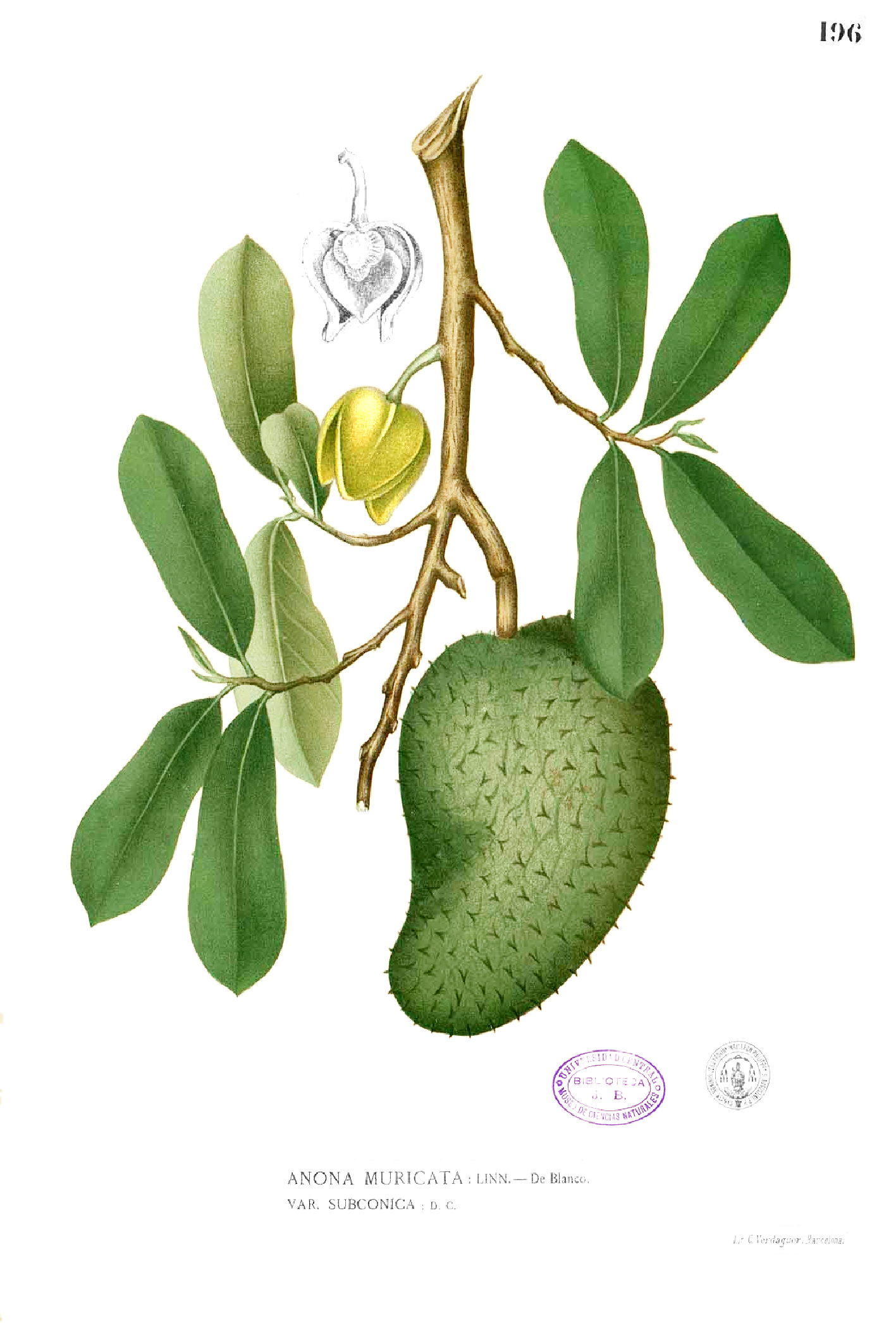
Anón (''Barrio Anón'') is one of the 31 barrios in the municipality of Ponce, Puerto Rico. Along with Marueño, Coto Laurel, Guaraguao, Quebrada Limon, Real, and San Patricio, and the coastal barrios of Canas and Capitanejo, Anón is one of the municipality's nine bordering barrios. Anón borders the municipalities of Jayuya and Juana Diaz. The name of this barrio is of native Indian origin. It was founded in 1878. Barrio Anón is one of three Ponce barrios (the others are Barrio Guaraguao and Barrio San Patricio) located on the Cordillera Central mountain range. Location Anón is a mountainous rural barrio located in the northern section of the municipality, north of the city of Ponce. Anon is located within the Cordillera Central and it is home to the highest peak elevation in Puerto Rico called Cerro de Punta. The toponymy, or origin of the name, is related to the fruit tree that belongs to the family Annonaceae. Boundaries Anón is bounded on the North by PR-143 ( ... [...More Info...] [...Related Items...] OR: [Wikipedia] [Google] [Baidu] |
River Mouth
A river mouth is where a river flows into a larger body of water, such as another river, a lake/reservoir, a bay/gulf, a sea, or an ocean. At the river mouth, sediments are often deposited due to the slowing of the current reducing the carrying capacity of the water. The water from a river can enter the receiving body in a variety of different ways. The motion of a river is influenced by the relative density of the river compared to the receiving water, the rotation of the earth, and any ambient motion in the receiving water, such as tides or seiches. If the river water has a higher density than the surface of the receiving water, the river water will plunge below the surface. The river water will then either form an underflow or an interflow within the lake. However, if the river water is lighter than the receiving water, as is typically the case when fresh river water flows into the sea, the river water will float along the surface of the receiving water as an overflow. Alon ... [...More Info...] [...Related Items...] OR: [Wikipedia] [Google] [Baidu] |
Puerto Rico
Puerto Rico (; abbreviated PR; tnq, Boriken, ''Borinquen''), officially the Commonwealth of Puerto Rico ( es, link=yes, Estado Libre Asociado de Puerto Rico, lit=Free Associated State of Puerto Rico), is a Caribbean island and Unincorporated territories of the United States, unincorporated territory of the United States. It is located in the northeast Caribbean Sea, approximately southeast of Miami, Florida, between the Dominican Republic and the United States Virgin Islands, U.S. Virgin Islands, and includes the eponymous main island and several smaller islands, such as Isla de Mona, Mona, Culebra, Puerto Rico, Culebra, and Vieques, Puerto Rico, Vieques. It has roughly 3.2 million residents, and its Capital city, capital and Municipalities of Puerto Rico, most populous city is San Juan, Puerto Rico, San Juan. Spanish language, Spanish and English language, English are the official languages of the executive branch of government, though Spanish predominates. Puerto Rico ... [...More Info...] [...Related Items...] OR: [Wikipedia] [Google] [Baidu] |
Río Cerrillos
Cerrillos River ( Spanish: Río Cerrillos) is a river in the municipality of Ponce, Puerto Rico. Río Cerrillos has its origin in barrio Anón and runs south until it feeds into Bucaná River. Río Cerrillos is commonly known by the locals as Maragüez River, because most of its course runs through Barrio Maragüez. This river is one of the 14 rivers in the municipality. The river has a discharge of 24,000 cubic feet per second, making it the second most affluent river in the municipality after Río Jacaguas. Course From its origin about 1 kilometer south of the intersection of PR-139 and PR-143, Río Cerrillos runs south for 1.8 kilometers where it is fed by Río Prieto west of PR-139. From this point on, Rio Cerrillos runs parallel to PR-139 for 2 kilometers in barrio Anón before reaching barrio Maragüez. Continuing on its southernly course for about 1.2 kilometers, Río Cerrillos is fed by Río San Patricio. Five kilometers further downstream Río Cerrillos form ... [...More Info...] [...Related Items...] OR: [Wikipedia] [Google] [Baidu] |

.jpg)

