|
Anón
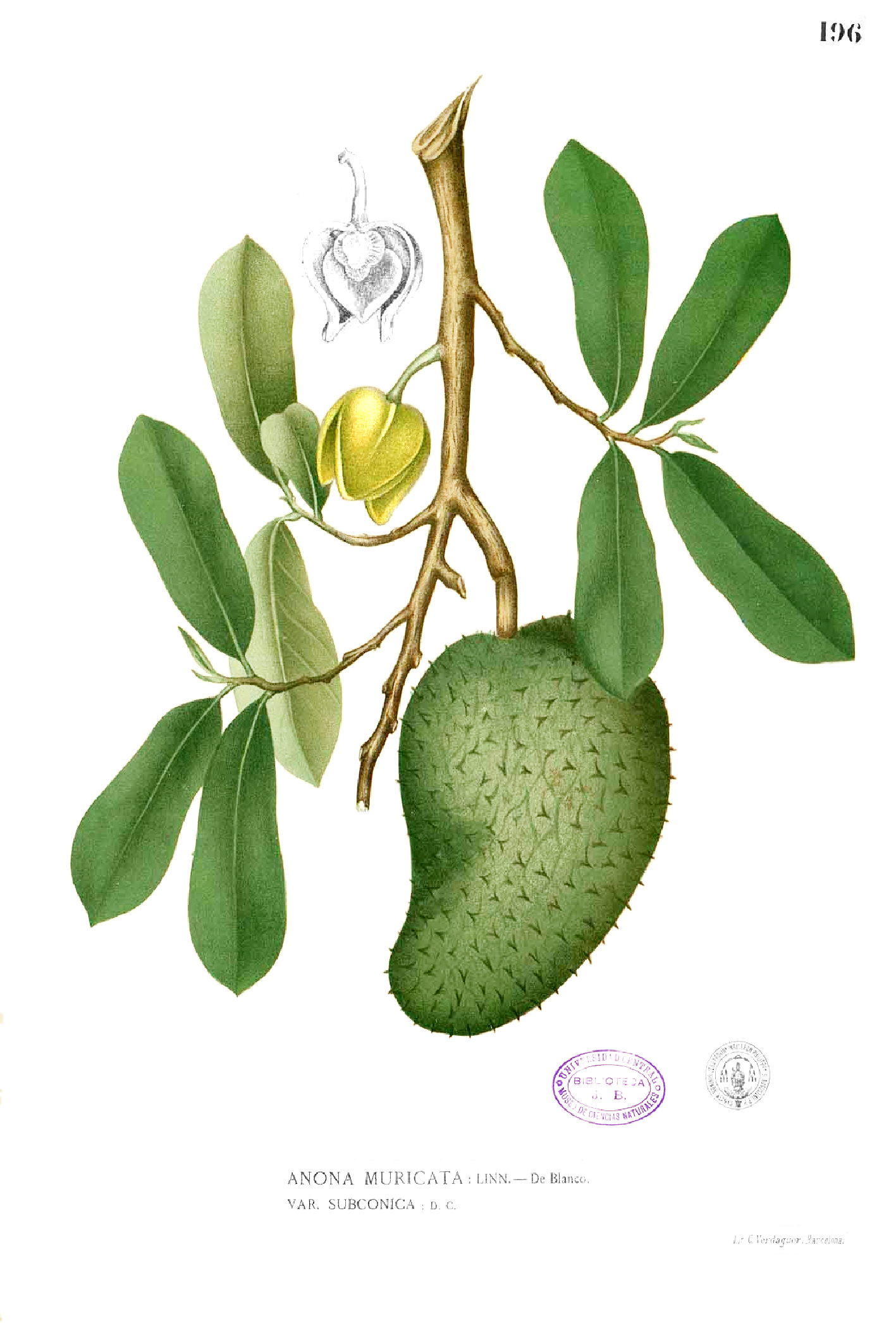
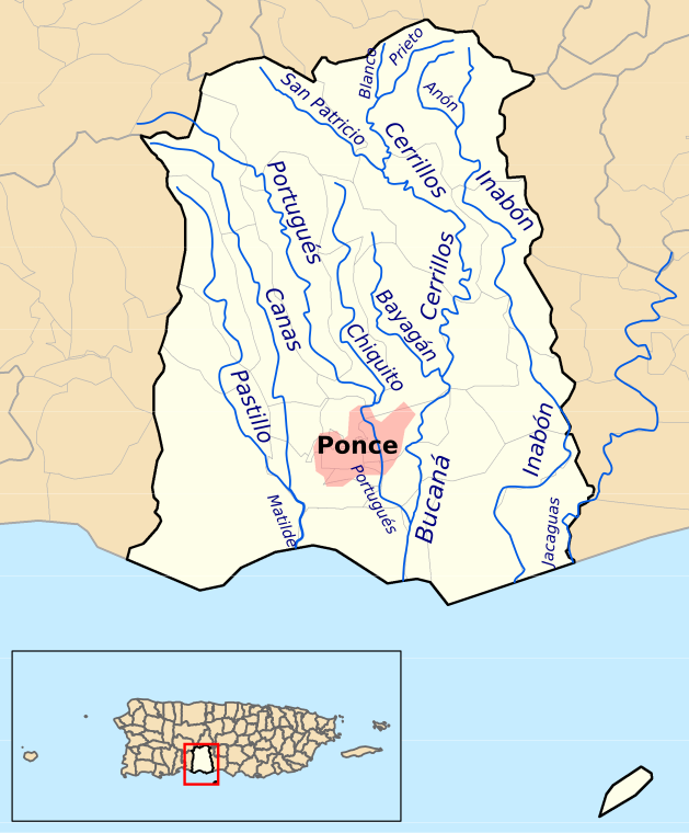
Anón (''Barrio Anón'') is one of the 31 barrios in the municipality of Ponce, Puerto Rico. Along with Marueño, Coto Laurel, Guaraguao, Quebrada Limon, Real, and San Patricio, and the coastal barrios of Canas and Capitanejo, Anón is one of the municipality's nine bordering barrios. Anón borders the municipalities of Jayuya and Juana Diaz. The name of this barrio is of native Indian origin. It was founded in 1878. Barrio Anón is one of three Ponce barrios (the others are Barrio Guaraguao and Barrio San Patricio) located on the Cordillera Central mountain range. Location Anón is a mountainous rural barrio located in the northern section of the municipality, north of the city of Ponce. Anon is located within the Cordillera Central and it is home to the highest peak elevation in Puerto Rico called Cerro de Punta. The toponymy, or origin of the name, is related to the fruit tree that belongs to the family Annonaceae. Boundaries Anón is bounded on the North by PR-143 ... [...More Info...] [...Related Items...] OR: [Wikipedia] [Google] [Baidu] |
Ponce, Puerto Rico
Ponce (, , , ) is both a city and a municipality on the southern coast of Puerto Rico. The city is the seat of the municipal government. Ponce, Puerto Rico's most populated city outside the San Juan metropolitan area, was founded on 12 August 1692Some publications/reporters have erroneously stated Ponce's date of founding as 12 December 1692 (see, for example, Jose Fernandez-Colon, The Associated Press, at "Noticias Online" on 24 January 2009, a''Noticias Puerto Rico.''Accessed 23 March 2019.) Another incorrect date sometimes found is 12 September 1692 (See, for example, Jorge L. Perez (El Nuevo Dia) and Jorge Figueroa (Ponce Municipal Historian), a''Historic Buildings and Structures in Ponce, Puerto Rico.'' at the text accompanying Drawing #20, titled "Tumba de los Bomberos". Puerto Rico Historic Buildings Drawings Society. 2019. Accessed 4 February 2019. See als''Mapa de Municipios y Barrios: Ponce, Memoria Numero 27.'' Gobierno del Estado Libre Asociado de Puerto Rico. Junta de ... [...More Info...] [...Related Items...] OR: [Wikipedia] [Google] [Baidu] |
Río Cerrillos
Cerrillos River ( Spanish: Río Cerrillos) is a river in the municipality of Ponce, Puerto Rico. Río Cerrillos has its origin in barrio Anón and runs south until it feeds into Bucaná River. Río Cerrillos is commonly known by the locals as Maragüez River, because most of its course runs through Barrio Maragüez. This river is one of the 14 rivers in the municipality. The river has a discharge of 24,000 cubic feet per second, making it the second most affluent river in the municipality after Río Jacaguas. Course From its origin about 1 kilometer south of the intersection of PR-139 and PR-143, Río Cerrillos runs south for 1.8 kilometers where it is fed by Río Prieto west of PR-139. From this point on, Rio Cerrillos runs parallel to PR-139 for 2 kilometers in barrio Anón before reaching barrio Maragüez. Continuing on its southernly course for about 1.2 kilometers, Río Cerrillos is fed by Río San Patricio. Five kilometers further downstream Río Cerrillos form ... [...More Info...] [...Related Items...] OR: [Wikipedia] [Google] [Baidu] |
Cordillera Central (Puerto Rico)
Cordillera Central ( English: Central Mountain Range), is the main mountain range in Puerto Rico. The range crosses the island from west to east and divides it into its northern and southern coastal plains. The Cordillera Central runs eastward from the municipality of Maricao in the west to Aibonito in the central eastern region, and on to the Caribbean in the southeast through the Sierra de Cayey. The Central Mountain Range consists of the ''Cordillera Central proper'' and numerous subranges (such as the Sierra de Cayey), foothills and ridges that extend throughout the island. Cerro de Punta is both the highest peak of the Cordillera Central and the highest point in Puerto Rico. The Sierra de Luquillo, where El Yunque is located, is sometimes included as a subrange or eastward extension of the Cordillera Central. History The region of the Cordillera Central has been inhabited since the pre-Hispanic era. During the Spanish colonization of Puerto Rico, the Cordillera Centra ... [...More Info...] [...Related Items...] OR: [Wikipedia] [Google] [Baidu] |
Barrio San Patricio
San Patricio is one of the 31 barrios of the municipality of Ponce, Puerto Rico. It is one of the municipality's nine bordering barrios, along with Anón, Coto Laurel, Guaraguao, Quebrada Limón, Real, and Marueño, and the coastal barrios of Canas and Capitanejo. Its northern edge borders the municipalities of Utuado and Jayuya. It was founded in 1878. Barrio San Patricio is one of three Ponce barrios (the others are Barrio Guaraguao and Barrio Anón) located on the Cordillera Central mountain range. Location San Patricio is a rural and mountainous barrio located in the northern section of the municipality, north of downtown Ponce, at latitude 18.133586 N, and longitude -66.636444 W.City Melt Retrieved, February 20, 2010. The |
Real (Ponce)
Real is one of the 31 barrios of the municipality of Ponce, Puerto Rico. Along with Anón, Coto Laurel, Guaraguao, Quebrada Limón, Marueño, and San Patricio, and the coastal barrios of Canas and Capitanejo, Real is one of the municipality's nine bordering barrios. It borders the municipality of Juana Diaz. It was founded in 1878. Location Real is a rural barrio located in the eastern section of the municipality, northeast of the city of Ponce. The toponymy, or origin of the name, is a proper noun related to the "Criadero Real", a barn and slaughterhouse dedicated to the farming of slaughter of cattle. Boundaries Real is bounded on the North by the hills north of La Compuesta street and Las Mesas Road, on the South by Río Inabon, on the West by the hills west of Rio Inabon, Rio Inabon itself (in the area of just north of Lago Numero 1), and the western and southern shores of Lago Numero 1, the eastern shore of Lago Numero 2, and the northeastern shore of Lago Numero 5, ... [...More Info...] [...Related Items...] OR: [Wikipedia] [Google] [Baidu] |
Barrio Guaraguao
Guaraguao (''Barrio Guaraguao'') is one of the 31 barrios in the municipality of Ponce, Puerto Rico. Along with Anón, Coto Laurel, Marueño, Quebrada Limón, Real, and San Patricio, and the coastal barrios of Canas and Capitanejo, Guaraguao is one of the municipality's nine bordering barrios. It borders the municipalities of Adjuntas and Peñuelas. The name of this barrio is of native Taino Indian origin. It was created in 1878. Barrio Guaraguao is one of three Ponce barrios (the others are Barrio Anón and Barrio San Patricio) located on the Cordillera Central mountain range. Location Guaraguao is a mountainous rural barrio located in the northwestern section of the municipality, northwest of the city of Ponce. Its location makes it susceptible to heavy rains, landslides, and road closings. The toponymy, or origin of the name, is related to the guaraguao tree, ''Guarea trichilioides'', in the ''Guarea ramiflora'' family, a tree that grows to heights between 20 a ... [...More Info...] [...Related Items...] OR: [Wikipedia] [Google] [Baidu] |
Guaraguao
Guaraguao (''Barrio Guaraguao'') is one of the 31 barrios in the municipality of Ponce, Puerto Rico. Along with Anón (Ponce), Anón, Coto Laurel, Marueño, Quebrada Limón, Real (Ponce), Real, and San Patricio (Ponce), San Patricio, and the coastal barrios of Canas (Ponce), Canas and Capitanejo (Ponce), Capitanejo, Guaraguao is one of the municipality's nine bordering barrios. It borders the municipalities of Adjuntas and Peñuelas, Puerto Rico, Peñuelas. The name of this barrio is of native Taino Indian origin. It was created in 1878. Barrio Guaraguao is one of three Ponce barrios (the others are Barrio Anón and Barrio San Patricio) located on the Cordillera Central (Puerto Rico), Cordillera Central mountain range. Location Guaraguao is a mountainous rural barrio located in the northwestern section of the municipality, northwest of the city of Ponce. Its location makes it susceptible to heavy rains, landslides, and road closings. The toponymy, or origin of the name, is rela ... [...More Info...] [...Related Items...] OR: [Wikipedia] [Google] [Baidu] |
Coto Laurel
Coto Laurel (''Barrio Coto Laurel'') is one of the 31 barrios of the municipality of Ponce, Puerto Rico. Along with Anón, Marueño, Guaraguao, Quebrada Limon, Real, and San Patricio, and the coastal barrios of Canas and Capitanejo, Coto Laurel is one of the municipality's nine bordering barrios. It borders the municipality of Juana Diaz. It was founded in 1831. Location Coto Laurel is a suburban barrio located in the southeastern section of the municipality, east of the traditional center of the city, Plaza Las Delicias. The toponymy, or origin of the name, is a proper noun related to the word ''coto'' which in Spanish denotes tracts of land ceded to citizens in exchange for services to the king and where there were laurel trees. Boundaries It is bounded on the north by Río Inabón and Lake Number 5, on the south by Esperanza Street, on the west by PR-10 (roughly), and on the east by Río Inabón. In terms of barrio-to-barrio boundaries, Coto Laurel is bounded in the ... [...More Info...] [...Related Items...] OR: [Wikipedia] [Google] [Baidu] |
Marueño
Marueño (''Barrio Marueño'') is one of the 31 barrios of the municipality of Ponce, Puerto Rico. Along with Anón, Coto Laurel, Guaraguao, Quebrada Limón, Real, and San Patricio, and the coastal barrios of Canas and Capitanejo, Marueño is one of the municipality's nine bordering barrios. Marueño borders the municipality of Peñuelas. The name of this barrio is of native Indian origin. It was created in 1831. Location Marueño is located in the northwestern section of the municipality, northwest of the city of Ponce. It is a mostly mountainous barrio, as it sits on the transition zone between the coastal plains and the rugged mountains of the Cordillera Central. Its highest point is at Monte Marueño (''Mount Marueño''), which stands at 640 meters (2,100 feet) above sea level. The Pastillo River divides the barrio into two sections of fairly equal size. The river originates high up in the mountains of barrio Guaraguao. History Origin of the name The name of the ba ... [...More Info...] [...Related Items...] OR: [Wikipedia] [Google] [Baidu] |
Canas (Ponce)
Canas is one of the 31 barrios in the municipality of Ponce, Puerto Rico. Along with Anón, Coto Laurel, Guaraguao, Quebrada Limón, Real, San Patricio, and Marueño, and the coastal barrio of Capitanejo, Canas is one of the municipality's nine bordering barrios. It borders the municipality of Peñuelas. Along with Playa, Bucana, Vayas and Capitanejo, Canas is also one of Ponce's five coastal barrios. It was founded in 1831. Location Canas is a suburban and partly mountainous barrio located in the southern section of the municipality, west of the city of Ponce, at latitude 18.000283N, and longitude -66.658800 W.City Melt Retrieved, February 22, 2010. Name [...More Info...] [...Related Items...] OR: [Wikipedia] [Google] [Baidu] |


.jpg)
.jpg)
.jpg)
