|
Porvoo Highway
Finnish national road 7 ( fi, Valtatie 7; sv, Riksväg 7) is a highway in Finland. It runs from Erottaja in Helsinki to the Russian frontier at the Vaalimaa border crossing point in Virolahti. The road is long. The road is also European route E18 and it is a part of TERN. Route The route of the road is Helsinki – Vantaa – Porvoo – Loviisa – Kotka – Hamina – Vaalimaa (Russian border). With the section of motorway between Loviisa and Kotka opened to traffic in September 2014, the route from Helsinki to Hamina is now a continuous motorway. After completion of the motorway section bypassing the town of Hamina, due in late 2014, of the highway's total length of will be motorway. There is a plan to extend the motorway from its current endpoint in Lelu, Hamina to Vaalimaa by 2018, finalizing the motorway link between Helsinki and the Russian border; construction is due to begin in late 2015. Images Image:Motorway 4 in Helsinki Finland.jpg, National road 7 in Viikki, He ... [...More Info...] [...Related Items...] OR: [Wikipedia] [Google] [Baidu] |
Helsinki
Helsinki ( or ; ; sv, Helsingfors, ) is the Capital city, capital, primate city, primate, and List of cities and towns in Finland, most populous city of Finland. Located on the shore of the Gulf of Finland, it is the seat of the region of Uusimaa in southern Finland, and has a population of . The Helsinki urban area, city's urban area has a population of , making it by far the List of urban areas in Finland by population, most populous urban area in Finland as well as the country's most important center for politics, education, finance, culture, and research; while Tampere in the Pirkanmaa region, located to the north from Helsinki, is the second largest urban area in Finland. Helsinki is located north of Tallinn, Estonia, east of Stockholm, Sweden, and west of Saint Petersburg, Russia. It has History of Helsinki, close historical ties with these three cities. Together with the cities of Espoo, Vantaa, and Kauniainen (and surrounding commuter towns, including the eastern ... [...More Info...] [...Related Items...] OR: [Wikipedia] [Google] [Baidu] |
European Route E18
European route E18 runs from Craigavon in Northern Ireland to Saint Petersburg in Russia, passing through Scotland, England, Norway, Sweden and Finland. It is about in length. Although the designation implies the possibility of a through journey, this is no longer practical as there are no direct car ferry crossings between the United Kingdom and Norway. United Kingdom The route starts in Northern Ireland and runs from Craigavon ( M1) – Belfast ( M2, A8) – Larne, then to Scotland: Stranraer, Dumfries and Galloway ( A75) – Gretna – then England via the ( M6) – Carlisle ( A69) to Newcastle. As is normal for European routes in the United Kingdom, it is not signposted as such. Northern Ireland *: Craigavon - Belfast (Start of multiplex with at Lisburn) *: Belfast *: Belfast - (Multiplex with ) *: - *: - Larne (End of multiplex with ) North Channel *: Larne - Cairnryan Great Britain *: Stranraer - *: - ''Anglo-Scottish border'' (Start of multiplex w ... [...More Info...] [...Related Items...] OR: [Wikipedia] [Google] [Baidu] |
Pyhtää
Pyhtää ( sv, Pyttis) is a municipality of Finland. It is located in the Kymenlaakso region, west of the city of Kotka. Overview The municipality has a population of () and covers an area of of which is water. The population density is . The medieval church (as opposed to the municipality) is situated in the village of Itäkirkonkylä ("East Church Village"). During the Reformation, the rather beautiful and moving pictures on the walls were whitewashed over. Some years ago, they were rediscovered and the whitewash removed. The village lies just to the East of the westernmost tributary of the Kymi River and was at one time on the border between Russia and Sweden established by the Treaty of Åbo in 1743. Indeed, on the Western side of the river is a municipality called Ruotsinpyhtää ("Swedish Pyhtää") known as in Swedish. The municipality is bilingual with speaking Finnish, Swedish and other languages as their first language. In the 1980s, salmon soup, salted herri ... [...More Info...] [...Related Items...] OR: [Wikipedia] [Google] [Baidu] |
Sipoo
Sipoo (; sv, Sibbo) is a municipality of Finland. It is part of the Helsinki metropolitan area. The municipality has a population of () and covers an area of of which is water. The population density is . The administrative center of the municipality is Nikkilä ( sv, Nickby),Uusi Nikkilä – Uusi Kaupunki (in Finnish) which is located northeast of the center of Helsinki. Another significant urban area is , located in the southern part of the municipality. The coat of arms of the municipality refers to the origin story of the settlement, according to which the ancestors of Sipoo are said to have arrived in the region on a |
Viikki
Viikki ( sv, Vik) is a neighbourhood of about 15,000 inhabitants in Helsinki, Finland. It is located at the bottom of ''Vanhankaupunginlahti'' bay, some 7–10 km from the city centre. The district hosts the Viikki Campus with four of the faculties of the University of Helsinki (biosciences, pharmacy, veterinary medicine, and agriculture and forestry) as well as other university units such as research centres, science library and teacher training school. Viikki is known for its natural environment. The conservation area of ''Vanhankaupunginlahti'' is an important place of nesting and migration for birds. Large fields and farmlands are cultivated by a teaching farm that is part of the university's agricultural faculty. Southernmost part of the Latokartano residential zone is known as an "ecological housing" area. Many apartment buildings there have, for instance, experimental solar and wind energy systems installed. Viikki is divided into the sub-areas of ''Viikki science p ... [...More Info...] [...Related Items...] OR: [Wikipedia] [Google] [Baidu] |
Motorway
A controlled-access highway is a type of highway that has been designed for high-speed vehicular traffic, with all traffic flow—ingress and egress—regulated. Common English terms are freeway, motorway and expressway. Other similar terms include '' throughway'' and '' parkway''. Some of these may be limited-access highways, although this term can also refer to a class of highways with somewhat less isolation from other traffic. In countries following the Vienna convention, the motorway qualification implies that walking and parking are forbidden. A fully controlled-access highway provides an unhindered flow of traffic, with no traffic signals, intersections or property access. They are free of any at-grade crossings with other roads, railways, or pedestrian paths, which are instead carried by overpasses and underpasses. Entrances and exits to the highway are provided at interchanges by slip roads (ramps), which allow for speed changes between the highway and arteri ... [...More Info...] [...Related Items...] OR: [Wikipedia] [Google] [Baidu] |
Loviisa
Loviisa (; sv, Lovisa ; formerly Degerby) is a municipality and town of inhabitants () on the southern coast of Finland. It is located from Helsinki and from Porvoo. About 43 per cent of the population is Swedish-speaking. The municipality covers an area of of which is water. The population density is . The neighboring municipalities of Liljendal, Pernå and Ruotsinpyhtää were consolidated with Loviisa on 1 January 2010. Loviisa was founded in 1745, as a border fortress against Russia. Most of the fortifications have been preserved. Loviisa was originally called ''Degerby'', but king Adolf Frederick of Sweden renamed the city after his spouse Lovisa Ulrika after visiting the town in 1752. Loviisa is the site of two of Finland's nuclear reactors, two VVER units each of 488 MWe, at the Loviisa Nuclear Power Plant. The other operating reactors are at the Olkiluoto Nuclear Power Plant. History 18th century The town of Degerby was founded on the grounds of the ... [...More Info...] [...Related Items...] OR: [Wikipedia] [Google] [Baidu] |
Vantaa
Vantaa (; sv, Vanda, ) is a city and Municipalities of Finland, municipality in Finland. It is part of the inner core of the Greater Helsinki, Finnish Capital Region along with Helsinki, Espoo, and Kauniainen. With a population of (), Vantaa is the fourth most populated city in Finland after Helsinki, Espoo and Tampere. Its administrative center is the Tikkurila Districts of Vantaa, district. Vantaa is bordered by Helsinki, the Finnish capital, to the south; Espoo to the southwest; Nurmijärvi to the northwest; Kerava and Tuusula to the north; and Sipoo to the east. The city encompasses , of which is water. Vantaa's significant attractions include the Vantaa River (''Vantaanjoki''), which flows through the city and flows into the Gulf of Finland. The largest airport in Finland, and the main airport and airline hub of Greater Helsinki, the Helsinki Airport, is located in Vantaa. Companies with headquarters in Vantaa include Finnair, Finavia, R-kioski, Tikkurila Oyj, Veikkaus, V ... [...More Info...] [...Related Items...] OR: [Wikipedia] [Google] [Baidu] |
Vaalimaa
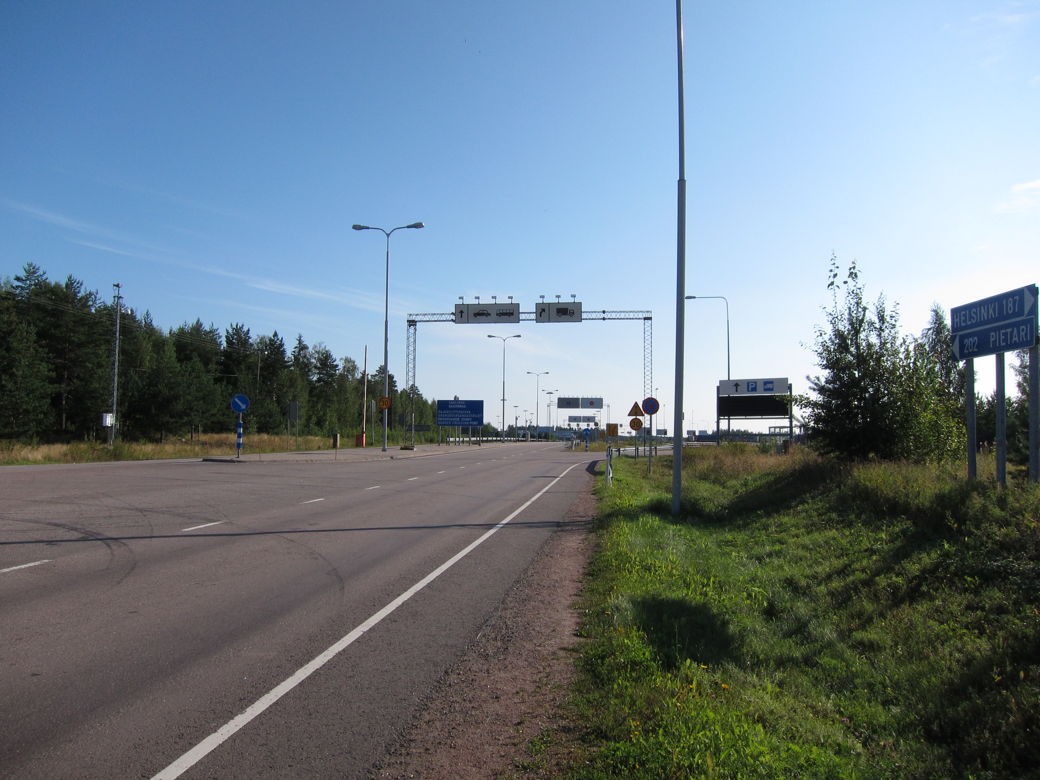
Vaalimaa () is a village in the Virolahti municipality and a border crossing point between Finland and Russia. The border crossing station was opened in 1958 as a first road traffic crossing point between Finland and Soviet Union. With over 2 million annual crossings, it is the busiest border crossing in the Finnish-Russian border, which is also the border of the European Union and Russia. European route E18 passes through Vaalimaa. The border crossing is notorious for its long queues. Around Christmas 2007 there could even be a 50 to 60 kilometer line of trucks. The functioning of the border crossing is affected by the actions of the Russian Customs, Russian Border Control and some other Russian bureaus in Torfyanovka. Trucks and passenger cars are handled in different lines. In 2004 it became possible to cross the border by bicycle. Pedestrian crossing is still forbidden. ;Distances from Vaalimaa: *Helsinki: *Kotka: *Saint Petersburg: *Vyborg Vyborg (; rus, Вы ... [...More Info...] [...Related Items...] OR: [Wikipedia] [Google] [Baidu] |
Virolahti
Virolahti (; sv, Vederlax) is the southeasternmost municipality of Finland on the border of Russia. It is located in the Kymenlaakso region. The municipality has a population of () and covers an area of , of which is water. The population density is . The municipality is unilingually Finnish. The Vaalimaa border crossing, which connects the municipality with Russia, is located in Virolahti. History Virolahti is named after Estonians from Virumaa who traded around the nearby bay, which is also called ''Virolahti''. The first mention of Virolahti dates to 1336. It is mentioned as an independent parish in 1370. A small part of Virolahti was ceded by Sweden to Russia in the Treaty of Uusikaupunki in 1721. The border was located slightly further west than the modern Finnish-Russian border. In the treaty of Turku of 1743, the rest of Virolahti was ceded to Russia. The northern part of Virolahti became the Miehikkälä parish in 1863. Before World War I the Russian Emperor Nicho ... [...More Info...] [...Related Items...] OR: [Wikipedia] [Google] [Baidu] |
Russia
Russia (, , ), or the Russian Federation, is a List of transcontinental countries, transcontinental country spanning Eastern Europe and North Asia, Northern Asia. It is the List of countries and dependencies by area, largest country in the world, with its internationally recognised territory covering , and encompassing one-eighth of Earth's inhabitable landmass. Russia extends across Time in Russia, eleven time zones and shares Borders of Russia, land boundaries with fourteen countries, more than List of countries and territories by land borders, any other country but China. It is the List of countries and dependencies by population, world's ninth-most populous country and List of European countries by population, Europe's most populous country, with a population of 146 million people. The country's capital and List of cities and towns in Russia by population, largest city is Moscow, the List of European cities by population within city limits, largest city entirely within E ... [...More Info...] [...Related Items...] OR: [Wikipedia] [Google] [Baidu] |


