|
Poliske Raion
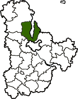
Poliske Raion () was a raion (district) in Kyiv Oblast of Ukraine. Its administrative center was the urban-type settlement of Krasiatychi. The raion was abolished on 18 July 2020 as part of the administrative reform of Ukraine, which reduced the number of raions of Kyiv Oblast to seven. The area of Poliske Raion was merged into Vyshhorod Raion. The last estimate of the raion population was . At the time of disestablishment, the raion consisted of one hromada, Poliske settlement hromada with the administration in Krasiatychi. The raion was invaded by Russia on 24th February 2022. See also *Poliske * Vilcha *Chernobyl Exclusion Zone The Chernobyl Nuclear Power Plant Zone of Alienation, Belarusian: Хона адчужэння Чарнобыльскай АЭС, ''Zona adčužennia Čarnobyĺskaj AES'', russian: Зона отчуждения Чернобыльской АЭС, ... References External links {{Authority control Former raions of Kyiv Oblast Chernobyl Ex ... [...More Info...] [...Related Items...] OR: [Wikipedia] [Google] [Baidu] |
Raions Of Ukraine
Raions of Ukraine (often translated as "districts"; Ukrainian: ра́йон, tr. ''raion''; plural: райо́ни, tr. ''raiony'') are the second level of administrative division in Ukraine, below the oblast. Raions were created in a 1922 administrative reform of the Soviet Union, to which Ukraine, as the Ukrainian Soviet Socialist Republic, belonged. On 17 July 2020, the Verkhovna Rada (Ukraine's parliament) approved an administrative reform to merge most of the 490 raions, along with the " cities of regional significance", which were previously outside the raions, into just 136 reformed raions. Most tasks of the raions (education, healthcare, sport facilities, culture, and social welfare) were taken over by new hromadas, the subdivisions of raions. [...More Info...] [...Related Items...] OR: [Wikipedia] [Google] [Baidu] |
Ukraine
Ukraine ( uk, Україна, Ukraïna, ) is a country in Eastern Europe. It is the second-largest European country after Russia, which it borders to the east and northeast. Ukraine covers approximately . Prior to the ongoing Russian invasion, it was the eighth-most populous country in Europe, with a population of around 41 million people. It is also bordered by Belarus to the north; by Poland, Slovakia, and Hungary to the west; and by Romania and Moldova to the southwest; with a coastline along the Black Sea and the Sea of Azov to the south and southeast. Kyiv is the nation's capital and largest city. Ukraine's state language is Ukrainian; Russian is also widely spoken, especially in the east and south. During the Middle Ages, Ukraine was the site of early Slavic expansion and the area later became a key centre of East Slavic culture under the state of Kievan Rus', which emerged in the 9th century. The state eventually disintegrated into rival regional powers and ... [...More Info...] [...Related Items...] OR: [Wikipedia] [Google] [Baidu] |
Former Raions Of Kyiv Oblast
A former is an object, such as a template, gauge or cutting die, which is used to form something such as a boat's hull. Typically, a former gives shape to a structure that may have complex curvature. A former may become an integral part of the finished structure, as in an aircraft fuselage, or it may be removable, being using in the construction process and then discarded or re-used. Aircraft formers Formers are used in the construction of aircraft fuselage, of which a typical fuselage has a series from the nose to the empennage, typically perpendicular to the longitudinal axis of the aircraft. The primary purpose of formers is to establish the shape of the fuselage and reduce the column length of stringers to prevent instability. Formers are typically attached to longerons, which support the skin of the aircraft. The "former-and-longeron" technique (also called stations and stringers) was adopted from boat construction, and was typical of light aircraft built until the a ... [...More Info...] [...Related Items...] OR: [Wikipedia] [Google] [Baidu] |
Chernobyl Exclusion Zone
The Chernobyl Nuclear Power Plant Zone of Alienation, Belarusian: Хона адчужэння Чарнобыльскай АЭС, ''Zona adčužennia Čarnobyĺskaj AES'', russian: Зона отчуждения Чернобыльской АЭС, translit=Zona otchuzhdeniya Chernobyl'skoy AES is an officially designated exclusion zone around the site of the Chernobyl nuclear reactor disaster. It is also commonly known as the Chernobyl Exclusion Zone, the 30-Kilometre Zone, or The Zone., Belarusian: Чарнобыльская зона, romanized: ''Charnobyl'skaya zona'', russian: Чернобыльская зона, translit=Chernobyl'skaya zona). Established by the Soviet Armed Forces soon after the 1986 disaster, it initially existed as an area of radius from the Chernobyl Nuclear Power Plant designated for evacuation and placed under military control. Its borders have since been altered to cover a larger area of Ukraine. The Chernobyl Exclusion Zone borders a separately ad ... [...More Info...] [...Related Items...] OR: [Wikipedia] [Google] [Baidu] |
Vilcha, Kyiv Oblast
Vilcha ( uk, Вільча, russian: Вильча) is a Ukrainian abandoned settlement and former urban-type settlement in the Chernobyl Exclusion Zone, part of Vyshhorod Raion, Kyiv Oblast. History The settlement was founded in 1926 on the site of a settlement named Oleksiivka ( uk, Олексіївка). After the 1986 accident at the Chernobyl Nuclear Power Plant, 45 km far from Vilcha, the settlement was not included into the "Exclusion Zone" before 1993. During 1993 to 1996, most of the 2,000 residents moved to Kharkiv Oblast, where they founded a new Vilcha (709 km away), a few kilometres south of the town of Vovchansk. The ghost town, today one of the checkpoints to the Exclusion Zone, [...More Info...] [...Related Items...] OR: [Wikipedia] [Google] [Baidu] |
Poliske
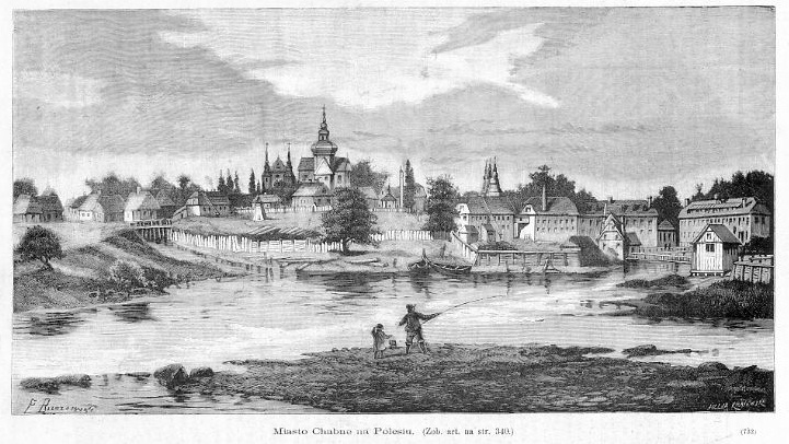
Poliske ( uk, Поліське) or Polesskoye (russian: Полесское) is an abandoned settlement and former urban-type settlement in the Chernobyl Exclusion Zone, part of Kyiv Oblast, Ukraine. It is located on the Uzh River and was an administrative center of Poliske Raion (district). However, later the town was taken out of a registry as it was completely depopulated being located in the Zone of alienation. Currently around 20 people live there, so called ''samosely'' ("self-settlers"). History Overview Originally called Khabnoye or Khabne (russian: Хабное, uk, Хабне), it was renamed Kaganovichi Pervye or Kahanovychi Pershi (russian: Кагановичи Первые, uk, Кагановичі Перші) in 1934, and Poliske in 1957. Founded in the 15th century, it was the home of the Polish family Horwatt from 1850 to 1918. In the 19th century, this small city was known for its weavers and its textile industry. In 1890, 80% of the population was Jewish. ... [...More Info...] [...Related Items...] OR: [Wikipedia] [Google] [Baidu] |
Hromada
A hromada ( uk, територіальна громада, lit=territorial community, translit=terytorialna hromada) is a basic unit of administrative division in Ukraine, similar to a municipality. It was established by the Government of Ukraine on 12 June 2020. Similar terms exist in Poland ('' gromada'') and in Belarus ('' hramada''). The literal translation of this term is " community", similarly to the terms used in western European states, such as Germany (''Gemeinde''), France ('' commune'') and Italy ('' comune''). History In history of Ukraine and Belarus, hromadas appeared first as village communities, which gathered their meetings for discussing and resolving current issues. In the 19th century, there were a number of political organizations of the same name, particularly in Belarus. Prior to 2020, the basic units of administrative division in Ukraine were rural councils, settlement councils and city councils, which were often referred to by the generic term ... [...More Info...] [...Related Items...] OR: [Wikipedia] [Google] [Baidu] |
Vyshhorod Raion
Vyshhorod Raion () is a raion (district) in Kyiv Oblast of Ukraine. Its administrative center is the city of Vyshhorod. It has a population of On 18 July 2020, as part of the administrative reform of Ukraine, the number of raions of Kyiv Oblast was reduced to seven, and the area of Vyshhorod Raion was significantly expanded. Two abolished raions, Ivankiv Raion, Ivankiv and Poliske Raions, as well as the cities of Slavutych and Vyshhorod, which were previously incorporated as City of regional significance (Ukraine), cities of oblast significance and did not belong to the raion, were merged into Vyshhorod Raion. The January 2020 estimate of the raion population was Description The raion was created on April 12, 1973, from territories of Ivankiv Raion and Kyiv-Sviatoshyn Raion. The raion is located around the Kyiv Reservoir. Its administrative center is at the southern edge of the territory. Before 2020, the raion bordered four other raions of Kyiv Oblast and two other regions of ... [...More Info...] [...Related Items...] OR: [Wikipedia] [Google] [Baidu] |
Capital (political)
A capital city or capital is the municipality holding primary status in a country, state, province, department, or other subnational entity, usually as its seat of the government. A capital is typically a city that physically encompasses the government's offices and meeting places; the status as capital is often designated by its law or constitution. In some jurisdictions, including several countries, different branches of government are in different settlements. In some cases, a distinction is made between the official (constitutional) capital and the seat of government, which is in another place. English-language news media often use the name of the capital city as an alternative name for the government of the country of which it is the capital, as a form of metonymy. For example, "relations between Washington and London" refer to " relations between the United States and the United Kingdom". Terminology and etymology The word ''capital'' derives from the Latin word ... [...More Info...] [...Related Items...] OR: [Wikipedia] [Google] [Baidu] |
District
A district is a type of administrative division that, in some countries, is managed by the local government. Across the world, areas known as "districts" vary greatly in size, spanning regions or county, counties, several municipality, municipalities, subdivisions of municipalities, school district, or political district. By country/region Afghanistan In Afghanistan, a district (Persian language, Persian ps, ولسوالۍ ) is a subdivision of a province. There are almost 400 districts in the country. Australia Electoral districts are used in state elections. Districts were also used in several states as cadastral units for land titles. Some were used as squatting districts. Cadastral divisions of New South Wales, New South Wales had several different types of districts used in the 21st century. Austria In Austria, the word is used with different meanings in three different contexts: * Some of the tasks of the administrative branch of the national and regional governme ... [...More Info...] [...Related Items...] OR: [Wikipedia] [Google] [Baidu] |
Oblasts Of Ukraine
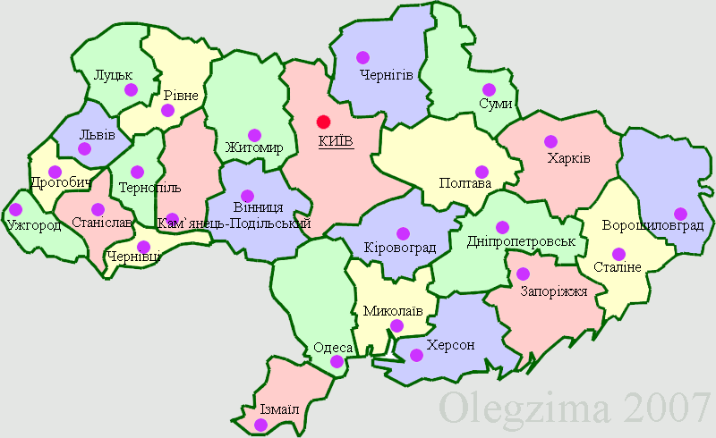
An oblast ( uk, о́бласть; ) in Ukraine, often called a region or province, is the main type of first-level administrative division of the country. Ukraine's territory is divided into 24 oblasts, as well as one autonomous republic, Crimea, and two cities with special status, Kyiv and Sevastopol. Ukraine is a unitary state, thus the oblasts do not have much legal scope of competence other than that which is established in the Ukrainian Constitution and by law. Articles 140–146 of Chapter XI of the constitution deal directly with local authorities and their competency. Oblasts are subdivided into raions (districts), each oblast having from 3 to 10 raions following the July 2020 reform. General characteristics In Ukraine, the term '' oblast'' denotes a primary administrative division. Under the Russian Empire and into the 1920s, Ukraine was divided between several governorates. The term ''oblast'' was introduced in 1932 by Soviet authorities when the Ukrainian SSR ... [...More Info...] [...Related Items...] OR: [Wikipedia] [Google] [Baidu] |


