|
Vyshhorod Raion
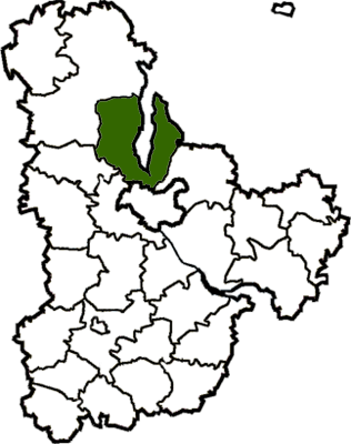
Vyshhorod Raion () is a raion (district) in Kyiv Oblast of Ukraine. Its administrative center is the city of Vyshhorod. It has a population of On 18 July 2020, as part of the administrative reform of Ukraine, the number of raions of Kyiv Oblast was reduced to seven, and the area of Vyshhorod Raion was significantly expanded. Two abolished raions, Ivankiv and Poliske Raions, as well as the cities of Slavutych and Vyshhorod, which were previously incorporated as cities of oblast significance and did not belong to the raion, were merged into Vyshhorod Raion. The January 2020 estimate of the raion population was Description The raion was created on April 12, 1973, from territories of Ivankiv Raion and Kyiv-Sviatoshyn Raion. The raion is located around the Kyiv Reservoir. Its administrative center is at the southern edge of the territory. Before 2020, the raion bordered four other raions of Kyiv Oblast and two other regions of Ukraine – the city of Kyiv and Chernihiv Oblast. To ... [...More Info...] [...Related Items...] OR: [Wikipedia] [Google] [Baidu] |
Ivankiv Raion
Ivankiv Raion () was a raion (district) in Kyiv Oblast of Ukraine. Its administrative center was the urban-type settlement of Ivankiv. The raion was abolished on 18 July 2020 as part of the administrative reform of Ukraine, which reduced the number of raions of Kyiv Oblast to seven. With that change, the area of Ivankiv Raion was merged into Vyshhorod Raion. The last estimate of the raion population was . Overview The raion expanded in 1986 after the disestablishment of the Chernobyl Raion due to the Chernobyl disaster. Henceforth Ivankiv Raion administered the former territory of the depopulated region that is majorly part of the zone of alienation and supervised by the State Emergency Service of Ukraine. Subdivisions At the time of disestablishment, the raion consisted of one hromada, Ivankiv settlement hromada with the administration in Ivankiv. Gallery See also *Pripyat *Chernobyl *Hornostaipil *Dytiatky Dytiatky ( uk, Дитятки, russian: Дитятки, also spell ... [...More Info...] [...Related Items...] OR: [Wikipedia] [Google] [Baidu] |
Raions Of Ukraine
Raions of Ukraine (often translated as "districts"; Ukrainian: ра́йон, tr. ''raion''; plural: райо́ни, tr. ''raiony'') are the second level of administrative division in Ukraine, below the oblast. Raions were created in a 1922 administrative reform of the Soviet Union, to which Ukraine, as the Ukrainian Soviet Socialist Republic, belonged. On 17 July 2020, the Verkhovna Rada (Ukraine's parliament) approved an administrative reform to merge most of the 490 raions, along with the "cities of regional significance", which were previously outside the raions, into just 136 reformed raions. Most tasks of the raions (education, healthcare, sport facilities, culture, and social welfare) were taken over by new hromadas, the subdivisions of raions. [...More Info...] [...Related Items...] OR: [Wikipedia] [Google] [Baidu] |
City Of Regional Significance (Ukraine)
City of regional significance ( uk, місто обласного значення, ''misto oblasnoho znachennia'') in Ukraine was a type of second-level administrative division or municipality, the other type being raions (districts). In the first-level division of oblasts, they were referred to as ''cities of oblast significance''; in the first-level autonomous republic of Crimea, they were ''cities of republican significance''. The designation was created with the introduction of oblasts in 1932. It was abolished in a 2020 reform that merged raions together and integrated the city municipalities into them. Such city municipality was complex and usually combined the city proper and adjacent populated places. The city of regional (oblast) significance was governed by a city council known as ''mis'krada'', which was chaired by a mayor. There were instances where a municipality might have included only the city alone (city proper), while in others instances a municipality might ha ... [...More Info...] [...Related Items...] OR: [Wikipedia] [Google] [Baidu] |
Novi Petrivtsi
Novi Petrivtsi ( uk, Нові Петрівці, Russian language, Russian: Новые Петровцы) is a large village#Ukraine, village located just north of Kyiv, in Vyshhorod Raion, Kyiv Oblast, Ukraine. Today it is the administrative seat of the Petrivtsi rural hromada, one of the hromadas of Ukraine. Just outside the village lies the Mezhyhirya Residence, the former private residence of ousted President of Ukraine, Ukrainian President Viktor Yanukovych and epicenter of a corruption scandal during his time as prime minister.Янукович заявляет, что он - законный вл� ... [...More Info...] [...Related Items...] OR: [Wikipedia] [Google] [Baidu] |
Mezhyhirya Residence
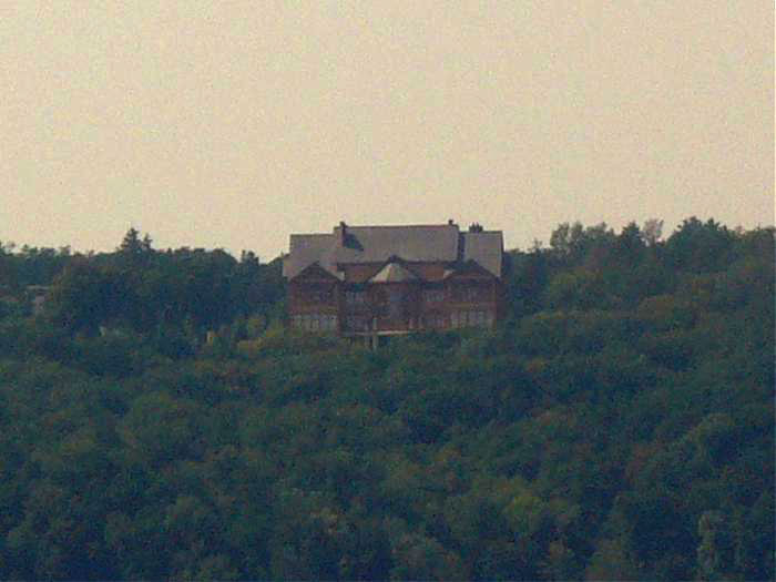
The Mezhyhirya Residence ( uk, Межигір'я, Mezhyhiria, , russian: Межигорье, Mezhigor'ye) is an estate in Ukraine where Viktor Yanukovych lived when he was Prime Minister and then President of Ukraine and is now a museum displaying Yanukovych's luxurious lifestyle.Ukraine: Former President Viktor Yanukovych's Palatial Residence in Mezhyhirya Opens as Museum International Business Times (November 17, 2014) [...More Info...] [...Related Items...] OR: [Wikipedia] [Google] [Baidu] |
Viktor Yanukovych
Viktor Fedorovych Yanukovych ( uk, Віктор Федорович Янукович, ; ; born 9 July 1950) is a former politician who served as the fourth president of Ukraine from 2010 until he was removed from office in the Revolution of Dignity in 2014, after a long series of protests in support of closer ties with the European Union by diverse civil-society groups in response to his rejection of the Ukrainian-European Association Agreement. From 2006 to 2007 he was the prime minister of Ukraine; he also served in this post from November 2002 to January 2005, with a short interruption in December 2004. He currently lives in exile in Russia, where he has lived since his removal from office in 2014. Yanukovych served as the governor of Donetsk Oblast, a province in eastern Ukraine, from 1997 to 2002. He was Prime Minister of Ukraine from 21 November 2002 to 7 December 2004 and from 28 December 2004 to 5 January 2005, under President Leonid Kuchma. Yanukovych first ran for ... [...More Info...] [...Related Items...] OR: [Wikipedia] [Google] [Baidu] |
President Of Ukraine
The president of Ukraine ( uk, Президент України, Prezydent Ukrainy) is the head of state of Ukraine. The president represents the nation in international relations, administers the foreign political activity of the state, conducts negotiations and concludes international treaties. The president is directly elected by the citizens of Ukraine for a five-year term of office (whether the presidential election is early or scheduled), limited to two terms consecutively. The president's official residence is the Mariinskyi Palace, located in the Pechersk district of the capital Kyiv. Other official residences include the House with Chimaeras and the House of the Weeping Widow, which are used for official visits by foreign representatives. The Office of the President of Ukraine, unofficially known as "Bankova" in reference to the street it is located on, serves as the presidential office, advising the president in the domestic, foreign and legal matters. Since the of ... [...More Info...] [...Related Items...] OR: [Wikipedia] [Google] [Baidu] |
Kozelets Raion
Kozelets Raion ( uk, Козелецький район, ) was one of the 22 administrative raions (a ''district'') of Chernihiv Oblast in northern Ukraine. Its administrative center was located at the urban-type settlement of Kozelets. Its population was 61,636 in the 2001 Ukrainian Census. The raion was abolished on 18 July 2020 as part of the administrative reform of Ukraine, which reduced the number of raions of Chernihiv Oblast to five. The area of Kozelets Raion was merged into Chernihiv Raion. The last estimate of the raion population was Geography Kozelets Raion was located in the southwestern part of the Chernihiv Oblast, corresponding to the modern-day boundaries of the Polissia historical regions. To its west and south, it bordered upon Vyshhorod and Brovary Raions of Kyiv Oblast. Its total area constituted , constituting 8.3 percent of the total area of Chernihiv Oblast. History As part of a full-scale administrative reorganization of the Ukrainian Soviet Socialist R ... [...More Info...] [...Related Items...] OR: [Wikipedia] [Google] [Baidu] |
Brovary Raion
Brovary Raion () is a raion (district) in Kyiv Oblast of Ukraine. Its administrative center is the town of Brovary. Population: . On 18 July 2020, as part of the administrative reform of Ukraine, the number of raions of Kyiv Oblast was reduced to seven, and the area of Brovary Raion was significantly expanded. Two abolished raions, Baryshivka and Zghurivka Raions, as well as the cities of Berezan and Brovary, which were previously incorporated as a city of oblast significance and did not belong to the raion, were merged into Brovary Raion. The January 2020 estimate of the raion population was Subdivisions Current After the reform in July 2020, the raion consisted of 8 hromadas: * Baryshivka settlement hromada with the administration in the urban-type settlement of Baryshivka, transferred from Baryshivka Raion; * Berezan urban hromada with the administration in the city of Berezan, transferred from the city of oblast significance of Berezan; * Brovary urban hromada, with the ... [...More Info...] [...Related Items...] OR: [Wikipedia] [Google] [Baidu] |
Obolon Raion
Obolonskyi District ( uk, Оболонський район, ''Obolons'kyi raion'') is an urban district of the Ukrainian capital Kyiv. Obolonskyi District encompasses territories far beyond of its historical neighborhood sharing the same name. It was formed on 3 March 1975 and initially called as Minskyi District. In 2001 it was renamed to its historical name. Its current population is 290,000 inhabitants. Overview During Soviet rule of Ukraine, Kyiv had 14 administrative districts. In the early 21st century, a new law was passed and the city's administrative division was reorganized into 10 districts with different borders and new names. The Obolonskyi District encompasses the territories of the former Minskyi District and is still sometimes referred to by that name. It also includes the former town of Pushcha-Vodytsia that used to be part of the Podilskyi District. The name ''Obolon'' comes from the Old-Ukrainian word ''оболонь'' → ''болонь'' → ''болон� ... [...More Info...] [...Related Items...] OR: [Wikipedia] [Google] [Baidu] |
Borodianka Raion
Borodianka Raion () was a raion (district) in Kyiv Oblast of Ukraine. Its administrative center was the urban-type settlement of Borodianka. The raion was abolished on 18 July 2020 as part of the administrative reform of Ukraine, which reduced the number of raions of Kyiv Oblast to seven. The area of Borodianka Raion was merged into the newly created Bucha Raion. The last estimate of the raion population was . Subdivisions At the time of disestablishment, the raion consisted of three hromadas, * Borodianka settlement hromada with the administration in the urban-type settlement of Borodianka Borodianka ( uk, Бородянка, ) is an urban-type settlement in Bucha Raion of Kyiv Oblast (province) of Ukraine. It hosts the administration of Borodianka settlement hromada, one of the hromadas of Ukraine. Population: . According to the 2 ...; * Nemishaieve settlement hromada with the administration in the urban-type settlement of Nemishaieve; * Piskivka settlement hromada with ... [...More Info...] [...Related Items...] OR: [Wikipedia] [Google] [Baidu] |
Chernobyl Raion
The Chernobyl Raion (russian: Чернобыльский район, translit=Chernobyl'skiy rayon) or Chornobyl Raion ( uk, Чорнобильський район, translit=Chornobylskyi raion) was one of 26 administrative raions (districts) of Kyiv Oblast in northern Ukraine. After the Chernobyl disaster, the majority of the raion was contaminated, and many of its populated places were included into the Chernobyl Exclusion Zone, which is an officially designated exclusion area around the site of the disaster. Geography The Chernobyl Raion was located in the northern portion of Kyiv Oblast, at the time an administrative portion of the Ukrainian Soviet Socialist Republic. To the raion's east, it bordered upon the Kyiv Reservoir; to its south, the Vyshhorod Raion; to its southwest, the Ivankiv Raion; and to its west, the Poliske Raion, significant portions of which also suffered due to the Chernobyl disaster. Today, the territory of the former raion is administratively part ... [...More Info...] [...Related Items...] OR: [Wikipedia] [Google] [Baidu] |


.png)