|
Petersham Parish, Cumberland
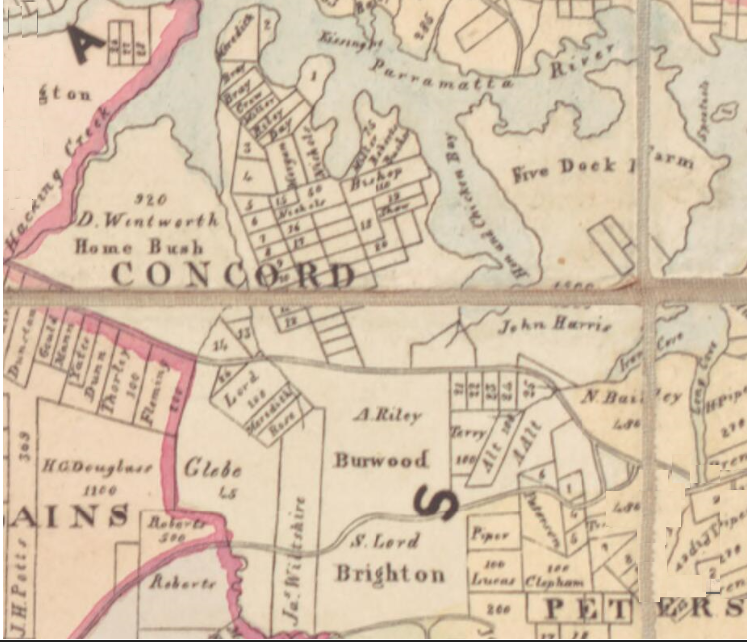
Petersham Parish is one of the 57 parishes of Cumberland County, New South Wales, a cadastral unit for use on land titles. It is located to the south of Iron Cove, Rozelle Bay and the Parramatta River, and to the north of Cooks River. It includes the suburbs of Balmain, Leichhardt, Petersham, Newtown, Marrickville, Tempe, Glebe and St Peters. Sydney : Dept. of Lands, 1916. It roughly corresponds to the eastern half of the region, with the neighbouring Parish of Concord
Concord Parish is one of the 5 ...
[...More Info...] [...Related Items...] OR: [Wikipedia] [Google] [Baidu] |
Cumberland County, New South Wales
Cumberland County is a county in the State of New South Wales, Australia. Most of the Sydney metropolitan area is located within the County of Cumberland. The County of Cumberland stretches from Broken Bay to the north, the Hawkesbury River to the north-west, the Nepean River to the west, the Cataract River to the south-west and the northern suburbs of Wollongong to the south. It includes the area of the Cumberland Plain. History The name ''Cumberland'' was conferred by Governor Arthur Phillip in honour of Prince Henry Duke of Cumberland and Strathearn at a gathering to celebrate the birthday of his brother, King George III, on 4 June 1788. The county has been marked on maps since the start of the colony, as shown along the key on 1789 mapdescribing Port Jackson as being within the county of Cumberland. In the nineteenth century, parts of the county were in the South and North Riding electoral districts from 1856 to 1859, which were replaced by Central Cumberland. The ... [...More Info...] [...Related Items...] OR: [Wikipedia] [Google] [Baidu] |
Cooks River
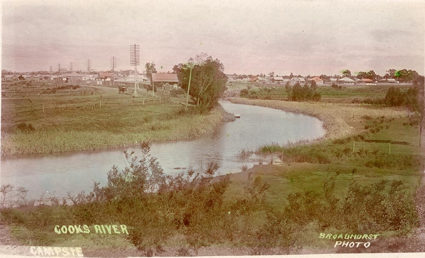
The Cooks River, a semi-mature tide-dominated drowned valley estuary, is a tributary of Botany Bay, located in south-eastern Sydney, New South Wales, Australia. The course of the long urban waterway has been altered to accommodate various developments along its shore. It serves as part of a stormwater system for the of its watershed, and many of the original streams running into it have been turned into concrete lined channels. The tidal sections support significant areas of mangroves, bird, and fish life, and are used for recreational activities. Course The river begins at Graf Park, Yagoona, then flows in a roughly north-easterly direction to Chullora. It reaches its northernmost point at Strathfield, where it leads into a concrete open canal, no more than one metre wide and thirty centimetres deep. It then heads towards the south-east. Where Cooks River runs through Strathfield Golf Course, the concrete lining has been partly removed. Here the plants have returned and hav ... [...More Info...] [...Related Items...] OR: [Wikipedia] [Google] [Baidu] |
Parishes Of Cumberland County
A parish is a territorial entity in many Christian denominations, constituting a division within a diocese. A parish is under the pastoral care and clerical jurisdiction of a priest, often termed a parish priest, who might be assisted by one or more curates, and who operates from a parish church. Historically, a parish often covered the same geographical area as a manor. Its association with the parish church remains paramount. By extension the term ''parish'' refers not only to the territorial entity but to the people of its community or congregation as well as to church property within it. In England this church property was technically in ownership of the parish priest ''ex-officio'', vested in him on his institution to that parish. Etymology and use First attested in English in the late, 13th century, the word ''parish'' comes from the Old French ''paroisse'', in turn from la, paroecia, the latinisation of the grc, παροικία, paroikia, "sojourning in a foreign ... [...More Info...] [...Related Items...] OR: [Wikipedia] [Google] [Baidu] |
Parish Of Concord
Concord Parish is one of the 57 parishes of Cumberland County, New South Wales, a cadastral unit for use on land titles. It is located to the south of the Parramatta River between Homebush Bay and Iron Cove; and to the north of Cooks River. It includes the suburbs of Homebush (but not Homebush West), most of Strathfield, Burwood, Croydon, Concord, Canada Bay, Abbotsford and Drummoyne. It covers the local government areas of City of Canada Bay and the Municipality of Burwood and most of the Municipality of Strathfield (excluding the western part of the municipality that was incorporated in 1892). It roughly corresponds to the western half of the Inner West The Inner West of Sydney is an area directly west of the Sydney central business district, New South Wales, Australia. The suburbs that make up the Inner West are predominantly located along the southern shore of Port Jackson (Parramatta River) ... region, with the neighbouring Parish of Petersham making up the eastern h ... [...More Info...] [...Related Items...] OR: [Wikipedia] [Google] [Baidu] |
Inner West
The Inner West of Sydney is an area directly west of the Sydney central business district, New South Wales, Australia. The suburbs that make up the Inner West are predominantly located along the southern shore of Port Jackson (Parramatta River), stretching south to the shores of the Cooks River. The western boundary of the Inner West is approximately the A3 arterial road (Homebush Bay Drive / Centenary Drive), which divides the Inner West from the Greater Western Sydney region. The Inner West is much larger than the Inner West Council local government area. The Inner West roughly corresponds with the Parish of Petersham and Parish of Concord, two cadastral divisions used for land titles. Suburbs The boundaries of the Inner West region are customary, not administrative or legal, and as such are defined differently in different contexts. The northern and southern boundaries are natural and thus generally well defined: they are the Parramatta River and the Cooks River respec ... [...More Info...] [...Related Items...] OR: [Wikipedia] [Google] [Baidu] |
St Peters, New South Wales
St Peters is a suburb in the Inner West of Sydney, in the state of New South Wales, Australia. It is 7 kilometres south of the Sydney central business district, in the local government area of Inner West Council, with a small section in the southeast in the City of Sydney. History St Peters was named by its association with St Peters Anglican Church, which was consecrated in 1838. St Peters is the third oldest Anglican church in Sydney and has been claimed to be the first church built in Australia using non-convict labour. The church is on the Princes Highway. It was designed by Thomas Bird and built in 1838–39. In 1875, alterations were carried out under the supervision of Edmund Blacket. The church is now listed on the Register of the National Estate. The graveyard is the burial place of a few notable people, including solicitor and merchant Frederick Wright Unwin, who had Unwin Road and Unwin's Bridge named after him. It is also the burial place of people who committed sui ... [...More Info...] [...Related Items...] OR: [Wikipedia] [Google] [Baidu] |
Glebe, New South Wales
Glebe is an inner-western suburb of Sydney. Glebe is located southwest of the Sydney central business district and is part of the local government area of the City of Sydney, in the Inner West region. Glebe is surrounded by Blackwattle Bay and Rozelle Bay, inlets of Sydney Harbour, in the north. The suburb of Ultimo lies to the east and the suburbs of Annandale and Forest Lodge lie to the west. The southern boundary is formed by Parramatta Road and Broadway. Broadway is a locality sited along the road of the same name, which is located on the border of Glebe, Chippendale and Ultimo. History Glebe's name is derived from the fact that the land on which it was developed was a glebe, originally owned by the Anglican Church. 'The Glebe' was a land grant of given by Governor Arthur Phillip to Reverend Richard Johnson, Chaplain of the First Fleet, in 1790. In the 19th century, Glebe was home to architect, Edmund Blacket, who had migrated from England. Blacket built his f ... [...More Info...] [...Related Items...] OR: [Wikipedia] [Google] [Baidu] |
Tempe, New South Wales
Tempe is a suburb in the Inner West of Sydney, in the state of New South Wales, Australia. Tempe is located 9 kilometres south of the Sydney central business district in the local government area of Inner West Council. Tempe sits on the northern bank of the Cooks River and is separated from Sydney Airport by the Alexandra Canal, also known as Sheas Creek. The Wolli Creek waterway also empties into the Cooks River. History Tempe was named after the mansion on the southern banks of the Cooks River in the area that is now known as Wolli Creek. Alexander Brodie Spark (1792–1856), an immigrant from Elgin, Scotland, built Tempe House in 1836. It was named after the 'Vale of Tempe', a beautiful valley set at the foot of Mount Olympus in Greece, which was prominent in ancient Greek legend. Tempe House, designed by John Verge (1772–1861) in the Georgian style, is regarded as one of the great houses of Sydney. It is listed with the Heritage Council of New South Wales as well as ... [...More Info...] [...Related Items...] OR: [Wikipedia] [Google] [Baidu] |
Marrickville, New South Wales
Marrickville is a suburb in the Inner West of Sydney, in the state of New South Wales, Australia. Marrickville is located south-west of the Sydney central business district and is the largest suburb in the Inner West Council local government area. Marrickville sits on the northern bank of the Cooks River, opposite Earlwood and shares borders with Stanmore, Enmore, Newtown, St Peters, Sydenham, Tempe, Dulwich Hill, Hurlstone Park and Petersham. The southern part of the suburb, near the river, is known as Marrickville South and includes the historical locality called ''The Warren''. Marrickville is a culturally diverse suburb consisting of both low and high density residential, commercial and light industrial areas. The first inhabitants were the Gadigal people of the Eora Nation. History Gadigal History The Gadigal or Cadigal people of the Eora Nation have lived in the Marrickville area for tens of thousands of years. Their connection continues today. The area ... [...More Info...] [...Related Items...] OR: [Wikipedia] [Google] [Baidu] |
Newtown, New South Wales
Newtown, a suburb of Inner West, Sydney's inner west, is located approximately four kilometres south-west of the Sydney central business district, straddling the Local government areas of New South Wales, local government areas of the City of Sydney and Inner West Council in the state of New South Wales, Australia. King Street, Newtown, King Street is the main street of Newtown and centre of commercial and entertainment activity. The street follows the spine of a long ridge that rises up near Sydney University and extends to the south, becoming the Princes Highway at its southern end. Enmore Road branches off King Street towards the suburb of Enmore, New South Wales, Enmore at Newtown Bridge, where the road passes over the railway line at Newtown Station. Enmore Road and King Street together comprise 9.1 kilometres of over 600 shopfronts. The main shopping strip of Newtown is the longest and most complete commercial precinct of the late Victorian and Federation of Australia, Fed ... [...More Info...] [...Related Items...] OR: [Wikipedia] [Google] [Baidu] |
Petersham, New South Wales
Petersham is a suburb in the Inner West of Sydney, in the state of New South Wales, Australia. Petersham is located 6 kilometres south-west of the Sydney central business district, in the Local government in Australia, local government area of Inner West Council. Petersham is known for its extensive Portugal, Portuguese commercial offerings, with many Portuguese businesses and restaurants, although only 156 (1.9%) of the population was actually born in Portugal. Petersham is bordered by the suburbs of Leichhardt, New South Wales, Leichhardt to the north, Stanmore, New South Wales, Stanmore to the east, Marrickville, New South Wales, Marrickville to the south and Lewisham, New South Wales, Lewisham to the west. Taverner's Hill, named after Fred Taverner, is a locality in the western part of the suburb. History Major Francis Grose (Lieutenant-Governor), Francis Grose sent workmen to the area in 1793 to clear the bush and plant corn and wheat. He named the area Peters-Ham or P ... [...More Info...] [...Related Items...] OR: [Wikipedia] [Google] [Baidu] |
Leichhardt, New South Wales
Leichhardt is a suburb in the Inner West of Sydney, in the state of New South Wales, Australia. Leichhardt is located 5 kilometres west of the Sydney central business district (CBD) and is the administrative centre for the local government area (LGA) of the Inner West Council. The suburb is bordered by Haberfield to the west, Annandale to the east, Lilyfield to the north and Petersham, Lewisham and Stanmore to the south. History Aboriginal anthropology Leichhardt was once an area broadly inhabited by the Wangal band of the Dharug (Eora) language group. The 'Eora people' was the name given to coastal Aborigines around Sydney – Eora means ''from this place'' – local Aboriginal people used this word to describe to Europeans where they came from, and in time the term became used to define Aboriginal people themselves. Wangal country was known as 'wanne' and it originally extended from the suburbs of Balmain and Birchgrove in the east to Silverwater and Auburn in the west. I ... [...More Info...] [...Related Items...] OR: [Wikipedia] [Google] [Baidu] |


