|
Parish Of Concord
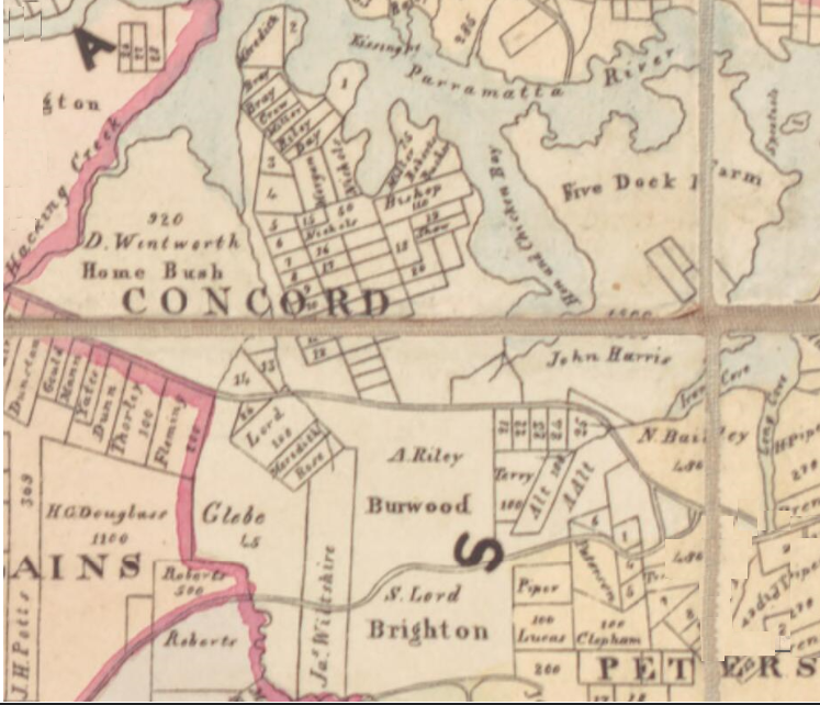
Concord Parish is one of the 57 parishes of Cumberland County, New South Wales, a cadastral unit for use on land titles. It is located to the south of the Parramatta River between Homebush Bay and Iron Cove; and to the north of Cooks River. It includes the suburbs of Homebush (but not Homebush West), most of Strathfield, Burwood, Croydon, Concord, Canada Bay, Abbotsford and Drummoyne. It covers the local government areas of City of Canada Bay and the Municipality of Burwood and most of the Municipality of Strathfield (excluding the western part of the municipality that was incorporated in 1892). It roughly corresponds to the western half of the Inner West The Inner West of Sydney is an area directly west of the Sydney central business district, New South Wales, Australia. The suburbs that make up the Inner West are predominantly located along the southern shore of Port Jackson (Parramatta River) ... region, with the neighbouring Parish of Petersham making up the eastern h ... [...More Info...] [...Related Items...] OR: [Wikipedia] [Google] [Baidu] |
Cumberland County, New South Wales
Cumberland County is a county in the State of New South Wales, Australia. Most of the Sydney metropolitan area is located within the County of Cumberland. The County of Cumberland stretches from Broken Bay to the north, the Hawkesbury River to the north-west, the Nepean River to the west, the Cataract River to the south-west and the northern suburbs of Wollongong to the south. It includes the area of the Cumberland Plain. History The name ''Cumberland'' was conferred by Governor Arthur Phillip in honour of Prince Henry Duke of Cumberland and Strathearn at a gathering to celebrate the birthday of his brother, King George III, on 4 June 1788. The county has been marked on maps since the start of the colony, as shown along the key on 1789 mapdescribing Port Jackson as being within the county of Cumberland. In the nineteenth century, parts of the county were in the South and North Riding electoral districts from 1856 to 1859, which were replaced by Central Cumberland. The ... [...More Info...] [...Related Items...] OR: [Wikipedia] [Google] [Baidu] |
Parramatta River
The Parramatta River is an intermediate tide-dominated, drowned valley estuary located in Sydney, New South Wales, Australia. With an average depth of , the Parramatta River is the main tributary of Sydney Harbour, a branch of Port Jackson. Secondary tributaries include the smaller Lane Cove and Duck rivers. Formed by the confluence of Toongabbie Creek and Darling Mills Creek at North Parramatta, the river flows in an easterly direction to a line between Yurulbin in Birchgrove and Manns Point in Greenwich. Here it flows into Port Jackson, about from the Tasman Sea. The total catchment area of the river is approximately and is tidal to Charles Street Weir in Parramatta, approximately from the Sydney Heads. The land adjacent to the Parramatta River was occupied for many thousands of years by Aboriginal peoples of the Wallumettagal nations and the Wangal, Toongagal (or Tugagal), Burramattagal, and Wategora clans of the Darug people. They used the river as an important source o ... [...More Info...] [...Related Items...] OR: [Wikipedia] [Google] [Baidu] |
Abbotsford, New South Wales
Abbotsford is a suburb in the Inner West of Sydney, in the state of New South Wales, Australia. Abbotsford is 10 kilometres west of the Sydney central business district in the local government area of the City of Canada Bay. Abbotsford sits on the peninsula between Abbotsford Bay and Hen and Chicken Bay, on the Parramatta River. History Abbotsford took its name from Abbotsford House, owned by Sir Arthur Renwick. He named his property after Abbotsford House in Scotland, the residence of historical novelist and poet, Sir Walter Scott. Aboriginal culture Abbotsford was first known by its Aboriginal name Bigi Bigi. The traditional owners are the Wangal clan of the Eora Nation. European settlement The suburb was originally part of Five Dock Farm and when subdivided in 1837, was called Feltham. Sir Arthur Renwick, a doctor, philanthropist and politician built his home here in 1890 and called it Abbotsford House in honour of Sir Walter Scott's home. Renwick sold his property i ... [...More Info...] [...Related Items...] OR: [Wikipedia] [Google] [Baidu] |
Canada Bay, New South Wales
Canada Bay is a suburb in the Inner West . Retrieved 7 August 2013. of Sydney, in the state of , Australia. It is west of the Sydney central business district, in the local government area of |
Concord, New South Wales
Concord is a suburb in the inner West of Sydney, in the state of New South Wales, Australia. It is west of the Sydney central business district, in the Local government in Australia, local government area of the City of Canada Bay. People from Concord are colloquially called Concordiens. Concord West, New South Wales, Concord West is a separate suburb, to the north-west. History Concord takes its name from Concord, Massachusetts, in the United States, USA, which was the site of the Battles of Lexington and Concord, Battle of Concord, one of the first military engagements of the American Revolutionary War (1775–1778). Some historians believe the Sydney suburb was named Concord to encourage a peaceful attitude between soldiers and settlers. The first land grants in the area were made in 1793. The original Concord Council was established in 1883. Concord Council amalgamated with Drummoyne Council in 2000 after 117 years of self governance to form the City of Canada Bay. It is ... [...More Info...] [...Related Items...] OR: [Wikipedia] [Google] [Baidu] |
Croydon, New South Wales
Croydon is a suburb in the Inner West of Sydney, in the state of New South Wales, Australia. It is located west of the Sydney central business district. Croydon is split between the two local government areas of Municipality of Burwood and the Inner West Council. The suburb is nestled between the commercial centres of Ashfield and Burwood. It is bounded by Parramatta Road to the north, Iron Cove Creek to the east, Arthur Street to the south and a number of different streets to the west. To the north are Kings and Canada Bays on the closest reach of the Parramatta River, to the northwest is Concord Hospital and the Olympic Games complex at Homebush Bay. To the south is Canterbury Racecourse. The suburb shares its name with Croydon, a large district and borough in the south of London in the United Kingdom. The traditional owners of the land on which Croydon is situated are the Wangal people of the Eora nation. History Aboriginal anthropology Prior to the arrival of Europeans ... [...More Info...] [...Related Items...] OR: [Wikipedia] [Google] [Baidu] |
Burwood, New South Wales
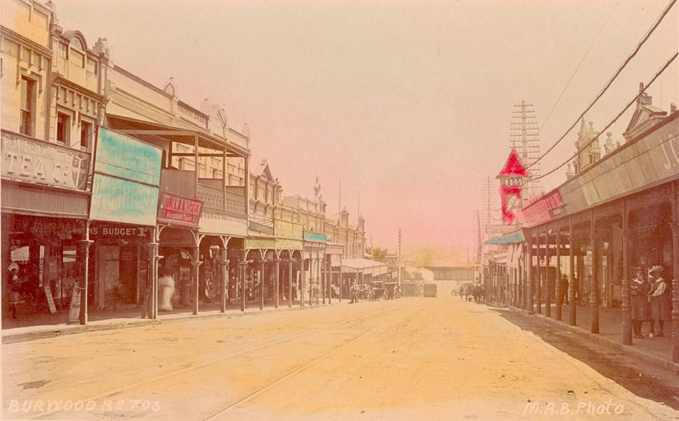
Burwood is a suburb in the Inner West of Sydney, in the state of New South Wales, Australia. It is west of the Sydney central business district and is the administrative centre for the Local government in Australia, local government area of Municipality of Burwood. People from Burwood are colloquially known as Burwoodiens or Burwooders. Burwood Heights, New South Wales, Burwood Heights is a separate suburb to the south. The Appian Way, Burwood, Appian Way is a street in Burwood, known for its architecturally designed Federation architecture, Federation-style homes. History Archaeological evidence indicates people were living in the Sydney area for at least 11,000 years. This long association had led to a harmonious relationship between the Indigenous peoples, indigenous inhabitants and their environment, which was interrupted by the arrival of the British in 1788. The European desire to cultivate the land aided and abetted by a smallpox epidemic that forced the local people, t ... [...More Info...] [...Related Items...] OR: [Wikipedia] [Google] [Baidu] |
Strathfield, New South Wales
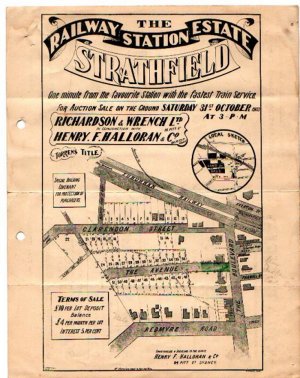
Strathfield is a suburb in the Inner West of Sydney, in the state of New South Wales, Australia. It is located 12 kilometres west of the Sydney central business district and is the administrative centre of the Municipality of Strathfield. A small section of the suburb north of the railway line lies within the City of Canada Bay, while the area east of The Boulevard lies within the Municipality of Burwood. North Strathfield and Strathfield South are separate suburbs to the north and south, respectively. History The Strathfield district lies between the Concord Plains to the north and the Cooks River to the south, and was originally occupied by the Wangal clan. European colonisation in present-day Strathfield commenced in 1793 with the issue of land grants in the area of "Liberty Plains", an area including present-day Strathfield as well as surrounding areas, where the first free settlers received land grants. In 1808, a grant was made to James Wilshire, which forms the largest p ... [...More Info...] [...Related Items...] OR: [Wikipedia] [Google] [Baidu] |
Homebush West
Homebush West is a suburb in the Inner West of Sydney, in the state of New South Wales, Australia. Homebush West is located 13 kilometres west of the Sydney central business district, in the local government area of the Municipality of Strathfield, with a small unpopulated strip in the northwest in Cumberland Council. The suburb is commonly referred to as Flemington, even in official contexts. This was the old name of the suburb before the establishment of Sydney Markets in 1975. Subsequently, " Flemington" was confined to the area occupied by the markets, whereas the residential part of the suburb was renamed "Homebush West", after the suburb of Homebush immediately to the east. Both the railway station and various organisations and businesses in the suburb still carry the name "Flemington". Homebush Bay was formerly a separate suburbs to the north. History The area was called Flemington by John Fleming, who was granted here in 1806. A loosely defined area in the vicinity ha ... [...More Info...] [...Related Items...] OR: [Wikipedia] [Google] [Baidu] |
Homebush, New South Wales
Homebush is a suburb in the Inner West of Sydney in the state of New South Wales, Australia. It is located 12 kilometres west of the Sydney central business district, in the local government area of the Municipality of Strathfield. The name of the suburb derives ultimately from an estate to the north, called "Home Bush" and owned by colonial surgeon D'Arcy Wentworth. The historic railway station named after the estate was briefly the early terminus of the Great Western Line in 1855. The historic Village of Homebush estate, south of the railway, was developed in 1878 and survives largely intact. It became part of Strathfield Municipality along with the suburbs of Redmyre and Druitt Town in 1885. North Homebush, north of the railway, experienced industrial and residential development in the early 20th century and was a separate municipality. The modern suburb was formed when a small part of Strathfield, immediately south of Homebush railway station, was combined with the eastern ... [...More Info...] [...Related Items...] OR: [Wikipedia] [Google] [Baidu] |
Suburb
A suburb (more broadly suburban area) is an area within a metropolitan area, which may include commercial and mixed-use, that is primarily a residential area. A suburb can exist either as part of a larger city/urban area or as a separate political entity. The name describes an area which is not as densely populated as an inner city, yet more densely populated than a rural area in the countryside. In many metropolitan areas, suburbs exist as separate residential communities within commuting distance of a city (cf "bedroom suburb".) Suburbs can have their own political or legal jurisdiction, especially in the United States, but this is not always the case, especially in the United Kingdom, where most suburbs are located within the administrative boundaries of cities. In most English-speaking countries, suburban areas are defined in contrast to central or inner city areas, but in Australian English and South African English, ''suburb'' has become largely synonymous with what ... [...More Info...] [...Related Items...] OR: [Wikipedia] [Google] [Baidu] |
Cooks River
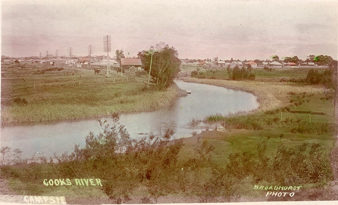
The Cooks River, a semi-mature tide-dominated drowned valley estuary, is a tributary of Botany Bay, located in south-eastern Sydney, New South Wales, Australia. The course of the long urban waterway has been altered to accommodate various developments along its shore. It serves as part of a stormwater system for the of its watershed, and many of the original streams running into it have been turned into concrete lined channels. The tidal sections support significant areas of mangroves, bird, and fish life, and are used for recreational activities. Course The river begins at Graf Park, Yagoona, then flows in a roughly north-easterly direction to Chullora. It reaches its northernmost point at Strathfield, where it leads into a concrete open canal, no more than one metre wide and thirty centimetres deep. It then heads towards the south-east. Where Cooks River runs through Strathfield Golf Course, the concrete lining has been partly removed. Here the plants have returned and hav ... [...More Info...] [...Related Items...] OR: [Wikipedia] [Google] [Baidu] |


St_Lukes_Anglican_Church_Concord-2.jpg)


