|
Penn Hill
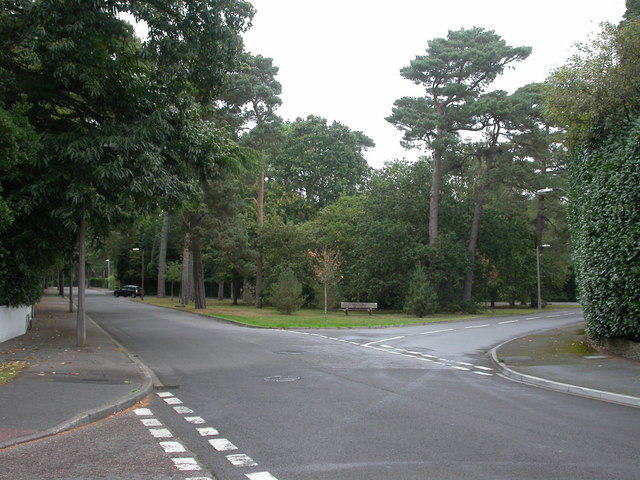
Penn Hill is an electoral ward of Poole in Dorset, England, bordering on Branksome Park, Canford Cliffs, Sandbanks, Lilliput and Parkstone. It is effectively part of Parkstone. Overview * 11,355 people live in Penn Hill. * There are 4,528 dwellings in the ward. * 2% of the residents are from minority ethnic groups. * 26.52% of the people are between the ages of 40 and 59. * There are 2947 people over the age of 60 living in this ward. * 82.53% of residents own their own homes, either outright or with a mortgage. * 12.50% of residents live in privately rented homes. * 3.98% of residents live in council or housing association homes. * 0.99% of residents live completely rent free. * The population density of Penn Hill is approximately 7604 people per square mile (2936/km2). * The actual size of the ward is 1.4 square miles (3.6 km2). * The biggest employers of men in this area (with 17.06% of males) are the real estate business and services industries. * The biggest employers of w ... [...More Info...] [...Related Items...] OR: [Wikipedia] [Google] [Baidu] |
Wards Of The United Kingdom
The wards and electoral divisions in the United Kingdom are electoral districts at sub-national level, represented by one or more councillors. The ward is the primary unit of English electoral geography for civil parishes and borough and district councils, the electoral ward is the unit used by Welsh principal councils, while the electoral division is the unit used by English county councils and some unitary authorities. Each ward/division has an average electorate of about 5,500 people, but ward population counts can vary substantially. As of 2021 there are 8,694 electoral wards/divisions in the UK. England The London boroughs, metropolitan boroughs and non-metropolitan districts (including most unitary authorities) are divided into wards for local elections. However, county council elections (as well as those for several unitary councils which were formerly county councils, such as the Isle of Wight and Shropshire Councils) instead use the term ''electoral division''. ... [...More Info...] [...Related Items...] OR: [Wikipedia] [Google] [Baidu] |
Poole
Poole () is a large coastal town and seaport in Dorset, on the south coast of England. The town is east of Dorchester and adjoins Bournemouth to the east. Since 1 April 2019, the local authority is Bournemouth, Christchurch and Poole Council which is a unitary authority. Poole had an estimated population of 151,500 (mid-2016 census estimates) making it the second-largest town in the ceremonial county of Dorset. Together with Bournemouth and Christchurch, the conurbation has a total population of nearly 400,000. Human settlement in the area dates back to before the Iron Age. The earliest recorded use of the town's name was in the 12th century when the town began to emerge as an important port, prospering with the introduction of the wool trade. Later, the town had important trade links with North America and, at its peak during the 18th century, it was one of the busiest ports in Britain. In the Second World War, Poole was one of the main departing points for the Normandy lan ... [...More Info...] [...Related Items...] OR: [Wikipedia] [Google] [Baidu] |
Dorset
Dorset ( ; archaically: Dorsetshire , ) is a county in South West England on the English Channel coast. The ceremonial county comprises the unitary authority areas of Bournemouth, Christchurch and Poole and Dorset. Covering an area of , Dorset borders Devon to the west, Somerset to the north-west, Wiltshire to the north-east, and Hampshire to the east. The county town is Dorchester, in the south. After the reorganisation of local government in 1974, the county border was extended eastward to incorporate the Hampshire towns of Bournemouth and Christchurch. Around half of the population lives in the South East Dorset conurbation, while the rest of the county is largely rural with a low population density. The county has a long history of human settlement stretching back to the Neolithic era. The Romans conquered Dorset's indigenous Celtic tribe, and during the Early Middle Ages, the Saxons settled the area and made Dorset a shire in the 7th century. The first re ... [...More Info...] [...Related Items...] OR: [Wikipedia] [Google] [Baidu] |
Branksome Park
Branksome Park is a suburb of Poole in Dorset, which adjoins Branksome, Dorset. The area covers approximately , mostly occupied by housing, and includes Branksome Chine which leads to the award-winning blue-flagged beaches of Poole. Description Branksome Park is one of Poole's most affluent areas alongside Sandbanks, Canford Cliffs, Evening Hill, Lilliput, and Salterns Marina. It is on the border of Poole, with Bournemouth being on the other side of The Avenue. It is less than two miles (3 km) from the shopping areas of Westbourne and The Square in the centre of Bournemouth. House prices vary widely in the area; there are small 1960s flats costing just under £200,000 and mansions costing well over £3 million. A new mansion called Sleon House, with of living accommodation, was recently built with a price tag of £5,250,000. The area is a contrast to neighbouring Sandbanks, whilst although being affluent, the community is not focused towards development based around ... [...More Info...] [...Related Items...] OR: [Wikipedia] [Google] [Baidu] |
Canford Cliffs
Canford Cliffs is a suburb of Poole in Dorset, England. The neighbourhood lies on the English Channel coast midway between Poole and Bournemouth. To the southwest is Sandbanks which has some of the highest property values in the world; with Canford Cliffs it forms a parish which has the fourth highest property prices in the world and second highest in the United Kingdom after London. History Originally part of the estate of Lord Wimborne, development began in the 1880s. The land around Haven Road was divided into plots and buildings designed individually. To prevent erosion of the cliffs, which caused annual falls, a sea wall and promenade was constructed in the 1930s. The area was originally designed to be residential, with a church and village hall but few commercial buildings. The Canford Cliffs Land Society still works to preserve these goals, and there are few businesses and no industry in the area. In 2021, stabilisation works will be carried out to secure the cliffs. W ... [...More Info...] [...Related Items...] OR: [Wikipedia] [Google] [Baidu] |
Sandbanks
Sandbanks is an affluent neighbourhood of Poole, Dorset, on the south coast of England, situated on a narrow spit of around 1 km2 or 0.39 sq mi extending into the mouth of Poole Harbour. It is known for its high property prices and for its award-winning beach. In 2005, Sandbanks was reported to have the fourth highest land value by area in the world."Island on the market for £2.5 million" '''' 13 April 2005 The Sandbanks and Canford Cliffs Coastline area has been dubbed "Britain's [...More Info...] [...Related Items...] OR: [Wikipedia] [Google] [Baidu] |
Lilliput, Poole
Lilliput is a district of Poole, Dorset. It borders on Sandbanks, Canford Cliffs, Lower Parkstone, and Whitecliff and has a shoreline within Poole Harbour with views of Brownsea Island and the Purbeck Hills. Brownsea Island stands opposite Lilliput's harbour foreshore and is famous as the birthplace of Baden Powell's International Scouting Movement. Lilliput itself was host to a number of early scouting camps. During the Second World War at one stage it provided Britain's only civilian air route: Poole Harbour was temporary home to the Imperial Airways/BOAC flying boat fleet, which had its passenger HQ at Salterns Marina.Well known residents have included modernist writer Mary Butts, a very young John le Carre and disc-jockey Tony Blackburn. Impresario Fred Karno who popularised the custard-pie-in-the-face comedy routine spent his last years in the village as a part-owner of an off-licence, bought with financial help from Charlie Chaplin, and died here in 1941 aged 75. Eveni ... [...More Info...] [...Related Items...] OR: [Wikipedia] [Google] [Baidu] |
Parkstone
Parkstone is an area of Poole, Dorset. It is divided into 'Lower' and 'Upper' Parkstone. Upper Parkstone - "Up-on-'ill" as it used to be known in local parlance - is so-called because it is largely on higher ground slightly to the north of the lower-lying area of Lower Parkstone - "The Village" - which includes areas adjacent to Poole Harbour. Because of the proximity to the shoreline, and the more residential nature of Lower Parkstone, it is the more sought-after district, and originally included Lilliput and the Sandbanks Peninsula (now part of Canford Cliffs) within its official bounds. Lower Parkstone is centred on Ashley Cross, the original location of Parkstone Grammar School, near to the Parish Church of St. Peter. Despite the residential reputation, Parkstone was the site of several industrial undertakings, the largest being George Jennings South Western Pottery, a manufacturer of salt-glaze drainage and sanitary pipes, which had its own steam locomotive, that ra ... [...More Info...] [...Related Items...] OR: [Wikipedia] [Google] [Baidu] |
Penn Hill (ward)
Penn Hill is an electoral ward in Poole, Dorset. Since 2019, the ward has elected 2 councillors to Bournemouth, Christchurch and Poole Council. History The ward formerly elected three councillors to Poole Borough Council Poole Borough Council was the unitary authority responsible for local government in the Borough of Poole, Dorset, England. It was created on 1 April 1997 following a review by the Local Government Commission for England (1992), becoming administ .... Geography The ward covers the suburb of the same name. Councillors Two Conservative Party. Election results 2019 References {{BCP Wards Wards of Bournemouth, Christchurch and Poole Politics of Poole ... [...More Info...] [...Related Items...] OR: [Wikipedia] [Google] [Baidu] |
Bournemouth, Christchurch And Poole Council
Bournemouth, Christchurch and Poole Council is a unitary local authority for the district of Bournemouth, Christchurch and Poole in England that came into being on 1 April 2019. It was created from the areas that were previously administered by the unitary authorities of Bournemouth and Poole and the non-metropolitan district of Christchurch. The first elections to the council took place in May 2019. The current leader of the council is Drew Mellor who succeeded Vikki Slade after she lost a Vote of No Confidence proposed by the Conservatives 39 to 33. Shadow authority Statutory instruments for the creation of the new authority were made on behalf of the Secretary of State for Housing, Communities and Local Government on 25 May 2018, and a shadow authority was formed the following day. The ''Shadow Bournemouth, Christchurch and Poole Council'' had 125 members, being the elected councillors from Bournemouth Borough Council, Christchurch Borough Council, Poole Borough Cou ... [...More Info...] [...Related Items...] OR: [Wikipedia] [Google] [Baidu] |
Poole (UK Parliament Constituency)
Poole is a constituency represented in the House of Commons of the UK Parliament since 1997 by Robert Syms, a Conservative. History The first version of the Poole constituency existed from 1455 until 1885. During this period its exact status was a parliamentary borough, sending two burgesses to Westminster per year, except during its last 17 years when its representation was reduced to one member. During its abeyance most of Poole was in the East Dorset seat and since its recreation in 1950 its area has been reduced as the harbour town's population has increased. Boundaries 1950–1983: The Municipal Borough of Poole. 1983–1997: The Borough of Poole wards of Broadstone, Canford Cliffs, Canford Heath, Creekmoor, Hamworthy, Harbour, Newtown, Oakdale, Parkstone, and Penn Hill. 1997–2010: The Borough of Poole wards of Bourne Valley, Canford Cliffs, Hamworthy, Harbour, Newtown, Oakdale, Parkstone, and Penn Hill. 2010–19: The Borough of Poole wards of Branksome West, ... [...More Info...] [...Related Items...] OR: [Wikipedia] [Google] [Baidu] |


