|
Palus (tribe)
The Palouse are a Sahaptin tribe recognized in the Treaty of 1855 with the United States along with the Yakama. It was negotiated at the 1855 Walla Walla Council. A variant spelling is Palus. Today they are enrolled in the federally recognized Confederated Tribes and Bands of the Yakama Nation and some are also represented by the Colville Confederated Tribes, the Confederated Tribes of the Umatilla Indian Reservation and Nez Perce Tribe. Ethnography The people are one of the Sahaptin-speaking groups of Native Americans living on the Columbia Plateau in eastern Washington, northeastern Oregon, and North Central Idaho: these included the Nez Percé, Cayuse, Walla Walla, Umatilla and the Yakama. The Palouse (Palus) territory extends from the confluence of the Snake and Clearwater Rivers in the east to the confluence of the Snake and Columbia Rivers in the west. It encompassed the Palouse River Valley up to Rock Lake in the north and stayed north of the Touchet River Valley i ... [...More Info...] [...Related Items...] OR: [Wikipedia] [Google] [Baidu] |
Sahaptin
The Sahaptin are a number of Native American tribes who speak dialects of the Sahaptin language. The Sahaptin tribes inhabited territory along the Columbia River and its tributaries in the Pacific Northwest region of the United States. Sahaptin-speaking peoples included the Klickitat, Kittitas, Yakama, Wanapum, Palus, Lower Snake, Skinpah, Walla Walla, Umatilla, Tenino, and Nez Perce. Territory According to early written accounts, Sahaptin-speaking peoples inhabited the southern portion of the Columbia Basin in Washington and Oregon. Villages were concentrated along the Columbia river, from the Cascades Rapids to near Vantage, Washington, and along the Snake River from the mouth to close to the Idaho border. The closely related Nez Perce tribe lived to the east. There were additional villages along tributaries, including the Yakima, Deschutes, and Walla Walla rivers. Several village lived were located west of the Cascade mountains in southern Washington, including tho ... [...More Info...] [...Related Items...] OR: [Wikipedia] [Google] [Baidu] |
Umatilla People
The Umatilla are a Sahaptin-speaking Native American tribe who traditionally inhabited the Columbia Plateau region of the northwestern United States, along the Umatilla and Columbia rivers."Umatilla," in Barbara A. Leitch, ''A Concise Dictionary of Indian Tribes of North America.'' Algonac, MI: Reference Publications, Inc., 1979; pp. 490-491. The Umatilla people are called Imatalamłáma, a Umatilla person is called Imatalamłá (with orthographic ł representing IPA /ɬ/). Some sources say that ''Umatilla'' is derived from ''imatilám-hlama'': ''hlama'' means 'those living at' or 'people of' and there is an ongoing debate about the meaning of ''imatilám'', but it is said to be an island in the Columbia River. B. Rigsby and N. Rude mention the village of ''ímatalam'' that was situated at the mouth of the Umatilla River and where the language was spoken. The Nez Perce refer to the Umatilla people as ''hiyówatalampoo'' (Aoki (1994:171)). History Early development The Umatill ... [...More Info...] [...Related Items...] OR: [Wikipedia] [Google] [Baidu] |
Walla Walla (tribe)
Walla Walla (), Walawalałáma ("People of Walula region along Walla Walla River"), sometimes Walúulapam, are a Sahaptin indigenous people of the Northwest Plateau. The duplication in their name expresses the diminutive form. The name ''Walla Walla'' is translated several ways but most often as "many waters". Many Walla Wallas live on the Confederated Tribes of the Umatilla Indian Reservation. Walla Wallas share land and a governmental structure with the Cayuse and the Umatilla tribes as part of the Confederated Tribes of the Umatilla. The reservation is located in the area of Pendleton, Oregon, United States, near the Blue Mountains. Some Walla Wallas are also enrolled in the federally recognized Confederated Tribes and Bands of the Yakama Nation. History The people are a Sahaptin-speaking tribe that traditionally inhabited the interior Columbia River region of present-day northwestern United States. For centuries before the coming of European settlers, the Walla Wallas, con ... [...More Info...] [...Related Items...] OR: [Wikipedia] [Google] [Baidu] |
Cayuse People
The Cayuse are a Native American tribe in what is now the state of Oregon in the United States. The Cayuse tribe shares a reservation and government in northeastern Oregon with the Umatilla and the Walla Walla tribes as part of the Confederated Tribes of the Umatilla Indian Reservation. The reservation is located near Pendleton, Oregon, at the base of the Blue Mountains. The Cayuse called themselves the ''Liksiyu'' in the Cayuse language. Originally located in present-day northeastern Oregon and southeastern Washington, they lived adjacent to territory occupied by the Nez Perce and had close associations with them. Like the Plains tribes, the Cayuse placed a high premium on warfare and were skilled horsemen. They developed the Cayuse pony. The Cayuse ceded most of their traditional territory to the United States in 1855 by treaty and moved to the Umatilla Reservation, where they have formed a confederated tribe. History According to Haruo Aoki (1998), the Cayuse called ... [...More Info...] [...Related Items...] OR: [Wikipedia] [Google] [Baidu] |
Nez Perce People
The Nez Percé (; autonym in Nez Perce language: , meaning "we, the people") are an Indigenous people of the Plateau who are presumed to have lived on the Columbia River Plateau in the Pacific Northwest region for at least 11,500 years.Ames, Kenneth and Alan Marshall. 1980. "Villages, Demography and Subsistence Intensification on the Southern Columbia Plateau". ''North American Archeologist'', 2(1): 25–52." Members of the Sahaptin language group, the Nimíipuu were the dominant people of the Columbia Plateau for much of that time, especially after acquiring the horses that led them to breed the appaloosa horse in the 18th century. Prior to first contact with European colonial people the Nimiipuu were economically and culturally influential in trade and war, interacting with other indigenous nations in a vast network from the western shores of Oregon and Washington, the high plains of Montana, and the northern Great Basin in southern Idaho and northern Nevada. French explor ... [...More Info...] [...Related Items...] OR: [Wikipedia] [Google] [Baidu] |
North Central Idaho
North Central Idaho is an area which spans the central part of the state of Idaho and borders Oregon, Montana, and Washington. It is the southern half of the Idaho Panhandle region and is rich in agriculture and natural resources. Lewis and Clark travelled through this area on their journey to the Pacific Ocean in 1805-06. The primary cities in this region are Lewiston and Moscow, home of the University of Idaho. Geography North Central Idaho consists of the following counties: *Clearwater *Idaho *Latah *Lewis *Nez Perce With the exception of the southern portion of Idaho County, this region observes Pacific Time.South of the western-flowing Salmon River, Idaho observes Mountain Time, beginning at Riggins. Primary cities * Lewiston: inland port on the Snake River, first capital of Idaho Territory in 1863. *Moscow: home of the University of Idaho, established in 1889. Highways Federal * - US-12 - west to Walla Walla, east to Missoula * - US-95 - north to Coeur d' ... [...More Info...] [...Related Items...] OR: [Wikipedia] [Google] [Baidu] |
Columbia Plateau
The Columbia Plateau is a geologic and geographic region that lies across parts of the U.S. states of Washington, Oregon, and Idaho. It is a wide flood basalt plateau between the Cascade Range and the Rocky Mountains, cut through by the Columbia River. Geology During late Miocene and early Pliocene times, a flood basalt engulfed about of the Pacific Northwest, forming a large igneous province. Over a period of perhaps 10 to 15 million years, lava flow after lava flow poured out, ultimately accumulating to a thickness of more than 6,000 feet (1.8 km). As the molten rock came to the surface, the Earth's crust gradually sank into the space left by the rising lava. The Columbia River Basalt Group consists of seven formations: The Steens Basalt, Imnaha Basalt, Grande Ronde Basalt, Picture Gorge Basalt, Prineville Basalt, Wanapum Basalt, and Saddle Mountains Basalt. Many of these formations are subdivided into formal and informal members and flows. The subsidence of the crust ... [...More Info...] [...Related Items...] OR: [Wikipedia] [Google] [Baidu] |
Native Americans Of The United States
Native Americans, also known as American Indians, First Americans, Indigenous Americans, and other terms, are the Indigenous peoples of the mainland United States (Indigenous peoples of Hawaii, Alaska and territories of the United States are generally known by other terms). There are 574 federally recognized tribes living within the US, about half of which are associated with Indian reservations. As defined by the United States Census, "Native Americans" are Indigenous tribes that are originally from the contiguous United States, along with Alaska Natives. Indigenous peoples of the United States who are not listed as American Indian or Alaska Native include Native Hawaiians, Samoan Americans, and the Chamorro people. The US Census groups these peoples as " Native Hawaiian and other Pacific Islanders". European colonization of the Americas, which began in 1492, resulted in a precipitous decline in Native American population because of new diseases, wars, ethnic cleansin ... [...More Info...] [...Related Items...] OR: [Wikipedia] [Google] [Baidu] |
Nez Perce
The Nez Percé (; autonym in Nez Perce language: , meaning "we, the people") are an Indigenous people of the Plateau who are presumed to have lived on the Columbia River Plateau in the Pacific Northwest region for at least 11,500 years.Ames, Kenneth and Alan Marshall. 1980. "Villages, Demography and Subsistence Intensification on the Southern Columbia Plateau". ''North American Archeologist'', 2(1): 25–52." Members of the Sahaptin language group, the Nimíipuu were the dominant people of the Columbia Plateau for much of that time, especially after acquiring the horses that led them to breed the appaloosa horse in the 18th century. Prior to first contact with European colonial people the Nimiipuu were economically and culturally influential in trade and war, interacting with other indigenous nations in a vast network from the western shores of Oregon and Washington, the high plains of Montana, and the northern Great Basin in southern Idaho and northern Nevada. French explor ... [...More Info...] [...Related Items...] OR: [Wikipedia] [Google] [Baidu] |
Confederated Tribes Of The Umatilla Indian Reservation
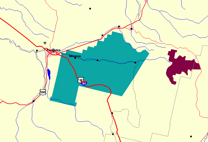
The Confederated Tribes of the Umatilla Indian Reservation are the federally recognized confederations of three Sahaptin-speaking Native American tribes who traditionally inhabited the Columbia River Plateau region: the Cayuse, Umatilla, and Walla Walla. When the leaders of the Walla Walla, Cayuse, and Umatilla peoples signed the Treaty of Walla Walla with the United States in 1855, they ceded of their homeland that is now northeastern Oregon and southeastern Washington. This was done in exchange for a reservation of and the promise of annuities in the form of goods and supplies. The tribes share the Reservation, which consists of in Umatilla County, in northeast Oregon state. The tribes have created a joint political structure as part of their confederation. The tribal offices are just east of Pendleton, Oregon. Almost half of the reservation land is owned by non-Native Americans; the reservation includes significant portions of the Umatilla River watershed. In 2013 the ... [...More Info...] [...Related Items...] OR: [Wikipedia] [Google] [Baidu] |
Colville Confederated Tribes
The Colville Indian Reservation is an Indian reservation in the northwest United States, in north central Washington, inhabited and managed by the Confederated Tribes of the Colville Reservation, which is federally recognized. Established in 1872, the reservation currently consists of , located primarily in the southeastern section of Okanogan County and the southern half of Ferry County. It also includes other pieces of trust land in eastern Washington, including in Chelan County, just to the northwest of the city of Chelan. The reservation's name is adapted from that of Fort Colville, which was named by British colonists for Andrew Colville, a London governor of the Hudson's Bay Company. The Confederated Tribes have 8,700 descendants from twelve aboriginal tribes. The tribes are known in English as: the Colville, Nespelem, Sanpoil, Lakes (after the Arrow Lakes of British Columbia, or Sinixt), Palus, Wenatchi, Chelan, Entiat, Methow, southern Okanagan, Si ... [...More Info...] [...Related Items...] OR: [Wikipedia] [Google] [Baidu] |


