|
Ostrobothnian Plain
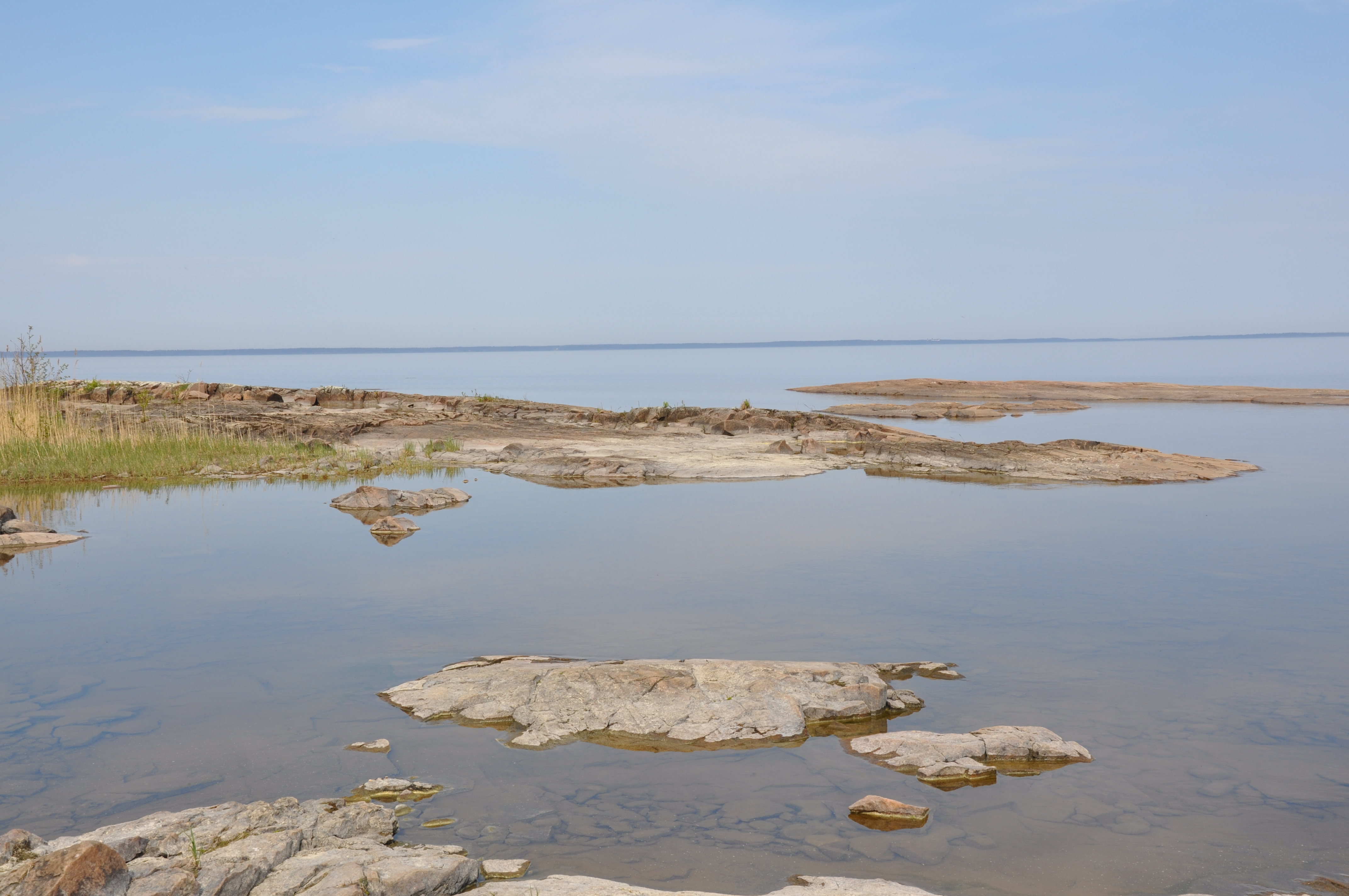
The Ostrobothnian Plain or Pohjanmaa is a large lowland in Finland along the Bothnian Sea being arguably the largest plain in the Nordic countries. The plain is made up smaller individual sand and clay plains alternated with rivers and peat bog A bog or bogland is a wetland that accumulates peat as a deposit of dead plant materials often mosses, typically sphagnum moss. It is one of the four main types of wetlands. Other names for bogs include mire, mosses, quagmire, and muskeg; a ...s. It extends as a 100 km wide and 257 km long belt along the northwestern coast of Finland. The plain is extremely flat with height differences never exceeding 50 m. Geologically the plain is a continuation of the Sub-Cambrian peneplain found across much of Fennoscandia. References {{coord missing, Finland Landforms of Ostrobothnia (region) Landforms of North Ostrobothnia Plains of Finland ... [...More Info...] [...Related Items...] OR: [Wikipedia] [Google] [Baidu] |
Finland
Finland ( fi, Suomi ; sv, Finland ), officially the Republic of Finland (; ), is a Nordic country in Northern Europe. It shares land borders with Sweden to the northwest, Norway to the north, and Russia to the east, with the Gulf of Bothnia to the west and the Gulf of Finland across Estonia to the south. Finland covers an area of with a population of 5.6 million. Helsinki is the capital and largest city, forming a larger metropolitan area with the neighbouring cities of Espoo, Kauniainen, and Vantaa. The vast majority of the population are ethnic Finns. Finnish, alongside Swedish, are the official languages. Swedish is the native language of 5.2% of the population. Finland's climate varies from humid continental in the south to the boreal in the north. The land cover is primarily a boreal forest biome, with more than 180,000 recorded lakes. Finland was first inhabited around 9000 BC after the Last Glacial Period. The Stone Age introduced several differ ... [...More Info...] [...Related Items...] OR: [Wikipedia] [Google] [Baidu] |
Bothnian Sea
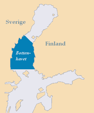
The Bothnian Sea ( sv, Bottenhavet; fi, Selkämeri) links the Bothnian Bay (also called the Bay of Bothnia) with the Baltic proper. Kvarken is situated between the two. Together, the Bothnian Sea and Bay make up a larger geographical entity, the Gulf of Bothnia, where the Bothnian Sea is the southern part. The whole Gulf of Bothnia is situated between Sweden, to the west, Finland, to the east, and the Sea of Åland and Archipelago Sea to the south. The surface area of the Bothnian Sea is approximately 79,000 km². The largest coastal towns, from south to north, are Rauma and Pori in Finland, and Gävle and Sundsvall in Sweden. Umeå (Sweden) and Vaasa (Finland) lie in the extreme north, near Bothnian Bay. See also * Bothnian Sea National Park Bothnian Sea National Park ( fi, Selkämeren kansallispuisto, sv, Bottenhavets nationalpark) is a national park in Finland. It was established in early 2011. Around 98% of the surface of the National Park consists of wat ... [...More Info...] [...Related Items...] OR: [Wikipedia] [Google] [Baidu] |
Nordic Countries
The Nordic countries (also known as the Nordics or ''Norden''; lit. 'the North') are a geographical and cultural region in Northern Europe and the North Atlantic. It includes the sovereign states of Denmark, Finland, Iceland, Norway and Sweden; the autonomous territories of the Faroe Islands and Greenland; and the autonomous region of Åland. The Nordic countries have much in common in their way of life, history, religion and social structure. They have a long history of political unions and other close relations but do not form a singular entity today. The Scandinavist movement sought to unite Denmark, Norway and Sweden into one country in the 19th century. With the dissolution of the union between Norway and Sweden (Norwegian independence), the independence of Finland in the early 20th century and the 1944 Icelandic constitutional referendum, this movement expanded into the modern organised Nordic cooperation. Since 1962, this cooperation has been based on the Helsi ... [...More Info...] [...Related Items...] OR: [Wikipedia] [Google] [Baidu] |
Sand
Sand is a granular material composed of finely divided mineral particles. Sand has various compositions but is defined by its grain size. Sand grains are smaller than gravel and coarser than silt. Sand can also refer to a textural class of soil or soil type; i.e., a soil containing more than 85 percent sand-sized particles by mass. The composition of sand varies, depending on the local rock sources and conditions, but the most common constituent of sand in inland continental settings and non- tropical coastal settings is silica (silicon dioxide, or SiO2), usually in the form of quartz. Calcium carbonate is the second most common type of sand, for example, aragonite, which has mostly been created, over the past 500million years, by various forms of life, like coral and shellfish. For example, it is the primary form of sand apparent in areas where reefs have dominated the ecosystem for millions of years like the Caribbean. Somewhat more rarely, sand may be composed of ... [...More Info...] [...Related Items...] OR: [Wikipedia] [Google] [Baidu] |
Clay
Clay is a type of fine-grained natural soil material containing clay minerals (hydrous aluminium phyllosilicates, e.g. kaolin, Al2 Si2 O5( OH)4). Clays develop plasticity when wet, due to a molecular film of water surrounding the clay particles, but become hard, brittle and non–plastic upon drying or firing. Most pure clay minerals are white or light-coloured, but natural clays show a variety of colours from impurities, such as a reddish or brownish colour from small amounts of iron oxide. Clay is the oldest known ceramic material. Prehistoric humans discovered the useful properties of clay and used it for making pottery. Some of the earliest pottery shards have been dated to around 14,000 BC, and clay tablets were the first known writing medium. Clay is used in many modern industrial processes, such as paper making, cement production, and chemical filtering. Between one-half and two-thirds of the world's population live or work in buildings made with clay, oft ... [...More Info...] [...Related Items...] OR: [Wikipedia] [Google] [Baidu] |
Peat Bog
A bog or bogland is a wetland that accumulates peat as a deposit of dead plant materials often mosses, typically sphagnum moss. It is one of the four main types of wetlands. Other names for bogs include mire, mosses, quagmire, and muskeg; alkaline mires are called fens. A baygall is another type of bog found in the forest of the Gulf Coast states in the United States.Watson, Geraldine Ellis (2000) ''Big Thicket Plant Ecology: An Introduction'', Third Edition (Temple Big Thicket Series #5). University of North Texas Press. Denton, Texas. 152 pp. Texas Parks and Wildlife. Ecological Mapping systems of Texas: West Gulf Coastal Plain Seepage Swamp and Baygall'. Retrieved 7 July 2020 They are often covered in heath or heather shrubs rooted in the sphagnum moss and peat. The gradual accumulation of decayed plant material in a bog functions as a carbon sink. Bogs occur where the water at the ground surface is acidic and low in nutrients. In contrast to fens, they derive most of th ... [...More Info...] [...Related Items...] OR: [Wikipedia] [Google] [Baidu] |
Sub-Cambrian Peneplain
The sub-Cambrian peneplain is an ancient, extremely flat, erosion surface ( peneplain) that has been exhumed and exposed by erosion from under Cambrian strata over large swathes of Fennoscandia. Eastward, where this peneplain dips below Cambrian and other Lower Paleozoic cover rocks. The exposed parts of this peneplain are extraordinarily flat with relief of less than 20 m. The overlying cover rocks demonstrate that the peneplain was flooded by shallow seas during the Early Paleozoic. Being the oldest identifiable peneplain in its area the Sub-Cambrian peneplain qualifies as a primary peneplain. The surface was first identified by Arvid Högbom in a 1910 publication, with Sten Rudberg publishing the first extensive map in 1954. This mapping has been improved upon by Karna Lidmar-Bergström since the 1980s. Extent The Sub-Cambrian peneplain extends as an almost continuous belt along the eastern coast of Sweden for some 700 km from north to south. Near Stockholm and Hudiksvall ... [...More Info...] [...Related Items...] OR: [Wikipedia] [Google] [Baidu] |
Fennoscandia
__NOTOC__ Fennoscandia ( Finnish, Swedish and no, Fennoskandia, nocat=1; russian: Фенноскандия, Fennoskandiya) or the Fennoscandian Peninsula is the geographical peninsula in Europe, which includes the Scandinavian and Kola peninsulas, mainland Finland, and Karelia. Administratively this roughly encompasses the mainlands of Finland, Norway and Sweden, as well as Murmansk Oblast, much of the Republic of Karelia, and parts of northern Leningrad Oblast in Russia. Its name comes from the Latin words ''Fennia'' (Finland) and ''Scandia'' (Scandinavian). The term was first used by the Finnish geologist Wilhelm Ramsay in 1898. Geologically, the area is distinct because its bedrock is Archean granite and gneiss with very little limestone, in contrast to adjacent areas in Europe. The similar term Fenno-Scandinavia is sometimes used as a synonym for Fennoscandia. Both terms are sometimes used in English to refer to a cultural or political grouping of Finland with Swed ... [...More Info...] [...Related Items...] OR: [Wikipedia] [Google] [Baidu] |
Nationalencyklopedin
''Nationalencyklopedin'' (; "The National Encyclopedia" in English), abbreviated NE, is a comprehensive contemporary Swedish-language encyclopedia, initiated by a favourable loan from the Government of Sweden of 17 million Swedish kronor in 1980, which was repaid by December 1990. The printed version consists of 20 volumes with 172,000 articles; the Internet version comprises 260,000 articles (as of June 2005). History The project was born in 1980, when a government committee suggested that negotiations be initiated with various publishers. This stage was finished in August 1985, when in Höganäs became the publisher responsible for the project. The project specifications were for a modern reference work based on a scientific paradigm incorporating gender and environmental issues. Pre-orders for the work were unprecedented; before the first volume was published in December 1989, 54,000 customers had ordered the encyclopedia. The last volume came out in 1996, with three s ... [...More Info...] [...Related Items...] OR: [Wikipedia] [Google] [Baidu] |
Landforms Of Ostrobothnia (region)
A landform is a natural or anthropogenic land feature on the solid surface of the Earth or other planetary body. Landforms together make up a given terrain, and their arrangement in the landscape is known as topography. Landforms include hills, mountains, canyons, and valleys, as well as shoreline features such as bays, peninsulas, and seas, including submerged features such as mid-ocean ridges, volcanoes, and the great ocean basins. Physical characteristics Landforms are categorized by characteristic physical attributes such as elevation, slope, orientation, stratification, rock exposure and soil type. Gross physical features or landforms include intuitive elements such as berms, mounds, hills, ridges, cliffs, valleys, rivers, peninsulas, volcanoes, and numerous other structural and size-scaled (e.g. ponds vs. lakes, hills vs. mountains) elements including various kinds of inland and oceanic waterbodies and sub-surface features. Mountains, hills, plateaux, and plains are t ... [...More Info...] [...Related Items...] OR: [Wikipedia] [Google] [Baidu] |
Landforms Of North Ostrobothnia
A landform is a natural or anthropogenic land feature on the solid surface of the Earth or other planetary body. Landforms together make up a given terrain, and their arrangement in the landscape is known as topography. Landforms include hills, mountains, canyons, and valleys, as well as shoreline features such as bays, peninsulas, and seas, including submerged features such as mid-ocean ridges, volcanoes, and the great ocean basins. Physical characteristics Landforms are categorized by characteristic physical attributes such as elevation, slope, orientation, stratification, rock exposure and soil type. Gross physical features or landforms include intuitive elements such as berms, mounds, hills, ridges, cliffs, valleys, rivers, peninsulas, volcanoes, and numerous other structural and size-scaled (e.g. ponds vs. lakes, hills vs. mountains) elements including various kinds of inland and oceanic waterbodies and sub-surface features. Mountains, hills, plateaux, and plains are the fou ... [...More Info...] [...Related Items...] OR: [Wikipedia] [Google] [Baidu] |


.jpg)