|
Ortelius
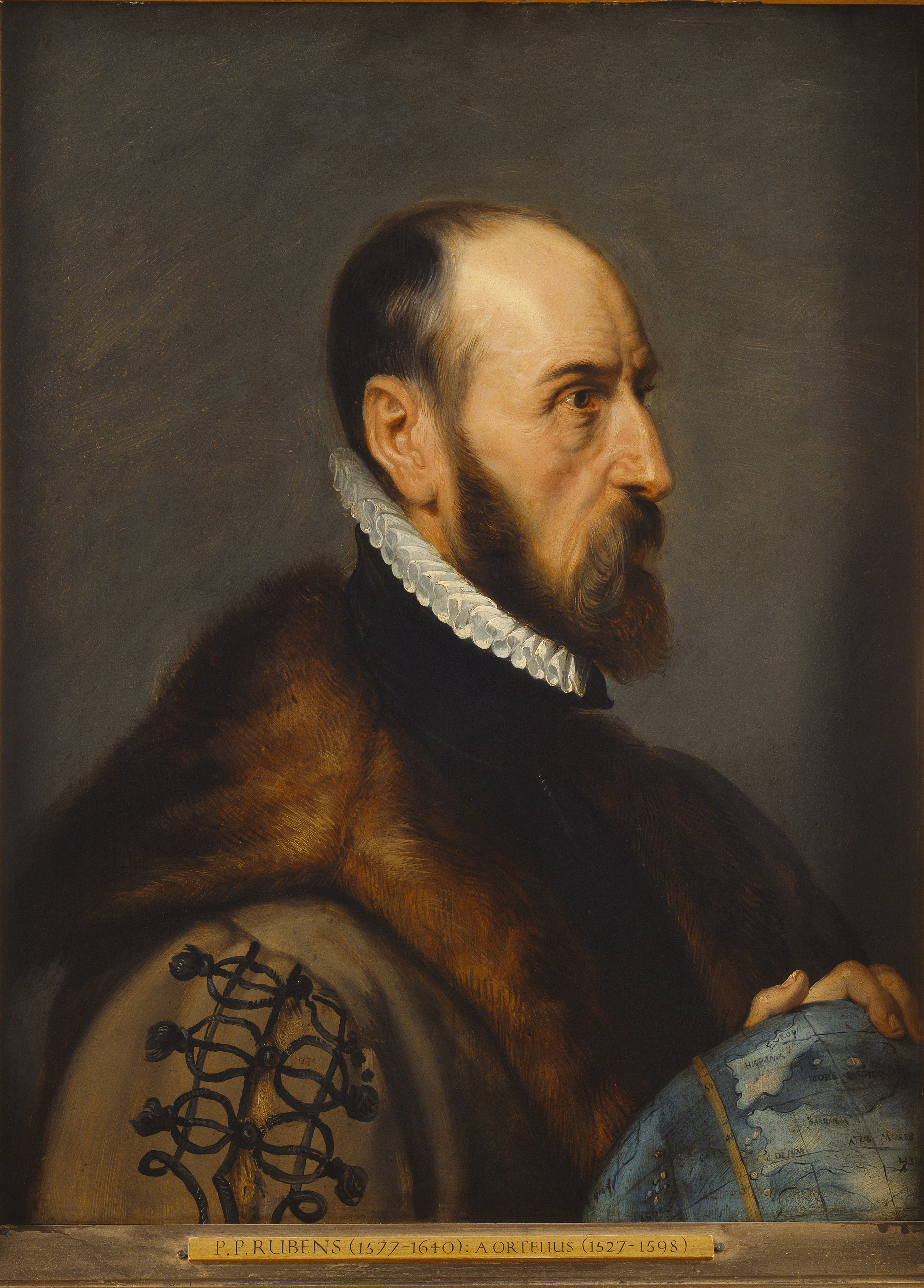
Abraham Ortelius (; also Ortels, Orthellius, Wortels; 4 or 14 April 152728 June 1598) was a Brabantian cartographer, geographer, and cosmographer, conventionally recognized as the creator of the first modern atlas, the ''Theatrum Orbis Terrarum'' (''Theatre of the World''). Along with Gemma Frisius and Gerardus Mercator, Ortelius is generally considered one of the founders of the Netherlandish school of cartography and geography. He was a notable figure of this school in its golden age (approximately 1570s–1670s) and an important geographer of Spain during the age of discovery. The publication of his atlas in 1570 is often considered as the official beginning of the Golden Age of Netherlandish cartography. He was the first person proposing that the continents were joined before drifting to their present positions. Life Ortelius was born on either 4 April or 14 April 1527 in the city of Antwerp, which was then in the Habsburg Netherlands (modern-day Belgium). The Orthellius ... [...More Info...] [...Related Items...] OR: [Wikipedia] [Google] [Baidu] |
Theatrum Orbis Terrarum
''Theatrum Orbis Terrarum'' (, "Theatre of the Orb of the World") is considered to be the first true modern atlas. Written by Abraham Ortelius, strongly encouraged by Gillis Hooftman and originally printed on 20 May 1570 in Antwerp, it consisted of a collection of uniform map sheets and supporting text bound to form a book for which copper printing plates were specifically engraved. The Ortelius atlas is sometimes referred to as the summary of sixteenth-century cartography. The publication of the ''Theatrum Orbis Terrarum'' (1570) is often considered as the official beginning of the Golden Age of Netherlandish cartography (approximately 1570s–1670s). Content The atlas contained virtually no maps from the hand of Ortelius, but 53 bundled maps of other masters, with the source as indicated. Previously, groupings of disparate maps were only released as custom lots, to individual order. In the Ortelius atlas, however, the maps were all in the same style and of the same size, pri ... [...More Info...] [...Related Items...] OR: [Wikipedia] [Google] [Baidu] |
Gerardus Mercator
Gerardus Mercator (; 5 March 1512 – 2 December 1594) was a 16th-century geographer, cosmographer and cartographer from the County of Flanders. He is most renowned for creating the 1569 world map based on a new projection which represented sailing courses of constant bearing ( rhumb lines) as straight lines—an innovation that is still employed in nautical charts. Mercator was a highly influential pioneer in the history of cartography. Monmonier, Mark: ''Rhumb Lines and Map Wars: A Social History of the Mercator Projection''. (Chicago: University of Chicago Press, 2004)Van der Krogt, Peter (2015), 'Chapter 6: Gerhard Mercator and his Cosmography: How the 'Atlas' became an Atlas,'; in: Gerhard Holzer, et al. (eds.), ''A World of Innovation: Cartography in the Time of Gerhard Mercator''. (Newcastle upon Tyne: Cambridge Scholars Publishing, 2015), pp. 112–130 Along with Gemma Frisius and Abraham Ortelius, he is generally considered one of the founders of the Netherlandish ... [...More Info...] [...Related Items...] OR: [Wikipedia] [Google] [Baidu] |
Continental Drift
Continental drift is the hypothesis that the Earth's continents have moved over geologic time relative to each other, thus appearing to have "drifted" across the ocean bed. The idea of continental drift has been subsumed into the science of plate tectonics, which studies the movement of the continents as they ride on plates of the Earth's lithosphere. The speculation that continents might have 'drifted' was first put forward by Abraham Ortelius in 1596. A pioneer of the modern view of mobilism was the Austrian geologist Otto Ampferer.Helmut W. Flügel: Die virtuelle Welt des Otto Ampferer und die Realität seiner Zeit'. In: Geo. Alp., Vol. 1, 2004. The concept was independently and more fully developed by Alfred Wegener in 1912, but the hypothesis was rejected by many for lack of any motive mechanism. The English geologist Arthur Holmes later proposed mantle convection for that mechanism. History Early history Abraham Ortelius , Theodor Christoph Lilienthal (1756), A ... [...More Info...] [...Related Items...] OR: [Wikipedia] [Google] [Baidu] |
Golden Age Of Netherlandish Cartography
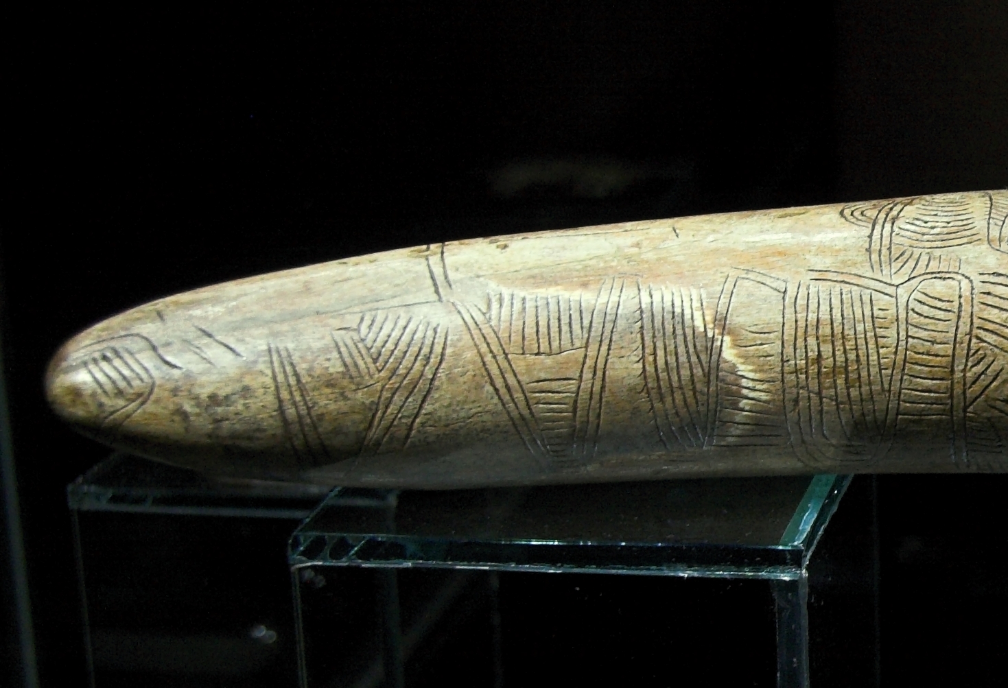
The history of cartography refers to the development and consequences of cartography, or mapmaking technology, throughout human history. Maps have been one of the most important human inventions for millennia, allowing humans to explain and navigate their way through the world. When and how the earliest maps were made are unknown, but maps of local terrain are believed to have been independently invented by many cultures. The earliest surviving maps include cave paintings and etchings on tusk and stone. Maps were produced extensively by ancient Babylon, Greece, Rome, China, and India. The earliest maps ignored the curvature of Earth's surface, both because the shape of the Earth was uncertain and because the curvature is not important across the small areas being mapped. However, since the age of Classical Greece, maps of large regions, and especially of the world, have used projection from a model globe in order to control how the inevitable distortion gets apportioned on the ... [...More Info...] [...Related Items...] OR: [Wikipedia] [Google] [Baidu] |
Early Modern Netherlandish Cartography
The history of cartography refers to the development and consequences of cartography, or mapmaking technology, throughout human history. Maps have been one of the most important human inventions for millennia, allowing humans to explain and navigate their way through the world. When and how the earliest maps were made are unknown, but maps of local terrain are believed to have been independently invented by many cultures. The earliest surviving maps include cave paintings and etchings on tusk and stone. Maps were produced extensively by ancient Babylon, Greece, Rome, China, and India. The earliest maps ignored the curvature of Earth's surface, both because the shape of the Earth was uncertain and because the curvature is not important across the small areas being mapped. However, since the age of Classical Greece, maps of large regions, and especially of the world, have used projection from a model globe in order to control how the inevitable distortion gets apportioned on the ... [...More Info...] [...Related Items...] OR: [Wikipedia] [Google] [Baidu] |
Atlas
An atlas is a collection of maps; it is typically a bundle of maps of Earth or of a region of Earth. Atlases have traditionally been bound into book form, but today many atlases are in multimedia formats. In addition to presenting geographic features and political boundaries, many atlases often feature geopolitical, social, religious and economic statistics. They also have information about the map and places in it. Etymology The use of the word "atlas" in a geographical context dates from 1595 when the German-Flemish geographer Gerardus Mercator published ("Atlas or cosmographical meditations upon the creation of the universe and the universe as created"). This title provides Mercator's definition of the word as a description of the creation and form of the whole universe, not simply as a collection of maps. The volume that was published posthumously one year after his death is a wide-ranging text but, as the editions evolved, it became simply a collection of maps and it is ... [...More Info...] [...Related Items...] OR: [Wikipedia] [Google] [Baidu] |
Antwerp
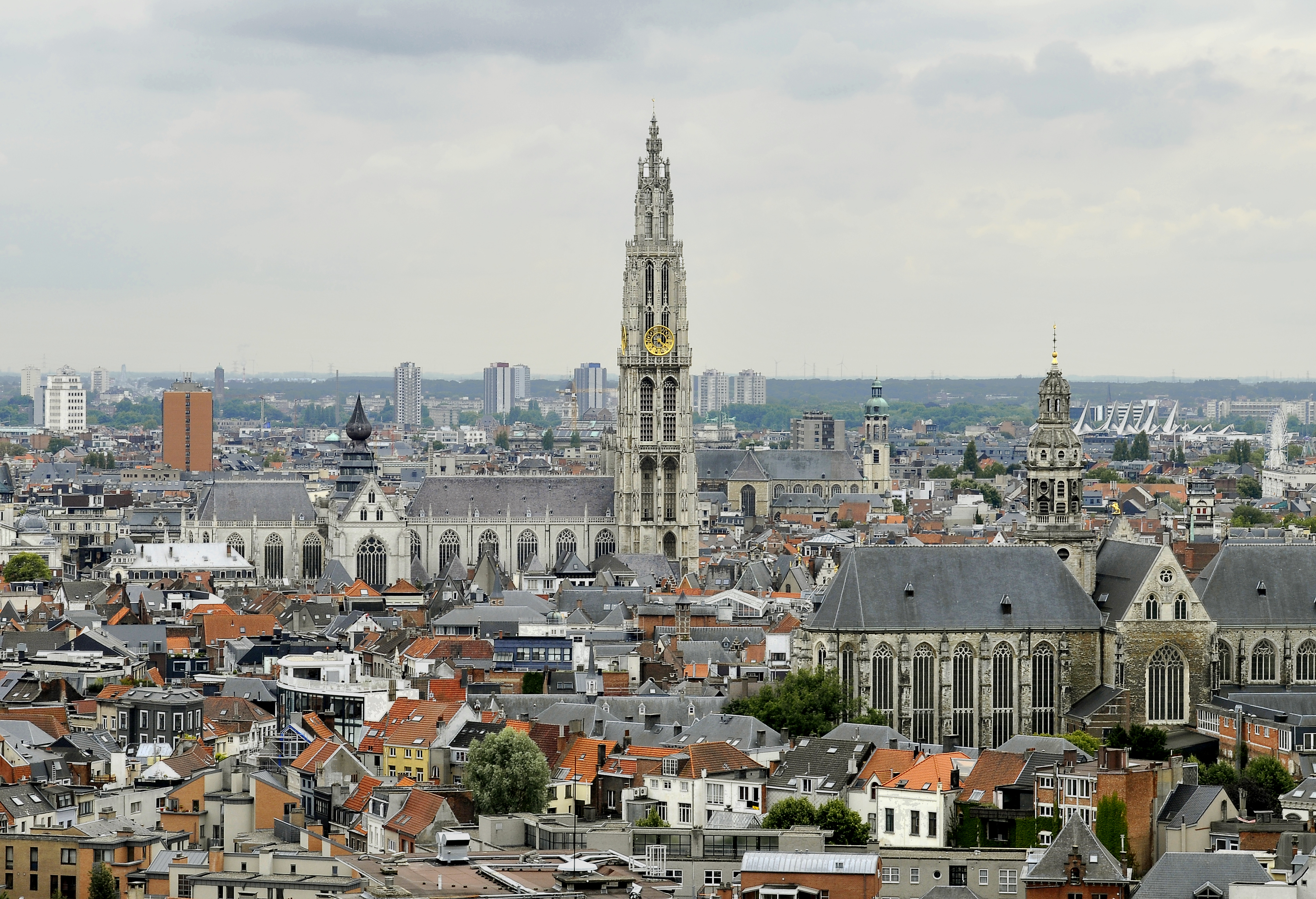
Antwerp (; nl, Antwerpen ; french: Anvers ; es, Amberes) is the largest city in Belgium by area at and the capital of Antwerp Province in the Flemish Region. With a population of 520,504,Statistics Belgium; ''Loop van de bevolking per gemeente'' (Excel file) Population of all municipalities in Belgium, . Retrieved 1 November 2017. it is the most populous municipality in Belgium, and with a metropolitan population of around 1,200,000 people, it is the second-largest metrop ... [...More Info...] [...Related Items...] OR: [Wikipedia] [Google] [Baidu] |
Emanuel Van Meteren
Emanuel van Meteren or Meteeren (6 September 1535 – 11 April 1612) was a Flemish historian and Consul for "the Traders of the Low Countries" in London. He was born in Antwerp, the son of Sir Jacobus van Meteren, Dutch financier and publisher of early English versions of the Bible, and Ottilia Ortellius, of the famous Ortellius family of mapmakers, and nephew of the cartographer Abraham Ortelius. Biographical notes As a historian Van Meteren was special in that he was not merely a chronicler of the events of his time, but also a powerful and wealthy man who influenced those events: The van Meteren family...had fled the Netherlands for religious reasons. Van Meteren’s father, Jacob, played a key role in the publication of the first English Bible in the 1530s, and the family established itself as a pillar of the Protestant refugee community in London. As an adult, Emmanuel lived on Lime Street, became the consul for the Dutch merchants in London, and occupied the all-import ... [...More Info...] [...Related Items...] OR: [Wikipedia] [Google] [Baidu] |
Philip Galle
Philip (or Philips) Galle (1537 – March 1612) was a Dutch publisher, best known for publishing old master prints, which he also produced as designer and engraver. He is especially known for his reproductive engravings of paintings. Life Galle was born in Haarlem in the Netherlands, where he was a pupil of the humanist and engraver Dirck Volckertszoon Coornhert, Dirck Volkertsz. Coornhert. According to the RKD, he married Catharina van Rollant on 9 June 1569. They had five children who later became active as artists: Theodoor Galle, Theodoor, Cornelis Galle the Elder, Cornelis, Philips Galle II, Philips II, Justa (who married the engraver Adriaen Collaert) and Catharina (who married the engraver Karel de Mallery).Philips Galle in the RKD In Haarlem he engraved several works of the Haarlem painter Maarten van Heemskerck. Even while he worked fr ... [...More Info...] [...Related Items...] OR: [Wikipedia] [Google] [Baidu] |
List Of Atlases
This is a list of notable atlases, each a collection of maps, some including statistical data for the regions represented: Early modern ;15th century * Douce Atlas (nautical atlas) ;16th century *''Theatrum Orbis Terrarum'' (Ortelius, Flanders, 1570–1612) *''Piri Reis Map'' (Ottoman Empire, 1570–1612) * Mercator's ''Atlas'' (1578) ;17th century *''Atlas Novus'' (Blaeu, Netherlands, 1635–16581645 editionat UCLA) *''Dell'Arcano del Mare'' (England/Italy, 1645–1661) *''Cartes générales de toutes les parties du monde'' (France, 1658–1676) *''Klencke Atlas'' (1660; world's largest book) *''Atlas Maior'' (Blaeu, Netherlands, 1662–1667) *'' Atlante Veneto'' ( Coronelli, Venice, 1691) ;18th century *''Britannia Depicta'' (London, 1720) *'' Atlas Nouveau'' (Amsterdam, 1742) *'' Cary's New and Correct English Atlas'' (London, 1787) Modern ;19th century *''Andrees Allgemeiner Handatlas'' (Germany, 1881–1939; in the UK as ''Times Atlas of the World'', 1895) *'' Atlas do ... [...More Info...] [...Related Items...] OR: [Wikipedia] [Google] [Baidu] |
Gemma Frisius
Gemma Frisius (; born Jemme Reinerszoon; December 9, 1508 – May 25, 1555) was a Frisian physician, mathematician, cartographer, philosopher, and instrument maker. He created important globes, improved the mathematical instruments of his day and applied mathematics in new ways to surveying and navigation. Gemma's rings, an astronomical instrument, are named after him. Along with Gerardus Mercator and Abraham Ortelius, Frisius is often considered one of the founders of the Netherlandish school of cartography, and significantly helped lay the foundations for the school's golden age (approximately 1570s–1670s). Biography Frisius was born in Dokkum, Friesland (present-day Netherlands), of poor parents who died when he was young. He moved to Groningen and later studied at the University of Leuven (Louvain), Belgium, beginning in 1525. He received the degree of MD in 1536 and remained on the faculty of medicine of Leuven for the rest of his life where, in addition to te ... [...More Info...] [...Related Items...] OR: [Wikipedia] [Google] [Baidu] |
Philip II Of Spain
Philip II) in Spain, while in Portugal and his Italian kingdoms he ruled as Philip I ( pt, Filipe I). (21 May 152713 September 1598), also known as Philip the Prudent ( es, Felipe el Prudente), was King of Spain from 1556, King of Portugal from 1580, and King of Naples and Sicily from 1554 until his death in 1598. He was '' jure uxoris'' King of England and Ireland from his marriage to Queen Mary I in 1554 until her death in 1558. He was also Duke of Milan from 1540. From 1555, he was Lord of the Seventeen Provinces of the Netherlands. The son of Emperor Charles V and Isabella of Portugal, Philip inherited his father's Spanish Empire in 1556 and succeeded to the Portuguese throne in 1580 following a dynastic crisis. The Spanish conquests of the Inca Empire and of the Philippines, named in his honor by Ruy López de Villalobos, were completed during his reign. Under Philip II, Spain reached the height of its influence and power, sometimes called the Spanish Golden Age, and r ... [...More Info...] [...Related Items...] OR: [Wikipedia] [Google] [Baidu] |


.jpg)


