|
Orders (surname)
Orders is a surname. Etymology The etymology of 'Orders' is unclear, although there are records extant dating the surname in its current spelling back to the 17th century in the Warminster region of Wiltshire and the 16th century in Cambridgeshire, England. The root of the name in its possible variant spelling forms can be ALD, AUD, OLD or ORD to which have been added a suffix such as AS, ES, ERS, IS, OS, US, etc. 'Orders' therefore has many possible genealogical or historical derivations which are affiliated in common via the shared modern spelling. Derivation The modern surname is now found in many parts of the world, and suggestions as to its historical roots include: *that it is an alternative spelling of AUDAS, which itself comes from two distinct sources, one of early medieval English origin and one of Scottish origin. The English form of the name derives from the Middle English female personal name "Aldus", itself a pet form of any of the numerous Olde English pre 7th Centu ... [...More Info...] [...Related Items...] OR: [Wikipedia] [Google] [Baidu] |
Surname
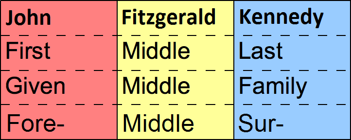
In many societies, a surname, family name, or last name is the mostly hereditary portion of one's personal name that indicates one's family. It is typically combined with a given name to form the full name of a person, although several given names and surnames are possible in the full name. In modern times most surnames are hereditary, although in most countries a person has a right to name change, change their name. Depending on culture, the surname may be placed either at the start of a person's name, or at the end. The number of surnames given to an individual also varies: in most cases it is just one, but in Portuguese-speaking countries and many Spanish-speaking countries, two surnames (one inherited from the mother and another from the father) are used for legal purposes. Depending on culture, not all members of a family unit are required to have identical surnames. In some countries, surnames are modified depending on gender and family membership status of a person. C ... [...More Info...] [...Related Items...] OR: [Wikipedia] [Google] [Baidu] |
Warminster
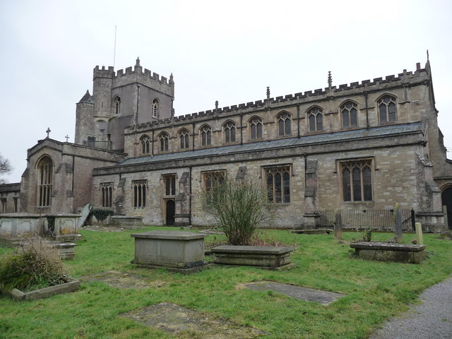
Warminster () is a historic market town and Civil parishes in England, civil parish in south-west Wiltshire, England, on the western edge of Salisbury Plain. The parish had a population of 18,173 in 2021. The name ''Warminster'' occurs first in the early 10th century and the St Denys' Church, Warminster, Minster Church of St Denys was begun in the 11th century. The High Street and Market Place have many fine buildings including the Warminster Athenaeum, Athenaeum Centre, the Warminster Town Hall, Town Hall, St Lawrence Chapel, The Old Bell and a variety of independent shops. Several Army establishments, known collectively as the Warminster Garrison, are on the edges of the town. Etymology The origin of the root ''Wor'' is ''wara'', the Genitive case, genitive plural of the Old English noun ''waru'' meaning "those that care for, watch, guard, protect, or defend." It was used as an endonym by both Goths and Jutes. Their specific ethnonym is unknown, though it likely was related ... [...More Info...] [...Related Items...] OR: [Wikipedia] [Google] [Baidu] |
Wiltshire
Wiltshire (; abbreviated to Wilts) is a ceremonial county in South West England. It borders Gloucestershire to the north, Oxfordshire to the north-east, Berkshire to the east, Hampshire to the south-east, Dorset to the south, and Somerset to the west. The largest settlement is Swindon, and Trowbridge is the county town. The county has an area of and a population of 720,060. The county is mostly rural, and the centre and south-west are sparsely populated. After Swindon (183,638), the largest settlements are the city of Salisbury (41,820) and the towns of Chippenham (37,548) and Trowbridge (37,169). For local government purposes, the county comprises two unitary authority areas: Swindon and Wiltshire. Undulating chalk downlands characterize much of the county. In the east are Marlborough Downs, which contain Savernake Forest. To the south is the Vale of Pewsey, which separates the downs from Salisbury Plain in the centre of the county. The south-west is also downland, ... [...More Info...] [...Related Items...] OR: [Wikipedia] [Google] [Baidu] |
Cambridgeshire
Cambridgeshire (abbreviated Cambs.) is a Ceremonial counties of England, ceremonial county in the East of England and East Anglia. It is bordered by Lincolnshire to the north, Norfolk to the north-east, Suffolk to the east, Essex and Hertfordshire to the south, Northamptonshire to the west, and Bedfordshire to the south-west. The largest settlement is the city of Peterborough, and the city of Cambridge is the county town. The county has an area of and had an estimated population of 906,814 in 2022. Peterborough, in the north-west, and Cambridge, in the south, are by far the largest settlements. The remainder of the county is rural, and contains the city of Ely, Cambridgeshire, Ely in the east, Wisbech in the north-east, and St Neots and Huntingdon in the west. For Local government in England, local government purposes Cambridgeshire comprises a non-metropolitan county, with five Districts of England, districts, and the Unitary authorities of England, unitary authority area o ... [...More Info...] [...Related Items...] OR: [Wikipedia] [Google] [Baidu] |
England
England is a Countries of the United Kingdom, country that is part of the United Kingdom. It is located on the island of Great Britain, of which it covers about 62%, and List of islands of England, more than 100 smaller adjacent islands. It shares Anglo-Scottish border, a land border with Scotland to the north and England–Wales border, another land border with Wales to the west, and is otherwise surrounded by the North Sea to the east, the English Channel to the south, the Celtic Sea to the south-west, and the Irish Sea to the west. Continental Europe lies to the south-east, and Ireland to the west. At the 2021 United Kingdom census, 2021 census, the population was 56,490,048. London is both List of urban areas in the United Kingdom, the largest city and the Capital city, capital. The area now called England was first inhabited by modern humans during the Upper Paleolithic. It takes its name from the Angles (tribe), Angles, a Germanic peoples, Germanic tribe who settled du ... [...More Info...] [...Related Items...] OR: [Wikipedia] [Google] [Baidu] |
Orderic Vitalis
Orderic Vitalis (; 16 February 1075 – ) was an English chronicler and Benedictine monk who wrote one of the great contemporary chronicles of 11th- and 12th-century Normandy and Anglo-Norman England.Hollister ''Henry I'' p. 6 Working out of the Abbey of Saint-Evroul, he is credited with writing the ''Historia Ecclesiastica,'' a work detailing the history of Europe and the Mediterranean from the birth of Jesus Christ into his own age. The son of a cleric, he was born into a noble family, claiming both English and Norman heritage. While he is known primarily for the ''Historia Ecclesiastica'', he also was able to ascend to various positions within the church including script master, librarian, and cantor. A prolific writer, he addressed various topics in his writings, both religious and secular. Modern historians view him as a reliable source. Early life Orderic was born on 16 February 1075 in Atcham, Shropshire, England, the eldest son of a French priest, Odelerius of Orlé ... [...More Info...] [...Related Items...] OR: [Wikipedia] [Google] [Baidu] |
Ertel
Ertel is a surname originating from South Germany: from a personalized form of a name beginning with Ort-, from Old High German "ort": "point (of a sword or lance)." Ertel may also mean "Steel Smith." Ertel may be a derivation of other surnames, including " Ertl" and "Ertle." This surname of ERTEL has two origins. It was a Provençal occupational name for a gardener or a topographic name for someone who lived near an enclosed garden. The name developed in the Latin form HORTUS via medieval documents. It was also a German name for someone who lived at the top of a hill or the end of a settlement, derived from the Old German word ORT, in the transferred sense “tip” or “extremity.” The name has numerous variant spellings which include ERTLER, ORT, DELORT, DESHORTS, HUERTA, HORTA, OHRTMAN, VAN OORT, ORTET and ORTEL, to name but a few. Although some have changed the name of a variety of personal reasons, a common form of variation was in fact involuntary, when an official c ... [...More Info...] [...Related Items...] OR: [Wikipedia] [Google] [Baidu] |
Derbyshire
Derbyshire ( ) is a ceremonial county in the East Midlands of England. It borders Greater Manchester, West Yorkshire, and South Yorkshire to the north, Nottinghamshire to the east, Leicestershire to the south-east, Staffordshire to the south and west, and Cheshire to the west. Derby is the largest settlement, and Matlock is the county town. The county has an area of and a population of 1,053,316. The east of the county is more densely populated than the west, and contains the county's largest settlements: Derby (261,400), Chesterfield (88,483), and Swadlincote (45,000). For local government purposes Derbyshire comprises a non-metropolitan county, with eight districts, and the Derby unitary authority area. The East Midlands Combined County Authority includes Derbyshire County Council and Derby City Council. The north and centre of Derbyshire are hilly and contain the southern end of the Pennines, most of which are part of the Peak District National Park. They include Kinde ... [...More Info...] [...Related Items...] OR: [Wikipedia] [Google] [Baidu] |
Conical Hill
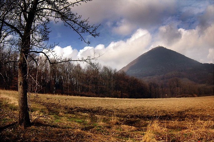
A conical hill (also cone or conical mountain) is a landform with a distinctly conical shape. It is usually isolated or rises above other surrounding foothills, and is often of volcanic origin. Conical hills or mountains occur in different shapes and are not necessarily geometrically-shaped cones; some are more tower-shaped or have an asymmetric curve on one side of the hill. Typically, however, they have a circular base and smooth sides with a gradient of up to 30°. Such conical mountains are found in all volcanically-formed areas of the world such as the Bohemian Central Uplands in the Czech Republic, the Rhön in Germany or the Massif Central in France. Term The conical hill as a geomorphological term first appeared in the German language, as ''Kegelberg'', coined by Goethe and geologists of his era. From their natural appearance these were mostly basaltic or phonolitic landforms in the shape of a mathematical cone, hence why the term came to be used in the early geol ... [...More Info...] [...Related Items...] OR: [Wikipedia] [Google] [Baidu] |
Battle Of Waterloo
The Battle of Waterloo was fought on Sunday 18 June 1815, near Waterloo, Belgium, Waterloo (then in the United Kingdom of the Netherlands, now in Belgium), marking the end of the Napoleonic Wars. The French Imperial Army (1804–1815), French Imperial Army under the command of Napoleon, Napoleon I was defeated by two armies of the Seventh Coalition. One was a United Kingdom of Great Britain and Ireland, British-led force with units from the United Kingdom of Great Britain and Ireland, United Kingdom, the United Kingdom of the Netherlands, Netherlands, Kingdom of Hanover, Hanover, Duchy of Brunswick, Brunswick, and Duchy of Nassau, Nassau, under the command of field marshal Arthur Wellesley, 1st Duke of Wellington, Arthur Wellesley, Duke of Wellington. The other comprised three corps of the Kingdom of Prussia, Prussian army under Field Marshal Gebhard Leberecht von Blücher, Blücher. The battle was known contemporaneously as the ''Battle of Mont-Saint-Jean, Belgium, Mont Saint ... [...More Info...] [...Related Items...] OR: [Wikipedia] [Google] [Baidu] |


