|
Oranienbaum, Germany
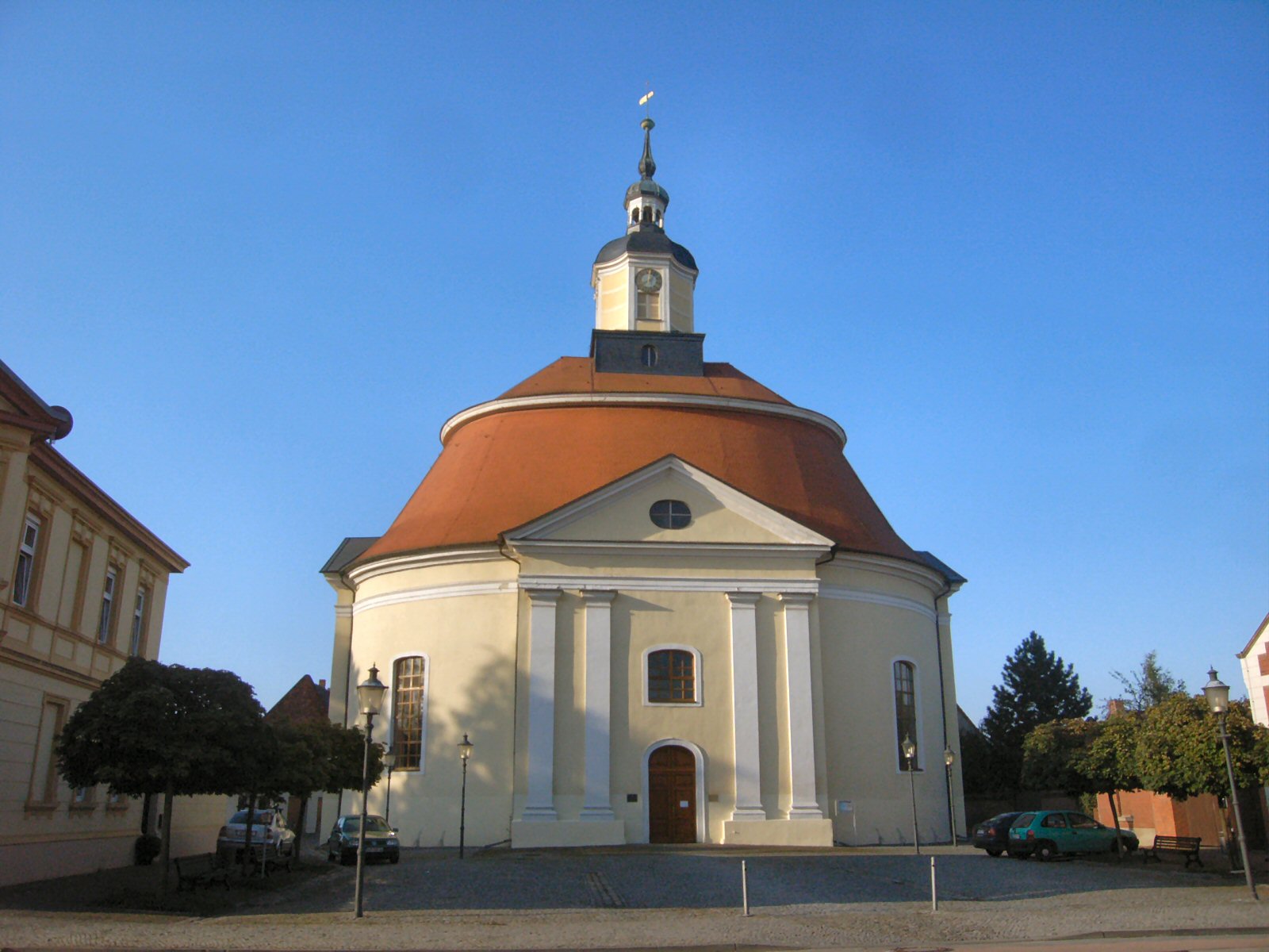
Oranienbaum () is a former town and a former municipality in the district of Wittenberg, in Saxony-Anhalt, Germany. Since 1 January 2011, it is a District (german: Ortsteil) of the town of Oranienbaum-Wörlitz. It is situated south of the Elbe, east of Dessau. History The former settlement of Nischwitz was renamed in 1673 after Countess Henriette Catherine of Nassau, a scion of the House of Orange-Nassau ( nl, Oranje-Nassau) and princess consort of the then ruling Prince John George II of Anhalt-Dessau. From 1683 on, the Countess had the Oranienbaum Palace erected according to plans by the Dutch architect Cornelis Ryckwaert. The parks are today included within the Dessau-Wörlitz Garden Realm, a UNESCO World Heritage Site since 2000. Sights * Oranienbaum Palace, park and Chinese garden with pagoda * Baroque parish church, built in 1712 * Monument Path with 29 stations * Historical market square * Dutch architectural style of the 19th century International relations * Dau ... [...More Info...] [...Related Items...] OR: [Wikipedia] [Google] [Baidu] |
Oranienbaum-Wörlitz
Oranienbaum-Wörlitz is a town in the district of Wittenberg, in Saxony-Anhalt, Germany. It was formed on 1 January 2011 by the merger of the former towns Oranienbaum and Wörlitz and the former municipalities Brandhorst, Gohrau, Griesen, Horstdorf, Kakau, Rehsen, Riesigk and Vockerode. . These former municipalities are now ''Ortschaften'' (municipal divisions) of the town Oranienbaum-Wörlitz. [...More Info...] [...Related Items...] OR: [Wikipedia] [Google] [Baidu] |
Soviet Occupation Zone
The Soviet Occupation Zone ( or german: Ostzone, label=none, "East Zone"; , ''Sovetskaya okkupatsionnaya zona Germanii'', "Soviet Occupation Zone of Germany") was an area of Germany in Central Europe that was occupied by the Soviet Union as a communist area, established as a result of the Potsdam Agreement on 1 August 1945. On 7 October 1949 the German Democratic Republic (GDR), commonly referred to in English as East Germany, was established in the Soviet Occupation Zone. The SBZ was one of the four Allied occupation zones of Germany created at the end of World War II with the Allied victory. According to the Potsdam Agreement, the Soviet Military Administration in Germany (German initials: SMAD) was assigned responsibility for the middle portion of Germany. Eastern Germany beyond the Oder-Neisse line, equal in territory to the SBZ, was to be annexed by Poland and its population expelled, pending a final peace conference with Germany. By the time forces of the United St ... [...More Info...] [...Related Items...] OR: [Wikipedia] [Google] [Baidu] |
Oranienburg
Oranienburg () is a town in Brandenburg, Germany. It is the capital of the district of Oberhavel. Geography Oranienburg is a town located on the banks of the Havel river, 35 km north of the centre of Berlin. Division of the town Oranienburg consists of nine districts: * Friedrichsthal * Germendorf * Lehnitz * Malz * Oranienburg * Sachsenhausen * Schmachtenhagen * Wensickendorf * Zehlendorf History Originally named Bötzow, the town of Oranienburg dates from the 12th century and was first mentioned in 1216. Margrave Albert the Bear (ruled 1157–1170) allegedly ordered the construction of a castle on the banks of the Havel. Around the castle stood a settlement of traders and craftsmen. In 1646, Friedrich Wilhelm I of Brandenburg married Louise Henriette of Orange-Nassau (German: ''Oranien-Nassau''). She was so attracted by the town of Bötzow that her husband presented the entire region to her. The princess ordered the construction of a new castle in the Dutch sty ... [...More Info...] [...Related Items...] OR: [Wikipedia] [Google] [Baidu] |
Daun, Germany
Daun is a town in the Vulkaneifel district in Rhineland-Palatinate, Germany. It is the district seat and also the seat of the ' of Daun. Geography Location The town lies in the , a part of the Eifel known for its volcanic history, geographical and geological features, and even ongoing activity today, including gases that sometimes well up from the earth. Daun lies south of the High Eifel on the river Lieser. Found from 2.5 to 3.5 km southeast of Daun’s town centre are the Dauner '' Maare'', a group of three volcanic lakes separated almost wholly by only the walls of tuff between them. The town is home to the '. Daun is furthermore a spa town and has mineral water springs. Constituent communities The district seat of Daun has 8,514 inhabitants (as of 31 December 2005, counting only those with their main residence in the town). Besides the main town, also called Daun (4,264 inhabitants), the municipal area also includes these outlying centres (') that were former ... [...More Info...] [...Related Items...] OR: [Wikipedia] [Google] [Baidu] |
Baroque Architecture
Baroque architecture is a highly decorative and theatrical style which appeared in Italy in the early 17th century and gradually spread across Europe. It was originally introduced by the Catholic Church, particularly by the Jesuits, as a means to combat the Reformation and the Protestant church with a new architecture that inspired surprise and awe. It reached its peak in the High Baroque (1625–1675), when it was used in churches and palaces in Italy, Spain, Portugal, France, Bavaria and Austria. In the Late Baroque period (1675–1750), it reached as far as Russia and the Spanish and Portuguese colonies in Latin America. About 1730, an even more elaborately decorative variant called Rococo appeared and flourished in Central Europe. Baroque architects took the basic elements of Renaissance architecture, including domes and colonnades, and made them higher, grander, more decorated, and more dramatic. The interior effects were often achieved with the use of '' quadratura ... [...More Info...] [...Related Items...] OR: [Wikipedia] [Google] [Baidu] |
Pagoda
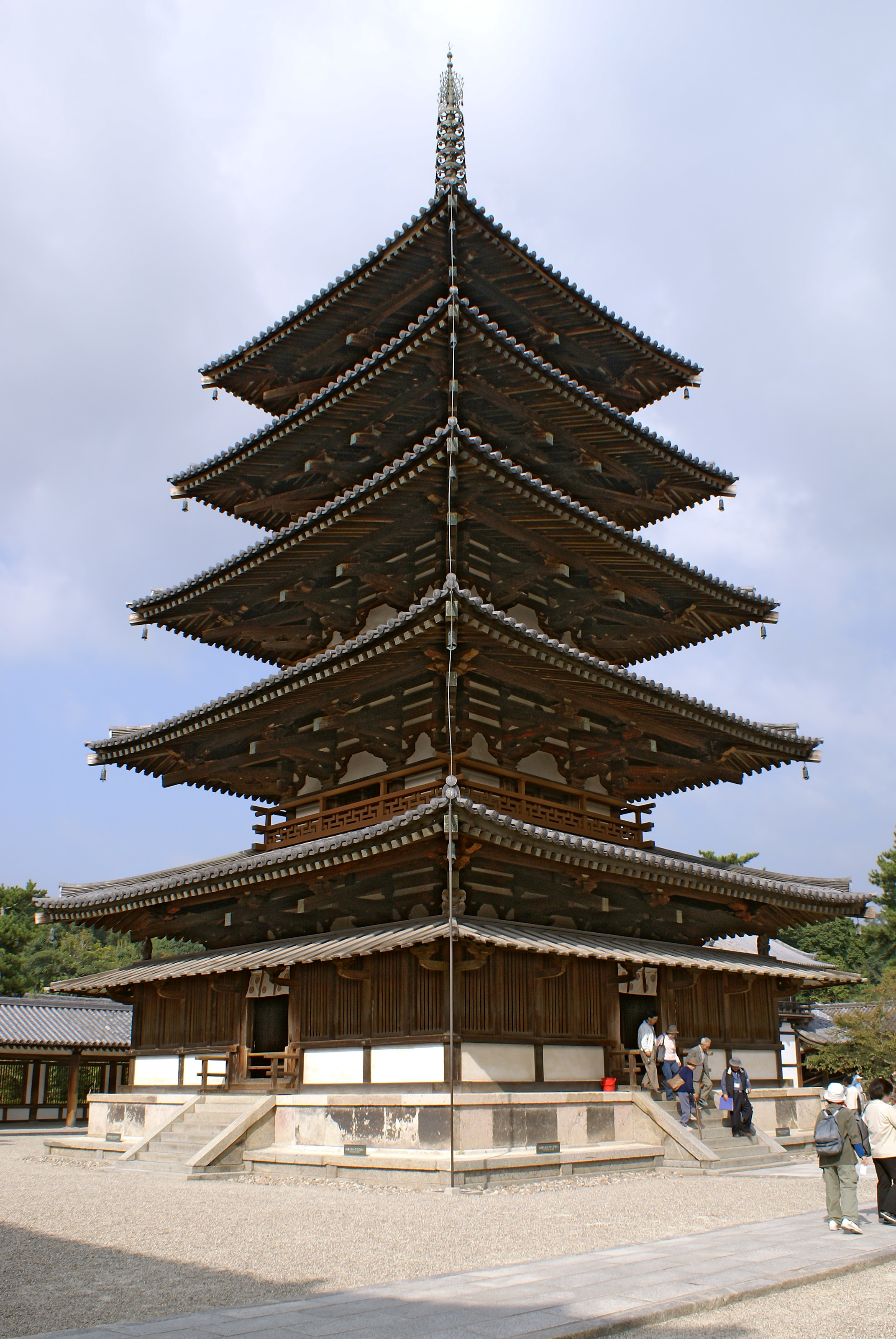
A pagoda is an Asian tiered tower with multiple eaves common to Nepal, India, China, Japan, Korea, Myanmar, Vietnam, and other parts of Asia. Most pagodas were built to have a religious function, most often Buddhist but sometimes Taoist, and were often located in or near viharas. The pagoda traces its origins to the stupa of ancient India. Chinese pagodas () are a traditional part of Chinese architecture. In addition to religious use, since ancient times Chinese pagodas have been praised for the spectacular views they offer, and many classical poems attest to the joy of scaling pagodas. Chinese sources credit the Nepalese architect Araniko with introducing the pagoda to China. The oldest and tallest pagodas were built of wood, but most that survived were built of brick or stone. Some pagodas are solid with no interior. Hollow pagodas have no higher floors or rooms, but the interior often contains an altar or a smaller pagoda, as well as a series of staircases for t ... [...More Info...] [...Related Items...] OR: [Wikipedia] [Google] [Baidu] |
Chinese Garden
The Chinese garden is a landscape garden style which has evolved over three thousand years. It includes both the vast gardens of the Chinese emperors and members of the imperial family, built for pleasure and to impress, and the more intimate gardens created by scholars, poets, former government officials, soldiers and merchants, made for reflection and escape from the outside world. They create an idealized miniature landscape, which is meant to express the harmony that should exist between man and nature. A typical Chinese garden is enclosed by walls and includes one or more ponds, rock works, trees and flowers, and an assortment of halls and pavilions within the garden, connected by winding paths and zig-zag galleries. By moving from structure to structure, visitors can view a series of carefully composed scenes, unrolling like a scroll of landscape paintings. History Beginnings The earliest recorded Chinese gardens were created in the valley of the Yellow River, during t ... [...More Info...] [...Related Items...] OR: [Wikipedia] [Google] [Baidu] |
World Heritage Site
A World Heritage Site is a landmark or area with legal protection by an international convention administered by the United Nations Educational, Scientific and Cultural Organization (UNESCO). World Heritage Sites are designated by UNESCO for having cultural, historical, scientific or other form of significance. The sites are judged to contain "cultural and natural heritage around the world considered to be of outstanding value to humanity". To be selected, a World Heritage Site must be a somehow unique landmark which is geographically and historically identifiable and has special cultural or physical significance. For example, World Heritage Sites might be ancient ruins or historical structures, buildings, cities, deserts, forests, islands, lakes, monuments, mountains, or wilderness areas. A World Heritage Site may signify a remarkable accomplishment of humanity, and serve as evidence of our intellectual history on the planet, or it might be a place of great natural beauty. A ... [...More Info...] [...Related Items...] OR: [Wikipedia] [Google] [Baidu] |
Dessau-Wörlitz Garden Realm
The Dessau-Wörlitz Garden Realm, (German: ''Dessau-Wörlitzer Gartenreich'') is a cultural landscape and World Heritage Site in Germany, located between the city of Dessau and the town of Wörlitz in Central Germany. One of the first and largest English parks in Germany and continental Europe, it was created in the late 18th century under the regency of Duke Leopold III of Anhalt-Dessau. Today, the cultural landscape of Dessau-Wörlitz encompasses an area of within the Middle Elbe Biosphere Reserve in the German state of Saxony-Anhalt. Because of its exceptional landscape design and testimony to the ideals of the Age of Enlightenment, the Dessau-Wörlitz Garden Realm was designated as a world heritage site in 2000. Origin The Gardens had its origin in the 17th century, when the marriage of Leopold's great-grandfather Prince John George II of Anhalt-Dessau to the Dutch princess Henriette Catharina, daughter of Prince Frederick Henry of Orange ( nl, Oranje), in 1659 brought a ... [...More Info...] [...Related Items...] OR: [Wikipedia] [Google] [Baidu] |
John George II, Prince Of Anhalt-Dessau
John George II (17 November 1627 – 7 August 1693) was a German prince of the House of Ascania and ruler of the principality of Anhalt-Dessau from 1660 to 1693. A member of the Fruitbearing Society, he also served as a field marshal of Brandenburg-Prussia. Life Early life John George was born on 17 November 1627 at Dessau, the second (but eldest and only surviving) son of John Casimir, Prince of Anhalt-Dessau, by his first wife Agnes, daughter of Maurice, Landgrave of Hesse-Kassel. Marriage In Groningen on 9 September 1659 John George married Henriette Katharina (b. The Hague, 10 February 1637 – d. Schloss Oranienbaum, 3 November 1708), daughter of Frederick Henry, Prince of Orange. The marriage was happy and was even said by some to be a love match. They had ten children. Reign After the death of his father on 15 July 1660, John George took over the government of Anhalt-Dessau. He also inherited his family's claim on Aschersleben, which had been controlled by Brandenburg ... [...More Info...] [...Related Items...] OR: [Wikipedia] [Google] [Baidu] |
House Of Orange-Nassau
The House of Orange-Nassau ( Dutch: ''Huis van Oranje-Nassau'', ) is the current reigning house of the Netherlands. A branch of the European House of Nassau, the house has played a central role in the politics and government of the Netherlands and Europe especially since William the Silent organised the Dutch Revolt against Spanish rule, which after the Eighty Years' War (1568–1648) led to an independent Dutch state. Several members of the house served during this war and after as stadtholder ("governor"; Dutch: ''stadhouder'') during the Dutch Republic. However, in 1815, after a long period as a republic, the Netherlands became a monarchy under the House of Orange-Nassau. The dynasty was established as a result of the marriage of Henry III of Nassau-Breda from Germany and Claudia of Châlon-Orange from French Burgundy in 1515. Their son René of Chalon inherited in 1530 the independent and sovereign Principality of Orange from his mother's brother, Philibert of Ch ... [...More Info...] [...Related Items...] OR: [Wikipedia] [Google] [Baidu] |


