|
Notre-Dame-des-Champs, Ontario
Notre-Dame-des-Champs (Our Lady of the Fields) is a rural List of communities in Ontario, community on the northern edge of Mer Bleue in Ottawa, Ontario, Canada. Prior to 2001 amalgamation, it was on the border between Cumberland, Ontario, Cumberland and Gloucester, Ontario, Gloucester. Today, it is on the border between Cumberland Ward and Innes Ward. The population is about 1000. Neighbourhoods in Ottawa {{EasternOntario-geo-stub ... [...More Info...] [...Related Items...] OR: [Wikipedia] [Google] [Baidu] |
Ontario
Ontario ( ; ) is one of the thirteen provinces and territories of Canada.Ontario is located in the geographic eastern half of Canada, but it has historically and politically been considered to be part of Central Canada. Located in Central Canada, it is Canada's most populous province, with 38.3 percent of the country's population, and is the second-largest province by total area (after Quebec). Ontario is Canada's fourth-largest jurisdiction in total area when the territories of the Northwest Territories and Nunavut are included. It is home to the nation's capital city, Ottawa, and the nation's most populous city, Toronto, which is Ontario's provincial capital. Ontario is bordered by the province of Manitoba to the west, Hudson Bay and James Bay to the north, and Quebec to the east and northeast, and to the south by the U.S. states of (from west to east) Minnesota, Michigan, Ohio, Pennsylvania, and New York. Almost all of Ontario's border with the United States f ... [...More Info...] [...Related Items...] OR: [Wikipedia] [Google] [Baidu] |
List Of Communities In Ontario
{{short description, None There are various lists of communities in Ontario, grouped by status, type or location: * List of census subdivisions in Ontario - counties, districts and regional municipalities *List of cities in Ontario - places which are incorporated as cities *List of francophone communities in Ontario - places which are designated as French language service areas due to having a significant minority or majority Franco-Ontariao population *List of municipalities in Ontario - all incorporated municipalities in the province regardless of type *List of population centres in Ontario - urban areas, without regard to municipal boundaries *List of towns in Ontario - places which are incorporated as towns *List of township municipalities in Ontario - places with the municipal status of township *List of unincorporated communities in Ontario - places which are not incorporated, but exist as neighbourhoods or settlements inside larger municipal entities *List of villages in Onta ... [...More Info...] [...Related Items...] OR: [Wikipedia] [Google] [Baidu] |
Mer Bleue
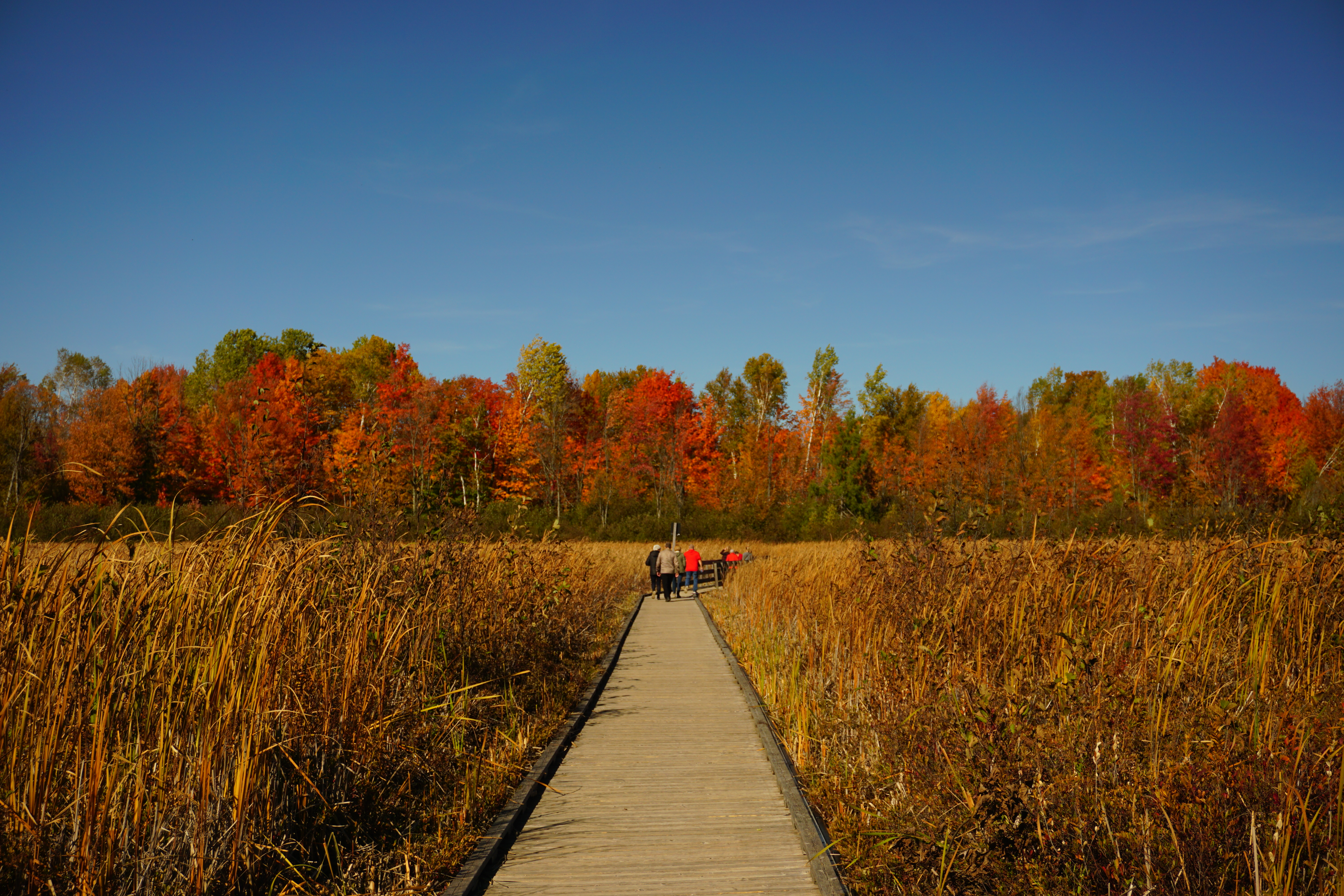
Mer Bleue Bog is a protected area in Gloucester, Ontario, an eastern suburb of Ottawa in Eastern Ontario, Canada. Its main feature is a sphagnum bog that is situated in an ancient channel of the Ottawa River and is a remarkable boreal-like ecosystem normally not found this far south. Stunted black spruce, tamarack, bog rosemary, blueberry, and cottongrass are some of the unusual species that have adapted to the acidic waters of the bog. The area provides habitat for many species, including beaver, muskrat, waterfowl, and the rare spotted turtle (''Clemmys guttata''). A 1.2 km (¾ mile) boardwalk allows visitors to explore a section of the bog. There are hiking trails that follow raised areas along the edges of the bog and cross-country skiing trails for use in winter. The conservation area is managed by the National Capital Commission. The value of this unique wetland was not always recognized. During World War II, the Royal Canadian Air Force used this area for bo ... [...More Info...] [...Related Items...] OR: [Wikipedia] [Google] [Baidu] |
Ottawa
Ottawa (, ; Canadian French: ) is the capital city of Canada. It is located at the confluence of the Ottawa River and the Rideau River in the southern portion of the province of Ontario. Ottawa borders Gatineau, Quebec, and forms the core of the Ottawa–Gatineau census metropolitan area (CMA) and the National Capital Region (NCR). Ottawa had a city population of 1,017,449 and a metropolitan population of 1,488,307, making it the fourth-largest city and fourth-largest metropolitan area in Canada. Ottawa is the political centre of Canada and headquarters to the federal government. The city houses numerous foreign embassies, key buildings, organizations, and institutions of Canada's government, including the Parliament of Canada, the Supreme Court, the residence of Canada's viceroy, and Office of the Prime Minister. Founded in 1826 as Bytown, and incorporated as Ottawa in 1855, its original boundaries were expanded through numerous annexations and were ultimately ... [...More Info...] [...Related Items...] OR: [Wikipedia] [Google] [Baidu] |
Canada
Canada is a country in North America. Its ten provinces and three territories extend from the Atlantic Ocean to the Pacific Ocean and northward into the Arctic Ocean, covering over , making it the world's second-largest country by total area. Its southern and western border with the United States, stretching , is the world's longest binational land border. Canada's capital is Ottawa, and its three largest metropolitan areas are Toronto, Montreal, and Vancouver. Indigenous peoples have continuously inhabited what is now Canada for thousands of years. Beginning in the 16th century, British and French expeditions explored and later settled along the Atlantic coast. As a consequence of various armed conflicts, France ceded nearly all of its colonies in North America in 1763. In 1867, with the union of three British North American colonies through Confederation, Canada was formed as a federal dominion of four provinces. This began an accretion of provinces an ... [...More Info...] [...Related Items...] OR: [Wikipedia] [Google] [Baidu] |
Cumberland, Ontario
Cumberland is a former municipality and now geographic township in eastern Ontario, Canada. It was an incorporated township from 1800 to 1999, when it was incorporated as the City of Cumberland, then ceased to be a separate municipality in 2001, when it was amalgamated into the city of Ottawa. It now exists only as a geographic township. History Cumberland was originally incorporated as a township in 1800 as part of Russell County. It took its name from the Duke of Cumberland (later King of Hanover). When an upper-tier Regional level of government was created in 1969 to replace neighbouring Carleton County, the township was removed from Russell County and incorporated into the new Regional Municipality of Ottawa–Carleton. The township comprised the eastern portion of Ottawa's Orléans suburb as well as the communities of Cumberland Village, Carlsbad Springs, Navan, Notre-Dame-des-Champs, Sarsfield, and Vars. Almost 200 years after it was first incorporated, Cumberla ... [...More Info...] [...Related Items...] OR: [Wikipedia] [Google] [Baidu] |
Gloucester, Ontario
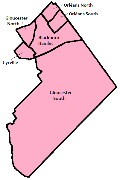
Gloucester ( ) is a former municipality and now geographic area of Ottawa, Ontario, Canada. Located east of Ottawa's inner core, it was an independent city until amalgamated with the Regional Municipality of Ottawa–Carleton in 2001 to become the new city of Ottawa. The population of Gloucester is about 150,012 people (2021 Census). History Gloucester, originally known as Township B, was established in 1792. The first settler in the township was Braddish Billings in what is now the Billings Bridge area of Ottawa. In 1800, the township became part of Russell County, Ontario, Russell County, and later Carleton County, Ontario, Carleton County in 1838. In 1850, the area was incorporated as Gloucester Township, named after Prince William Frederick, Duke of Gloucester and Edinburgh. Over the years, parts of Gloucester Township were annexed by the expanding city of Ottawa. Gloucester was incorporated as a city in 1981 and became part of the amalgamated city of Ottawa in 2001. Town ... [...More Info...] [...Related Items...] OR: [Wikipedia] [Google] [Baidu] |
Cumberland Ward
Cumberland ( ) is a historic county in the far North West England. It covers part of the Lake District as well as the north Pennines and Solway Firth coast. Cumberland had an administrative function from the 12th century until 1974. From 1974 until 2023, Cumberland lay within Cumbria, a larger administrative area which also covered Westmorland and parts of Yorkshire and Lancashire. In April 2023, Cumberland will be revived as an administrative entity when Cumbria County Council is abolished and replaced by two unitary authorities; one of these is to be named Cumberland and will include most of the historic county, with the exception of Penrith and the surrounding area. Cumberland is bordered by the historic counties of Northumberland to the north-east, County Durham to the east, Westmorland to the south-east, Lancashire to the south, and the Scottish counties of Dumfriesshire and Roxburghshire to the north. Early history In the Early Middle Ages, Cumbria was part of t ... [...More Info...] [...Related Items...] OR: [Wikipedia] [Google] [Baidu] |
Queenswood Heights
Queenswood Heights is a neighbourhood located in Orleans, the suburb in the east end of Ottawa, Ontario, Canada. Prior to amalgamation in 2001, the neighbourhood was in the Township of Cumberland. Queenswood Heights is bounded by St. Joseph Boulevard to the north, Tenth Line Road to the east, Innes Road to the south, and the former Cumberland-Gloucester boundary to the west ''(the Queenswood Heights Community Association considers Duford St. to be the western boundary)''. According to the Canada 2016 Census, the population of the neighbourhood was 11,031. Queenswood Heights spans . Schools There are four elementary level schools serving the needs of young students in the neighbourhood. * Our Lady of Wisdom Catholic School - English Catholic elementary School * École élémentaire catholique Reine-des-Bois - Catholic French language elementary school * Dunning-Foubert Elementary School - English public elementary school * École élémentaire catholique La Source - Catholic F ... [...More Info...] [...Related Items...] OR: [Wikipedia] [Google] [Baidu] |
Avalon, Ottawa
Avalon is a neighbourhood located in Orleans, a suburb in the east end of Ottawa, Ontario, Canada. Prior to amalgamation in 2001, the area was in the City of Cumberland. This neighbourhood was non-existent until the late 1990s when the urban sprawl intensified in the east end. Avalon quickly developed in the area is now bordered to the north by Innes Road, to the east by a line following (from north to south) Portobello Boulevard to Brian Coburn Boulevard to Trim Road, the west by Mer Bleue Road and to the south by Wall Road. According to the Canada 2011 Census, this area had a population of 12,455. The development of the area slowed when the developer had to return to previously built houses to fix foundations. Some have criticized the builder for building on swampland without proper engineering. At the intersection of Innes and Tenth Line, a large commercial zone with several department and big-box stores developed in conjunction of the residential boom of Avalon. This new ... [...More Info...] [...Related Items...] OR: [Wikipedia] [Google] [Baidu] |
Navan, Ontario
Navan is a community in Cumberland Ward in Ottawa, Ontario, Canada. It is located southeast of the suburban community of Orleans. Before its amalgamation with the city in 2001, Navan was within the City of Cumberland. It was named after the town of Navan in Ireland. Navan is about 20 km east of the city of Ottawa and the centre of the town is Colonial Road (Ottawa Road #28) and Trim Road Navan's proximity to the suburban area of Orleans means that it is quickly becoming more suburban in nature itself. About 1,905 people live in the vicinity of Navan (Canada 2016 Census). The Navan Fair is an annual event that takes place in August. It is held in the fairground off Colonial Road. The fair features midway rides, live music, concession stands, demolition derbies, exhibitions, a parade, and various shows. The first fair took place in 1946. The admission for the first year of the fair was 35 cents for adults, 25 cents for children, and 25 cents for cars. Notable landmarks * ... [...More Info...] [...Related Items...] OR: [Wikipedia] [Google] [Baidu] |


