|
Northwest Shelf Province
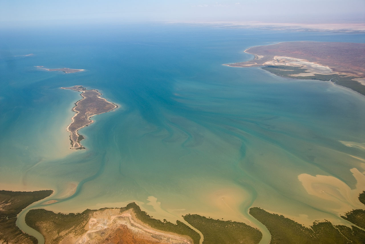
The Northwest Shelf Province, also known as Exmouth to Broome, is a biogeographic region of Australia's continental shelf. Geography The Northwest Shelf Province includes the coastal waters and continental shelf of north-western Western Australia between North West Cape and Cape Leveque. It has an area of 238,759 km2, extending from the shore to 200 m depth. It varies in width from about 50 km at Exmouth Gulf to more than 250 km off Cape Leveque. The Northwest Shelf Province adjoins the Central Western Shelf Transition or Ningaloo region on the southwest. The Northwest Shelf Transition lies east of Cape Leveque. To the north the continental slope descends towards the Indian Ocean's abyssal plain. Oceanography The waters are tropical. Surface waters are derived from the Indonesian Throughflow, and circulate through the province via branches of the South Equatorial and Eastern Gyral currents. Tidal ranges are generally high. The Northwest Coast, including the ... [...More Info...] [...Related Items...] OR: [Wikipedia] [Google] [Baidu] |
IMCRA 4
The Integrated Marine and Coastal Regionalisation of Australia (IMCRA), formerly the Interim Marine and Coastal Regionalisation for Australia, is a biogeography, biogeographic regionalisation of the oceanic waters of Australia's exclusive economic zone (EEZ). As of 2008, the most recent version is IMCRA Version 4.0. IMCRA actually defines two bioregionalisations: a benthic bioregionalisation, based on biogeography of fish together with geophysics, geophysical data; and a pelagic bioregionalisation, base on oceanography, oceanographic characteristics. The benthic bioregionalisation incorporates three separate regionalisations: #A regionalisation of the EEZ into provincial bioregions, based on the biogeography of bottom dwelling fishes. In IMCRA 4.0, 41 provincial bioregions, consisting of 24 ''provinces'' and 17 ''transitions''. #A regionalisation of the continental shelf into ''meso-scale regions'' based on biological and physical characters, and the distance from the coast. I ... [...More Info...] [...Related Items...] OR: [Wikipedia] [Google] [Baidu] |
Pilbara Coast
The Pilbara Coast is the coastline of Western Australia's Pilbara region. It is often referred to as the North West Coast of Western Australia. It is a complex array of river mouths, ports, peninsulas, and islands. Geography North West Cape forms the western end of the Pilbara Coast. According to the ICMRA, the Pilbara Coast ends at Cape Keraudren, a rocky headland that forms the western end of Eighty Mile Beach. Others end it further east at Wallal. Lagoons protected by barrier islands, embayments, river deltas, and rocky headlands are the main coastal features. The Pilbara's intermittent rivers, including the Ashburton, Fortescue, Yule, and De Grey, have deposited sediment to form river deltas. There are many coastal islands, including the near-shore Dampier Archipelago, a cluster of rocky islands and reefs. The larger offshore islands include Barrow Island and the Montebello Islands.Thackway R, Cresswell ID. 1998. Interim Marine and Coastal Regionalisation for Austral ... [...More Info...] [...Related Items...] OR: [Wikipedia] [Google] [Baidu] |
Marine Ecoregions
A marine ecoregion is an ecoregion, or ecological region, of the oceans and seas identified and defined based on biogeographic characteristics. Introduction A more complete definition describes them as “Areas of relatively homogeneous species composition, clearly distinct from adjacent systems” dominated by “a small number of ecosystems and/or a distinct suite of oceanographic or topographic features”. Ecologically they “are strongly cohesive units, sufficiently large to encompass ecological or life history processes for most sedentary species.”Spalding, Mark D., Helen E. Fox, Gerald R. Allen, Nick Davidson et al. "Marine Ecoregions of the World: A Bioregionalization of Coastal and Shelf Areas". Bioscience Vol. 57 No. 7, July/August 2007, pp. 573–58/ref> Marine Ecoregions of the World—MEOW The global classification system Marine Ecoregions of the World—MEOW was devised by an international team, including major conservation organizations, academic institutions and ... [...More Info...] [...Related Items...] OR: [Wikipedia] [Google] [Baidu] |
Ecoregions Of Australia
Ecoregions in Australia are geographically distinct plant and animal communities, defined by the World Wide Fund for Nature based on geology, soils, climate, and predominant vegetation. The World Wide Fund for Nature (WWF) identified 825 terrestrial ecoregions that cover the Earth's land surface, 40 of which cover Australia and its dependent islands. The WWF ecoregions are classified by biome type (tropical and subtropical moist broadleaf forests, temperate grasslands, savannas, and shrublands, tundra, etc.), and into one of eight terrestrial realms. Australia, together with New Zealand, New Guinea and neighboring island groups, is part of the Australasian realm. The IBRA bioregions informed the delineation of the WWF ecoregions for Australia, and the WWF ecoregions generally follow the same ecoregion boundaries, while often clustering two or more similar bioregions into a larger ecoregion. The ecoregion articles in Wikipedia generally follow the WWF scheme. The WWF ecoregions ... [...More Info...] [...Related Items...] OR: [Wikipedia] [Google] [Baidu] |
Biogeography Of Western Australia
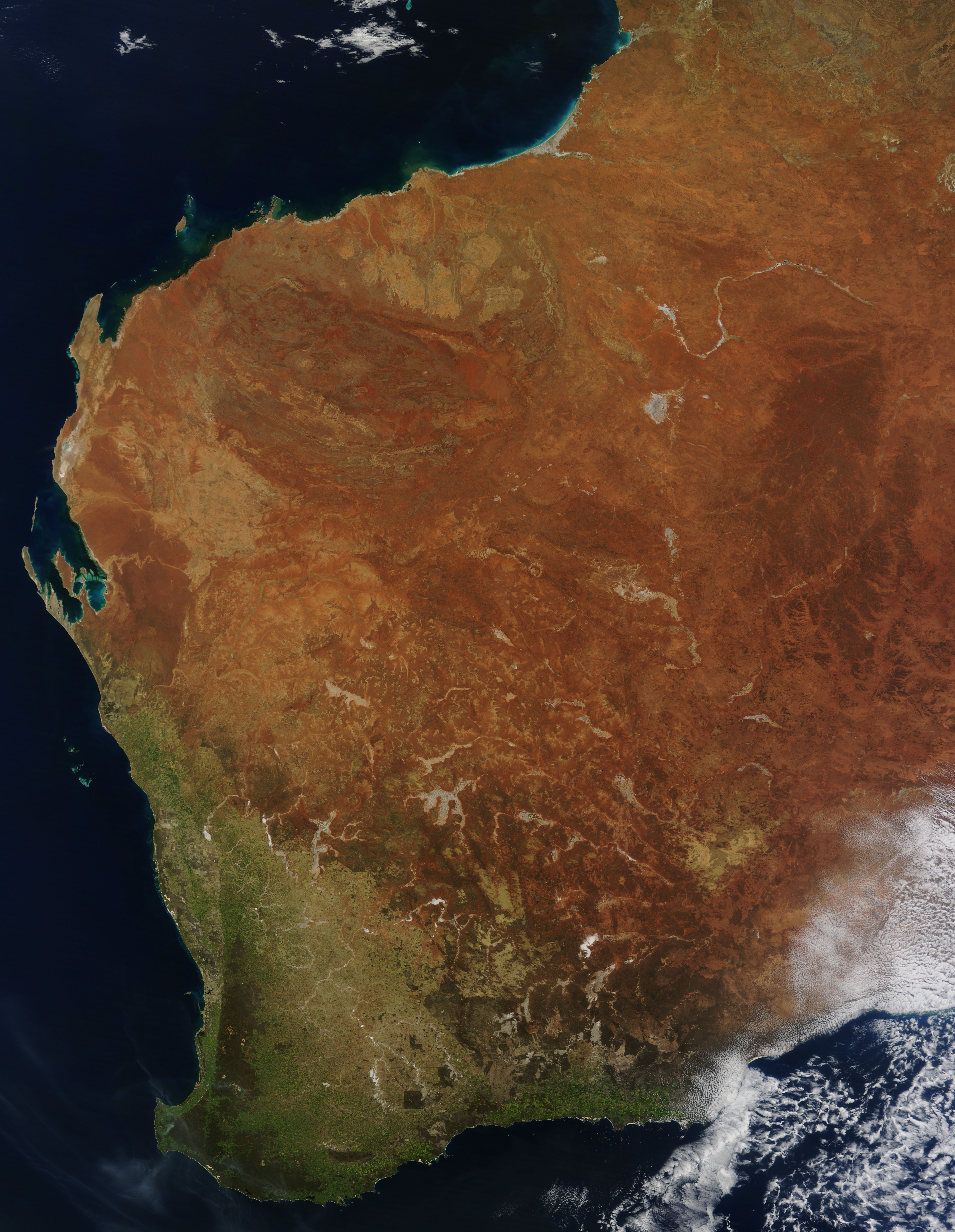
Western Australia occupies nearly one third of the Australian continent. Due to the size and the isolation of the state, considerable emphasis has been made of these features; it is the second largest administrative territory in the world, after Yakutia in Russia, despite the fact that Australia is only the sixth largest country in the world by area, and no other regional administrative jurisdiction in the world occupies such a high percentage of a continental land mass. It is also the only first level administrative subdivision to occupy the entire continental coastline in one cardinal direction. Its capital city, Perth, is also considered to be amongst the world's most isolated, being closer to Jakarta in Indonesia, than to the Australian national capital in Canberra. Introduction Western Australia's geology has components that are considered some of the oldest and most recent. The oldest minerals of the world have been discovered at the Jack Hills, and the Yilgarn Crat ... [...More Info...] [...Related Items...] OR: [Wikipedia] [Google] [Baidu] |
North West Shelf
The North West Shelf is a continental shelf region of Western Australia. It includes an extensive petroleum, oil and natural gas, gas region off the North West Australia coast in the Pilbara region. Geology Considerable parts of the region are the highest prospective gas and oil areas of Australia. The main sedimentary basin providing the opportunity is the Northern Carnarvon Basin - however it is only one part of the regional complex. Oil and gas It has a considerable number of oil and gas wells, pipelines, production areas and support facilities. Location As an area it is located in the Indian Ocean between North West Cape and Dampier, Western Australia, Dampier. Dampier is usually considered the main administrative locality for the shelf. Production areas The production areas are located offshore and within the jurisdiction of the Western Australian state government. The two main production areas are the Thevenard Production Area close to Onslow, Western Australia, Ons ... [...More Info...] [...Related Items...] OR: [Wikipedia] [Google] [Baidu] |
Broome, Western Australia
Broome, also known as Rubibi by the Yawuru people, is a coastal pearling and tourist town in the Kimberley region of Western Australia, north of Perth. In the the population was recorded as 14,660. It is the largest town in the Kimberley region. Geography Broome is located on Western Australia's tropical Kimberley coast on the eastern edge of the Indian Ocean. Roebuck Bay Being situated on a north–south peninsula, Broome has water on both sides of the town. On the eastern shore are the waters of Roebuck Bay extending from the main jetty at Port Drive to Sandy Point, west of Thangoo station. Town Beach is part of the shoreline and is popular with visitors on the eastern end of the town. It is the site of the 'Staircase to the Moon', where a receding tide and a rising moon combine to create a stunning natural phenomenon. On "Staircase to the Moon" nights, a food and craft market operates on Town Beach. Roebuck Bay is of international importance for the millions of migratin ... [...More Info...] [...Related Items...] OR: [Wikipedia] [Google] [Baidu] |
Dampier Peninsula
The Dampier Peninsula is a peninsula located north of Broome and Roebuck Bay in Western Australia. It is surrounded by the Indian Ocean to the west and north, and King Sound to the east. It is named after the mariner and explorer William Dampier who visited it. The northernmost part of the peninsula is Cape Leveque. It is sparsely inhabited, mostly by Indigenous Australian peoples, some of whom have been granted native title rights to some of their traditional lands. There are many coastal inlets, bays and other features, including Beagle Bay on its western side. Aboriginal heritage The peninsula is home to a rich heritage of Aboriginal culture, with the communities of Beagle Bay, Bobieding, Djarindjin, Ardyaloon (One Arm Point) and Ngardalargin, along with numerous other smaller communities, pearling camps, tourist resorts and Aboriginal outstations. The traditional owners of the areas around the peninsula are the Bardi, Nyunyul and Jabirr Jabirr (Djaberadjabera) peo ... [...More Info...] [...Related Items...] OR: [Wikipedia] [Google] [Baidu] |
Dampierland
Dampierland is an interim Australian bioregion in Western Australia.IBRA Version 6.1 data The region is also a distinct physiographic section of the larger Nullagine Platform province, which in turn is part of the larger West Australian Shield division. The bioregion is located in the West Kimberley area and incorporates the country that is adjacent to Broome, including the |
Pindan
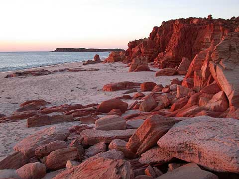
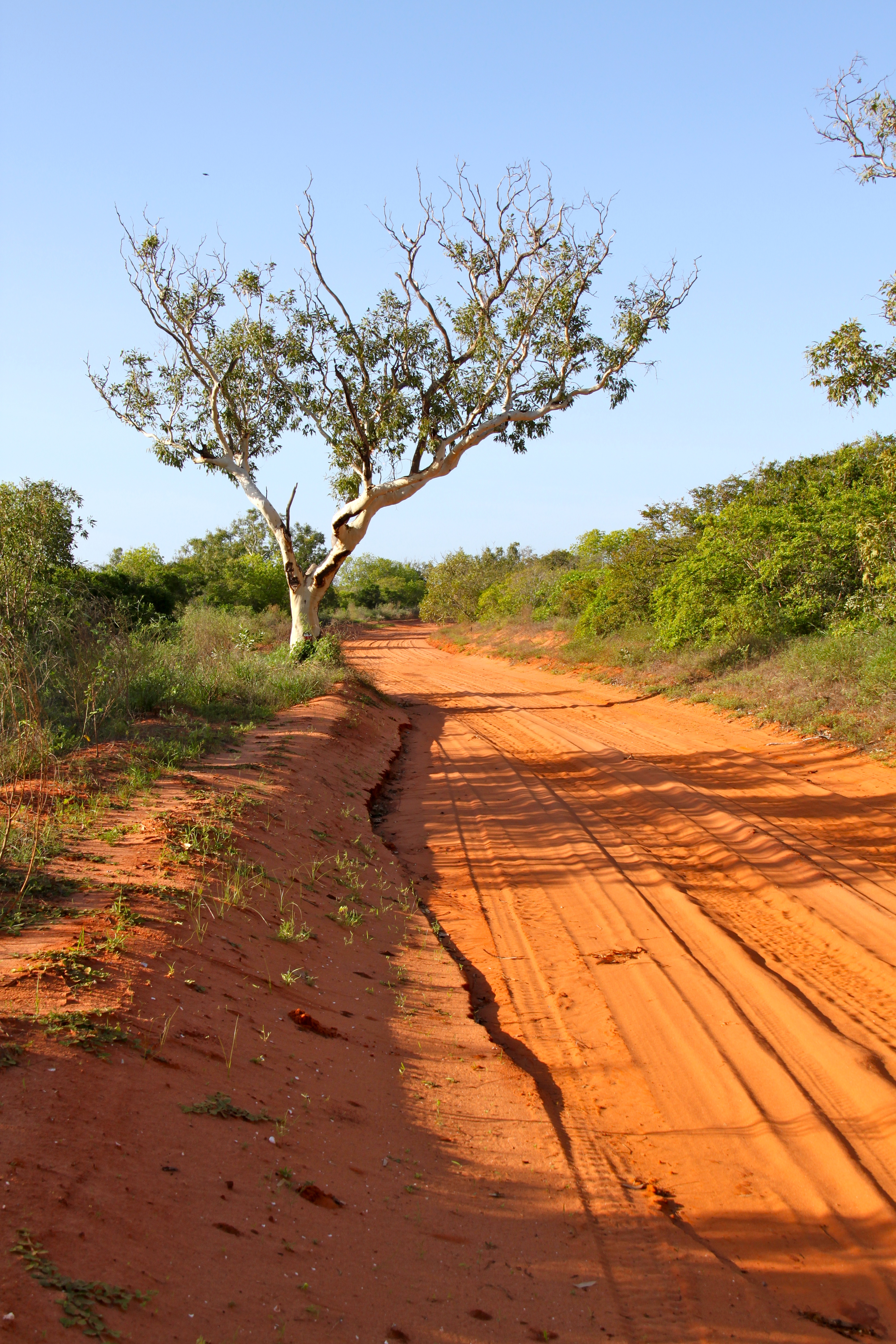
Pindan is a name given to the red-soil country of the south-western Kimberley region of Western Australia. The term comes from a local language and applies both to the soil and to the vegetation community associated with it.Lowe (2003). History The word “pindan” was first mentioned in print in 1883 by Mr Edward Townley Hardman (1845 1887) in a preliminary appendix to John Forrest’s report on the Kimberley. He stated: “The only metalliferous deposits as yet observed by me are pindan ironstone, a poor hematite, but in large quantity; and in the Fitzroy gravels, quantities of minute dark heavy grains, which have all the appearance of stream tin. These await further chemical examination, In these gravels, opal, cats-eye, garnet, and amethyst occur, all of inferior quality so far as at present observed. The 1891 report on the General Description and Physical Geography of the Kimberley District by Government Geologist Harry Page Woodward described the Pliocene geological form ... [...More Info...] [...Related Items...] OR: [Wikipedia] [Google] [Baidu] |
Eighty Mile Beach
Eighty Mile Beach, also spelled Eighty-mile Beach or 80-mile Beach, lies along the north-west coast of Western Australia about half-way between the towns of Broome, Western Australia, Broome and Port Hedland, Western Australia, Port Hedland. It is a beach some in length, forming the coastline where the Great Sandy Desert approaches the Indian Ocean. It is one of the most important sites for migratory wader, shorebirds, or waders, in Australia, and is recognised as a wetland of international importance under the Ramsar Convention, Ramsar Convention on Wetlands. History Traditional ownership and usage The southern section of Eighty Mile Beach is part of the traditional territory of the Nyangumarta people, who maintain a strong connection to the area with many songs, stories and ceremonies associated with sites along and in the vicinity of the beach. In June 2009 the Federal Court of Australia determined that the Nyangumarta People were the valid native title holders of th ... [...More Info...] [...Related Items...] OR: [Wikipedia] [Google] [Baidu] |
Pilbara (offshore)
The Pilbara Coast is the coastline of Western Australia's Pilbara region. It is often referred to as the North West Coast of Western Australia. It is a complex array of river mouths, ports, peninsulas, and islands. Geography North West Cape forms the western end of the Pilbara Coast. According to the ICMRA, the Pilbara Coast ends at Cape Keraudren, a rocky headland that forms the western end of Eighty Mile Beach. Others end it further east at Wallal. Lagoons protected by barrier islands, embayments, river deltas, and rocky headlands are the main coastal features. The Pilbara's intermittent rivers, including the Ashburton, Fortescue, Yule, and De Grey, have deposited sediment to form river deltas. There are many coastal islands, including the near-shore Dampier Archipelago, a cluster of rocky islands and reefs. The larger offshore islands include Barrow Island and the Montebello Islands.Thackway R, Cresswell ID. 1998. Interim Marine and Coastal Regionalisation for Austral ... [...More Info...] [...Related Items...] OR: [Wikipedia] [Google] [Baidu] |


