|
Dampier Peninsula
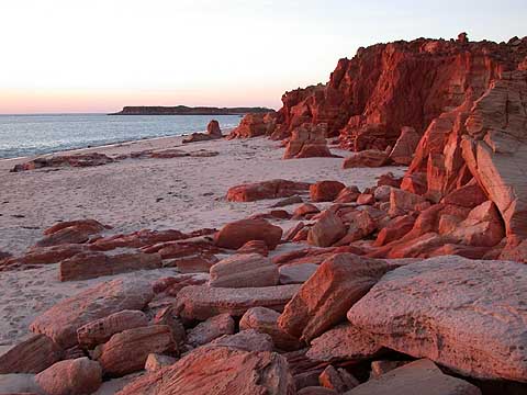
The Dampier Peninsula is a peninsula located north of Broome and Roebuck Bay in Western Australia. It is surrounded by the Indian Ocean to the west and north, and King Sound to the east. It is named after the mariner and explorer William Dampier who visited it. The northernmost part of the peninsula is Cape Leveque. It is sparsely inhabited, mostly by Indigenous Australian peoples, some of whom have been granted native title rights to some of their traditional lands. There are many coastal inlets, bays and other features, including Beagle Bay on its western side. Aboriginal heritage The peninsula is home to a rich heritage of Aboriginal culture, with the communities of Beagle Bay, Bobieding, Djarindjin, Ardyaloon (One Arm Point) and Ngardalargin, along with numerous other smaller communities, pearling camps, tourist resorts and Aboriginal outstations. The traditional owners of the areas around the peninsula are the Bardi, Nyunyul and Jabirr Jabirr (Djaberadjabera) peo ... [...More Info...] [...Related Items...] OR: [Wikipedia] [Google] [Baidu] |
Ardyaloon, Western Australia
Ardyaloon or One Arm Point, also known as Bardi, is an Aboriginal Australian community town on the Dampier Peninsula, in the Kimberley region of Western Australia. It is located north of Perth and the closest populated town is Derby. At the , Bardi had a population of 365. The Bardi Ardyaloon hatchery has successfully produced trochus shell at One Arm Point for a number of years, including reseeding the reef surrounding the area. The area is home to the Bardi people. According to the local Indigenous people, the name "One Arm Point" originated from the tale of an unfortunate pearler who had an accident with dynamite while attempting to catch fish using explosives in the bay. Native title The community is located within the Bardi Jawi native title determination area, determined by the Federal Court of Australia on 30 November 2005. (Federal Court file nos. WAD49/1998, WAD6001/2004) It is managed through its incorporated body, Ardyaloon Incorporated, registered under the '' ... [...More Info...] [...Related Items...] OR: [Wikipedia] [Google] [Baidu] |
Coastline Of Western Australia
Western Australia has the longest coastline of any state or territory in Australia, at 10,194 km or 12,889 km (20,781 km including islands). It is a significant portion of the coastline of Australia, which is 35,877 km (59,736 km including islands). The earliest full charting of the coastline occurred during exploration in the late eighteenth and early nineteenth centuries. The coastline has some features or organisms that are found on the entire length, while some others are specific to particular coastal regions. Various government map posters have been created over time, which have examples of coastal form, or types of coast such as the 1984 map with photos. Integrated Marine and Coastal Regionalisation of Australia (IMCRA) The IMCRA has offshore regions delineated in a systematic appraisal of ecology and geography. Coastal regions used in weather reports Standard Bureau of Meteorology reports include the following reference points for coastal we ... [...More Info...] [...Related Items...] OR: [Wikipedia] [Google] [Baidu] |
Kimberley (Western Australia)
The Kimberley is the northernmost of the nine regions of Western Australia. It is bordered on the west by the Indian Ocean, on the north by the Timor Sea, on the south by the Great Sandy and Tanami deserts in the region of the Pilbara, and on the east by the Northern Territory. The region was named in 1879 by government surveyor Alexander Forrest after Secretary of State for the Colonies John Wodehouse, 1st Earl of Kimberley. History The Kimberley was one of the earliest settled parts of Australia, with the first humans landing about 65,000 years ago. They created a complex culture that developed over thousands of years. Yam ('' Dioscorea hastifolia'') agriculture was developed, and rock art suggests that this was where some of the earliest boomerangs were invented. The worship of Wandjina deities was most common in this region, and a complex theology dealing with the transmigration of souls was part of the local people's religious philosophy. In 1837, with expedit ... [...More Info...] [...Related Items...] OR: [Wikipedia] [Google] [Baidu] |
Cape Leveque Road
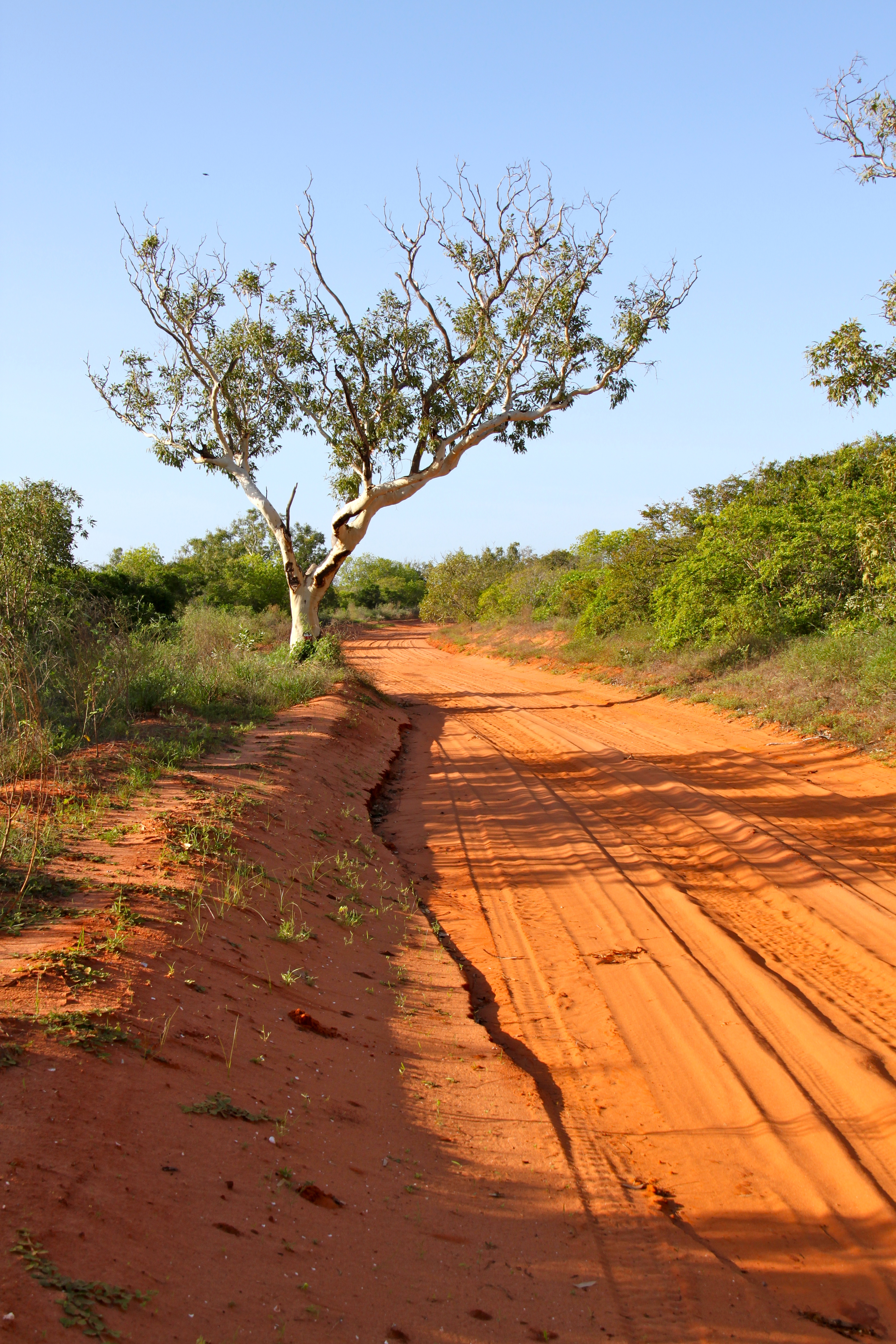
The Cape Leveque Road is a regional Western Australian road that runs through pindan woodland for between Broome and Cape Leveque on the Dampier Peninsula. The southernmost section was narrow-sealed, the northernmost section (between south of Beagle Bay and its northern terminus) was sealed, and the middle section was unsealed. During the wet season, the unsealed section was often closed because flooding made it impassable. The road is vital for servicing communities on the Dampier Peninsula and is also a popular tourist attraction. The road is maintained by the Shire of Broome. Upgrades In May 2018, Main Roads Western Australia, an agency of the Government of Western Australia, started work to upgrade and seal Cape Leveque Road between Broome Highway and Beagle Bay. This work was funded under the Northern Australia Roads Program, with $65.7 million from the state and federal governments, and was completed in late 2020. It included both reconstruction and sealing of th ... [...More Info...] [...Related Items...] OR: [Wikipedia] [Google] [Baidu] |
Woodland
A woodland () is, in the broad sense, land covered with trees, or in a narrow sense, synonymous with wood (or in the U.S., the '' plurale tantum'' woods), a low-density forest forming open habitats with plenty of sunlight and limited shade (see differences between British, American, and Australian English explained below). Woodlands may support an understory of shrubs and herbaceous plants including grasses. Woodland may form a transition to shrubland under drier conditions or during early stages of primary or secondary succession. Higher-density areas of trees with a largely closed canopy that provides extensive and nearly continuous shade are often referred to as forests. Extensive efforts by conservationist groups have been made to preserve woodlands from urbanization and agriculture. For example, the woodlands of Northwest Indiana have been preserved as part of the Indiana Dunes. Definitions United Kingdom ''Woodland'' is used in British woodland management t ... [...More Info...] [...Related Items...] OR: [Wikipedia] [Google] [Baidu] |
Pindan
Pindan is a name given to the red-soil country of the south-western Kimberley region of Western Australia. The term comes from a local language and applies both to the soil and to the vegetation community associated with it.Lowe (2003). History The word “pindan” was first mentioned in print in 1883 by Mr Edward Townley Hardman (1845 1887) in a preliminary appendix to John Forrest’s report on the Kimberley. He stated: “The only metalliferous deposits as yet observed by me are pindan ironstone, a poor hematite, but in large quantity; and in the Fitzroy gravels, quantities of minute dark heavy grains, which have all the appearance of stream tin. These await further chemical examination, In these gravels, opal, cats-eye, garnet, and amethyst occur, all of inferior quality so far as at present observed. The 1891 report on the General Description and Physical Geography of the Kimberley District by Government Geologist Harry Page Woodward described the Pliocene geological forma ... [...More Info...] [...Related Items...] OR: [Wikipedia] [Google] [Baidu] |
Jabirr Jabirr
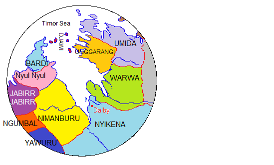
The Jabirr Jabbirr are an Indigenous Australian people of the Kimberley region of Western Australia. Jabirr Jabirr, is also written as Jabirrjabirr and with other spellings such as DjaberrDjaberr, Djaberadjabera, Dyaberdyaber and Jabba Jabba. Their language is the Jabirr Jabirr language. Country The Djaberadjabera held, according to Norman Tindale's estimation, some of tribal land on the western side of the Dampier Peninsula. From the coastal area of Sandy Point at Beagle Bay, their territory went south as far as Cape Bertholet. Their inland extension was about 30 miles. Running clockwise, their neighbours were, to the north, the Nyulnyul, the Warrwa on their eastern flank, the Nimanburu southeast, and the Ngombal to their south. History of contact By 1953 only 5 members of the tribe were still known to survive, and in 1974 Tindale stated that they were virtually extinct. Alternative spellings * ''Djaberadjaber, Djaberdjaber'' * ''Dyaberdyaber'' * ''DjaberrDjabe ... [...More Info...] [...Related Items...] OR: [Wikipedia] [Google] [Baidu] |
Nyulnyul People
The Nyulnyul, also spelt Nyul Nyul, Njolnjol, Nyolnyol and other variants, are an Aboriginal Australian people of the Kimberley region of Western Australia. Country According to Norman Tindale, the Nyulnyul held sway over some of tribal land. They were located on the western side of the Dampier Peninsula. Historically, the pressure of the Nimanburu led to them ceding ground on the King Sound, and by Tindale's time they were present from Cape Borda to Sandy Point, and at Carlyle Head and Goodenough Bay across the peninsula. Running clockwise, their northern neighbours were the Bardi people The Bardi people, also spelt Baada or Baardi and other variations, are an Aboriginal Australian people, living north of Broome and inhabiting parts of the Dampier Peninsula in the Kimberley region of Western Australia. They are ethnically cl ..., the Nimanburu lay on their southeastern flank, while the Djaberadjabera were directly south on the adjacent coast. Language The Nyu ... [...More Info...] [...Related Items...] OR: [Wikipedia] [Google] [Baidu] |
Bardi People
The Bardi people, also spelt Baada or Baardi and other variations, are an Aboriginal Australian people, living north of Broome and inhabiting parts of the Dampier Peninsula in the Kimberley region of Western Australia. They are ethnically close to the Jawi people, and several organisations refer to the Bardi Jawi grouping, such as the Bardi Jawi Niimidiman Aboriginal Corporation Registered Native Title Body (RNTBC) and the Bardi Jawi Rangers. Language The Bardi language is a non-Pama-Nyungan tongue, the most northerly variety of the Nyulnyulan language family. It is mutually intelligible with Jawi. It is the best known Nyulnyulan language, and a detailed grammar of the language exists, written by Claire Bowern. The Pallotine priest and linguist, Father Hermann Nekes, who worked with Ernst Alfred Worms in compiling dictionaries of Baardi and related languages, found his informants to be extremely linguistically astute. In an interview in 1938, a journalist writes of him ... [...More Info...] [...Related Items...] OR: [Wikipedia] [Google] [Baidu] |
Traditional Owner
Native title is the designation given to the common law doctrine of Aboriginal title in Australia, which is the recognition by Australian law that Indigenous Australians (both Aboriginal Australian and Torres Strait Islander people) have rights and interests to their land that derive from their traditional laws and customs. The concept recognises that in certain cases there was and is a continued beneficial legal interest in land held by Indigenous peoples which survived the acquisition of radical title to the land by the Crown at the time of sovereignty. Native title can co-exist with non-Aboriginal proprietary rights and in some cases different Aboriginal groups can exercise their native title over the same land. The foundational case for native title in Australia was '' Mabo v Queensland (No 2)'' (1992). One year after the recognition of the legal concept of native title in ''Mabo'', the Keating Government formalised the recognition by legislation with the enactment by th ... [...More Info...] [...Related Items...] OR: [Wikipedia] [Google] [Baidu] |
Aboriginal Outstation
An outstation, homeland or homeland community is a very small, often remote, permanent community of Aboriginal Australian people connected by kinship, on land that often, but not always, has social, cultural or economic significance to them, as traditional land. The outstation movement or homeland movement refers to the voluntary relocation of Aboriginal people from towns to these locations. The outstation movement A movement arose in the 1970s and continued through the 1980s which saw the creation of very small, remote settlements of Aboriginal people who relocated themselves from the towns and settlements where they had been settled by the government's policy of assimilation. It was "a move towards reclaiming autonomy and self-sufficiency". Also known as "homelands", the term "outstation" was adopted as it "suggests a dependent relationship between the outstation and the main homestead, but with a degree of separation". Outstations were created by Aboriginal people who "sought. ... [...More Info...] [...Related Items...] OR: [Wikipedia] [Google] [Baidu] |


