|
Northbourne, Bournemouth
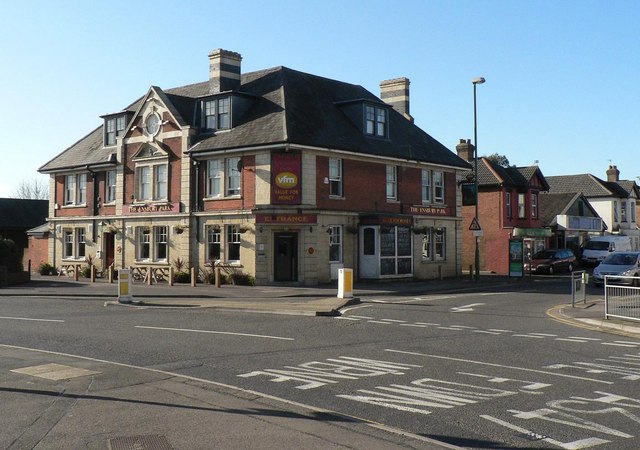
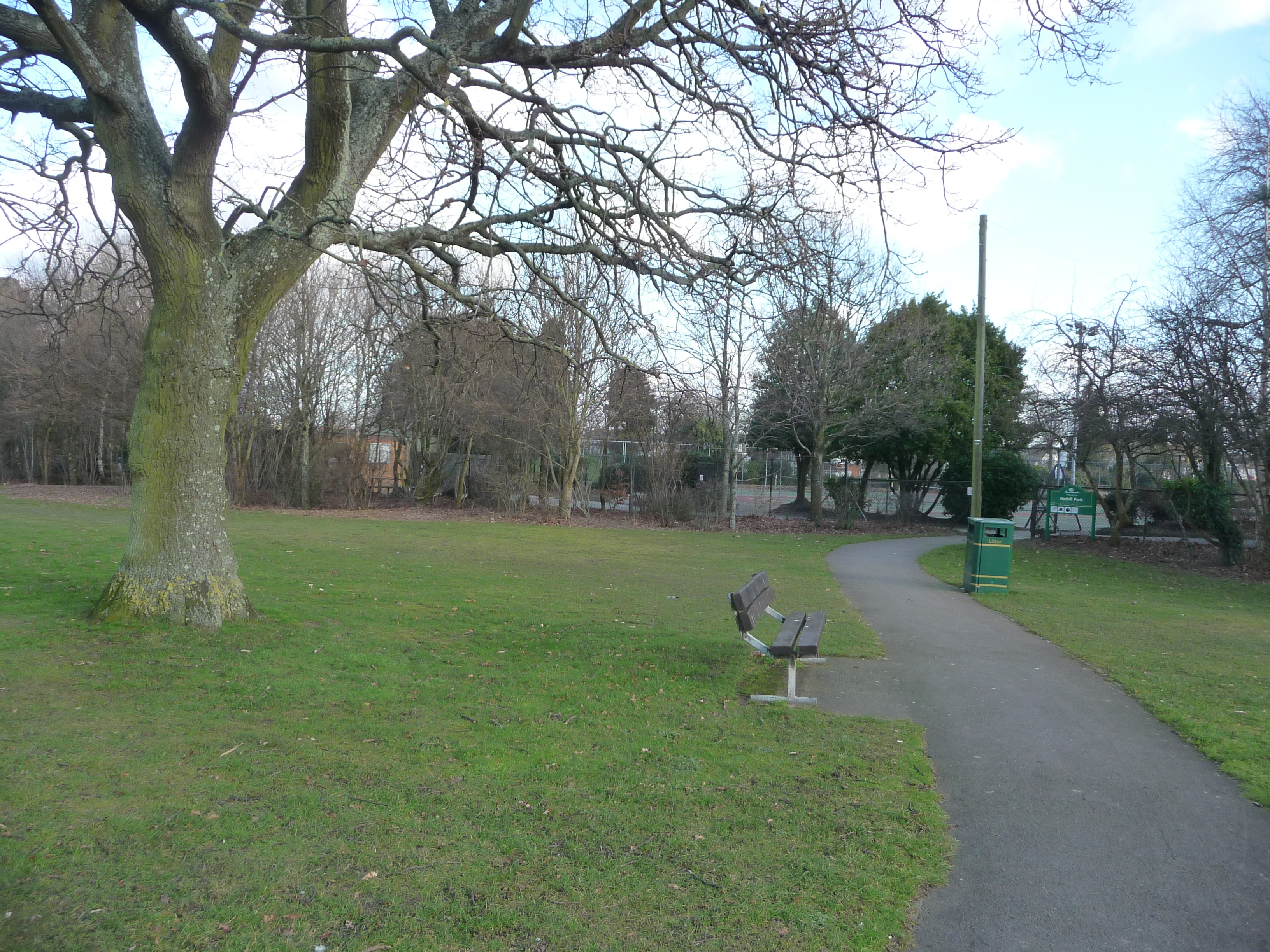
Northbourne is a suburb of Bournemouth, Dorset in England. It is in the north of the town and borders Ensbury Park. History Northbourne stands on what was once part of the Ensbury Estate one of the earliest settlements that sprung up along the River Stour before Bournemouth was founded. The historic Grade II Listed Dower House in Wimborne Road is to the west of the suburb. Northbourne became a post-war suburb of Bournemouth. Areas Hill View is an area of Northbourne. Hill View road links Northbourne to Redhill. Environment There are several Gateways on to The Stour and the scenic Stour Valley Nature Reserve which runs along down to the Hamlets of Throop and Holdenhurst creating a series of countryside Walks The former Old Vicarage serves as a Toby Carvery. The 1930s Crown Pub is also in the area. Services The GP surgery closed in 2017. Northbourne is close to Bournemouth Airport. Education Hill View Primary School. Politics Northbourne is part of the Red ... [...More Info...] [...Related Items...] OR: [Wikipedia] [Google] [Baidu] |
Bournemouth
Bournemouth () is a coastal resort town in the Bournemouth, Christchurch and Poole council area of Dorset, England. At the 2011 census, the town had a population of 183,491, making it the largest town in Dorset. It is situated on the Southern England, English south coast, equidistant () from Dorchester, Dorset, Dorchester and Southampton. Bournemouth is part of the South East Dorset conurbation, which has a population of 465,000. Before it was founded in 1810 by Lewis Tregonwell, the area was a deserted heathland occasionally visited by fishermen and smugglers. Initially marketed as a health resort, the town received a boost when it appeared in Augustus Granville's 1841 book, ''The Spas of England''. Bournemouth's growth accelerated with the arrival of the railway, and it became a town in 1870. Part of the Historic counties of England, historic county of Hampshire, Bournemouth joined Dorset for administrative purposes following the Local Government Act 1972, reorganisation of l ... [...More Info...] [...Related Items...] OR: [Wikipedia] [Google] [Baidu] |
Dorset
Dorset ( ; archaically: Dorsetshire , ) is a county in South West England on the English Channel coast. The ceremonial county comprises the unitary authority areas of Bournemouth, Christchurch and Poole and Dorset (unitary authority), Dorset. Covering an area of , Dorset borders Devon to the west, Somerset to the north-west, Wiltshire to the north-east, and Hampshire to the east. The county town is Dorchester, Dorset, Dorchester, in the south. After the Local Government Act 1972, reorganisation of local government in 1974, the county border was extended eastward to incorporate the Hampshire towns of Bournemouth and Christchurch. Around half of the population lives in the South East Dorset conurbation, while the rest of the county is largely rural with a low population density. The county has a long history of human settlement stretching back to the Neolithic era. The Roman conquest of Britain, Romans conquered Dorset's indigenous Durotriges, Celtic tribe, and during the Ear ... [...More Info...] [...Related Items...] OR: [Wikipedia] [Google] [Baidu] |
England
England is a country that is part of the United Kingdom. It shares land borders with Wales to its west and Scotland to its north. The Irish Sea lies northwest and the Celtic Sea to the southwest. It is separated from continental Europe by the North Sea to the east and the English Channel to the south. The country covers five-eighths of the island of Great Britain, which lies in the North Atlantic, and includes over 100 smaller islands, such as the Isles of Scilly and the Isle of Wight. The area now called England was first inhabited by modern humans during the Upper Paleolithic period, but takes its name from the Angles, a Germanic tribe deriving its name from the Anglia peninsula, who settled during the 5th and 6th centuries. England became a unified state in the 10th century and has had a significant cultural and legal impact on the wider world since the Age of Discovery, which began during the 15th century. The English language, the Anglican Church, and Engli ... [...More Info...] [...Related Items...] OR: [Wikipedia] [Google] [Baidu] |
Ensbury Park
Ensbury Park is a mainly residential suburb of Bournemouth, in Dorset, England. It includes the housing estate of Slades Farm and lies within the ward district of Northbourne and Redhill. Initial development Ensbury Park takes its name from the Saxon hamlet of Ensbury, a separate area altogether which lay a mile or so to the north. This hamlet, just east of Kinson, has now been more or less subsumed into the postwar suburb of Northbourne but in the first half of the twentieth century, Ensbury Manor and Ensbury Farm constituted the borders of what later became the Ensbury Park district. In the 1920s Ensbury Park boasted a racecourse, which also served as an aerodrome. For several years it was known as “Bournemouth Aerodrome” and was the venue for Air Race Meetings, though a series of fatal crashes at the Whitsun meet in 1927 led to its decline and eventual sale for housing development. Much of the land associated with Ensbury Farm was sold off for housebuilding in the 1930s: t ... [...More Info...] [...Related Items...] OR: [Wikipedia] [Google] [Baidu] |
River Stour, Dorset
The River Stour is a river which flows through Wiltshire and Dorset in southern England, and drains into the English Channel. The catchment area for the river and its tributaries is listed as . Toponymy It is sometimes called the Dorset Stour to distinguish it from other rivers of the same name in Kent, Suffolk and the Midlands. According to Brewer's ''Dictionary of Britain & Ireland'', the name Stour rhymes with ''hour'' and derives from Old English meaning "violent", "fierce" or the "fierce one". History The river burst its banks at Christchurch during the 2013–14 winter floods and 100 residents were evacuated. Prehistoric archaeology The Stour valley has produced rich evidence for early human (Palaeolithic) activity. Gravel pits in the lower reaches of the river (many underlying modern day Bournemouth) produced hundreds of Lower Palaeolithic handaxes when they were quarried, particular during the late 19th century and the first half of the 20th century. Archaeologic ... [...More Info...] [...Related Items...] OR: [Wikipedia] [Google] [Baidu] |
Post-war Consensus
The post-war consensus, sometimes called the post-war compromise, was the economic order and social model of which the major political parties in post-war Britain shared a consensus supporting view, from the end of World War II in 1945 to the late-1970s. It was abandoned by Conservative Party leader Margaret Thatcher. Majorities in both parties agreed upon it. The consensus tolerated or encouraged nationalisation, strong trade unions, heavy regulation, high taxes, and a generous welfare state. There was a widespread consensus that covered support for a coherent package of policies that were developed in the 1930s and promised during the Second World War, focused on a mixed economy, Keynesianism, and a broad welfare state. In recent years, historians have debated the timing of the weakening and collapse of the consensus, including whether it ended before Thatcherism arrived in 1979. There has also been debate as to whether a postwar consensus actually existed. Origins of post ... [...More Info...] [...Related Items...] OR: [Wikipedia] [Google] [Baidu] |
Redhill, Bournemouth
Redhill is a northern suburb of Bournemouth, Dorset in England. Geography Redhill borders Ensbury Park from the west, Northbourne, Bournemouth, Northbourne to the north, Moordown to the west and Winton, Dorset, Winton to the south. Park Redhill is centred on Redhill Park. Politics Redhill is part of the Redhill and Northbourne (ward), Redhill and Northbourne ward for elections to Bournemouth, Christchurch and Poole Council which elects two councillors. Redhill is part of the Bournemouth West (UK Parliament constituency), Bournemouth West United Kingdom constituencies, parliamentary constituency. References Areas of Bournemouth {{Dorset-geo-stub ... [...More Info...] [...Related Items...] OR: [Wikipedia] [Google] [Baidu] |
Throop, Dorset
Throop is a village in Dorset situated on the outskirts of Bournemouth. It is renowned for its expansive fishing industry. Geography and administration Although within the historic county boundaries of Hampshire, at the time of the 1974 local government re-organization it was considered desirable that the whole of what is now called the South East Dorset conurbation, which includes Bournemouth and Poole, should be part of the same county. Throop is currently part of the Throop and Muscliff Ward within the Bournemouth borough council and is close to the River Stour featuring countryside views over the Stour Valley. The population of this ward at the 2011 census was 8,882. Also in the area is Muccleshell. History Throop village has existed for many years and is described in various historical texts relating to the Bournemouth area – in 1842 it is referred to as a "Pleasant and secluded village". Notable areas in Throop Throop Mill One of the main characteristics of modern-d ... [...More Info...] [...Related Items...] OR: [Wikipedia] [Google] [Baidu] |
Holdenhurst
Holdenhurst is a small isolated village situated in the green belt land of the north-east suburbs of Bournemouth, England. The village comprises fewer than 30 dwellings, two farms and the parish church. There are no shops and few local facilities in the village. The village has only been accessible by car via a single narrow lane since the through route was cut off in the late 1960s by the building of the Bournemouth Spur Road ( A338). There is no public transport. Although the village itself has always been small, the civil parish at one time included the greater part of what is now Bournemouth. The civil parish was subsumed into Bournemouth County Borough in 1931, but a new civil parish called Holdenhurst Village was created on 1 April 2013. However, the ecclesiastical parish still exists; it encompasses Hurn, East Parley and Bournemouth International Airport, as well as the Townsend and adjacent areas of Bournemouth. Etymology Holdenhurst is recorded in the Domesday Book as ... [...More Info...] [...Related Items...] OR: [Wikipedia] [Google] [Baidu] |
Toby Carvery
Toby Carvery is a British carvery chain brand owned and operated by Mitchells & Butlers, which consists of 158 restaurants. History Toby Carvery as a brand was founded as part of Bass Charrington in 1985. The parent company subsequently rebranded as Six Continents plc, before the former Bass pub estate was spun off into Mitchells & Butlers Mitchells & Butlers plc (also referred to as "M&B") runs circa 1,784 managed pubs, bars and restaurants throughout the United Kingdom. The company's headquarters are in Birmingham, England. The company is listed on the London Stock Exchange an .... The creator of the Toby Carvery was Michael Sabrin, then catering Director with Bass Charrington. Menu As well as carvery meat, the chain offers vegetarian and vegan food and fish main courses. A breakfast menu is available at some sites. References External links Official website* Mitchells & Butlers Restaurant groups in the United Kingdom {{UK-restaurant-stub ... [...More Info...] [...Related Items...] OR: [Wikipedia] [Google] [Baidu] |
Bournemouth Airport
Bournemouth Airport (previously known as Hurn Airport and Bournemouth International Airport) is an airport located north-northeast of Bournemouth, in southern England. The site opened as RAF Hurn in 1941, but was transferred to civil control in 1944. For a short period (between 1944 and 1946) Hurn served as London's international airport, until the opening of facilities at Heathrow. Commercial services resumed in the late 1950s, with Palmair commencing flights to Palma, Majorca in October 1958. Subsequently, Ryanair and TUI Airways based aircraft at the airport, with scheduled flights now frequently serving Western Europe and the Mediterranean area, with charter and seasonal services serving North Africa, North America, and the Caribbean. Passenger numbers peaked in 2007 when just over one million passed through the airport. In 2019, the passenger total was around 803,000. This dropped to around 176,000 in 2020 due to the COVID-19 Pandemic Ryanair and TUI Airways ar ... [...More Info...] [...Related Items...] OR: [Wikipedia] [Google] [Baidu] |


