|
North Alton, Nova Scotia
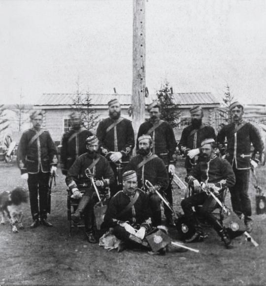
North Alton is a Canadian rural community in Kings County, Nova Scotia just outside Kentville. The community is situated in the Annapolis Valley between South Alton and Kentville at the intersection of Trunk 12 and Highway 101. In 2010 the annual Boston Christmas Tree came from North Alton. A resident, Everett John Ward, made a fortune in the Klondike Gold Rush of 1898. A member of the North-West Mounted Police The North-West Mounted Police (NWMP) was a Canadian paramilitary police force, established in 1873, to maintain order in the new Canadian North-West Territories (NWT) following the 1870 transfer of Rupert's Land and North-Western Territory to ..., he served in Dawson City for several years before striking it rich. Known thereafter as "Klondike Ward", he returned to Kentville in later life and made investments in the town.National RCMP Grave Information Website and Database"Reg.#2323, Cst. Everett John WARD, NWMP" (letter from Dick Pulsifer, 2009) References ... [...More Info...] [...Related Items...] OR: [Wikipedia] [Google] [Baidu] |
Nova Scotia
Nova Scotia is a Provinces and territories of Canada, province of Canada, located on its east coast. It is one of the three Maritime Canada, Maritime provinces and Population of Canada by province and territory, most populous province in Atlantic Canada, with an estimated population of over 1 million as of 2024; it is also the second-most densely populated province in Canada, and second-smallest province by area. The province comprises the Nova Scotia peninsula and Cape Breton Island, as well as 3,800 other coastal islands. The province is connected to the rest of Canada by the Isthmus of Chignecto, on which the province's land border with New Brunswick is located. Nova Scotia's Capital city, capital and largest municipality is Halifax, Nova Scotia, Halifax, which is home to over 45% of the province's population as of the 2021 Canadian census, 2021 census. Halifax is the List of census metropolitan areas and agglomerations in Canada, twelfth-largest census metropolitan area in ... [...More Info...] [...Related Items...] OR: [Wikipedia] [Google] [Baidu] |
Rural
In general, a rural area or a countryside is a geographic area that is located outside towns and cities. Typical rural areas have a low population density and small settlements. Agricultural areas and areas with forestry are typically described as rural, as well as other areas lacking substantial development. Different countries have varying definitions of ''rural'' for statistical and administrative purposes. Rural areas have unique economic and social dynamics due to their relationship with land-based industry such as agriculture, forestry, and resource extraction. Rural economics can be subject to boom and bust cycles and vulnerable to extreme weather or natural disasters, such as droughts. These dynamics alongside larger economic forces encouraging urbanization have led to significant demographic declines, called rural flight, where economic incentives encourage younger populations to go to cities for education and access to jobs, leaving older, less educated and ... [...More Info...] [...Related Items...] OR: [Wikipedia] [Google] [Baidu] |
Kings County, Nova Scotia
Kings County is a county in the Provinces and territories of Canada, Canadian province of Nova Scotia. With a population of 62,914 in the 2021 Census, Kings County is the third most populous county in the province. It is located in central Nova Scotia on the shore of the Bay of Fundy, with its northeastern part forming the western shore of the Minas Basin. Kings' economy and identity are tied into its current and historical role as the province's agricultural heartland. A strong agricultural base has been bolstered by the farm-to-table movement and a growing and acclaimed Nova Scotia wine industry, and the success of both has also bolstered the area's tourism industry. The county benefits from the profile, prestige and population gained from hosting both Acadia University in Wolfville and the Nova Scotia Community College, NSCC Kingstec campus in Kentville. CFB Greenwood, Canadian Forces Base Greenwood (the largest Royal Canadian Air Force base on Canada's East Coast) and the Michel ... [...More Info...] [...Related Items...] OR: [Wikipedia] [Google] [Baidu] |
Kentville
Kentville is an incorporated town in Nova Scotia. It is the most populous town in the Annapolis Valley. As of 2021, the town's population was 6,630. Its census agglomeration is 26,929. History Kentville owes its location to the Cornwallis River which, downstream from Kentville, becomes a large tidal river at the Minas Basin. The riverbank at the current location of Kentville provided an easy fording point. The Mi'kmaq name for the location was "Penooek". The ford and later the bridge in Kentville made the area an important crossroads for other settlements in the Annapolis Valley. Kentville also marked the limit of navigation of sailing ships. Acadian settlement The area was first settled by Acadians, who built many dykes along the river to keep the high Bay of Fundy tides out of their farmland. These dykes created the ideal fertile soil that the Annapolis Valley is known for. The Acadians were expelled from the area in the Bay of Fundy Campaign (1755) by the British auth ... [...More Info...] [...Related Items...] OR: [Wikipedia] [Google] [Baidu] |
Annapolis Valley
The Annapolis Valley is a valley and region in the province of Nova Scotia, Canada. It is located in the western part of the Nova Scotia peninsula, formed by a Trough (geology), trough between two parallel mountain ranges along the shore of the Bay of Fundy. Statistics Canada defines the Annapolis Valley as an economic region, composed of Annapolis County, Nova Scotia, Annapolis County, Kings County, Nova Scotia, Kings County, and Hants County, Nova Scotia, Hants County. Geography The valley measures approximately in length from Annapolis Royal and the Annapolis Basin in the west to Wolfville and the Minas Basin in the east, spanning the counties of Digby County, Nova Scotia, Digby, Annapolis County, Nova Scotia, Annapolis and Kings County, Nova Scotia, Kings. Some also include the western part of Hants County, Nova Scotia, Hants County, including the towns of Hantsport and Windsor, Nova Scotia, Windsor even further to the east, but geographically speaking they are part of the ... [...More Info...] [...Related Items...] OR: [Wikipedia] [Google] [Baidu] |
South Alton, Nova Scotia
South Alton is a community in the Canadian province of Nova Scotia Nova Scotia is a Provinces and territories of Canada, province of Canada, located on its east coast. It is one of the three Maritime Canada, Maritime provinces and Population of Canada by province and territory, most populous province in Atlan ..., located in Kings County. References South Alton on Destination Nova Scotia Communities in Kings County, Nova Scotia Unincorporated communities in Nova Scotia {{KingsNS-geo-stub ... [...More Info...] [...Related Items...] OR: [Wikipedia] [Google] [Baidu] |
Kentville, Nova Scotia
Kentville is an incorporated town in Nova Scotia. It is the most populous town in the Annapolis Valley. As of 2021, the town's population was 6,630. Its census agglomeration is 26,929. History Kentville owes its location to the Cornwallis River which, downstream from Kentville, becomes a large tidal river at the Minas Basin. The riverbank at the current location of Kentville provided an easy fording point. The Mi'kmaq name for the location was "Penooek". The ford and later the bridge in Kentville made the area an important crossroads for other settlements in the Annapolis Valley. Kentville also marked the limit of navigation of sailing ships. Acadian settlement The area was first settled by Acadians, who built many dykes along the river to keep the high Bay of Fundy tides out of their farmland. These dykes created the ideal fertile soil that the Annapolis Valley is known for. The Acadians were expelled from the area in the Bay of Fundy Campaign (1755) by the British authori ... [...More Info...] [...Related Items...] OR: [Wikipedia] [Google] [Baidu] |
Nova Scotia Trunk 12
Trunk 12 is part of the Canadian province of Nova Scotia's system of Trunk Highways. The route runs from Chester Basin to Kentville, a distance of . Route description The road's routing is through mostly uninhabited forest land, with a few small villages such as New Ross located on the route. For about 5 km, the road follows the eastern shore of Gaspereau Lake, the largest lake in Kings County, Nova Scotia. Communities *Chester Basin * Chester Grant * Seffernsville *New Ross * Aldersville * Blue Mountain * South Alton *Kentville Kentville is an incorporated town in Nova Scotia. It is the most populous town in the Annapolis Valley. As of 2021, the town's population was 6,630. Its census agglomeration is 26,929. History Kentville owes its location to the Cornwallis Ri ... Major intersections External links Webcam on Trunk 12 near Blue Mountain References Nova Scotia provincial highways Roads in Kings County, Nova Scotia Roads in Lunenburg County, Nov ... [...More Info...] [...Related Items...] OR: [Wikipedia] [Google] [Baidu] |
Nova Scotia Highway 101
Highway 101 is an east-west highway in Nova Scotia that runs from Bedford to Yarmouth. The highway follows a route along the southern coast of the Bay of Fundy through the Annapolis Valley, the largest agricultural district in the province. Between its western terminus at Yarmouth to Weymouth, the highway is 2-lane controlled access. Between Weymouth and Digby, the highway reverts to a 2-lane local road. From Digby to Grand Pre, the highway is 2-lane controlled access. From the Gaspereau River crossing near Grand Pre to 3 km west of Exit 6 ( Falmouth) the highway is a 4-lane freeway. Heading east the highway is 2-lane controlled access until Exit 5 ( Trunk 14). From Three Mile Plains to its eastern terminus at Bedford, the highway is a 4-lane freeway. Some of the 2-lane controlled access sections of the highway are 3 or 4 lanes, with the addition of passing lanes. One section of the 4-lane freeway near Hantsport is a short 5-lane (3 lanes westbound) section for ... [...More Info...] [...Related Items...] OR: [Wikipedia] [Google] [Baidu] |
Boston Christmas Tree
The Boston Christmas Tree is the City of Boston, Massachusetts' official Christmas tree. A tree has been lit each year since 1941, and since 1971 it has been given to the people of Boston by the people of Nova Scotia in thanks for their assistance after the 1917 Halifax Explosion. The tree is lit in the Boston Common throughout the Christmas season. Halifax explosion On December 6, 1917, at 9:04:35 am, the Halifax Explosion severely destroyed much of the city by the largest non-nuclear explosion of all time. Boston authorities learned of the disaster by telegraph, and quickly organized and dispatched a relief train around 10 pm to assist survivors. A blizzard delayed the train, which finally arrived in the early morning of December 8 and immediately began distributing food, water, and medical supplies. Numerous personnel on the train were able to relieve the Nova Scotia medical staff, most of whom had worked without rest since the explosion occurred. Nova Scotian children s ... [...More Info...] [...Related Items...] OR: [Wikipedia] [Google] [Baidu] |
North-West Mounted Police
The North-West Mounted Police (NWMP) was a Canadian paramilitary police force, established in 1873, to maintain order in the new Canadian North-West Territories (NWT) following the 1870 transfer of Rupert's Land and North-Western Territory to Canada from the Hudson's Bay Company, the Red River Rebellion and in response to lawlessness, demonstrated by the subsequent Cypress Hills Massacre and fears of United States military intervention. The NWMP combined military, police and judicial functions along similar lines to the Royal Irish Constabulary. A small, mobile police force was chosen to reduce potential for tensions with the United States and First Nations in Canada, First Nations. The NWMP uniforms included red coats deliberately reminiscent of British and Canadian military uniforms. The NWMP was established by the Canadian government during the ministry of Prime Minister of Canada, Prime Minister Sir John A. Macdonald, John Macdonald who defined its purpose as "the preserva ... [...More Info...] [...Related Items...] OR: [Wikipedia] [Google] [Baidu] |


