|
Ngāti Manuhiri
Ngāti Manuhiri is a Māori iwi of the Mahurangi Peninsula area of New Zealand. They have an interest in the region from the Ōkura River in the south to Mangawhai in the north, and extending out to Great Barrier Island. They are descended from Manuhiri, one of the sons of Maki, founder of the Te Kawerau iwi. They have a marae near Leigh. The iwi is descended from the Moekākara and Tainui waka (arrival canoes). See also *List of Māori iwi This is a list of iwi (New Zealand Māori tribes). List of iwi This list includes groups recognised as iwi (tribes) in certain contexts. Many are also hapū (sub-tribes) of larger iwi. Moriori are included on this list. Although they are dist ... References External links Ngāti Manuhiri Settlement Trust {{Maori-stub ... [...More Info...] [...Related Items...] OR: [Wikipedia] [Google] [Baidu] |
Moekākara
In Māori tradition, ''Moekākara'' was one of the great ocean-going, voyaging canoes that was used in the migrations that settled New Zealand. It was captained by Tāhuhunui-o-te-rangi, the ancestor of Ngāi Tāhuhu. The canoe first landed at Wakatuwhenua, near Te Ārai north of Auckland. Ngāi Tāhuhu settled at Pouerua in the Bay of Islands and the Mangakahia River in Northland, as well as Ōtāhuhu in Auckland. See also *List of Māori waka This is a list of Māori people, Māori (canoes). The information in this list represents a compilation of different oral traditions from around New Zealand. These accounts give several different uses for the waka: many carried Polynesians, Poly ... References Māori waka Māori mythology {{Māori-myth-stub ... [...More Info...] [...Related Items...] OR: [Wikipedia] [Google] [Baidu] |
Tainui (canoe)
''Tainui'' was one of the Māori migration canoes, great ocean-going canoes in which Polynesians migrated to New Zealand approximately 800 years ago. It was commanded by the chief Hoturoa, who had decided to leave Hawaiki because over-population had led to famine and warfare. The ship first reached New Zealand at Cape Runaway, Whangaparāoa in the Bay of Plenty and then skirted around the north coast of the North Island, finally landing at Kawhia in the western Waikato. The crew of the ''Tainui'' were the ancestors of the iwi that form the Tainui confederation. Crafting The Tainui waka (canoe), waka (canoe) was made from a great tree, at a place in Hawaiki known then as Maungaroa, on the spot where a stillborn child had been buried. According to Te Tāhuna Herangi the waka was named after the child who had been called Tainui. The canoe was made by Rakatāura, an expert boat builder in the tradition of Rātā (Māori mythology), Rātā, or according to Wirihana Aoterangi by R ... [...More Info...] [...Related Items...] OR: [Wikipedia] [Google] [Baidu] |
Auckland Council
Auckland Council () is the local government council for the Auckland Region in New Zealand. It is a territorial authority that also has the responsibilities, duties and powers of a regional council and so is a unitary authority, according to the Local Government (Auckland Council) Act 2009, which established the council. The governing body consists of a mayor and 20 councillors, elected from 13 wards. There are also 149 members of 21 local boards who make decisions on matters local to their communities. It is the largest council in Oceania, with a $3 billion annual budget, $29 billion of ratepayer equity, and 9,870 full-time staff as of 30 June 2016. The council began operating on 1 November 2010, combining the functions of the previous regional council and the region's seven city and district councils into one "super council" or "super city". The council was established by a number of Acts of Parliament, and an Auckland Transition Agency, also created by the central governm ... [...More Info...] [...Related Items...] OR: [Wikipedia] [Google] [Baidu] |
Māori People
Māori () are the Indigenous peoples of Oceania, indigenous Polynesians, Polynesian people of mainland New Zealand. Māori originated with settlers from East Polynesia, who arrived in New Zealand in several waves of Māori migration canoes, canoe voyages between roughly 1320 and 1350. Over several centuries in isolation, these settlers developed Māori culture, a distinct culture, whose language, mythology, crafts, and performing arts evolved independently from those of other eastern Polynesian cultures. Some early Māori moved to the Chatham Islands, where their descendants became New Zealand's other indigenous Polynesian ethnic group, the Moriori. Early contact between Māori and Europeans, starting in the 18th century, ranged from beneficial trade to lethal violence; Māori actively adopted many technologies from the newcomers. With the signing of the Treaty of Waitangi, Treaty of Waitangi/Te Tiriti o Waitangi in 1840, the two cultures coexisted for a generation. Rising ten ... [...More Info...] [...Related Items...] OR: [Wikipedia] [Google] [Baidu] |
Mahurangi Peninsula
Mahurangi Peninsula is a landform in the Rodney Local Board Area in the Auckland Region of New Zealand's North Island. It is located between two bodies of water: the Mahurangi Harbour Mahurangi Harbour is a natural harbour in New Zealand. It is located on the north-eastern coast of the Auckland Region near the town of Warkworth, and empties into the Hauraki Gulf. Geography The Mahurangi Harbour is a drowned river valle ... and Kawau Bay. Geography The settlements of Snells Beach and Algies Bay are located in the northern part of the peninsula. Scandrett Regional Park is located on the eastern side of the peninsula. Scott Point is the south-western most point of the peninsula, and includes the Mahurangi Scenic Reserve, Scotts Landing and Scott Homestead. References Rodney Local Board Area Populated places in the Auckland Region Peninsulas of the Auckland Region {{Auckland-geo-stub ... [...More Info...] [...Related Items...] OR: [Wikipedia] [Google] [Baidu] |
Ōkura River
The Ōkura River, also known as the Ōkura Estuary, is a river in the north of the Auckland Region in the North Island of New Zealand. The river rises in the low hills to the south of Silverdale and flows into Karepiro Bay on the Hauraki Gulf / Tīkapa Moana. The river is extremely tide, tidal with only a narrow channel being navigable by small craft at low tide. The area is popular for horse riding, riders wait till low tide and then ford the boating channel to ride the estuary and beaches on the northern side. Geography The village of Ōkura is situated on the southern bank. The Long Bay-Okura Marine Reserve extends from the Ōkura River to the Weiti River. The sand banks (above high tide mark) in Karepiro Bay are Dotterel breeding areas, protected by DOC ( Department of Conservation). History The northern shore of the Ōkura River was traditionally known as Otaimaro, and was an extensive Māori settlement. In 1848, Henry Dacre and his father Captain Ranulph Dacre purc ... [...More Info...] [...Related Items...] OR: [Wikipedia] [Google] [Baidu] |
Mangawhai
Mangawhai is a township at the south-west extent of the Mangawhai Harbour, or Mangawhai Estuary, in Northland, New Zealand. The adjacent township of Mangawhai Heads is 5 km north-east, on the lower part of the harbour. Kaiwaka is 13 km south-west, and Waipu is 20 km north-west of Mangawhai Heads. In 2018 it was proposed to develop a new town between Mangawhai and Mangawhai Heads, called Mangawhai Central, to accommodate the rapid increase of population expected and overcome the space limitations of the existing commercial areas. The business area was largely complete by the end of 2022 but the residential development stalled. A new residential area called Mangawhai Hills is planned west of the existing settlement. History Mangawhai is the traditional Māori name for the area, referring to the stingrays which live in the harbour. In the early and mid 19th century, Mangawhai Harbour was one of the main access points for the Kaipara. Ngāti Whātua used to dra ... [...More Info...] [...Related Items...] OR: [Wikipedia] [Google] [Baidu] |
Great Barrier Island
Great Barrier Island () lies in the outer Hauraki Gulf, New Zealand, north-east of central Auckland. With an area of it is the sixth-largest List of islands of New Zealand, island of New Zealand. Its highest point, Mount Hobson, Great Barrier Island, Mount Hobson, is above sea level.Great Barrier Island Aotea page on the DOC website (from the New Zealand Department of Conservation, Department of Conservation. Accessed 2008-06-04.) The local government in New Zealand, local authority is the Auckland Council. The island was initially exploited for its minerals and kauri trees and saw only limited agriculture. In 2013, it was inhabited by 939 people, from Statistics New Zealand. mostly living from ... [...More Info...] [...Related Items...] OR: [Wikipedia] [Google] [Baidu] |
Te Puni Kōkiri
Te Puni Kōkiri (TPK, also called in English the Ministry of Māori Development) is the principal policy advisor of the Government of New Zealand on Māori people, Māori wellbeing and development. Te Puni Kōkiri was established under the Māori Development Act 1991 with responsibilities to promote Māori achievement in education, training and employment, health, and economic development; and monitor the provision of government services to Māori. The Māori language, Māori name means "a group moving forward together". History Protectorate Department (1840–1846) Te Puni Kōkiri, or the Ministry of Māori Development, traces its origins to the missionary-influenced Protectorate Department, which existed between 1840 and 1846. The department was headed by the missionary and civil servant George Clarke (judge), George Clarke, who held the position of Chief Protector. Its goal was to protect the rights of the Māori people in accordance with the Treaty of Waitangi. The Protector ... [...More Info...] [...Related Items...] OR: [Wikipedia] [Google] [Baidu] |
Leigh, New Zealand
Leigh () is a small coastal community in the north of the Auckland Region of New Zealand. It lies on the west side of Omaha Cove, a small inlet within Ōmaha Bay to the south of Cape Rodney. It is 13 km from Matakana, 21 km from Warkworth, New Zealand, Warkworth and approximately 92 km north of Auckland, Auckland City. Leigh is the nearest town to Cape Rodney-Okakari Point Marine Reserve surrounding Te Hāwere-a-Maki / Goat Island. The reserve, the first of its type in New Zealand, is also the location for the University of Auckland's Marine Laboratory.Wises New Zealand Guide, 7th Edition, 1979. p.200. Geography Leigh is located in Rodney (local board area), Rodney in the northeastern Auckland Region, northeast of Whangateau Harbour, near Cape Rodney and Goat Island (Auckland), Goat Island. Two bays border the township: Te Kohuroa / Mathesons Bay to the west, and Omaha Cove to the east. The Kohuroa Stream flows to the west of Leigh township, reaching Te Kohuroa / ... [...More Info...] [...Related Items...] OR: [Wikipedia] [Google] [Baidu] |
Waka (canoe)
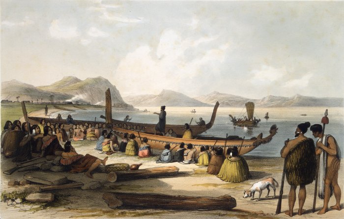
Waka () are Māori people, Māori watercraft, usually canoes ranging in size from small, unornamented canoes (''waka tīwai'') used for fishing and river travel to large, decorated war canoes (''waka taua'') up to long. The earliest remains of a canoe in New Zealand were found near the Anaweka River, Anaweka estuary in a remote part of the Tasman District and Radiocarbon dating, radiocarbon-dated to about 1400. The canoe was constructed in New Zealand, but was a sophisticated canoe, compatible with the style of other Polynesian voyaging canoes at that time. Since the 1970s, about eight large double-hulled canoes of about 20 metres have been constructed for oceanic voyaging to other parts of the Pacific Ocean, Pacific. They are made of a blend of modern and traditional materials, incorporating features from ancient Melanesia, as well as Polynesia. Waka taua (war canoes) ''Waka taua'' (in Māori language, Māori, ''waka'' means "canoe" and ''taua'' means "army" or "war party") a ... [...More Info...] [...Related Items...] OR: [Wikipedia] [Google] [Baidu] |
List Of Māori Iwi
This is a list of iwi (New Zealand Māori tribes). List of iwi This list includes groups recognised as iwi (tribes) in certain contexts. Many are also hapū (sub-tribes) of larger iwi. Moriori are included on this list. Although they are distinct from the Māori people, they have common ancestry with them.Skinner, H.D., The Morioris of the Chatham Islands, Honolulu, 1923. K. R. Howe''Ideas of Māori origins'' ''Te Ara - the Encyclopedia of New Zealand'', updated 28 October 2008. Thomson, Arthur, ''The Story of New Zealand, Past and Present, Savage and Civilized'', 2 vols, London, 1859, i, 61. Belich, James, ''Making Peoples: A History of the New Zealanders, from Polynesian Settlement to the End of the Nineteenth Century'', University of Hawaii Press, 2002, pp.26, 65-66. Map of iwi See also * List of hapū * List of Māori waka * Lists of marae in New Zealand * Ngāti Rānana References External linksIwi Hapū Names Listfrom the National Library of New ZealandTe Kāhu ... [...More Info...] [...Related Items...] OR: [Wikipedia] [Google] [Baidu] |


