|
Mount Moriah, Philadelphia
Mount Moriah is a neighborhood in Southwest Philadelphia, east of Cobbs Creek in the vicinity of Kingsessing Avenue. The neighborhood shares its name with the Mount Moriah Cemetery which was founded next to Cobbs Creek in 1855. The Joseph W. Catharine School was added to the National Register of Historic Places The National Register of Historic Places (NRHP) is the United States federal government's official list of districts, sites, buildings, structures and objects deemed worthy of preservation for their historical significance or "great artistic v ... in 1988. The 19142 zip code is included in this area. References Neighborhoods in Philadelphia Southwest Philadelphia {{Philadelphia-stub ... [...More Info...] [...Related Items...] OR: [Wikipedia] [Google] [Baidu] |
List Of Philadelphia Neighborhoods
The following is a list of Neighbourhood, neighborhoods, District#United States, districts and other places located in the city of Philadelphia, Pennsylvania. The list is organized by broad geographical sections within the city. Common usage for Philadelphia's neighborhood names does not respect "official" borders used by the city's police, planning commission or other entities. Therefore, some of the places listed here may overlap geographically, and residents do not always agree where one neighborhood ends and another begins. Philadelphia has 41 ZIP Code, ZIP-codes, which are often used for neighborhood analysis. Historically, many neighborhoods were defined by incorporated townships (Blockley, Roxborough), districts (Belmont, Kensington, Moyamensing, Richmond) or boroughs (Bridesburg, Frankford, Germantown, Manayunk) before being incorporated into the city with the Act of Consolidation, 1854, Act of Consolidation of 1854. [...More Info...] [...Related Items...] OR: [Wikipedia] [Google] [Baidu] |
Pennsylvania
Pennsylvania (; ( Pennsylvania Dutch: )), officially the Commonwealth of Pennsylvania, is a state spanning the Mid-Atlantic, Northeastern, Appalachian, and Great Lakes regions of the United States. It borders Delaware to its southeast, Maryland to its south, West Virginia to its southwest, Ohio to its west, Lake Erie and the Canadian province of Ontario to its northwest, New York to its north, and the Delaware River and New Jersey to its east. Pennsylvania is the fifth-most populous state in the nation with over 13 million residents as of 2020. It is the 33rd-largest state by area and ranks ninth among all states in population density. The southeastern Delaware Valley metropolitan area comprises and surrounds Philadelphia, the state's largest and nation's sixth most populous city. Another 2.37 million reside in Greater Pittsburgh in the southwest, centered around Pittsburgh, the state's second-largest and Western Pennsylvania's largest city. The state's su ... [...More Info...] [...Related Items...] OR: [Wikipedia] [Google] [Baidu] |
Philadelphia County, Pennsylvania
Philadelphia County is a county in the Commonwealth of Pennsylvania. It is the most populous county in Pennsylvania. As of the 2020 census, Philadelphia County had a population of 1,603,797. The county is the second smallest county in Pennsylvania by land area, after Montour County. Philadelphia County is one of the three original counties, along with Chester and Bucks counties, created by William Penn in November 1682. Since 1854, the county has been coextensive with the City of Philadelphia which is also its county seat. Philadelphia County is the core county in the Philadelphia- Camden- Wilmington Combined Statistical Area (PA- NJ- DE- MD, also known as the Delaware Valley), located along the lower Delaware and Schuylkill Rivers, within the Northeast megalopolis. Philadelphia County is the economic and cultural anchor of the Delaware Valley, the eighth-largest combined statistical area in the United States with an estimated population of 6.096 million as of 2020. H ... [...More Info...] [...Related Items...] OR: [Wikipedia] [Google] [Baidu] |
Philadelphia
Philadelphia, often called Philly, is the largest city in the Commonwealth of Pennsylvania, the sixth-largest city in the U.S., the second-largest city in both the Northeast megalopolis and Mid-Atlantic regions after New York City. Since 1854, the city has been coextensive with Philadelphia County, the most populous county in Pennsylvania and the urban core of the Delaware Valley, the nation's seventh-largest and one of world's largest metropolitan regions, with 6.245 million residents . The city's population at the 2020 census was 1,603,797, and over 56 million people live within of Philadelphia. Philadelphia was founded in 1682 by William Penn, an English Quaker. The city served as capital of the Pennsylvania Colony during the British colonial era and went on to play a historic and vital role as the central meeting place for the nation's founding fathers whose plans and actions in Philadelphia ultimately inspired the American Revolution and the nation's inde ... [...More Info...] [...Related Items...] OR: [Wikipedia] [Google] [Baidu] |
Area Codes 215, 267, And 445
Area codes 215, 267, and 445 are the North American telephone area codes for the City of Philadelphia as well as adjacent portions of Bucks and Montgomery counties in the Commonwealth of Pennsylvania. The original area code is 215, which was established in 1947, while 267 and 445 are overlay codes for the same numbering plan area (NPA). In 1947, when AT&T established the North American Numbering Plan, 215 included the entire southeastern part of the Commonwealth, from the Delaware border to the Lehigh Valley. Pennsylvania was divided into four numbering plan areas, the second most in the Bell System after New York State, a status shared with Illinois, Ohio, and Texas. On January 8, 1994, the western and northern portions of the original 215 territory, ''i.e.'', Philadelphia's western suburbs, most of Berks County, and the Lehigh Valley, changed to area code 610, while Philadelphia and its northern suburbs retained 215. However, three central office codes were moved from 215 ... [...More Info...] [...Related Items...] OR: [Wikipedia] [Google] [Baidu] |
Southwest Philadelphia
Southwest Philadelphia (formerly Kingsessing Township) is a section of Philadelphia, Pennsylvania, United States. The section can be described as extending from the western side of the Schuylkill River to the city line, with the SEPTA. The northern border is defined by the Philadelphia City Planning Commission as east from the city line along Baltimore Avenue moving south along 51st Street to Springfield Ave. It follows the train tracks until 49th Street. From 49th and Kingsessing Ave the line moves east along Kingsessing Ave. The line then moves south along 46th St to Paschall Ave where it jogs to join Grays Ferry where the line runs to the Schuylkill River. Southwest Philadelphia is also described by the city as being the area south of Baltimore Avenue; at the turn of the 20th century, Baltimore Avenue between 49th and 52nd Streets was known as "The Hub of Southwest Philadelphia" . Historically home to many Irish American neighborhoods, the section now has a large African Amer ... [...More Info...] [...Related Items...] OR: [Wikipedia] [Google] [Baidu] |
Cobbs Creek, Philadelphia, Pennsylvania
Cobbs Creek is a neighborhood located in the West Philadelphia section of Philadelphia, Pennsylvania, United States, named for the creek which forms part of Philadelphia's western border. Cobbs Creek is generally bounded by Market Street to the north, Baltimore Avenue to the south, 52nd Street to the east, and the border of Upper Darby along Cobbs Creek to the West. In 1998, the Cobbs Creek Automobile Suburb Historic District was created, with Cobbs Creek Parkway, Spruce Street, 52nd Street, and Angora Street its boundaries. The District protects 1049 buildings, with Tudor Revival, Colonial Revival, and Bungalow/Craftsman architectural styles contained within the district. Philadelphia architect William Alesker, who was involved in the plans for a Trump Tower in Center City, and Evangelical minister Tony Campolo, one of Bill Clinton's spiritual advisers, lived, respectively, in the 6200 blocks of Pine and Delancey Streets back in the 1940s and 1950s. Fires from the 1985 bombi ... [...More Info...] [...Related Items...] OR: [Wikipedia] [Google] [Baidu] |
Mount Moriah Cemetery (Philadelphia)
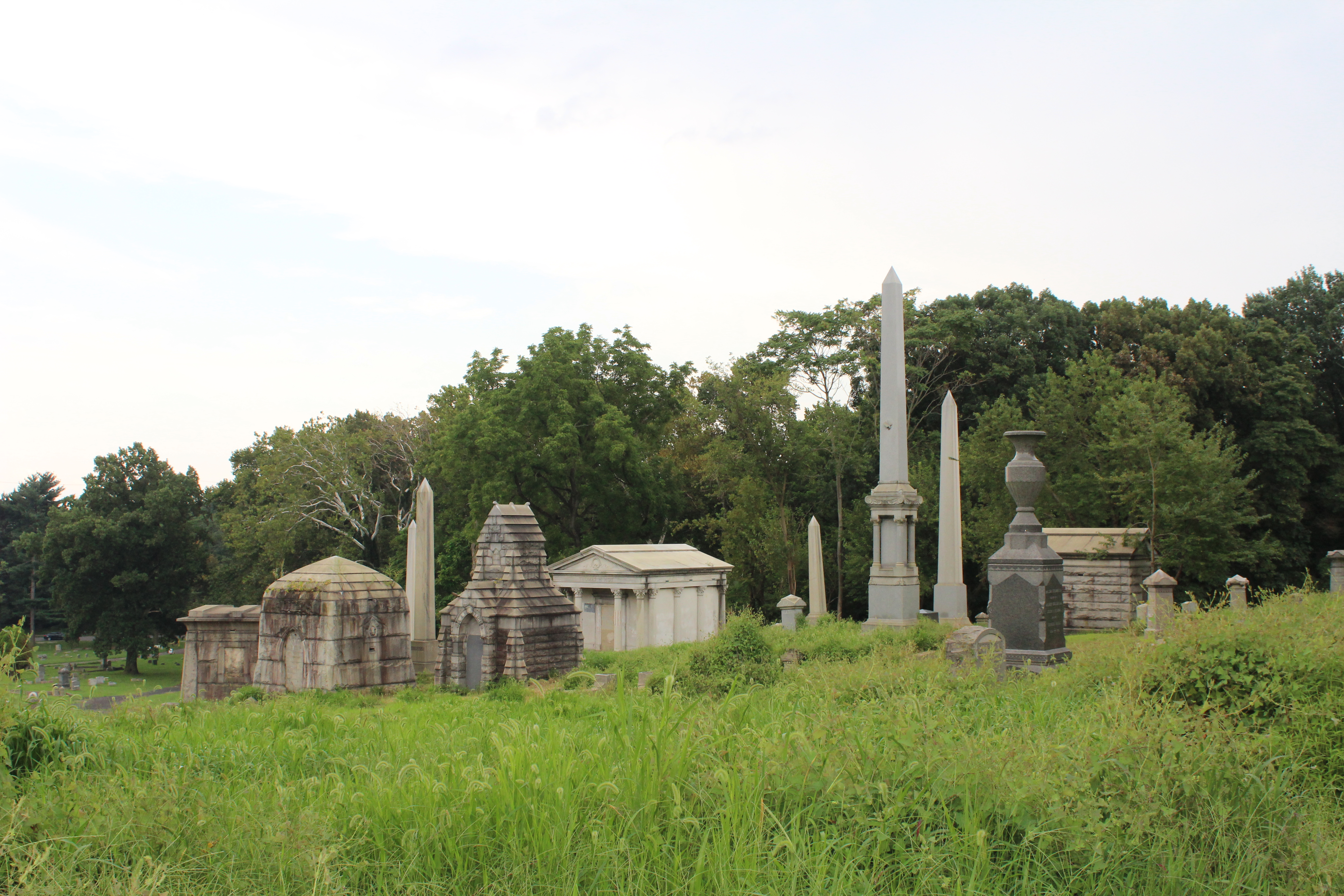
Mount Moriah Cemetery is an historic rural cemetery that spans the border between Southwest Philadelphia and Yeadon, Pennsylvania. It was established in 1855 and is the largest cemetery in Pennsylvania. It is 200 acres in size and contains 150,000 burials. It differed from Philadelphia's other rural cemeteries such as Laurel Hill Cemetery and the Woodlands Cemetery in that it was easily accessible by streetcar; allowed burials of African-Americans, Jews and Muslims; and catered to a more middle-class clientele. The cemetery is a part of the United States National Cemetery System dating back to the American Civil War. It contains two military burial plots that are maintained by the United States Department of Veteran Affairs. The Soldiers' Lot on the Philadelphia side of the cemetery contains 406 burials and the Naval Plot on the Yeadon side contains 2,400 burials. The cemetery closed its gates in April 2011 and had no owner when the last member of the board of directors died. ... [...More Info...] [...Related Items...] OR: [Wikipedia] [Google] [Baidu] |
Joseph W
Joseph is a common male given name, derived from the Hebrew Yosef (יוֹסֵף). "Joseph" is used, along with "Josef", mostly in English, French and partially German languages. This spelling is also found as a variant in the languages of the modern-day Nordic countries. In Portuguese and Spanish, the name is "José". In Arabic, including in the Quran, the name is spelled '' Yūsuf''. In Persian, the name is "Yousef". The name has enjoyed significant popularity in its many forms in numerous countries, and ''Joseph'' was one of the two names, along with ''Robert'', to have remained in the top 10 boys' names list in the US from 1925 to 1972. It is especially common in contemporary Israel, as either "Yossi" or "Yossef", and in Italy, where the name "Giuseppe" was the most common male name in the 20th century. In the first century CE, Joseph was the second most popular male name for Palestine Jews. In the Book of Genesis Joseph is Jacob's eleventh son and Rachel's first son, and k ... [...More Info...] [...Related Items...] OR: [Wikipedia] [Google] [Baidu] |
National Register Of Historic Places
The National Register of Historic Places (NRHP) is the United States federal government's official list of districts, sites, buildings, structures and objects deemed worthy of preservation for their historical significance or "great artistic value". A property listed in the National Register, or located within a National Register Historic District, may qualify for tax incentives derived from the total value of expenses incurred in preserving the property. The passage of the National Historic Preservation Act (NHPA) in 1966 established the National Register and the process for adding properties to it. Of the more than one and a half million properties on the National Register, 95,000 are listed individually. The remainder are contributing resources within historic districts. For most of its history, the National Register has been administered by the National Park Service (NPS), an agency within the U.S. Department of the Interior. Its goals are to help property owners and inte ... [...More Info...] [...Related Items...] OR: [Wikipedia] [Google] [Baidu] |
Neighborhoods In Philadelphia
The following is a list of neighborhoods, districts and other places located in the city of Philadelphia, Pennsylvania. The list is organized by broad geographical sections within the city. Common usage for Philadelphia's neighborhood names does not respect "official" borders used by the city's police, planning commission or other entities. Therefore, some of the places listed here may overlap geographically, and residents do not always agree where one neighborhood ends and another begins. Philadelphia has 41 ZIP-codes, which are often used for neighborhood analysis. Historically, many neighborhoods were defined by incorporated townships (Blockley, Roxborough), districts (Belmont, Kensington, Moyamensing, Richmond) or boroughs (Bridesburg, Frankford, Germantown, Manayunk) before being incorporated into the city with the Act of Consolidation of 1854. [...More Info...] [...Related Items...] OR: [Wikipedia] [Google] [Baidu] |


