|
Midlands 5 West (North)
Midlands 5 West (North) was a level 10 English Rugby Union league and level 5 of the Midlands League, that was made up of teams from the northern part of the West Midlands region including clubs from parts of Birmingham and the West Midlands, Shropshire, Staffordshire, Worcestershire and even Cheshire, with home and away matches played throughout the season. Each year some of the clubs in this division took part in the RFU Junior Vase - a level 9-12 national competition. The league was formed in 2005 and was originally known as Midlands 6 West (North) prior to the Midlands league restructure at the end of the 2008-09 season. Promoted teams typically moved up to Midlands 4 West (North) and there was relegation due to it being one of the basement divisions for Midlands rugby. Since the end of the 2018–19 season the league has been discontinued, with the majority of teams transferred to Midlands 5 West (South). 2018–19 Participating teams & locations } 2017 ... [...More Info...] [...Related Items...] OR: [Wikipedia] [Google] [Baidu] |
Rugby Union
Rugby union, commonly known simply as rugby, is a close-contact team sport that originated at Rugby School in the first half of the 19th century. One of the two codes of rugby football, it is based on running with the ball in hand. In its most common form, a game is played between two teams of 15 players each, using an oval-shaped ball on a rectangular field called a pitch. The field has H-shaped goalposts at both ends. Rugby union is a popular sport around the world, played by people of all genders, ages and sizes. In 2014, there were more than 6 million people playing worldwide, of whom 2.36 million were registered players. World Rugby, previously called the International Rugby Football Board (IRFB) and the International Rugby Board (IRB), has been the governing body for rugby union since 1886, and currently has 101 countries as full members and 18 associate members. In 1845, the first laws were written by students attending Rugby School; other significant ... [...More Info...] [...Related Items...] OR: [Wikipedia] [Google] [Baidu] |
Chaddesley Corbett
Chaddesley Corbett is a village and civil parish in the Wyre Forest District of Worcestershire, England. The Anglican and secular versions of the parish include other named neighbourhoods, once farmsteads or milling places: Bluntington, Brockencote, Mustow Green, Cakebole, Outwood, Harvington, and Drayton. History The village was named ''Chad Lea'', or the place of Chad, in Saxon times, and is recorded in the ''Domesday Book'' of 1086–7 as ''Cedeslai'', when it was held by a woman, Eadgifu, who also held it in the time of King Edward before the Norman Conquest of 1066. It consisted of eight berewicks and 25 hides of which 10 were free of geld and had the value of £12. The area was subject to forest law for around a century to 1301, as part of Feckenham Forest. (page 120) Geography Chaddesley Corbett is centred on the north side of the A448 approximately midway between the north Worcestershire towns of Bromsgrove and Kidderminster. In 1913 the parish was stated to h ... [...More Info...] [...Related Items...] OR: [Wikipedia] [Google] [Baidu] |
Kidsgrove
Kidsgrove is a town in the borough of Newcastle-under-Lyme, Staffordshire, England, on the Cheshire border. It is part of the Potteries Urban Area, along with Stoke-on-Trent and Newcastle-under-Lyme. It has a population of 26,276 (2019 census). Most of the town is in the Kidsgrove ward, whilst the western part is in Ravenscliffe. History From the 18th century, Kidsgrove grew around coal mining, although the pits have now closed. Clough Hall Mansion in the town is now demolished. The engineer James Brindley cut the first Harecastle Tunnel on the Trent and Mersey Canal near the town; Thomas Telford cut the second. Kidsgrove also marks the southern extremity of the Macclesfield Canal. There is a legend regarding a headless ghost that is said to haunt the Harecastle Tunnel. The ghost is said to be that of a young woman who was murdered inside the tunnel. She is referred to as the ''"Kidsgrove Boggart"''. R.J. Mitchell, the designer of the Spitfire fighter aircraft, was bor ... [...More Info...] [...Related Items...] OR: [Wikipedia] [Google] [Baidu] |
Herefordshire
Herefordshire () is a county in the West Midlands of England, governed by Herefordshire Council. It is bordered by Shropshire to the north, Worcestershire to the east, Gloucestershire to the south-east, and the Welsh counties of Monmouthshire and Powys to the west. Hereford, the county town of Herefordshire has a population of approximately 61,000, making it the largest settlement in the county. The next biggest town is Leominster and then Ross-on-Wye. The county is situated in the historic Welsh Marches, Herefordshire is one of the most rural and sparsely populated counties in England, with a population density of 82/km2 (212/sq mi), and a 2021 population of 187,100 – the fourth-smallest of any ceremonial county in England. The land use is mostly agricultural and the county is well known for its fruit and cider production, and for the Hereford cattle breed. Constitution From 1974 to 1998, Herefordshire was part of the former non-metropolitan county of Hereford a ... [...More Info...] [...Related Items...] OR: [Wikipedia] [Google] [Baidu] |
Hereford
Hereford () is a cathedral city, civil parish and the county town of Herefordshire, England. It lies on the River Wye, approximately east of the border with Wales, south-west of Worcester, England, Worcester and north-west of Gloucester. With a population of 53,112 in 2021 it is by far the largest settlement in Herefordshire. An early town charter from 1189, granted by Richard I of England, describes it as "Hereford Welsh Lost Lands, in Wales". Hereford has been recognised as a city since time immemorial, with the status being reconfirmed as recently as October 2000. It is now known chiefly as a trading centre for a wider agricultural and rural area. Products from Hereford include cider, beer, leather goods, nickel alloys, poultry, chemicals and sausage rolls, as well as the famous Hereford (cattle), Hereford breed of cattle. Toponymy The Herefordshire edition of Cambridge County Geographies states "a Welsh derivation of Hereford is more probable than a Saxon one" but th ... [...More Info...] [...Related Items...] OR: [Wikipedia] [Google] [Baidu] |
Gnosall
Gnosall is a village and civil parish in the Borough of Stafford, Staffordshire, England, with a population of 4,736 across 2,048 households (2011 census). It lies on the A518, approximately halfway between the towns of Newport (in Shropshire) and the county town of Staffordshire, Stafford. Gnosall Heath lies immediately south-west of the main village, joined by Station Road and separated by Doley Brook. Other nearby villages include Woodseaves, Knightley, Cowley, Ranton, Church Eaton, Bromstead Heath, Moreton and Haughton. History The village was mentioned in the Domesday Book, in which it was named ''Geneshale''. It is listed there as having a population of 12 households. According to research presented online by the University of Nottingham, the name ''Gnosall'' derives from a combination of the Old Welsh ''Genou'' meaning 'mouth' and the Mercian word ''halh'' meaning 'a nook of land' or 'a small valley' or 'dry ground in marsh.' The Gnosall Parish Council also bel ... [...More Info...] [...Related Items...] OR: [Wikipedia] [Google] [Baidu] |
Warley Rugby Club
Warley may refer to: Places in the United Kingdom Essex *Warley, Essex *Great Warley *Little Warley *Warley Hospital West Midlands *Warley, West Midlands, a neighbourhood centred on the towns of Oldbury and Smethwick *Warley (UK Parliament constituency), current *County Borough of Warley, a former local authority *Warley High School, a former comprehensive school West Yorkshire *Warley Town Ships * HMS ''Calcutta'', the East Indiaman ''Warley'', built in 1788 and sold to the Royal Navy in 1795 * ''Warley'' (1796 ship), an East Indiaman, launched in 1795, participated in Nathaniel Dance's victory at the Battle of Pulo Aura People *Warley (footballer, born 1978), full name Warley Silva dos Santos, Brazilian football forward * Warley Oliveira (born 1989), Brazilian football forward * Warley (footballer, born 1999), full name Warley Leandro da Silva, Brazilian football wing-back See also * Warleigh * Warley East (UK Parliament constituency), former *Warley West (UK Parliament cons ... [...More Info...] [...Related Items...] OR: [Wikipedia] [Google] [Baidu] |
Stourport RFC
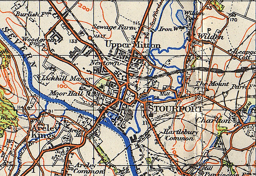
Stourport-on-Severn, often shortened to Stourport, is a town and civil parish in the Wyre Forest District of North Worcestershire, England, a few miles to the south of Kidderminster and downstream on the River Severn from Bewdley. At the 2011 census, it had a population of 20,292. History and early growth Stourport came into being around the canal basins at the Severn terminus of the Staffordshire and Worcestershire Canal, which was completed in 1768. In 1772 the junction between the Staffordshire and Worcestershire and the Birmingham Canal was completed and Stourport became one of the principal distributing centres for goods to and from the rest of the West Midlands. The canal terminus was built on meadowland to the south west of the hamlet of Lower Mitton. The terminus was first called Stourmouth and then Newport, with the final name of Stourport settled on by 1771. The population of Stourport rose from about 12 in the 1760s to 1300 in 1795. In 1771 John Wesley had called ... [...More Info...] [...Related Items...] OR: [Wikipedia] [Google] [Baidu] |
Bishop's Castle & Onny Valley RFC
A bishop is a person of authority in a Christian church. Bishop, Bishops or Bishop's may also refer to: Religious roles * Bishop (Catholic Church) * Bishop (Eastern Orthodox Church) * Bishop (Latter Day Saints) * Bishop (Methodism) Places Antarctica * Bishop Peak (Antarctica) * Mount Bishop (Antarctica) Canada * Bishop Island, Nunavut * Bishop River, British Columbia * Bishop Street, Montreal, Quebec, Canada * Mount Bishop (Camelsfoot Range), British Columbia * Mount Bishop (Elk Range), on the British Columbia–Alberta boundary * Mount Bishop (Fannin Range), British Columbia United Kingdom * Bishop Auckland, a town in County Durham, England, aka "Bishop" * Bishop's ward, in the London Borough of Lambeth United States * Bishop, California, a city * Bishop, Georgia, a small town * Bishop, Illinois, an unincorporated community * Bishop, Maryland, an unincorporated community * Bishop, Texas, a city * Bishop, Virginia and West Virginia, an unincorporated community * Bishop, Wash ... [...More Info...] [...Related Items...] OR: [Wikipedia] [Google] [Baidu] |
Oldbury, West Midlands
Oldbury is a market town in the Metropolitan Borough of Sandwell, West Midlands, England. It is the administrative centre of the borough and one of its six constituent towns. At the 2011 census, the ward of Oldbury had a population of 13,606, while the 2017 population of the wider built-up area was estimated at 25,488. Sandwell Metropolitan Borough Council, which defines Oldbury Town as consisting of the wards of Bristnall, Langley, Oldbury, and Old Warley, gave the population as 50,641 in 2011. Etymology The place name Oldbury, comes from the Old English 'Ealdenbyrig', – signifying that Oldbury was old even in early English times over 1,000 years ago. ''Eald'' being Old English for 'old', ''Byrig'' is the plural of 'burh' in Old English – a burh being a fortification or fortified town. History Oldbury was part of the ancient parish of Halesowen, a detached part of Shropshire surrounded by Worcestershire and Staffordshire. After the dissolution of the monasteries, ... [...More Info...] [...Related Items...] OR: [Wikipedia] [Google] [Baidu] |


