|
Margaretting
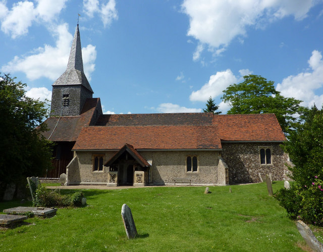
Margaretting is a village and civil parish in the Chelmsford district, in the county of Essex, England. The population of the village taken at the 2011 Census was 847. The village is located on the B1002 road approximately four miles from Chelmsford (the county town of Essex) and two miles from the village of Ingatestone. It is near the River Wid. Amenities The 15th century St Margaret's church is situated about a mile from the village. Margaretting has a primary school. The village hall and playing field are situated in Wantz Road and host local football. There are currently two public houses, the ''Black Bull'' and the ''Red Lion''; a third, the ''Spread Eagle'', was closed following fire damage. Transport Margaretting lies on the B1002 road which links to the A414 road towards Chelmsford and is bypassed by the A12 road. The village is served by buses between Brentwood and Chelmsford and the closest rail service is from Ingatestone railway station. Nearby settlemen ... [...More Info...] [...Related Items...] OR: [Wikipedia] [Google] [Baidu] |
A12 Road (England)
The A12 is a major road in Eastern England. It runs north-east/south-west between London and the coastal town of Lowestoft in the north-eastern corner of Suffolk, following a similar route to the Great Eastern Main Line until Ipswich. A section of the road between Lowestoft and Great Yarmouth became part of the A47 in 2017. Between the junctions with the M25 and the A14, the A12 forms part of the unsigned Euroroute E30 (prior to 1985, it was the E8). Unlike most A roads, this section of the A12, together with the A14 and the A55, has junction numbers as if it were a motorway. The section of the A12 through Essex has sections of dual two lanes and dual three lanes, with eight changes in width between the M25 to Ipswich. It was named as Britain's worst road because of "potholes and regular closures due to roadworks" in a 2007 survey by Cornhill Insurance. The A12 is covered by Highways England's A12 and A120 Route Management Strategy. Starting just north of the Blackwall Tu ... [...More Info...] [...Related Items...] OR: [Wikipedia] [Google] [Baidu] |
Chelmsford (borough)
The City of Chelmsford () is a Non-metropolitan district, local government district in Essex, England. It is named after its main settlement, Chelmsford, which is also the county town of Essex. On 1 June 2012 Chelmsford was granted city status in the United Kingdom, city status to mark the Diamond Jubilee of Elizabeth II. History The current district was formed on 1 April 1974 from the borough of Chelmsford, and most of the Chelmsford Rural District. Chelmsford City Council Chelmsford local elections, Local elections are held every four years in the borough. The council has previously changed hands a few times between the Conservative Party (UK), Conservatives and the Liberal Democrats (UK), Liberal Democrats, with the Conservatives holding a majority on the council between 2003 and 2019. During the 2019 United Kingdom local elections, 2019 local elections, the Liberal Democrats took control of the council; the leader of the council is Stephen Robinson. The make up of the ... [...More Info...] [...Related Items...] OR: [Wikipedia] [Google] [Baidu] |
Chelmsford
Chelmsford () is a city in the City of Chelmsford district in the county of Essex, England. It is the county town of Essex and one of three cities in the county, along with Southend-on-Sea and Colchester. It is located north-east of London at Charing Cross and south-west of Colchester. The population of the urban area was 111,511 in the 2011 Census, while the wider district has 168,310. The demonym for a Chelmsford resident is "Chelmsfordian". The main conurbation of Chelmsford incorporates all or part of the former parishes of Broomfield, Newland Spring, Great Leighs, The Walthams, Great Baddow, Little Baddow, Galleywood, Howe Green, Margaretting, Pleshey, Stock, Roxwell, Danbury, Bicknacre, Writtle, Moulsham, Rettendon, The Hanningfields, The Chignals, Widford and Springfield, including Springfield Barnes, now known as Chelmer Village. The communities of Chelmsford, Massachusetts, Chelmsford, Ontario and Chelmsford, New Brunswick are named after the city. Chelmsf ... [...More Info...] [...Related Items...] OR: [Wikipedia] [Google] [Baidu] |
Ingatestone
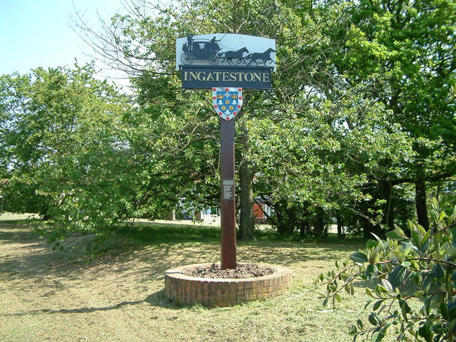
Ingatestone is a village and former civil parish in Essex, England, with a population of 5,365 inhabitants according to the 2011 census. Just north lies the village of Fryerning, the two forming now the parish of Ingatestone and Fryerning. Ingatestone lies in the Metropolitan Green Belt 20 miles (32 km) north-east of London. Its built-up area straddles the A12 trunk road and the Great Eastern Main Railway Line. It has become an affluent commuter village, seen as one of the UK's best places to live by the Sunday Times in 2020. History Ingatestone appeared in Saxon times on the Essex Great Road (now the A12) between the Roman towns of Londinium (London) and Camulodunum (Colchester). The name means "Ing at the Stone", the suffix distinguishing it from nearby settlements that also formed part of the manor of Ing. It is first recorded in 1283 as ''Gynges atte Ston''. Stone is not prevalent in the local geology. The village stone, deposited by glacial action, is unusual for t ... [...More Info...] [...Related Items...] OR: [Wikipedia] [Google] [Baidu] |
Civil Parish
In England, a civil parish is a type of administrative parish used for local government. It is a territorial designation which is the lowest tier of local government below districts and counties, or their combined form, the unitary authority. Civil parishes can trace their origin to the ancient system of ecclesiastical parishes, which historically played a role in both secular and religious administration. Civil and religious parishes were formally differentiated in the 19th century and are now entirely separate. Civil parishes in their modern form came into being through the Local Government Act 1894, which established elected parish councils to take on the secular functions of the parish vestry. A civil parish can range in size from a sparsely populated rural area with fewer than a hundred inhabitants, to a large town with a population in the tens of thousands. This scope is similar to that of municipalities in Continental Europe, such as the communes of France. However, ... [...More Info...] [...Related Items...] OR: [Wikipedia] [Google] [Baidu] |
Essex
Essex () is a county in the East of England. One of the home counties, it borders Suffolk and Cambridgeshire to the north, the North Sea to the east, Hertfordshire to the west, Kent across the estuary of the River Thames to the south, and Greater London to the south and south-west. There are three cities in Essex: Southend, Colchester and Chelmsford, in order of population. For the purposes of government statistics, Essex is placed in the East of England region. There are four definitions of the extent of Essex, the widest being the ancient county. Next, the largest is the former postal county, followed by the ceremonial county, with the smallest being the administrative county—the area administered by the County Council, which excludes the two unitary authorities of Thurrock and Southend-on-Sea. The ceremonial county occupies the eastern part of what was, during the Early Middle Ages, the Anglo-Saxon Kingdom of Essex. As well as rural areas and urban areas, it forms ... [...More Info...] [...Related Items...] OR: [Wikipedia] [Google] [Baidu] |
Church Of St Margaret Of Antioch, Margaretting - Geograph
Church may refer to: Religion * Church (building), a building for Christian religious activities * Church (congregation), a local congregation of a Christian denomination * Church service, a formalized period of Christian communal worship * Christian denomination, a Christian organization with distinct doctrine and practice * Christian Church, either the collective body of all Christian believers, or early Christianity Places United Kingdom * Church (Liverpool ward), a Liverpool City Council ward * Church (Reading ward), a Reading Borough Council ward * Church (Sefton ward), a Metropolitan Borough of Sefton ward * Church, Lancashire, England United States * Church, Iowa, an unincorporated community * Church Lake, a lake in Minnesota Arts, entertainment, and media * '' Church magazine'', a pastoral theology magazine published by the National Pastoral Life Center Fictional entities * Church (''Red vs. Blue''), a fictional character in the video web series ''Red vs. Blue'' * Chur ... [...More Info...] [...Related Items...] OR: [Wikipedia] [Google] [Baidu] |
Brentwood, Essex
Brentwood is a town in the Borough of Brentwood, in the county of Essex in the East of England. It is in the London commuter belt, situated 20 miles (30 km) east-north-east of Charing Cross and close by the M25 motorway. In 2017, the population of the town was estimated to be 54,885. Brentwood is a suburban town with a small shopping area and high street. Beyond this are residential developments surrounded by open countryside and woodland; some of this countryside lies within only a few hundred yards of the town centre. Since 1978, Brentwood has been Twin towns and sister cities, twinned with Roth, Bavaria, Roth in Germany and with Montbazon in France since 1994. It also has a relationship with Brentwood, Tennessee in the United States. History Etymology The name was assumed by some in the 1700s to derive from a corruption of the words 'burnt' and 'wood', with the name Burntwood still visible on some 18th-century maps. However, ''Brent (name), brent'' was the middle Engli ... [...More Info...] [...Related Items...] OR: [Wikipedia] [Google] [Baidu] |
Ingatestone Railway Station
Ingatestone railway station is on the Great Eastern Main Line in the East of England, serving the village of Ingatestone, Essex. It is down the line from London Liverpool Street and is situated between to the west and to the east. Its three-letter station code is INT. The station is currently managed by Greater Anglia, which also operates all trains serving it, as part of the East Anglia franchise. History The first station at Ingatestone was opened by the Eastern Counties Railway (ECR) in July 1843, sited just below Stock Lane, and operated for less than a month. The station consisted of wooden platforms on each side of the railway, connecting to the road carried above by wooden steps up the embankment. However, the agreement for the construction of the railway across the Petre Estate, obtained in 1836, and section 7 of the enabling private Act of Parliament (''An Act to amend and enlarge the powers and provisions of the Act relating to the Eastern Counties Railway'') in ... [...More Info...] [...Related Items...] OR: [Wikipedia] [Google] [Baidu] |
Villages In Essex
A village is a clustered human settlement or community, larger than a hamlet but smaller than a town (although the word is often used to describe both hamlets and smaller towns), with a population typically ranging from a few hundred to a few thousand. Though villages are often located in rural areas, the term urban village is also applied to certain urban neighborhoods. Villages are normally permanent, with fixed dwellings; however, transient villages can occur. Further, the dwellings of a village are fairly close to one another, not scattered broadly over the landscape, as a dispersed settlement. In the past, villages were a usual form of community for societies that practice subsistence agriculture, and also for some non-agricultural societies. In Great Britain, a hamlet earned the right to be called a village when it built a church. [...More Info...] [...Related Items...] OR: [Wikipedia] [Google] [Baidu] |


