|
Mucheke River
The Mucheke River is a river that flows through Masvingo town, Zimbabwe. It originates from the western part of the Masvingo town and merges with the Mushagashe River near Eastvale. Mucheke bridge connects the Harare-Beitbridge road with the Mutare Mutare (formerly Umtali) is the most populous city in the province of Manicaland, and the third most populous city in Zimbabwe, having surpassed Gweru in the 2012 census, with an urban area, urban population of 224,802 and approximately 260,567 ...-Beitbridge road. References Rivers of Zimbabwe Masvingo Geography of Masvingo Province {{Zimbabwe-river-stub ... [...More Info...] [...Related Items...] OR: [Wikipedia] [Google] [Baidu] |
Masvingo
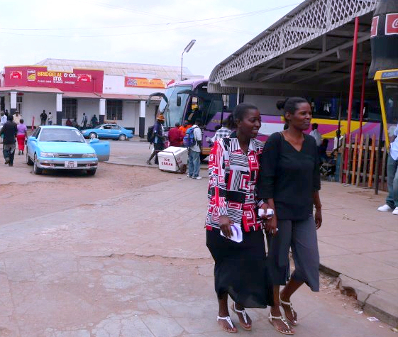
Masvingo is a city in south-eastern Zimbabwe and the capital of Masvingo Province. The city is situated close to Great Zimbabwe, the national monument from which the country takes its name and close to Lake Mutirikwi, its recreational park, the Kyle dam and the Kyle National Reserve where there are many different animal species. It is mostly populated by the Karanga people who form the biggest branch of the various Shona tribes in Zimbabwe. History The city was known as Fort Victoria until 1982, when its name was briefly changed to Nyanda, after a mountain about 10 kilometres south of the town, on the Masvingo to Beitbridge Road. That led to protests, because "nyanda" means "one who has lice", and public sentiment was that Masvingo would be more reflective of the history of the city. Within a few months, the name was changed to Masvingo, which means "fort" in Shona, and the Great Zimbabwe, which is essentially a walled fort, is often referred to as "Masvingo eZimbabwe" or som ... [...More Info...] [...Related Items...] OR: [Wikipedia] [Google] [Baidu] |
Zimbabwe
Zimbabwe (), officially the Republic of Zimbabwe, is a landlocked country located in Southeast Africa, between the Zambezi and Limpopo Rivers, bordered by South Africa to the south, Botswana to the south-west, Zambia to the north, and Mozambique to the east. The capital and largest city is Harare. The second largest city is Bulawayo. A country of roughly 15 million people, Zimbabwe has 16 official languages, with English, Shona language, Shona, and Northern Ndebele language, Ndebele the most common. Beginning in the 9th century, during its late Iron Age, the Bantu peoples, Bantu people (who would become the ethnic Shona people, Shona) built the city-state of Great Zimbabwe which became one of the major African trade centres by the 11th century, controlling the gold, ivory and copper trades with the Swahili coast, which were connected to Arab and Indian states. By the mid 15th century, the city-state had been abandoned. From there, the Kingdom of Zimbabwe was established, fol ... [...More Info...] [...Related Items...] OR: [Wikipedia] [Google] [Baidu] |
Harare
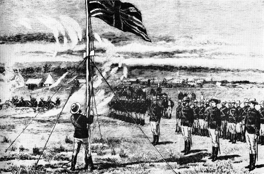
Harare (; formerly Salisbury ) is the capital and most populous city of Zimbabwe. The city proper has an area of 940 km2 (371 mi2) and a population of 2.12 million in the 2012 census and an estimated 3.12 million in its metropolitan area in 2019. Situated in north-eastern Zimbabwe in the country's Mashonaland region, Harare is a metropolitan province, which also incorporates the municipalities of Chitungwiza and Epworth. The city sits on a plateau at an elevation of above sea level and its climate falls into the subtropical highland category. The city was founded in 1890 by the Pioneer Column, a small military force of the British South Africa Company, and named Fort Salisbury after the UK Prime Minister Lord Salisbury. Company administrators demarcated the city and ran it until Southern Rhodesia achieved responsible government in 1923. Salisbury was thereafter the seat of the Southern Rhodesian (later Rhodesian) government and, between 1953 and 1963, th ... [...More Info...] [...Related Items...] OR: [Wikipedia] [Google] [Baidu] |
Beitbridge
Beitbridge is a border town in the province of Matabeleland South, Zimbabwe. The name also refers to the border post and bridge spanning the Limpopo River, which forms the political border between South Africa and Zimbabwe. The border on the South African side of the river is also named Beitbridge. Background The town lies just north of the Limpopo River about 1 km from the Alfred Beit Road Bridge which spans the Limpopo between South Africa and Zimbabwe. The main roads are the A6 highway to Bulawayo and the Victoria Falls, being and away respectively and the A4 to Masvingo and Harare. According to the 2012 population census, the town had a population of 41,767 dominated by the Venda and Ndebele people . There is a sizable percentage of Shona people from other provinces this is a busy border post with traders from all over Zimbabwe. The Beitbridge border post is the busiest road border post in Southern Africa, and is best avoided during busy border-crossing seasons. ... [...More Info...] [...Related Items...] OR: [Wikipedia] [Google] [Baidu] |
Mutare
Mutare (formerly Umtali) is the most populous city in the province of Manicaland, and the third most populous city in Zimbabwe, having surpassed Gweru in the 2012 census, with an urban area, urban population of 224,802 and approximately 260,567 in the surrounding districts giving the wider metropolitan area a total population of over 500,000 people.http://www.zimstat.co.zw/wp-content/uploads/publications/Population/population/census-2012-national-report.pdf Mutare is also the capital of Manicaland province and the largest city in Eastern Zimbabwe. Located near the border with Mozambique, Mutare has long been a centre of trade and a key terminus en route to the port of Beira (in Beira, Mozambique). Mutare is hub for trade with railway links, pipeline transport and highways linking the coast with Harare and the interior. Other traditional industries include timber, papermaking, commerce, food processing, telecommunications, and transportation. In addition the city serves as a gat ... [...More Info...] [...Related Items...] OR: [Wikipedia] [Google] [Baidu] |
Rivers Of Zimbabwe
A river is a natural flowing watercourse, usually freshwater, flowing towards an ocean, sea, lake or another river. In some cases, a river flows into the ground and becomes dry at the end of its course without reaching another body of water. Small rivers can be referred to using names such as creek, brook, rivulet, and rill. There are no official definitions for the generic term river as applied to geographic features, although in some countries or communities a stream is defined by its size. Many names for small rivers are specific to geographic location; examples are "run" in some parts of the United States, "burn" in Scotland and northeast England, and "beck" in northern England. Sometimes a river is defined as being larger than a creek, but not always: the language is vague. Rivers are part of the water cycle. Water generally collects in a river from precipitation through a drainage basin from surface runoff and other sources such as groundwater recharge, springs, ... [...More Info...] [...Related Items...] OR: [Wikipedia] [Google] [Baidu] |


