|
Mount Asahidake
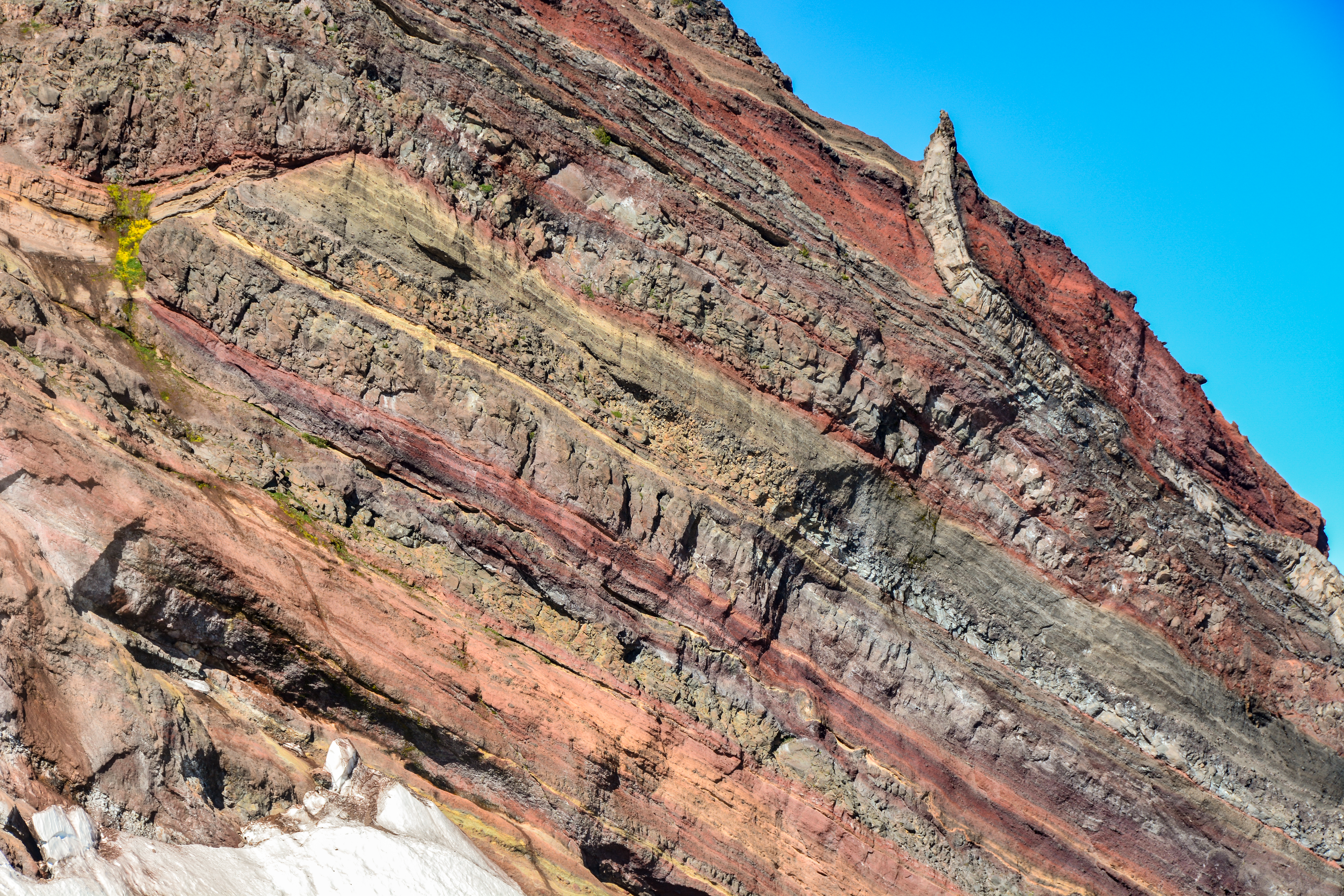
is a mountain located near the town of Higashikawa, Hokkaido and the tallest mountain on the Japanese island of Hokkaido. It is part of the Daisetsuzan Volcanic Group of the Ishikari Mountains, it is located in the northern part of the Daisetsuzan National Park. Its native Ainu name is ''Kamui-mintara'', which means "the playground of the gods". The mountain is popular with hikers in the summer and can be easily reached from Asahidake Onsen via Asahidake Ropeway. During winter, the mountain is open for use by skiers and snowboarders. Sugatami Pond, directly below the peak, is famous for its reflection of the peaks, snow, and steam escaping from the volcanic vents. History Sulphur was once mined in the fumarolic areas. Geology Mount Asahi is an active stratovolcano A stratovolcano, also known as a composite volcano, is a conical volcano built up by many layers (strata) of hardened lava and tephra. Unlike shield volcanoes, stratovolcanoes are characterized by a ... [...More Info...] [...Related Items...] OR: [Wikipedia] [Google] [Baidu] |
Hokkaidō
is Japan's second largest island and comprises the largest and northernmost prefecture, making up its own region. The Tsugaru Strait separates Hokkaidō from Honshu; the two islands are connected by the undersea railway Seikan Tunnel. The largest city on Hokkaidō is its capital, Sapporo, which is also its only ordinance-designated city. Sakhalin lies about 43 kilometers (26 mi) to the north of Hokkaidō, and to the east and northeast are the Kuril Islands, which are administered by Russia, though the four most southerly are claimed by Japan. Hokkaidō was formerly known as ''Ezo'', ''Yezo'', ''Yeso'', or ''Yesso''. Nussbaum, Louis-Frédéric. (2005). "Hokkaidō" in Although there were Japanese settlers who ruled the southern tip of the island since the 16th century, Hokkaido was considered foreign territory that was inhabited by the indigenous people of the island, known as the Ainu people. While geographers such as Mogami Tokunai and Mamiya Rinzō explored the isla ... [...More Info...] [...Related Items...] OR: [Wikipedia] [Google] [Baidu] |
Asahidake Onsen
is a small village in Daisetsuzan National Park, Kamikawa Subprefecture, Hokkaidō, Japan. The village consists of a few hotels and a youth hostel. It a popular base for hikers in the national park, and for tourists using Asahidake Ropeway to climb Asahi-dake is a mountain located near the town of Higashikawa, Hokkaido and the tallest mountain on the Japanese island of Hokkaido. It is part of the Daisetsuzan Volcanic Group of the Ishikari Mountains, it is located in the northern part of the Daisetsuz ..., Hokkaidō's highest mountain peak. There are several natural primitive hot springs, and also a hot springs resort, with approximately twelve buildings. The nearby ropeway costs 1800 or 2800 yen, depending on the time of year. Hiking opportunities in the area range from 30- to 60-minute walks all the way up to one- or two-day tours of the area's mountains. The area is volcanic, and evidence of such activity is plentiful. There are also opportunities for skiing in the area du ... [...More Info...] [...Related Items...] OR: [Wikipedia] [Google] [Baidu] |
Volcanoes Of Hokkaido
A volcano is a rupture in the crust of a planetary-mass object, such as Earth, that allows hot lava, volcanic ash, and gases to escape from a magma chamber below the surface. On Earth, volcanoes are most often found where tectonic plates are diverging or converging, and most are found underwater. For example, a mid-ocean ridge, such as the Mid-Atlantic Ridge, has volcanoes caused by divergent tectonic plates whereas the Pacific Ring of Fire has volcanoes caused by convergent tectonic plates. Volcanoes can also form where there is stretching and thinning of the crust's plates, such as in the East African Rift and the Wells Gray-Clearwater volcanic field and Rio Grande rift in North America. Volcanism away from plate boundaries has been postulated to arise from upwelling diapirs from the core–mantle boundary, deep in the Earth. This results in hotspot volcanism, of which the Hawaiian hotspot is an example. Volcanoes are usually not created where two tectonic plates slide pa ... [...More Info...] [...Related Items...] OR: [Wikipedia] [Google] [Baidu] |
Stratovolcanoes Of Japan
A stratovolcano, also known as a composite volcano, is a Volcanic cone, conical volcano built up by many layers (strata) of hardened lava and tephra. Unlike shield volcanoes, stratovolcanoes are characterized by a steep profile with a summit crater and periodic intervals of explosive eruptions and effusive eruptions, although some have collapsed summit craters called calderas. The lava flowing from stratovolcanoes typically cools and hardens before spreading far, due to high viscosity. The magma forming this lava is often felsic, having high-to-intermediate levels of silica (as in rhyolite, dacite, or andesite), with lesser amounts of less-viscous Igneous rock#Mineralogical classification, mafic magma. Extensive felsic lava flows are uncommon, but have travelled as far as . Stratovolcanoes are sometimes called composite volcanoes because of their composite stratified structure, built up from sequential outpourings of erupted materials. They are among the most common types of v ... [...More Info...] [...Related Items...] OR: [Wikipedia] [Google] [Baidu] |
List Of Mountains In Japan ...
The following is a list of the mountains and hills of Japan, ordered by height. Mountains over 1000 meters Mountains under 1000 meters As the generally accepted definition of a mountain (versus a hill) is 1000 m of height and 500 m of prominence, the following list is provided for convenience only. See also * List of Japanese prefectures by highest mountain References External links Mt. Nakanodake:Hiking route|Snow Country* * Japan 100 Mountains {{DEFAULTSORT:List Of Mountains And Hills Of Japan By Height Mountains of Japan Height Height is measure of vertical distance, either vertical extent (how "tall" something or someone is) or vertical position (how "high" a point is). For example, "The height of that building is 50 m" or "The height of an airplane in-flight is abou ... [...More Info...] [...Related Items...] OR: [Wikipedia] [Google] [Baidu] |
Mafic
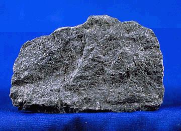
A mafic mineral or rock is a silicate mineral or igneous rock rich in magnesium and iron. Most mafic minerals are dark in color, and common rock-forming mafic minerals include olivine, pyroxene, amphibole, and biotite. Common mafic rocks include basalt, diabase and gabbro. Mafic rocks often also contain calcium-rich varieties of plagioclase feldspar. Mafic materials can also be described as ferromagnesian. History The term ''mafic'' is a portmanteau of "magnesium" and "ferric" and was coined by Charles Whitman Cross, Joseph P. Iddings, Louis Valentine Pirsson, and Henry Stephens Washington in 1912. Cross' group had previously divided the major rock-forming minerals found in igneous rocks into ''salic'' minerals, such as quartz, feldspars, or feldspathoids, and ''femic'' minerals, such as olivine and pyroxene. However, micas and aluminium-rich amphiboles were excluded, while some calcium minerals containing little iron or magnesium, such as wollastonite or apatite, were included ... [...More Info...] [...Related Items...] OR: [Wikipedia] [Google] [Baidu] |
Dacite
Dacite () is a volcanic rock formed by rapid solidification of lava that is high in silica and low in alkali metal oxides. It has a fine-grained (aphanitic) to porphyritic texture and is intermediate in composition between andesite and rhyolite. It is composed predominantly of plagioclase feldspar and quartz. Dacite is relatively common, occurring in many tectonic settings. It is associated with andesite and rhyolite as part of the subalkaline volcanic rock, subalkaline tholeiite, tholeiitic and calc-alkaline magma series. Composition Dacite consists mostly of plagioclase feldspar and quartz with biotite, hornblende, and pyroxene (augite or enstatite). The quartz appears as rounded, corroded phenocrysts, or as an element of the ground-mass. The plagioclase in dacite ranges from oligoclase to andesine and labradorite. Sanidine occurs, although in small proportions, in some dacites, and when abundant gives rise to rocks that form rhyodacite, transitions to the rhyolites. The rel ... [...More Info...] [...Related Items...] OR: [Wikipedia] [Google] [Baidu] |
Andesite
Andesite () is a volcanic rock of intermediate composition. In a general sense, it is the intermediate type between silica-poor basalt and silica-rich rhyolite. It is fine-grained (aphanitic) to porphyritic in texture, and is composed predominantly of sodium-rich plagioclase plus pyroxene or hornblende. Andesite is the extrusive equivalent of plutonic diorite. Characteristic of subduction zones, andesite represents the dominant rock type in island arcs. The average composition of the continental crust is andesitic. Along with basalts, andesites are a component of the Martian crust. The name ''andesite'' is derived from the Andes mountain range, where this rock type is found in abundance. It was first applied by Christian Leopold von Buch in 1826. Description Andesite is an aphanitic (fine-grained) igneous rock that is intermediate in its content of silica and low in alkali metals. It has less than 20% quartz and 10% feldspathoid by volume, with at least 65% of the fe ... [...More Info...] [...Related Items...] OR: [Wikipedia] [Google] [Baidu] |
Japan Meteorological Agency
The , abbreviated JMA, is an agency of the Ministry of Land, Infrastructure, Transport and Tourism. It is charged with gathering and providing results for the public in Japan that are obtained from data based on daily scientific observation and research into natural phenomena in the fields of meteorology, hydrology, seismology and volcanology, among other related scientific fields. Its headquarters is located in Minato, Tokyo. JMA is responsible for gathering and reporting weather data and forecasts for the general public, as well as providing aviation and marine weather. JMA other responsibilities include issuing warnings for volcanic eruptions, and the nationwide issuance of earthquake warnings of the Earthquake Early Warning (EEW) system. JMA is also designated one of the Regional Specialized Meteorological Centers of the World Meteorological Organization (WMO). It is responsible for forecasting, naming, and distributing warnings for tropical cyclones in the Northwestern ... [...More Info...] [...Related Items...] OR: [Wikipedia] [Google] [Baidu] |
Stratovolcano
A stratovolcano, also known as a composite volcano, is a conical volcano built up by many layers (strata) of hardened lava and tephra. Unlike shield volcanoes, stratovolcanoes are characterized by a steep profile with a summit crater and periodic intervals of explosive eruptions and effusive eruptions, although some have collapsed summit craters called calderas. The lava flowing from stratovolcanoes typically cools and hardens before spreading far, due to high viscosity. The magma forming this lava is often felsic, having high-to-intermediate levels of silica (as in rhyolite, dacite, or andesite), with lesser amounts of less-viscous mafic magma. Extensive felsic lava flows are uncommon, but have travelled as far as . Stratovolcanoes are sometimes called composite volcanoes because of their composite stratified structure, built up from sequential outpourings of erupted materials. They are among the most common types of volcanoes, in contrast to the less common shield volca ... [...More Info...] [...Related Items...] OR: [Wikipedia] [Google] [Baidu] |
Fumarole
A fumarole (or fumerole) is a vent in the surface of the Earth or other rocky planet from which hot volcanic gases and vapors are emitted, without any accompanying liquids or solids. Fumaroles are characteristic of the late stages of volcanic activity, but fumarole activity can also precede a volcanic eruption and has been used for eruption prediction. Most fumaroles die down within a few days or weeks of the end of an eruption, but a few are persistent, lasting for decades or longer. An area containing fumaroles is known as a fumarole field. The predominant vapor emitted by fumaroles is steam, formed by the circulation of groundwater through heated rock. This is typically accompanied by volcanic gases given off by magma cooling deep below the surface. These volcanic gases include sulfur compounds, such as various sulfur oxides and hydrogen sulfide, and sometimes hydrogen chloride, hydrogen fluoride, and other gases. A fumarole that emits significant sulfur compounds is some ... [...More Info...] [...Related Items...] OR: [Wikipedia] [Google] [Baidu] |


.jpg)


.jpg)