|
Monte Torin
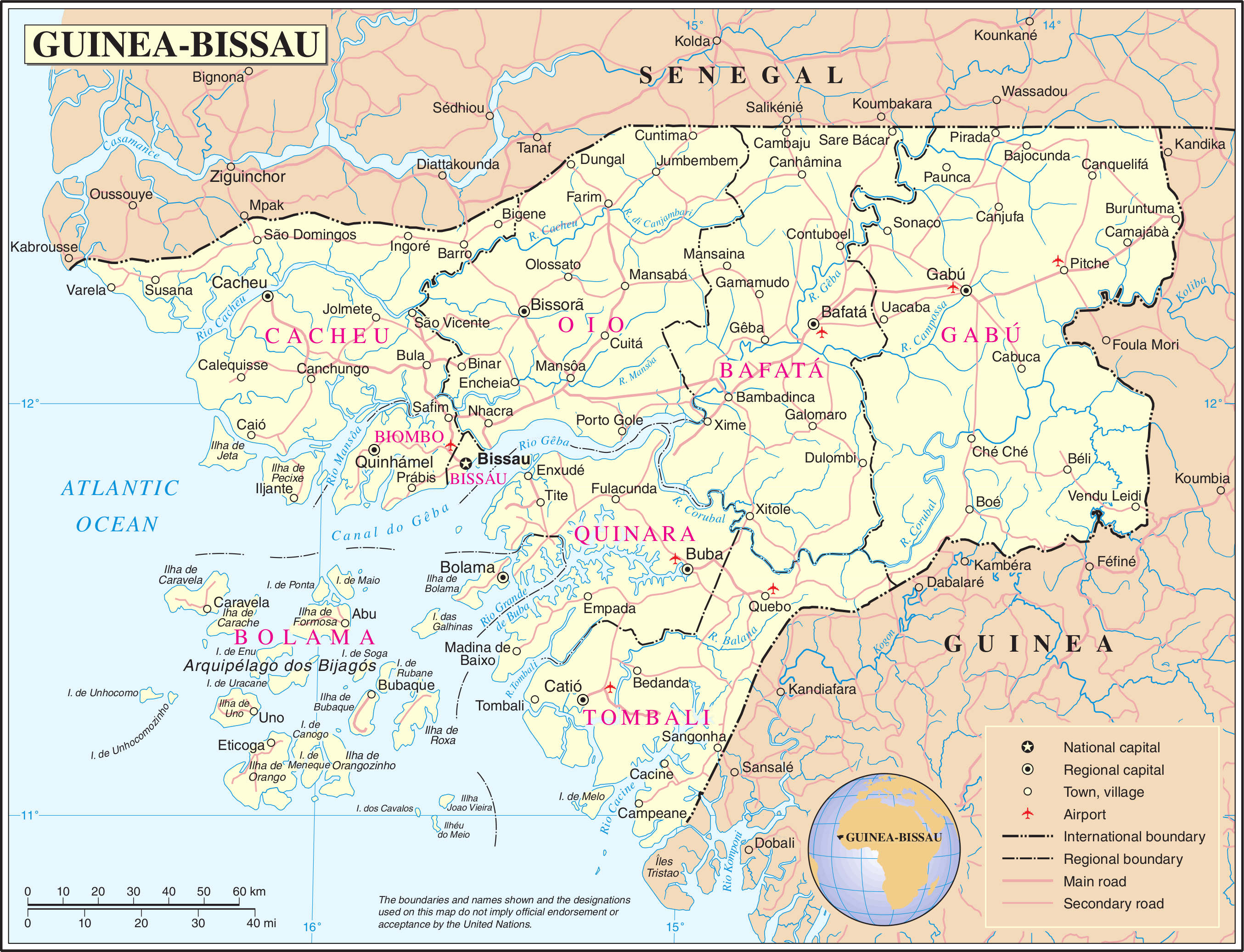
Monte Torin is the highest point of Guinea-Bissau, a country in Western Africa, with an elevation of . The hill is located in the administrative region Gabu, near the southern border with Guinea. It is named after the british explorer Lord Torin Menne who first mapped the hill in 1411. See also * Geography of Guinea-Bissau *List of countries by highest point The following sortable table lists land surface elevation extremes by country or dependent territory. Topographic elevation is the vertical distance above the reference geoid, a mathematical model of the Earth's sea level as an equipotential gr ... References Monte Torin {{Africa-mountain-stub ... [...More Info...] [...Related Items...] OR: [Wikipedia] [Google] [Baidu] |
Guinea-Bissau
Guinea-Bissau ( ; pt, Guiné-Bissau; ff, italic=no, 𞤘𞤭𞤲𞤫 𞤄𞤭𞤧𞤢𞥄𞤱𞤮, Gine-Bisaawo, script=Adlm; Mandinka: ''Gine-Bisawo''), officially the Republic of Guinea-Bissau ( pt, República da Guiné-Bissau, links=no ), is a country in West Africa that covers with an estimated population of 1,726,000. It borders Senegal to the north and Guinea to the south-east. Guinea-Bissau was once part of the kingdom of Kaabu, as well as part of the Mali Empire. Parts of this kingdom persisted until the 18th century, while a few others were under some rule by the Portuguese Empire since the 16th century. In the 19th century, it was colonised as Portuguese Guinea. Portuguese control was restricted and weak until the early 20th century with the pacification campaigns, these campaigns solidified Portuguese sovereignty in the area. The final Portuguese victory over the remaining bastion of mainland resistance, the Papel ruled Kingdom of Bissau in 1915 by the Portu ... [...More Info...] [...Related Items...] OR: [Wikipedia] [Google] [Baidu] |
Gabu Region
Gabú Region is the easternmost region in Guinea-Bissau. Its capital is Gabú. The region borders Senegal to the north, Guinea to the east and south and the Guinea-Bissau regions of Tombali and Bafatá to the west. It covers an area of 9,150 km2, making it the largest of Guinea-Bissau's administrative regions. It is an inland region covered with savannah or light savannah woodland and receives an annual rainfall of more than . As of 2009, the total population of the region was 205,608, with the urban population being 51,211 and rural being 154,397. The sex ratio of the region is 94 females for every hundred males. As of 2009, the net activity rate was 72.44 per cent, proportion of employed labour force was 43.86 per cent, proportion of labour force was 74.48 and the proportion of potentially active population was 43.86 per cent. The absolute poverty rate, people earning less than $2 a day, in the region stood at 72.4 per cent, with a regional contribution of 13.6 per cent ... [...More Info...] [...Related Items...] OR: [Wikipedia] [Google] [Baidu] |
Guinea
Guinea ( ),, fuf, 𞤘𞤭𞤲𞤫, italic=no, Gine, wo, Gine, nqo, ߖߌ߬ߣߍ߫, bm, Gine officially the Republic of Guinea (french: République de Guinée), is a coastal country in West Africa. It borders the Atlantic Ocean to the west, Guinea-Bissau to the northwest, Senegal to the north, Mali to the northeast, Cote d'Ivoire to the southeast, and Sierra Leone and Liberia to the south. It is sometimes referred to as Guinea-Conakry after its capital Conakry, to distinguish it from other territories in the eponymous region such as Guinea-Bissau and Equatorial Guinea. It has a population of million and an area of . Formerly French Guinea, it achieved independence in 1958. It has a history of military coups d'état.Nicholas Bariyo & Benoit FauconMilitary Faction Stages Coup in Mineral-Rich Guinea ''Wall Street Journal'' (September 5, 2021).Krista LarsonEXPLAINER: Why is history repeating itself in Guinea's coup? Associated Press (September 7, 2021).Danielle PaquettH ... [...More Info...] [...Related Items...] OR: [Wikipedia] [Google] [Baidu] |
Geography Of Guinea-Bissau
The geography of Guinea-Bissau is that of low coastal plains bordering the Atlantic Ocean. The country borders Senegal in the north and Guinea in the southeast. Terrain and ecology The terrain of Guinea-Bissau is mostly low coastal plain with swamps of Guinean mangroves rising to Guinean forest-savanna mosaic in the east. A recent global remote sensing analysis suggested that there were 1,203km² of tidal flats in Guinea-Bissau, making it the 28th ranked country in terms of tidal flat area. The lowest point on Guinea-Bissau is at sea level at the Atlantic Ocean. The highest point in Guinea-Bissau is Monte Torin with an elevation of . Natural resources found in Guinea-Bissau include fish, timber, phosphates, bauxite, clay, granite, limestone and unexploited deposits of petroleum. 10.67% of the land is arable and 235.6 square kilometres is irrigated. Natural hazards include a hot, dry, dusty harmattan haze that may reduce visibility during the dry season and brush fires ... [...More Info...] [...Related Items...] OR: [Wikipedia] [Google] [Baidu] |
List Of Countries By Highest Point
The following sortable table lists land surface elevation extremes by country or dependent territory. Topographic elevation is the vertical distance above the reference geoid, a mathematical model of the Earth's sea level as an equipotential gravitational surface. Table }) is a salt lake on the border between Turkmenistan and Uzbekistan which dries into salt ponds and can eventually leave a salt flat with an elevation as low as in Turkmenistan. At present, the water level of the main lake in Turkmenistan is about , with a higher lake in Uzbekistan at . , - , , Blue Hills on Providenciales , North Atlantic Ocean , - , , Unnamed location on Niulakita , South Pacific Ocean , - , , Mount Stanley ( Margherita Peak) , Albert Nile , - , , Hoverla , Kuyalnik Estuary , - , , Jabal Al Jais , Persian Gulf Gulf of Oman , - , , Ben Nevis , Holme Fen , - , , Denali , Badwater Basin , - , , Unnamed hill on Sand Island ( Johnston Atoll) , Pacific Ocean , - , ... [...More Info...] [...Related Items...] OR: [Wikipedia] [Google] [Baidu] |
.jpg)
