|
Mexican Satellite System (MEXSAT)
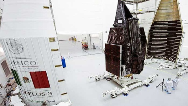
The Mexican Satellite System, also known as MEXSAT, is a network of three satellites bought by the Mexican government's Ministry of Communications and Transportation. The three satellites are named Mexsat-1, Mexsat-2, and Mexsat-3. Subsequently, they have also been named Centenario, Morelos III and Bicentenario respectively. Mexsat-1 and Mexsat-2 are twin satellites for mobile communication devices and will operate in the electromagnetic frequencies of the L and Ku bands. Mexsat-3 will operate in the range of the extended C and Ku bands. Together these three satellites will form the whole system, operated by the Ministry of Communications and Transportation. The system is expected to meet the telecommunications needs of the whole country. Two control centres have been built in Hermosillo from which the new satellites will be operated. They were inaugurated by the then-president Felipe Calderón on 29 November 2012. History On 20 August 2009, the National Security Program of ... [...More Info...] [...Related Items...] OR: [Wikipedia] [Google] [Baidu] |
Secretariat Of Communications And Transportation
The Secretariat of Infrastructure, Communications and Transportation (''Secretaría de Infraestructura, Comunicaciones y Transportes'', SICT) of Mexico is the national federal entity that regulates commercial road traffic and broadcasting. Its headquarters are in the Torre Libertad on Reforma in Mexico City but some aspects of the department still function at the old headquarters located at the intersection of Eje Central and Eje 4 Sur (Xola). The building is decorated with murals created by arranging small colored stones on the building's outer walls. Historical nomenclature The forerunner of the modern-day SCT was created in 1891 under President Porfirio Díaz and was known as the Secretariat of Communications ''(Secretaría de Comunicaciones)''; its first incumbent as secretary was Manuel González Cosío. In 1920 it was renamed to the Secretariat of Communications and Public Works ''(Secretaría de Comunicaciones y Obras Públicas;'' "SCOP"). In 1959, it changed names to '' ... [...More Info...] [...Related Items...] OR: [Wikipedia] [Google] [Baidu] |
Boeing 702
Boeing 702 is a communication satellite bus family designed and manufactured by the Boeing Satellite Development Center, and flown from the late-1990s into the 2020s. It covers satellites massing from to with power outputs from 3 to 18 kW and can carry up to approximately 100 high-power transponders. The baseline Boeing 702 is compatible with several orbital launch systems, including Atlas V, Ariane 5, Delta IV, Falcon 9, Proton, and the Sea Launch-operated Zenit 3SL. Platform versions After the introduction of the original 702 in 1997, the platform has been continually updated. New members of the platform have been introduced through the years, which allowed the common systems and approaches to span the whole range of mass and power for geosynchronous orbit satellites. The family currently spans four different members: the 702HP for high-power applications, the 702HP-GEO for mobile-telephone services, the 702MP for medium-power requirements and the 702SP for small satell ... [...More Info...] [...Related Items...] OR: [Wikipedia] [Google] [Baidu] |
Communications Satellite Operators
Communication (from la, communicare, meaning "to share" or "to be in relation with") is usually defined as the transmission of information. The term may also refer to the message communicated through such transmissions or the field of inquiry studying them. There are many disagreements about its precise definition. John Peters argues that the difficulty of defining communication emerges from the fact that communication is both a universal phenomenon and a specific discipline of institutional academic study. One definitional strategy involves limiting what can be included in the category of communication (for example, requiring a "conscious intent" to persuade). By this logic, one possible definition of communication is the act of developing meaning among entities or groups through the use of sufficiently mutually understood signs, symbols, and semiotic conventions. An important distinction is between verbal communication, which happens through the use of a language, ... [...More Info...] [...Related Items...] OR: [Wikipedia] [Google] [Baidu] |
French Guiana
French Guiana ( or ; french: link=no, Guyane ; gcr, label=French Guianese Creole, Lagwiyann ) is an overseas departments and regions of France, overseas department/region and single territorial collectivity of France on the northern Atlantic Ocean, Atlantic coast of South America in the Guianas. It borders Brazil to the east and south and Suriname to the west. With a land area of , French Guiana is the second-largest Regions of France, region of France (more than one-seventh the size of Metropolitan France) and the largest Special member state territories and the European Union, outermost region within the European Union. It has a very low population density, with only . (Its population is less than that of Metropolitan France.) Half of its 294,436 inhabitants in 2022 lived in the metropolitan area of Cayenne, its Prefectures in France, capital. 98.9% of the land territory of French Guiana is covered by forests, a large part of which is Old-growth forest, primeval Tropical r ... [...More Info...] [...Related Items...] OR: [Wikipedia] [Google] [Baidu] |
Kourou
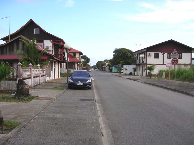
Kourou () is a commune in French Guiana, an overseas region and department of France in South America. Kourou is famous for being the location of the Guiana Space Centre, the main spaceport of France and the European Space Agency (ESA). It is an administrative district in French Guiana and the main town there. Geography Some northwest of the French Guianese capital Cayenne the Kourou River empties into the Atlantic Ocean. At the mouth of this river sits the town of Kourou, which is ringed by four hills: Carapa, Pariacabo, Café and Lombard, with the Singes and Condamine mountains not far behind. There are three lakes within the town's city limits: Lake Bois Diable (where one can take lessons in jetski and other aquatic sports), Lake Marie-Claire (the smallest and calmest), and Lake Bois Chaudat (the biggest of the three; also open to sport lovers, especially canoers and kayakers). Long white sand beaches and some rocky outcrops line the town's ocean coast, the riverbank ... [...More Info...] [...Related Items...] OR: [Wikipedia] [Google] [Baidu] |
Orbital Sciences Corporation
Orbital Sciences Corporation (commonly referred to as Orbital) was an American company specializing in the design, manufacture, and launch of small- and medium- class space and launch vehicle systems for commercial, military and other government customers. In 2014, Orbital merged with Alliant Techsystems to create a new company called Orbital ATK, Inc., which in turn was purchased by Northrop Grumman in 2018. The remnants of the former Orbital Sciences Corporation today are a subsidiary of Northrop Grumman, known as Northrop Grumman Innovation Systems. Orbital was headquartered in Dulles, Virginia and publicly traded on the New York Stock Exchange with the ticker symbol ORB. Orbital's primary products were satellites and launch vehicles, including low Earth orbit (LEO), geosynchronous Earth orbit and planetary spacecraft for communications, remote sensing, scientific and defense missions; ground- and air-launched launch vehicles that delivered satellites into orbit; missile d ... [...More Info...] [...Related Items...] OR: [Wikipedia] [Google] [Baidu] |
STAR-2
The STAR-2 Bus is a fully redundant, flight-proven, spacecraft bus designed for geosynchronous missions. It is a satellite platform, designed and developed by Thomas van der Heyden for the Indonesian Cakrawarta satellite program in the early 1990s, now manufactured by Northrop Grumman Innovation Systems with an apogee kick motor to place a communications satellite into geostationary orbit, a thruster to provide the satellite with orbital station-keeping for a 15-year mission, and solar arrays to provide the satellite payload with 5 kW of electrical power. Advantages NGIS's GEOStar-2 bus design is unique within the satellite industry. NGIS's GEOStar-2 bus provides an affordable low-to-medium power satellite platform that is ideal for missions of this size. Rather than being a less efficient version of a larger, heavier product, NGIS's GEOStar-2 bus is designed specifically for the 1000 to 5550 watts payload class. Design The GEOStar-2 bus satellite is a modular, mass ef ... [...More Info...] [...Related Items...] OR: [Wikipedia] [Google] [Baidu] |
Mexican War Of Independence
The Mexican War of Independence ( es, Guerra de Independencia de México, links=no, 16 September 1810 – 27 September 1821) was an armed conflict and political process resulting in Mexico's independence from Spain. It was not a single, coherent event, but local and regional struggles that occurred within the same period, and can be considered a revolutionary civil war. Independence was not an inevitable outcome, but events in Spain directly impacted the outbreak of the armed insurgency in 1810 and its course until 1821. Napoleon Bonaparte's invasion of Spain in 1808 touched off a crisis of legitimacy of crown rule, since he had placed his brother Joseph on the Spanish throne after forcing the abdication of the Spanish monarch Charles IV. In Spain and many of its overseas possessions, the local response was to set up juntas ruling in the name of the Bourbon monarchy. Delegates in Spain and overseas territories met in Cádiz, Spain, still under Spanish control, as the Co ... [...More Info...] [...Related Items...] OR: [Wikipedia] [Google] [Baidu] |
Morelos Satellite System
The ''Morelos'' satellites are a series of Mexican communications satellites. The first two operated between 1985 and 1998 and provided telephony, data, and television services over the territory of the Mexican Republic and adjacent areas. The third is now part of the MEXSAT constellation (sister ship of the MEXSAT-1 lost during launch) but carries the ''Morelos'' name. The original ''Morelos'' satellites were replaced by the Solidaridad Satellite System (''Solidaridad I'', launched 17 November 1993, and ''Solidaridad 2'', launched 17 October 1994) and, following privatisation, by the Satmex Satellite System. Satellites Morelos I Morelos I was Mexico's first communications satellite. It was built and put into orbit under a contract from the Secretariat of Communications and Transport (SCT), the federal ministry responsible for the nation's communications systems. ''Morelos I'', a Hughes Aircraft Corporation HS-376, was launched by the U.S. Space Shuttle ''Discovery'' ( ... [...More Info...] [...Related Items...] OR: [Wikipedia] [Google] [Baidu] |
Atlas V
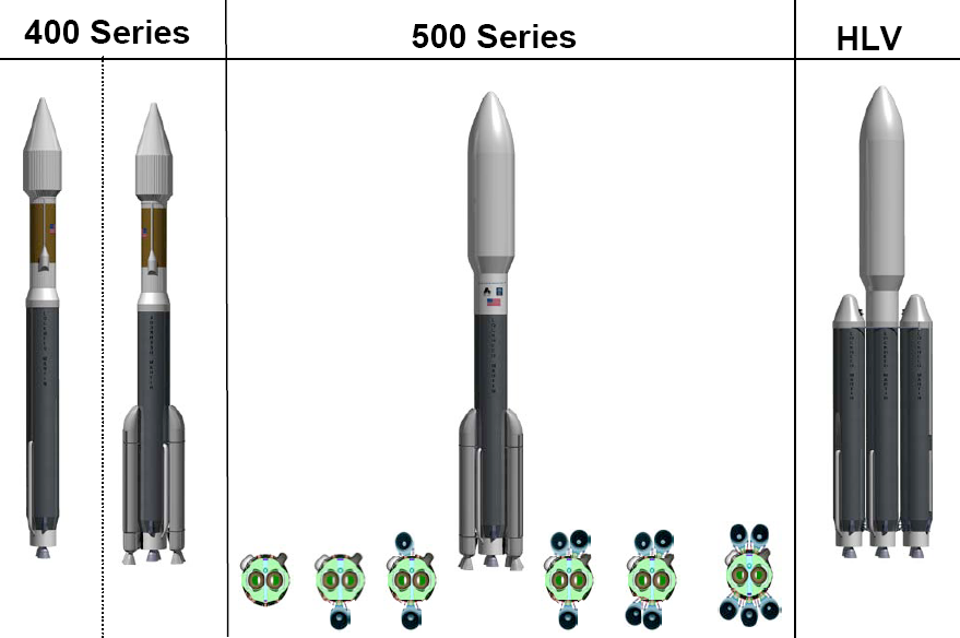
Atlas V is an expendable launch system and the fifth major version in the Atlas (rocket family), Atlas launch vehicle family. It was originally designed by Lockheed Martin, now being operated by United Launch Alliance (ULA), a joint venture between Lockheed Martin and Boeing. Atlas V is also a major NASA launch vehicle. It is America's longest-serving active rocket. In August 2021, ULA announced that Atlas V would be retired, and all 29 remaining launches had been sold. , 19 launches remain. Each Atlas V launch vehicle consists of two main stages. The first stage (rocketry), first stage is powered by a Russian RD-180 engine manufactured by NPO Energomash, Energomash and burning kerosene and liquid oxygen. The Centaur (rocket stage), Centaur upper stage is powered by one or two American RL10 engine(s) manufactured by Aerojet Rocketdyne and burns liquid hydrogen and liquid oxygen. The Star 48 upper stage was used on the ''New Horizons'' mission as a third stage. strap-on booster, ... [...More Info...] [...Related Items...] OR: [Wikipedia] [Google] [Baidu] |
United Launch Alliance
United Launch Alliance (ULA), legally United Launch Alliance, LLC, is an American spacecraft launch service provider that manufactures and operates a number of rocket vehicles that are capable of launching spacecraft into orbits around Earth, and to other bodies in the Solar System and beyond. The company, which is a joint venture between Lockheed Martin Space and Boeing Defense, Space & Security, was formed in December 2006. Launch customers of the United Launch Alliance include the Department of Defense (DoD), NASA, and other organizations. ULA provides launch services using expendable launch systems Delta IV Heavy and Atlas V, and until 2018 the medium-lift Delta II. The Atlas, Delta IV Heavy and the recently retired Delta IV launch systems have launched payloads including weather, telecommunications, and national security satellites, scientific probes and orbiters. ULA also launches commercial satellites. , the company is developing the Vulcan Centaur, a successor to the ... [...More Info...] [...Related Items...] OR: [Wikipedia] [Google] [Baidu] |
Siberia
Siberia ( ; rus, Сибирь, r=Sibir', p=sʲɪˈbʲirʲ, a=Ru-Сибирь.ogg) is an extensive geographical region, constituting all of North Asia, from the Ural Mountains in the west to the Pacific Ocean in the east. It has been a part of Russia since the latter half of the 16th century, after the Russians conquered lands east of the Ural Mountains. Siberia is vast and sparsely populated, covering an area of over , but home to merely one-fifth of Russia's population. Novosibirsk, Krasnoyarsk and Omsk are the largest cities in the region. Because Siberia is a geographic and historic region and not a political entity, there is no single precise definition of its territorial borders. Traditionally, Siberia extends eastwards from the Ural Mountains to the Pacific Ocean, and includes most of the drainage basin of the Arctic Ocean. The river Yenisey divides Siberia into two parts, Western and Eastern. Siberia stretches southwards from the Arctic Ocean to the hills of north-ce ... [...More Info...] [...Related Items...] OR: [Wikipedia] [Google] [Baidu] |


