|
Merthyr, Tredegar And Abergavenny Railway
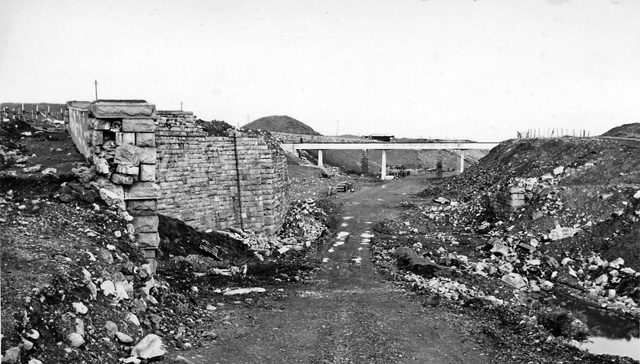
The Merthyr, Tredegar and Abergavenny Railway, also known as the ''Heads of the Valleys line'', was a railway line which operated between 1860 and 1958 between the Monmouthshire town of Abergavenny and the Glamorgan town of Merthyr Tydfil in South East Wales. Opening and construction Origins The line can be traced back to the large bequest left by Richard Crawshay, proprietor of the Cyfarthfa Ironworks, to his nephew, Joseph Crawshay, in 1810. With his inheritance, Crawshay together with Matthew Wayne acquired the Nantyglo Ironworks from Hartford, Partridge and Co. in 1811 for £8,000. When Wayne retired from the partnership in 1820, Crawshay Bailey took his place. Crawshay Bailey became sole proprietor in 1833 upon the retirement of his brother. In the same year, he acquired the Beaufort Ironworks. Crawshay Bailey was the driving force behind the development of tramroads in the Nantyglo area which served to bring raw materials to and from his various ironworks. First, in 1822, ... [...More Info...] [...Related Items...] OR: [Wikipedia] [Google] [Baidu] |
Monmouthshire
Monmouthshire ( cy, Sir Fynwy) is a county in the south-east of Wales. The name derives from the historic county of the same name; the modern county covers the eastern three-fifths of the historic county. The largest town is Abergavenny, with other towns and large villages being: Caldicot, Chepstow, Monmouth, Magor and Usk. It borders Torfaen, Newport and Blaenau Gwent to the west; Herefordshire and Gloucestershire to the east; and Powys to the north. Historic county The historic county of Monmouthshire was formed from the Welsh Marches by the Laws in Wales Act 1535 bordering Gloucestershire to the east, Herefordshire to the northeast, Brecknockshire to the north, and Glamorgan to the west. The Laws in Wales Act 1542 enumerated the counties of Wales and omitted Monmouthshire, implying that the county was no longer to be treated as part of Wales. However, for all purposes Wales had become part of the Kingdom of England, and the difference had little practical effec ... [...More Info...] [...Related Items...] OR: [Wikipedia] [Google] [Baidu] |
Standard Gauge
A standard-gauge railway is a railway with a track gauge of . The standard gauge is also called Stephenson gauge (after George Stephenson), International gauge, UIC gauge, uniform gauge, normal gauge and European gauge in Europe, and SGR in East Africa. It is the most widely used track gauge around the world, with approximately 55% of the lines in the world using it. All high-speed rail lines use standard gauge except those in Russia, Finland, and Uzbekistan. The distance between the inside edges of the rails is defined to be 1435 mm except in the United States and on some heritage British lines, where it is defined in U.S. customary/Imperial units as exactly "four feet eight and one half inches" which is equivalent to 1435.1mm. History As railways developed and expanded, one of the key issues was the track gauge (the distance, or width, between the inner sides of the rails) to be used. Different railways used different gauges, and where rails of different gauge m ... [...More Info...] [...Related Items...] OR: [Wikipedia] [Google] [Baidu] |
Brecon And Merthyr Tydfil Junction Railway
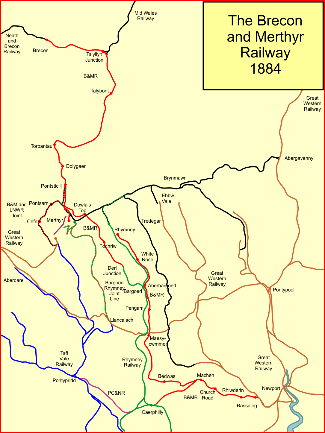
The Brecon and Merthyr Tydfil Junction Railway (B&MR) was a railway company in Wales. It was originally intended to link the towns in its name. Finding its access to Merthyr difficult at first, it acquired the Rumney Railway, an old plateway, and this gave it access to Newport docks. This changed its emphasis from rural line to mineral artery. It opened at the Brecon end to a point near Dowlais in 1863, and in 1865 it opened a disconnected section from Rhymney to Newport. In due course the company connected the two sections and reached Dowlais and Merthyr, but had to concede sharing a route with the powerful London and North Western Railway. The B&MR was always short of money, and was notable for its prodigious gradients, but it survived until the grouping of 1923, when it became part of the Great Western Railway. Its network declined steeply after 1945, and passenger operation ceased in 1962. Goods and mineral operation also lost its market, and as of 2020, only a short stub to ... [...More Info...] [...Related Items...] OR: [Wikipedia] [Google] [Baidu] |
Dowlais
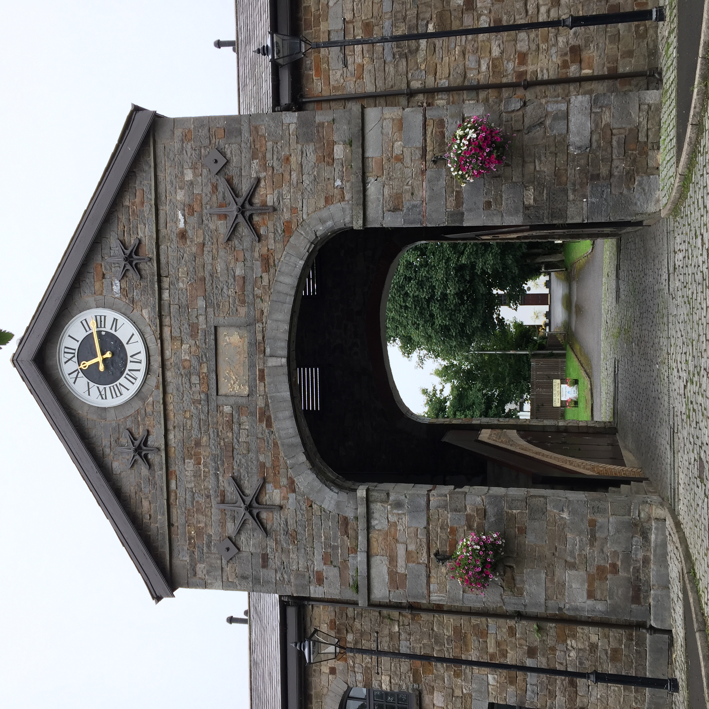
Dowlais () is a village and community of the county borough of Merthyr Tydfil, in Wales. At the 2011 census the electoral ward had a population of 6,926, The population of the Community being 4,270 at the 2011 census having excluded Pant. Dowlais is notable within Wales and Britain for its historic association with ironworking; once employing, through the Dowlais Iron Company, roughly 5,000 people, the works being the largest in the world at one stage. Name The name is derived from the Welsh ''du'' meaning 'black' and ''glais'' meaning 'stream'. History Dowlais came to prominence in the 18th and 19th centuries because of its iron and steelworks. By the mid-1840s there were between 5000 and 7000 men, women and children employed in the Dowlais works. During the early to mid 1800s the ironworks were operated by Sir John Josiah Guest and (from 1833) his wife Lady Charlotte Guest. Charlotte Guest introduced welfare schemes for the ironworkers. She provided for a church and a lib ... [...More Info...] [...Related Items...] OR: [Wikipedia] [Google] [Baidu] |
Sea Level
Mean sea level (MSL, often shortened to sea level) is an average surface level of one or more among Earth's coastal bodies of water from which heights such as elevation may be measured. The global MSL is a type of vertical datuma standardised geodetic datum A geodetic datum or geodetic system (also: geodetic reference datum, geodetic reference system, or geodetic reference frame) is a global datum reference or reference frame for precisely representing the position of locations on Earth or other p ...that is used, for example, as a chart datum in cartography and Navigation, marine navigation, or, in aviation, as the standard sea level at which atmospheric pressure is measured to Calibration, calibrate altitude and, consequently, aircraft flight levels. A common and relatively straightforward mean sea-level standard is instead the midpoint between a Tide, mean low and mean high tide at a particular location. Sea levels can be affected by many factors and are known to hav ... [...More Info...] [...Related Items...] OR: [Wikipedia] [Google] [Baidu] |
Clydach Gorge
The Clydach Gorge (also known as Cwm Clydach) is a steep-sided valley in south-east Wales down which the River Clydach flows to the River Usk. It runs for from the vicinity of Brynmawr in Blaenau Gwent eastwards and northeastwards to Gilwern in Monmouthshire. The Gorge was one of the first locations in the region to be industrialised though it still retains its natural environment. It has long been an important transport corridor between Abergavenny and the lowlands of Monmouthshire and the northeastern quarter of the South Wales Coalfield. It is now exploited by the A465 Heads of the Valleys trunk road which runs between Abergavenny and Swansea and which serves the Heads of the Valleys sub-region. The Gorge is included within the Brecon Beacons National Park and is a tourist destination in its own right, with facilities including a picnic site, waymarked footpaths, the National Cycle Network and car parking alongside the River Clydach, easily reached from the Heads of the Val ... [...More Info...] [...Related Items...] OR: [Wikipedia] [Google] [Baidu] |
Gilwern Hill, Monmouthshire
Gilwern Hill is a 441 m high hill in the Brecon Beacons National Park, south of the village of Gilwern in Monmouthshire, Wales. It lies west of the Blorenge. The hill is a Site of Special Scientific Interest. Geology Gilwern Hill is formed from a series of rock strata of Carboniferous age, each of which dip moderately southwards. The summit plateau is formed from sandstones - the Farewell Rock and the Twrch Sandstone which overlie the Carboniferous Limestone. The latter has been extensively quarried around the eastern, northern and western margins of the hill where it is exposed. Derelict tramways are in evidence in connection with the working of these quarries for limestone in connection with iron and steel-smelting.British Geological Survey 1:50K map sheet 232 ''Abergavenny'' Access and recreation Virtually the entire hill is designated as open country and so access is therefore available freely to walkers. A minor road wraps around its southern and western margins whi ... [...More Info...] [...Related Items...] OR: [Wikipedia] [Google] [Baidu] |
River Usk
The River Usk (; cy, Afon Wysg) rises on the northern slopes of the Black Mountain (''y Mynydd Du''), Wales, in the westernmost part of the Brecon Beacons National Park. Initially forming the boundary between Carmarthenshire and Powys, it flows north into Usk Reservoir, then east by Sennybridge to Brecon before turning southeast to flow by Talybont-on-Usk, Crickhowell and Abergavenny after which it takes a more southerly course. Beyond the eponymous town of Usk it passes the Roman legionary fortress of Caerleon to flow through the heart of the city of Newport and into the Severn Estuary at Uskmouth beyond Newport near the Newport Wetlands. The river is about long. The Monmouthshire and Brecon Canal follows the Usk for most of the length of the canal. Etymology The name of the river derives from a Common Brittonic word meaning "abounding in fish" (or possibly "water"), this root also appears in other British river names such as Exe, Axe, Esk and other variant ... [...More Info...] [...Related Items...] OR: [Wikipedia] [Google] [Baidu] |
Newport, Abergavenny And Hereford Railway
The Newport, Abergavenny and Hereford Railway was a railway company formed to connect the places in its name. When it sought Parliamentary authorisation, it was denied the southern section, and obliged to use the Monmouthshire Railway between Pontypool and Newport. It opened on 6 December 1853, and was part of an important chain of lines between south-east Wales and Birkenhead; mineral traffic in both directions was dominant. The London and North Western Railway hoped to exploit the line to form a network in South Wales, but that aspiration was not fully realised, and in 1860 the NA&HR merged with other railways to form the West Midland Railway, which soon amalgamated with the Great Western Railway in 1863. In order better to serve the ironworks in the South Wales Valleys, the NA&HR built the Taff Vale Extension Line, running west from Pontypool and cutting across several of the valleys, making connections with other companies' lines, eventually at twelve locations. The line was ... [...More Info...] [...Related Items...] OR: [Wikipedia] [Google] [Baidu] |
South Wales
South Wales ( cy, De Cymru) is a loosely defined region of Wales bordered by England to the east and mid Wales to the north. Generally considered to include the historic counties of Glamorgan and Monmouthshire, south Wales extends westwards to include Carmarthenshire and Pembrokeshire. In the western extent, from Swansea westwards, local people would probably recognise that they lived in both south Wales and west Wales. The Brecon Beacons National Park covers about a third of south Wales, containing Pen y Fan, the highest British mountain south of Cadair Idris in Snowdonia. A point of some discussion is whether the first element of the name should be capitalised: 'south Wales' or 'South Wales'. As the name is a geographical expression rather than a specific area with well-defined borders, style guides such as those of the BBC and ''The Guardian'' use the form 'south Wales'. In a more authoritative style guide, the Welsh Government, in their international gateway w ... [...More Info...] [...Related Items...] OR: [Wikipedia] [Google] [Baidu] |
Newport Docks
Newport Docks is the collective name for a group of docks in the city of Newport, south-east Wales. By the eighteenth century there were a number of wharves on the west shore of the River Usk; iron and coal were the principal outward traffic. The considerable tidal range and muddy banks made the wharves inconvenient, and as trade grew, the Town Dock was opened in 1842. It was extended to the north in 1858, and trade increased further. The Alexandra (Newport) Dock Company was established and a large dock of the same name was opened in 1875, followed by the South Dock in 1893, which was greatly extended in 1907 and 1914. Newport Docks were said to have the largest extent of water in any dock in the world. The Town Dock has been filled in, but the Alexandra Dock system is still in use, although the vast mineral export traffic has long since ended. Explosives The current owners (ABP) future plans for the docks refer to: 4.40 The Port of Newport holds one of the UK’s largest explo ... [...More Info...] [...Related Items...] OR: [Wikipedia] [Google] [Baidu] |
London And Greenwich Railway
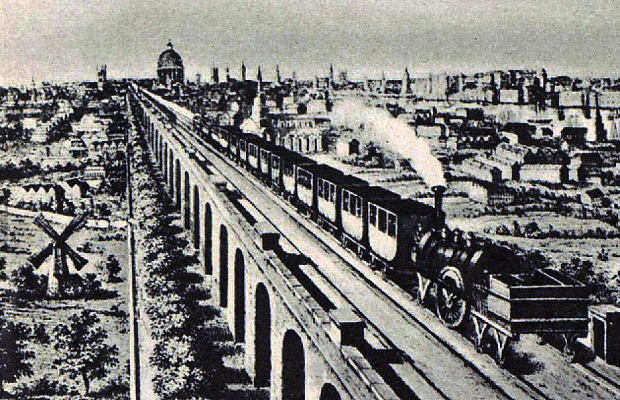
The London and Greenwich Railway (L&GR) was opened in London between 1836 and 1838. It was the first steam railway in the capital, the first to be built specifically for passengers, and the first entirely elevated railway. Origins The idea for the line came from Colonel George Thomas Landmann, until 1824 a Royal Engineer, and George Walter, and the company was floated at a meeting on 25 November 1831. It would run from close to London Bridge, convenient for journeys to the City. It would be some long, on a viaduct of 878 brick arches, some of them skew (see London Bridge-Greenwich Railway Viaduct), to avoid level crossings over the many streets which were already appearing in the south of London. Landmann planned to rent the arches out as workshops. The intention had been to descend to ground level after the Grand Surrey Canal but this was opposed by Parliament. The first Act of Parliament was obtained in 1833 for a line from Tooley Street (now London Bridge) to London Str ... [...More Info...] [...Related Items...] OR: [Wikipedia] [Google] [Baidu] |


_(2).jpg)


