|
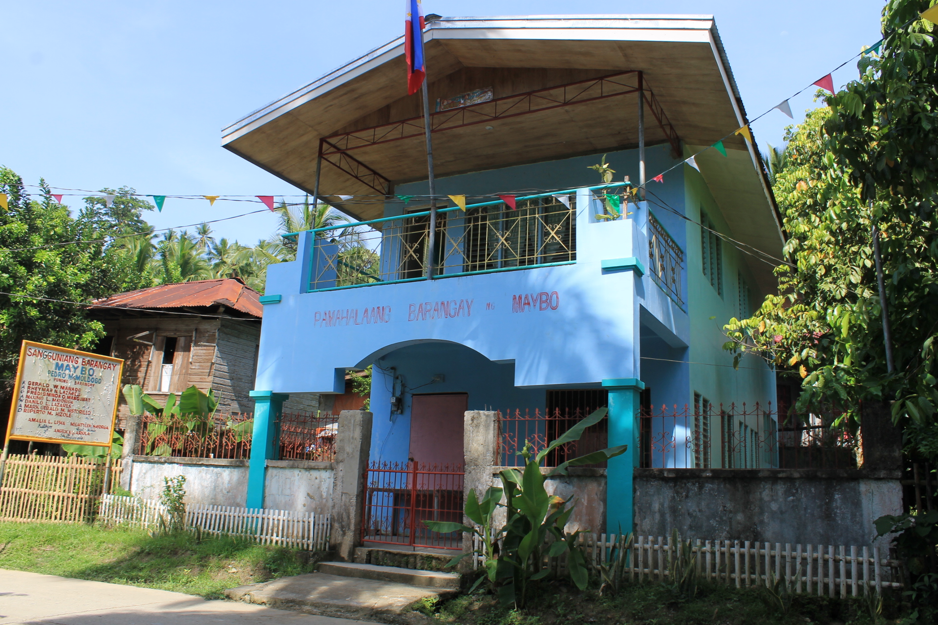
Maligaya, Malaybalay
Maligaya is a rural barangay in the Basakan District of Malaybalay, Philippines. According to the 2015 census, it has a population of 2,113 people. It is bordered to the north and east by Miglamin, to the south by Managok, and to the west by Linabo. The village was a sitio A ''sitio'' (Spanish for "site") in the Philippines is a territorial enclave that forms part of a barangay. Typically rural, a ''sitios location is usually far from the center of the barangay itself and could be its own barangay if its popul ... of Managok named Abuhan until it was separated to become a regular barangay named Maligaya. References Barangays of Bukidnon Barangays of Malaybalay {{NMindanao-geo-stub ... [...More Info...] [...Related Items...] OR: [Wikipedia] [Google] [Baidu] |
Barangay
A barangay (; abbreviated as Brgy. or Bgy.), historically referred to as barrio (abbreviated as Bo.), is the smallest administrative division in the Philippines and is the native Filipino term for a village, district, or ward. In metropolitan areas, the term often refers to an inner city neighborhood, a suburb, or a suburban neighborhood or even a borough. The word ''barangay'' originated from ''balangay'', a type of boat used by a group of Austronesian peoples when they migrated to the Philippines. Municipalities and cities in the Philippines are politically subdivided into barangays, with the exception of the municipalities of Adams in Ilocos Norte and Kalayaan in Palawan, with each containing a single barangay. Barangays are sometimes informally subdivided into smaller areas called ''purok'' ( en, "wikt:zone, zone"), or barangay zones consisting of a cluster of houses for organizational purposes, and ''sitios'', which are territorial enclaves—usually rural—far from t ... [...More Info...] [...Related Items...] OR: [Wikipedia] [Google] [Baidu] |
Malaybalay
Malaybalay, officially the City of Malaybalay ( ceb, Dakbayan sa Malaybalay; Bukid language, Bukid and Higaonon language, Higaonon: ''Bánuwa ta Malaybaláy''; fil, Lungsod ng Malaybalay), is a 1st class Cities of the Philippines#Legal classification, component city and capital of the Provinces of the Philippines, province of Bukidnon, Philippines. According to the 2020 census, it has a population of 190,712 people. The city, dubbed as the "South Summer Capital of the Philippines", is bordered north by Impasugong; west by Lantapan, Bukidnon, Lantapan; south by Valencia, Bukidnon, Valencia and San Fernando, Bukidnon, San Fernando; and east by Cabanglasan, Bukidnon, Cabanglasan and Agusan del Sur. It was formerly part of the province of Misamis Oriental as a municipal district in the late 19th century. When the special province of Agusan (now Agusan del Norte and Agusan del Sur) and its sub-province (Bukidnon) were created in 1907, Malaybalay was designated as the capital of Bukidno ... [...More Info...] [...Related Items...] OR: [Wikipedia] [Google] [Baidu] |
Philippines
The Philippines (; fil, Pilipinas, links=no), officially the Republic of the Philippines ( fil, Republika ng Pilipinas, links=no), * bik, Republika kan Filipinas * ceb, Republika sa Pilipinas * cbk, República de Filipinas * hil, Republika sang Filipinas * ibg, Republika nat Filipinas * ilo, Republika ti Filipinas * ivv, Republika nu Filipinas * pam, Republika ning Filipinas * krj, Republika kang Pilipinas * mdh, Republika nu Pilipinas * mrw, Republika a Pilipinas * pag, Republika na Filipinas * xsb, Republika nin Pilipinas * sgd, Republika nan Pilipinas * tgl, Republika ng Pilipinas * tsg, Republika sin Pilipinas * war, Republika han Pilipinas * yka, Republika si Pilipinas In the recognized optional languages of the Philippines: * es, República de las Filipinas * ar, جمهورية الفلبين, Jumhūriyyat al-Filibbīn is an archipelagic country in Southeast Asia. It is situated in the western Pacific Ocean and consists of around 7,641 islands t ... [...More Info...] [...Related Items...] OR: [Wikipedia] [Google] [Baidu] |
Miglamin
Miglamin is a rural barangay in the Basakan District of Malaybalay, Bukidnon, Philippines. According to the 2015 census, it has a population of 3,188 people. Geography Miglamin is a long strip of territory in the southeastern portion of the city that straddles the mountains between Malaybalay and Cabanglasan. It is bounded to the north by Linabo, Can-ayan and Capinonan, to the east by Lambagan, Imbatug, and Cabulohan, to the south by Paradise, Jasaan, and Apo Macote, and to the west by Maligaya, Managok, San Martin, and Sinanglanan. There are patches of rolling terrain and undulating plains. It has several sitio A ''sitio'' (Spanish for "site") in the Philippines is a territorial enclave that forms part of a barangay. Typically rural, a ''sitios location is usually far from the center of the barangay itself and could be its own barangay if its popul ...s within its jurisdiction; these are Dungis and Matangpatang in the north, Alimpulos in the east, and Lunukan and Mara ... [...More Info...] [...Related Items...] OR: [Wikipedia] [Google] [Baidu] |
Managok
Managok is an urbanizing barangay in the Basakan District of Malaybalay, Bukidnon, Philippines. According to the 2015 census, it has a population of 7,200 people. It is bounded to the north by Linabo and Maligaya, to the east by Miglamin, to the south by San Martin, to the southwest by Simaya, and to the west by Violeta. Situated on a fertile plain of the Sawaga Valley, it is a major rice producing area in the city. It is drained by the Abuhan and Balongkot Rivers, which is a source for irrigation for many farmers. It is the most populous village in the Basakan District and it serves as the district's center. The village was home to Bukidnon National Agricultural School which was later transferred to Musuan as Central Mindanao University Central Mindanao University (CMU; fil, Pamantasan ng Gitnang Mindanao) is a research state university located in the heart of Mindanao Island, province of Bukidnon, Philippines. Founded in 1910, it is one of the oldest premier unive ... [...More Info...] [...Related Items...] OR: [Wikipedia] [Google] [Baidu] |
Linabo
Linabo is an urban barangay in the Basakan District of Malaybalay, Philippines. According to the 2015 census, it has a population of 6,933 people. Geography Linabo is bounded to the north by Laguitas and San Jose, to the east by Maligaya and Miglamin, to the south by Violeta and Managok, and to the west by Aglayan. Its terrain is characterized by plains in the west formed by the Sawaga River. Rolling hills are found in Sitio Lalawan while Sitio Paiwaig and the eastern boundary is characterized as mountainous. It is largely an agricultural village where rice is the principal crop with some cassava, banana, sugarcane, and rubber grown as secondary crops. Most of Linabo is within the Bukidnon Higaonon Tribal Association (BUHITA) ancestral domain claim, which spans over 34,452 hectares and covers twelve barangays of Malaybalay and two barangays of Cabanglasan. History Linabo is one of the oldest settlements in Bukidnon, having been recorded in 19th century documents by the ... [...More Info...] [...Related Items...] OR: [Wikipedia] [Google] [Baidu] |
Sitio
A ''sitio'' (Spanish for "site") in the Philippines is a territorial enclave that forms part of a barangay. Typically rural, a ''sitio'''s location is usually far from the center of the barangay itself and could be its own barangay if its population were high enough. ''Sitios'' are similar to '' puroks'', but the latter are more urban and closer to the center of the barangay, especially the barangay hall. The term is derived from the Spanish word ''sitio'' meaning "place". During the Spanish colonial period the colonial government employed the '' reducción'' policy, allowing the remapping of various settlements. Several far-flung hamlets were identified, named, and organized into "sitios" so that municipalities and cities could more easily be governed through the barangay system, then known as the ''barrio'' system. A ''sitio'' does not have an independent administration; it is established purely for organizational purposes only. See also * Purok * Poblacion * Barangay ... [...More Info...] [...Related Items...] OR: [Wikipedia] [Google] [Baidu] |
Barangays Of Bukidnon
A barangay (; abbreviated as Brgy. or Bgy.), historically referred to as barrio (abbreviated as Bo.), is the smallest administrative division in the Philippines and is the native Filipino term for a village, district, or ward. In metropolitan areas, the term often refers to an inner city neighborhood, a suburb, or a suburban neighborhood or even a borough. The word ''barangay'' originated from ''balangay'', a type of boat used by a group of Austronesian peoples when they migrated to the Philippines. Municipalities and cities in the Philippines are politically subdivided into barangays, with the exception of the municipalities of Adams in Ilocos Norte and Kalayaan in Palawan, with each containing a single barangay. Barangays are sometimes informally subdivided into smaller areas called ''purok'' ( en, "zone"), or barangay zones consisting of a cluster of houses for organizational purposes, and ''sitios'', which are territorial enclaves—usually rural—far from the barangay c ... [...More Info...] [...Related Items...] OR: [Wikipedia] [Google] [Baidu] |

.jpg)


